
SLIDE 1
SR 247 in the California High Desert North of the San Bernardino - - PowerPoint PPT Presentation
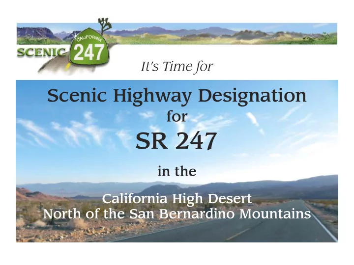
Its Time for Scenic Highway Designation for SR 247 in the California High Desert North of the San Bernardino Mountains State Route 247 and Nearby Points of Interest 78 miles Through High Desert Vistas Historic Associations
High Desert Vistas
Heavily Populated Southern California
the Mountains and Joshua Tree National Park
to Off-Highway Adventures
State Route 247 and Nearby Points of Interest
The status of a proposed state scenic highway changes from ELIGIBLE to OFFICIALLY DESIGNATED when the local governing body (San Bernardino County)
–Caltrans Landscape Architecture Program
is land that is visible from the highway. There are five legislatively required elements for scenic corridor protection:
–Caltrans Landscape Architecture Program
Regulations already exist in local codes The Town of Yucca Valley: 5 miles of highway are within town boundaries, some zoned industrial with little visible development Homestead Valley communities: Rural Low Density Zoning is established in the County Plan, with one Commercial Strip Lucerne Valley: Rural and Agricultural Zoning Miles and miles of BLM administered public lands “1. Regulation of land use and density of development”
“2. Detailed land and site planning” 247 mostly travels through wide open desert, Small Homestead Act communities settled in the 1950’s, and the old agricultural community of Lucerne Valley homesteaded in the early 1900’s. Built up areas are sparsely populated consistent in appearance with historic rural settlement. Some old structures are abandoned to the weather with ghost town ambiance
“3. Control of outdoor advertising”
No billboards are placed at the side of the highway. The infrequent signage is on or near the few commercial enterprises.
The pass through the Ord Mountains
“4. Careful attention to and control of earthmoving and landscaping; and
and equipment”
Already regulated in state and county codes
Two Distinct Sections – Two Distinct Histories
The Old Woman Springs Road Section and the Barstow Road Section
Sunrise paints a dusting of snow on the San Bernardino Mountains Sunset backlights a desert garden in the Ord Mountains
Two Distinct Sections – Two Distinct Histories
The Old Woman Springs Road Section
is a prehistoric and historic pathway, close to year-round springs flowing from the northern face of the San Bernardino Mountains. It carried the first surveyor, who found a native encampment of old women. It carried miners and freight headed for the Dale District east of Twentynine Palms. It became a main trail through the grazing lands of the desert half of the Heart Bar Ranch. And it brought the city folks after World War II to homestead their own 5 acres of desert living.
A watering trough in the San Bernardino Mountains still can be found by off-road explorers A watering trough in the San Bernardino Mountains still can be found by off-road explorers
The Old Woman Springs Road Section
An access route to historic California
The 247 traveler follows the trail of the early settlers, cowboys and miners
It is one of the least altered landscapes in the state.
Lucerne Valley and the Ord Mountains striped by cloud shadows
The Old Woman Springs Road Section
Amazing geological diversity
Comparatively recent lava flows and ash hills decorate the vistas along Old Woman Springs Road
The Old Woman Springs Road Section
An Access Route to Unsurpassed Desert Adventure in Johnson Valley
The 247 traveler with 4-wheel drive finds
in the Johnson Valley OHV Area
Self contained camping in groups or in seclusion attract visitors from all over the country The flat pans of the dry lakes
Popular with Nature Lovers and Filmmakers
Scenic 247 in the Johnson Valley area travels through vistas without transmission towers, buildings or pavement… a journey back in time
Rainy years bring out a flower display 360° with no modern visual intrusions
The Old Woman Springs Road Section
Two Distinct Sections – Two Distinct Histories
The Barstow Road Section
goes north though the old agricultural homesteads of the Lucerne Valley ending at the railroad hub at Barstow. It travels across the flats of the huge Lucerne Dry Lake, and climbs into the Ord Mountains before it swoops down into the Mojave River Valley. It fed into Route 66 at Barstow. Graded and paved later than the other section, it also carried its share of miners. Great stretches of the road are hardly settled at all.
The route traverses a dragon’s back of rocky ridges
The Barstow Road Section
Access to more Desert Adventures
Creosote bushes and cactus year round, a rock garden in the spring
Terrain Visible to the Traveler
The Barstow Road Section
Access to More Off-Road Recreation
Open Riding on any trail in the Stoddard Valley OHV Area Just a slight increase in elevation means an increase in vegetation
Where Can You Go From Here?
Near Yucca Valley at the South End
Joshua Tree National Park
east, Palm Springs to the south, and to Interstate 10
Joshua Tree National Park Pioneertown live-in Western movie set, seen in Roy Rogers and Gene Autry shows The Integretron in Landers Gubler’s world famous
Antiquing in Old Town Yucca Vallley
Where Can You Go From Here?
A stop in Lucerne Valley offers fuel and good food
The unincorporated community of Lucerne Valley has a population of about 6,000 people in 100 square miles. Tours are offered of limestone quarries visible on the flanks of the San Bernardinos. The Lucerne Valley Market and Hardware is a famous destination for travelers on Scenic 247
A modern general store for tourist or off-roader
Where Can You Go From Here?
Around Barstow at the North End
In the restored Barstow Railroad Station:
The Route 66 Mother Road Museum The Route 66 Mother Road Museum The historic Harvey House in the beautiful Casa del Desierto railroad station The historic Harvey House in the beautiful Casa del Desierto railroad station The crossroads city of Barstow
to fine dining for the traveler Prehistoric relics and historic artifacts greet the visitor Prehistoric relics and historic artifacts greet the visitor
–Caltrans Landscape Architecture Program
WHAT DOES SCENIC HIGHWAY DESIGNATION DO FOR US?
uses such as junkyards, dumps, concrete plants, and gravel pits, etc.
by proper siting, landscaping or screening.
detract from scenic views.
harmony with the surroundings
–Caltrans Landscape Architecture Program
WHAT ELSE DOES SCENIC HIGHWAY DESIGNATION DO FOR US?
existing contours, and to preserve important vegetative features.
minimizing development on steep slopes and along ridgelines.
(sound walls) by requiring a minimum setback for residential development adjacent to a scenic highway.
The King Clone, a single creosote bush spreading out from its center, considered the oldest living organism
–Caltrans Landscape Architecture Program
IN ADDITION, SCENIC HIGHWAY DESIGNATION WILL:
to preserve community values.
to promote local tourism that is consistent with the community's scenic values.
The unique lava buttes near Pioneertown, recently reprieved from the installation of wind turbines by grass roots community efforts