Space-time Visualizer Understanding Human Mobility from a Spatial - - PowerPoint PPT Presentation

space time visualizer
SMART_READER_LITE
LIVE PREVIEW

Space-time Visualizer Understanding Human Mobility from a Spatial - - PowerPoint PPT Presentation

Division of Spatial Information Science, University of Tsukuba Person Trip Data Browser and Space-time Visualizer Understanding Human Mobility from a Spatial Perspective Dr. Ko Ko Lwin and Professor Dr. Yuji Murayama Division of Spatial


slide-1
SLIDE 1

Person Trip Data Browser and Space-time Visualizer

Understanding Human Mobility from a Spatial Perspective

  • Dr. Ko Ko Lwin and Professor Dr. Yuji Murayama

Division of Spatial Information Science Faculty of Life and Environmental Sciences University of Tsukuba, Japan Jointed research project with CSIS Center for Spatial Information Science, University of Tokyo, Japan Project Homepage

http://land.geo.tsukuba.ac.jp/persontrips Geospatial World Forum 2014, Geneva, Switzerland (May 5-9, 2014)

Division of Spatial Information Science, University of Tsukuba

slide-2
SLIDE 2

Person Trip Data Browser and Space-time Visualizer

Mobil ile Sensin ing

MOBILE SENSING

By utilizing mobile communication devices and wireless networking, the movement of persons can be tracked or monitored by –

  • Using their mobile log data
  • Internet access
  • Usage of locational-based services
  • Known as “mobile sensing”
  • Good for real-time person flow information and

disaster management However, these data do not convey anything about personal information such as:

  • Age
  • Gender
  • Occupation
  • Purpose
  • Mode of transportation
  • etc.

Required for human geographers, social scientists, transportation planners, etc.

BIG-DATA IS EVERYWHERE

slide-3
SLIDE 3

Person Trip Data Browser and Space-time Visualizer

OD Data (Origin-Destination Route Identification)

660,000 records per file 1440 files for one day (Every one minute for 24 hours) Source: CSIS People Flow Project (PFLOW)

http://pflow.csis.u-tokyo.ac.jp/getflow_e.php

slide-4
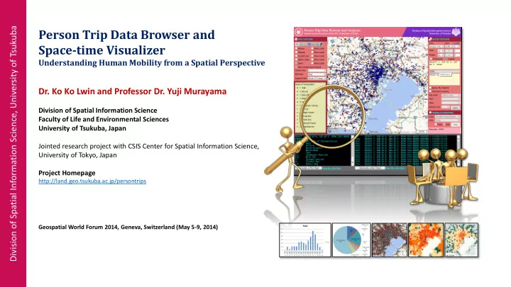
SLIDE 4

Person Trip Data Browser and Space-time Visualizer

CODED VALUES

Field ID Field Name Value Description 1 PID 1 – 660,000 Unique person ID 2 TNO 1, 2, 3, … Trip number 3 SNO 1, 2, 3, … Suntrap number 4 LON Longitude Longitude position 5 LAT Latitude Latitude position 6 GENDER 1, 2, 9 Gender 7 AGE 1 - 17 Age group 8 ZCODE Refer to a map Curent location by zone code 9 OCCUP See OCCUP Person occupation 10 PURPOSE See PURPOSE Purpose to trip 11 MAGFAC

  • Adjustment Factor

12 MAGFAC2

  • Adjustment Factor

13 TCODE See Mode of transportation

ATTRIBUTE INFORMATION (FIELDS) ATTRIBUTE VALUE (FIELD VALUE)

GENDER AGE GROUP

Code Value 1 Male 2 Female 9 Unknown Code Value Code Value 0 - 5 9 45 - 50 1 5 – 10 10 50 - 55 2 10 - 15 11 55 - 60 3 15 - 20 12 60 - 65 4 20 - 25 13 65 - 70 5 25 - 30 14 70 - 75 6 30 - 35 15 75 - 80 7 35 - 40 16 80 - 85 8 40 - 45 17 > 85 Code Value Code Value 1 Agricultural/Forestry/Fishery 9 Manager 2 Labor/Factory (Blue Collar) 10 Other Occupation 3 Sales 11 Elementary and Junior-high Student 4 Service 12 High School Student 5 Transport Service 13 College and University Student 6 Security Service 14 House-wife 7 Office Worker 15 No-occupation 8 Professional 16 Others (Not Categorized) 99 Unknown Code Value Code Value 1 To-From Office 9 To Send/Pick Up Activity 2 To-From School 10 For Selling and Buying 3 To Home 11 For Appointment 4 For Shopping 12 To/For Work (Fixing and Repairing) 5 For Short Recreation 13 To Agri./Forestry/Fishery Work 6 For Sight Seeing and Leisure 14 Other Business Purpose 7 For Medical Treatment 99 Others 8 For Attending Class

OCCUPATION PURPOSE TRANSPORTATION MODE

Code Value Code Value 1 Walk 9 Private Bus 2 Bicycle 10 Public Bus 3 Motor-Bicycle 11 Monorail Transit 4 Motor-Bike 12 Train/Subway 5 Taxi 13 Ship 6 Passenger Vehicles 14 Aircraft 7 Mini Car 15 No Movement 8 Freight Vehicle 16 Others 99 Unknown

slide-5
SLIDE 5

Person Trip Data Browser and Space-time Visualizer

BIGD ATA is everywhere …. Every one minute movement for 660,000 in one day (24H)

BUILDING A GEODATABASE

slide-6
SLIDE 6

Person Trip Data Browser and Space-time Visualizer

PERSON TRIP DATA BROWSER AND ANALYZER PERSON TRIP SPACE-TIME VISUALIZER

Extract person trip by various query strings Perform spatial analysis functions (e.g. person trip by specific rail-way line, business district , along coastal line, etc.) Visualize the data Export and integrate with other GIS applications Visualize specific person travel behavior (i.e. purpose, spending time, mode of transportation use, etc.) by his/her age group and occupation Generate Gant-Chart for his/her one day trip

http://land.geo.tsukuba.ac.jp/persontrips http://land.geo.tsukuba.ac.jp/persontrack

Basemap data source: Microsoft Bing Maps

slide-7
SLIDE 7

Person Trip Data Browser and Space-time Visualizer

Women shopping behavior by age group Percentage use of different transportation modes per hour for one day’s worth of trips

MORE DATA ANALYSIS INSTANTLY

Person Trip Data Browser and Analyzer

Basemap data source: Microsoft Bing Maps

slide-8
SLIDE 8

Person Trip Data Browser and Space-time Visualizer

PERFORM SPATIAL ANALYSIS INTERACTIVELY

Examples of a spatial query (A: Query by prefecture or administration unit; B: query by specific transportation route; C: query by specific radius

  • r buffer distance and D: query by specific business zone or place of

interest) Perform more spatial queries interactively

Basemap data source: Microsoft Bing Maps

slide-9
SLIDE 9

Person Trip Data Browser and Space-time Visualizer

Basemap data source: Microsoft Bing Maps

slide-10
SLIDE 10

Person Trip Data Browser and Space-time Visualizer

To work purpose To school purpose Calculates Gi* statistic for hot spot analysis

6:00 7:00 8:00 9:00 9:30 10:00 6:00 7:00 8:00 9:00 9:30 10:00

HOTSPOT ANALYSIS

slide-11
SLIDE 11

Person Trip Data Browser and Space-time Visualizer

Visualize the one day trip activities of desired person age group and occupation Visualize person spending time by trip purpose More …

Person Trip Space-Time Visualizer

See specific person’s one day travel behavior

Generate Gant-Chart for each person one day trip activities instantly

Basemap data source: Microsoft Bing Maps

slide-12
SLIDE 12

Person Trip Data Browser and Space-time Visualizer

Conclusion

Public survey data is still required for transportation planning, human mobility studies, social behavior studies, etc. Handling and extracting of large scale public survey data is a big challenging for researchers, social scientists, planners, etc. Here we provide “Person Trip Data Browser and Analyzer” to:

  • Extract desire various query strings
  • Extract by features
  • Extract by geometry
  • Thematic mapping for quick decision making
  • Thematic grid mapping for movement detection
  • Export to ESRI Shape files and integrate with their own data and

perform more GIS analytical functions We hope that will improve the studies of human mobility from a spatial perspective

slide-13
SLIDE 13

THANK YOU

We’re warmly invite you to visit our project sites

Person Trip Data Browser and Analyzer http://land.geo.tsukuba.ac.jp/persontrips Person Trip Space-Time Visualizer http://land.geo.tsukuba.ac.jp/persontrack