Site Visit Itinerary February 13 th (Waterberg Site Visit) 6:30 am - - PowerPoint PPT Presentation

site visit itinerary
SMART_READER_LITE
LIVE PREVIEW

Site Visit Itinerary February 13 th (Waterberg Site Visit) 6:30 am - - PowerPoint PPT Presentation

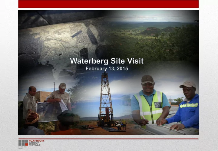
Site Visit Itinerary February 13 th (Waterberg Site Visit) 6:30 am Breakfast at Sundown Ranch 7:15 am Bus Transport to Charter Fights at Pilanesberg 8:00/8:15 am Charter Flights from Pilanesberg to Dendron 9:20/9:35 am Charter


slide-1
SLIDE 1
slide-2
SLIDE 2

Site Visit Itinerary

1

February 13th (Waterberg Site Visit) 6:30 am – Breakfast at Sundown Ranch 7:15 am – Bus Transport to Charter Fights at Pilanesberg 8:00/8:15 am – Charter Flights from Pilanesberg to Dendron 9:20/9:35 am – Charter Flights Arrive at Dendron 9:30/9:45 am – Eurocopter from Dendron to Waterberg Site 9:45/10:30 am – Eurocopter Arrives at Waterberg Site 10:45 am – Presentation at Waterberg 11:15 – Core Review at Waterberg 12:00 pm – Lunch at Waterberg Site 12:45/1:30 pm – Eurocopter from Waterberg to Dendron 1:00 pm/1:45 pm – Eurocopter Arrives at Dendron 1:30 pm/2:00 pm – Charter Flights from Dendron to OR Tambo 3:00/3:30 pm – Charter flights Arrives at O.R. Tambo International Airport in Johannesburg

slide-3
SLIDE 3

Safety

  • We are working under the guidance of the DMR mine, health

and safety regulations, with proper legal appointments and training.

  • There have been no reportable incidents or accidents to date.
  • Contractors and visitors fall under our responsibility.

2

slide-4
SLIDE 4

Waterberg Site Specific Safety Induction

  • Safety is our number one commitment in all our activities.
  • To maintain safe and successful visits, the following rules

are upheld:  Open shoes are prohibited.  Lifting of core trays is prohibited.  All signage should be adhered to at all times.  Beware of snakes, scorpions and spiders.  Generally be aware of your surroundings.  Sunburn protection should be used during extreme hot weather conditions.

3

slide-5
SLIDE 5

Waterberg Site Specific Safety Induction

  • Walking on core trays is prohibited.
  • Core picked up and viewed should be returned to its original

position please.

  • Please ask for any assistance. We have trained & qualified

personnel on site. Enjoy your visit

4

slide-6
SLIDE 6

Waterberg Introduction and Potential

  • The discovery of the Waterberg Ore Body

is a result of a strong partnership since 2010 between PTM and the Japanese government (JOGMEC).

  • 3-80m thick mineralized zones.
  • 150m from surface.
  • There will be mechanized mining with bulk methods.
  • The current Waterberg JV deposit is significant in the context of the current PGM market.
  • There is potential for several large scale mines at Waterberg with the possibility of

transforming the cost curve and safety of the industry.

  • It is REAL – 223 drill holes, 581 Intersections.
  • Worley Parson’s, DRA, SGS, JOGMEC and Wits University are all actively involved.

5

slide-7
SLIDE 7

PTM QA/QC Protocol

PTM(RSA) has a holistic approach to Data Precision and Accuracy.

  • Quality drilling.
  • X, Y and Z coordinates are verified by an

external survey company.

  • Downhole orientation surveys are done.
  • Logging/sampling is captured into the SABLE

system and all handwritten logs with signature trails are available in the borehole files.

  • Printed SABLE logs/sampling sheets are

checked and signed off.

  • A chain of custody letter accompanies all samples dispatched from site.
  • Site clearances are done by external environmental company.
  • Borehole files (per borehole) are kept on site and stored electronically at the JHB

Office.

  • The database is audited by an external QP.
  • The mineralized zones that are used in the economic model are signed off by an

external QP.

  • A peer review by a second and a third independent QP are also in progress.

6

slide-8
SLIDE 8

Waterberg Project Orientation Map

7

slide-9
SLIDE 9

Regional TMI

8

slide-10
SLIDE 10

Regional Gravity

9

slide-11
SLIDE 11

Waterberg Project Prospecting Licenses

Waterberg IV Waterberg III Waterberg II Waterberg I

Extension Granted = 488.86 km² JV Granted = 254.65 km²

10

slide-12
SLIDE 12

Waterberg Project I Exploration Done To Date

  • Airborne Gravity and Magnetics (FUGRO).
  • Structural interpretation (Xpotential).
  • Holes drilled = 181 holes.
  • Meters drilled = 195,885 m.
  • Primary samples taken = 102,059.
  • QC samples = 23,099.

11

slide-13
SLIDE 13

Waterberg Extension Project Exploration Done To Date

  • Airborne Gravity and Magnetics (FUGRO).
  • Structural interpretation (Xpotential).
  • Holes drilled on Waterberg Extension Project = 48 holes.
  • Waterberg II=39 holes.
  • Waterberg III + IV=9 Holes.
  • Meters drilled 49,629m.
  • Waterberg II 41,190m.
  • Waterberg III + IV 8,439m.
  • Primary samples taken 17,259.
  • Standard samples 3,765.

12

slide-14
SLIDE 14

Map Showing Airborne TMI (FUGRO)

13

slide-15
SLIDE 15

Map Showing Airborne Gravity (Residual GD)

14

slide-16
SLIDE 16

Interpreted Structure

Waterberg JV

Legend

Waterberg Extension Local Dykes Structures Major Structures Waterberg Outcrop Archean Granite Complex Basement Basement Complex Diabase Granite Dykes and bodies Platreef Bumbeni Complex Clarens Fm, Karoo Spgrp Drakensberg Grp, Karoo Spgrp Enon Fm, Uitenhage Grp Jozini Fm, Lebombo Grp Karoo Dolorite Suite Karoo Spgrp Komatipoort Suite Letaba Fm, Lebombo Grp Movene Fm, Lebombo Grp Mpilo Fm, Bumbeni Complex Suurberg Grp Tshokwane Granophyre

15

slide-17
SLIDE 17

Map Showing Composite Drilling Results

16

slide-18
SLIDE 18

3D Maps Showing Grade Thickness Correlation with Basement Topography

N N N Waterberg Extension

Super F-zone Upper edge view looking down dip Super F-zone Super F-zone looking up dip Embayment's Embayment's

17

slide-19
SLIDE 19

Level Plans showing Grade Thickness Blocks Relative to the Basement

View 950m below surface View 650m below surface View 350m below surface

18

slide-20
SLIDE 20

Waterberg Stratigraphic Column

19

slide-21
SLIDE 21

West - East Section 1

Section 1

Waterberg Extension

20

slide-22
SLIDE 22

West - East Section 2

  • 10300 E
  • 10200 E
  • 10200 E
  • 10100 E
  • 10100 E
  • 10000 E
  • 10000 E
  • 9900 E
  • 9900 E
  • 9800 E
  • 9800 E
  • 9700 E
  • 9700 E
  • 9600 E
  • 9600 E
  • 9500 E
  • 9500 E
  • 9400 E
  • 9400 E
  • 9300 E
  • 9300 E
  • 9200 E
  • 9200 E
  • 9100 E
  • 9100 E
  • 9000 E
  • 9000 E
  • 8900 E
  • 8900 E
  • 8800 E
  • 8800 E
  • 8700 E
  • 8700 E
  • 8600 E
  • 8600 E
  • 8500 E
  • 8500 E
  • 8400 E
  • 8400 E
  • 2583974 N
  • 2583973 N
  • 2583973 N
  • 2583972 N
  • 2583972 N
  • 2583971 N
  • 2583971 N
  • 2583970 N
  • 2583970 N
  • 2583969 N
  • 2583969 N
  • 2583968 N
  • 2583968 N
  • 2583967 N
  • 2583967 N
  • 2583966 N
  • 2583966 N
  • 2583965 N
  • 2583965 N
  • 2583964 N
  • 2583964 N
  • 2583963 N
  • 100 Elev
  • 100 Elev
0 Elev 0 Elev 100 Elev 100 Elev 200 Elev 200 Elev 300 Elev 300 Elev 400 Elev 400 Elev 500 Elev 500 Elev 600 Elev 600 Elev 700 Elev 700 Elev 800 Elev 800 Elev 900 Elev 900 Elev 1000 Elev 1000 Elev 1100 Elev 1100 Elev 1200 Elev 1200 Elev

WB034 WB042 WE026 WE029 WE030 GRADE 4.11 LENGHT 16 GRADE 2.13 LENGHT 41 GRADE 2.16 LENGHT 19 GRADE 1.87 LENGHT 16 GRADE 2.63 LENGHT 46

WATERBERG EXTENTION West East Section 2

Scale 1:5000.0 Date: 25/08/14 50 100 150 200 250 300 350 1:5000

JV Boundary

Section 2

Waterberg Extension

21

slide-23
SLIDE 23

West - East Section 3

JV Boundary

  • 9200 E
  • 9100 E
  • 9100 E
  • 9000 E
  • 9000 E
  • 8900 E
  • 8900 E
  • 8800 E
  • 8800 E
  • 8700 E
  • 8700 E
  • 8600 E
  • 8600 E
  • 8500 E
  • 8500 E
  • 8400 E
  • 8400 E
  • 8300 E
  • 8300 E
  • 8200 E
  • 8200 E
  • 8100 E
  • 8100 E
  • 8000 E
  • 8000 E
  • 7900 E
  • 7900 E
  • 7800 E
  • 7800 E
  • 7700 E
  • 7700 E
  • 7600 E
  • 7600 E
  • 7500 E
  • 7500 E
  • 7400 E
  • 7400 E
  • 7300 E
  • 2582753.4 N
  • 2582753.3 N
  • 2582753.3 N
  • 2582753.2 N
  • 2582753.2 N
  • 2582753.1 N
  • 2582753.1 N
  • 2582753 N
  • 2582753 N
  • 2582752.9 N
  • 2582752.9 N
  • 2582752.8 N
  • 2582752.8 N
  • 2582752.7 N
  • 2582752.7 N
  • 2582752.6 N
  • 2582752.6 N
  • 2582752.5 N
  • 2582752.5 N
  • 2582752.4 N
  • 2582752.4 N
  • 2582752.3 N
  • 2582752.3 N
  • 2582752.2 N
  • 2582752.2 N
  • 2582752.1 N
  • 100 Elev
  • 100 Elev
0 Elev 0 Elev 100 Elev 100 Elev 200 Elev 200 Elev 300 Elev 300 Elev 400 Elev 400 Elev 500 Elev 500 Elev 600 Elev 600 Elev 700 Elev 700 Elev 800 Elev 800 Elev 900 Elev 900 Elev 1000 Elev 1000 Elev 1100 Elev 1100 Elev 1200 Elev 1200 Elev

WE008 WE017 WE018 WE019 GRADE 4.86 LENGHT 61 GRADE 2.00 LENGHT 40 GRADE 0.85 LENGHT 25 GRADE 3.39 LENGHT 10

WATERBERG EXTENTION West East Section 3

Scale 1:5000.0 Date: 25/08/14 50 100 150 200 250 300 350 1:5000

JV Boundary

Section 3

Waterberg Extension

22

slide-24
SLIDE 24

Waterberg I and II Inferred Mineral Resources (June 2014)

Waterberg II Waterberg I

23

slide-25
SLIDE 25

Conclusion Waterberg I + II

  • There is a direct correlation between content and basement shape.
  • The F-Zone continues towards the North and is still open ended.
  • The grade thickness plots confirm the extension has good potential for larger areas
  • f higher grade thickness.
  • The main F-Zone "feeder" has not been discovered. “M” Zone – still to be found.
  • Waterberg I was the subject of an earlier PEA and is the subject of a PFS.
  • Considering Waterberg II – there is the opportunity to lower costs and increase

scale.

  • The Waterberg II Extension is a standalone potential
  • mine. Including the JV down dip resources there are

9.1M inferred ounces.

  • The resource is currently divided between WB II

extension 6.8M oz and JV down dip 2.3M oz.

  • Recent holes expands the potential beyond a structural

zone at the north end of Waterberg II – onto “Waterberg III”. 24

slide-26
SLIDE 26

Waterberg Extension Project WB III and WB IV

25

slide-27
SLIDE 27

Waterberg III Potential Resource

  • Strike length of 5.6km
  • WE049 intersected low

grade T zone and a F zone intersection of 11.35m @ 3.13g/t 2E including a high grade cut of 4.52m @ 6.03g/t 2E

26

slide-28
SLIDE 28

Waterberg IV Drilling Results

27

slide-29
SLIDE 29

Waterberg IV Exploration Area

  • Strike length of 7km.
  • An area of 550 plus km2.
  • Shape of the Bushveld is open.
  • Intercepts of 4 meters @ 3.72 2E.
  • Better than some of the current

UG-2 mines. 28

slide-30
SLIDE 30

Conclusion Waterberg III and IV

  • The discovery is very opportune.
  • The indication and interpretation from the airborne gravity and current

drillholes is that the BC does continue northwards beyond Waterberg II.

  • In Waterberg III the T-Zone has been intersected in WE046 with a local low
  • grade. This opens an area for the potential of higher-grade facies.
  • WE046D1 has intersected F-Zone at 1484.48m with a grade of 3.13g/t 2E and a

thickness of 11.35m .

  • Drilling in Waterberg IV has intersected mineralization and is open for

exploration.

  • A large area of potential shallow unexplored BC exists on the western side
  • f the property.

29

slide-31
SLIDE 31

Questions?

30

slide-32
SLIDE 32

Waterberg Project - PFS Progress

31

slide-33
SLIDE 33

DRA Global Footprint

Offices in Africa, Australia, North & South America, China, India, Oman, UK

  • ver

2100

Operations staff

1600

Project multi-disciplinary engineers and support staff

PROJECTS:

  • ANGOLA
  • AUSTRALIA
  • BOTSWANA
  • BRAZIL
  • BURKINA

FASO

  • CANADA
  • CHINA
  • DRC
  • GABON
  • GHANA
  • INDONESIA
  • KAZAKHSTAN
  • LIBERIA
  • MADAGASCAR
  • MALI
  • MOROCCO
  • MOZAMBIQUE
  • NAMIBIA
  • PERU
  • RUSSIA
  • SOUTH AFRICA
  • USA
  • TANZANIA
  • ZAMBIA
  • ZIMBABWE
  • ver

500

projects completed successfully around the world

32

slide-34
SLIDE 34

DRA Platinum Projects

33 PLATINUM PROFILE

  • DRA have designed and constructed
  • ver 40 concentrators in the southern

region of Africa over the last 10 years.

  • As a result, DRA has been instrumental

in about eighty percent of platinum plants in South Africa and Zimbabwe, which have a combined throughput of approximately 40 Mtpa.

  • Mining and surface Infrastructure Design,

Engineering, Procurement and Construction Management to suit.

slide-35
SLIDE 35

Management Structure

34

PTM Thys Uys DRA Study Sponsor Paul Howard Study Manager Greg Ruiter Process Engineer Danny du Pisani Estimating Manager Greg Lloyd Estimating Manager (Mining) Nico Cromhout Estimators TBA Project Engineer (Mechanical) Kurt Engel Drawing Office Snr Process Engineer Louise Lintvelt Snr Process Engineer Odette de Beer Planner (part time) Alwyn Kruger Project Administrator (part time) Heather Wiggill Cost Controller (part time) Priscilla Ambrosaeo Snr E,C&I Engineer TBA Civil & Infrastructure Engineer Trevor Morris Senior Mining Engineer Jaco Smit Mining Engineer Ulrich Bester Mining Gert Roets Infrastructure Graham Smith Winder Systems John Hartslief Process (Comminution) Paul Morgan E,C&I Ron Liddiard Process Val Coetzee

DRA Internal Consultants

Head Office Support

DRA Process Director Glen Bezuidenhout DRA E&I General Manager Ian Gebbie DRA Engineering Director Otto Koren DRA Mining Director Tertius van Niekerk

DRA Qualified Persons

Process Val Coetzee Snr Electrical Engineer TBA Snr C&I Engineer TBA Winder Systems Mechanical Engineer TBA

slide-36
SLIDE 36

DRA - Mogalakwena Platinum

35

slide-37
SLIDE 37

DRA – Pilanesberg Platinum

36

slide-38
SLIDE 38

DRA – Unki Platinum

37

slide-39
SLIDE 39

DRA – Everest Platinum

38

slide-40
SLIDE 40

DRA – Maseve Platinum

39

slide-41
SLIDE 41

Site Infrastructure and Bulk Services

  • Surface layout pending Mine Access design and layout
  • Concentrator positioned to minimise transportation costs
  • TSF site located away from established village
  • Road access route identified
  • Possible housing site being investigated at Bochum
  • Electricity Supply well advanced – Cost Est. done. Budget Quote stage
  • Raw Water Supply – On board with Dept. Water and Sanitation

40

slide-42
SLIDE 42

41 Goedetrouw Eskom Borutho 400/132kV Substation

Three route

  • ptions

for the 132kV

  • verhead

line

slide-43
SLIDE 43

Bulk Water Supply Option Map

42

slide-44
SLIDE 44

In Conclusion

  • DRA Team

Platinum Experience In particular the Northern Limb - Ivanhoe engineer Assigned senior engineers – in line with potential scale

  • PTM Team

Strong and experienced in projects and mining as Owner and Operator of the Maseve Mine and Waterberg JV Recent additions to full time team adds depth for decisions

  • PFS on track for completion mid 2015

A resource update expected shortly from recent drilling Mining – and Access methods: Option Studied & Trade-Offs underway Metallurgical Test Work nearing completion 43