SLIDE 1
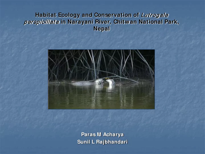
Habitat Ecology and Conservation of Lut ro
rogale pers rspicillat a in Narayani River, Chitwan National Park,
Nepal
Paras M Acharya Sunil L Rajbhandari
SLIDE 2
I ntroduction
Out of 13 species of otter recorded worldwide, 2 species are recorded in Nepal: 1) Eurasian otter, Lutra lutra; 2) Smooth-coated otter, Lutrogale perscipillata.
The common otter, Lutra lutra is included as Near threatened (Nt) species in the IUCN red list and in the Appendix I of CITES, Smooth coated otter, Lutrogale perscipillata in the IUCN Vulnerable (Vu) category and in the Appendix II of CITES.
This study assesses the habitat ecology of Lutrogale perscipillata in Narayani River of Chitwan National Park.
SLIDE 3
Study Area: Narayani River
SLIDE 4
SLIDE 5 Methods
Survey over 75 km stretch was conducted by canoes to assess the distribution of
- tters by checking 600 m stretch of river with 50 m width in every 1 or 1.5 km
transect on both banks of the river. The sampling was conducted from Sikrauli to Tribeni.
During the survey, the presence of otter was determined by different signs such as footprints, spraints, holts (dens), slides, and grooming sites. GPS location of otter signs was recorded. The habitat parameters such as substrate type, distance from bank, water depth, escape cover etc. were measured to know the relationship of these parameters to otter occurrence.
Footprints were measured with a ruler, taking the greatest width, i.e. across toes one and five.
Fishermen, nature guides, park rangers and game scouts, local communities were interviewed to generate information.
Arc View GIS 9.0 was used to map the distribution of the otters in the park.
SLIDE 6
SLIDE 7
SLIDE 8
SLIDE 9
SLIDE 10
Results
Observation of otter signs
The survey in January, 2009 recorded a large number of otter signs mainly tracks, scats, grooming, and resting sites in the western channel of Narayani river draining along the side of Nawalparasi district in the shallow channels with Sandy Island, muddy sand and elevated banks. Otter signs were also recorded in the eastern main channel of Narayani (Meghauli and Chauki Ghol).
The survey in June, 2009 recorded otter signs largely tracks in shallow braided channels near Gidha , Teen Bhangala, and Dibyapuri of the channel draining along the Nawalparasi district. The tracks were mostly found on the bank within park banks adjoining the confluence of shallow channels with the main river, mud/sandy islands in between the shallow channels with dense coverage of Saccharum spontaneum (Figure 2).
SLIDE 11
Location of Otter Signs
SLIDE 12
SLIDE 13
Table 1: Tracks and habitat features recorded in January 2009
SLIDE 14
Table 2: Tracks and habitat features recorded in June 2009
SLIDE 15
Table 3: Measurement of tracks
SLIDE 16
Table 4: Scat Location and habitat features
SLIDE 17
SLIDE 18
Table 5: Grooming sites with habitat parameters
SLIDE 19 Threats
Fishing
Fishing practice was rampant throughout the river basin. Chitwan National Park have provided the fishing license to fishermen living on fringe of the river to regulate fishing, human movement, and exploitation of aquatic resource and improvement of crocodile habitats.
Mullahs from Tribeni use large nets (Tiyarii fishing net) to collect all the fish from the specific area which further threatens the fish assemblages, otters, and crocodiles.
I ndustrial Pollution
There is a little doubt that pollution could be the cause of otter population decline. Discharges from the Gorkha Brewery and Bhrikuti Paper and Pulp factory and Pharmaceutical and Gill Mary were the major sources of pollution in Narayani River affecting otters, crocodiles, fish and other fauna.
Grazing
High grazing pressure was recorded in Gohithis, Badraughat, Ratanpur, Gaidakhasa and Seri. Lacks of places for cattle grazing, inadequate awareness and inadequate patrolling have seriously disturbed the riverine habitat thereby threatening the otter populations.
Sands and Boulder extraction
Sand and boulder extraction was observed around the key otter habitat near Gidha
- Post. Such activities were also observed in between Gohigajara and Tribeni. These
activities may severally affect otter habitats.
SLIDE 20
SLIDE 21
SLIDE 22 Recommendations
The exact spatial and temporal distribution of otters in Narayani could be obtained only through undertaking detailed research to investigate status, habitat requirements, , population size, feeding habits, breeding,
The zone between II and III should be protected as an otter sanctuary of park through strict patrolling and monitoring by local Game Post Offices.
Promote level of awareness to local licensed fishermen/ fishermen of crocodile project about importance and values of otter in river system.
Community based otter group should be established in local level under the supervision of park’s warden to monitor key otter habitats, and enhancing the awareness level to local communities/ buffer zone CF users, rangers, game scouts, water users about otter conservation.
The industries located in the catchments of river e.g. Gill Mary Distillery, and Pharmaceutical Industries should follow the proper treatment process and maintain the standards and monitor the consequences of discharge to aquatic systems in consultation with Chitwan National park.
CNP should dialogue with Valmiki Tiger reserve authorities regularly to solve the issues of river basin management and mugger crocodile and gharial conservation and poaching of wildlife.
The CNP should make a monitoring plan to study the impact of Gandak barrage in the migration and movement of fish, dolphin, gharial, marsh crocodile and otters.
SLIDE 23 Conclusion
Signs of otters mainly track, scats, resting site, grooming/rolling site and holts were found in abundance along the length of Narayani within the park from Gidha post to Bhosarghat (zones II and III). The large numbers of otter signs
- n the sandy islands of protected bank of the river in between these two
zones were due to prevalence of sandy islands, shallow water courses, woody debris, patches of islands in between the channels.
The absence of otter signs downstream from Amaltari to Tribeni barrage may be attributed to several reasons such as stagnant condition of river, due to impact of dam, rocky cliffs and boulders on shoreline, less escape coverage and high fishing pressure. Some areas like Kathona and Vellogi in downstream reaches have few sandy islands but otter signs were not recorded due to deeper water, rocky cliffs and less escape cover. Footprints measured in different places showed larger footprint with a maximum length
- f 10 cm and width of 8 cm corresponds to presence of Lutrogale
perspicillata.
Spraints were deposited by otters on sandy banks with dense coverage of Saccharum and Phragmites sps.with an average water depth of 1.5 m . Increasing human disturbances over fishing, cattle grazing, sand and boulder extraction, industrial pollution, inadequate awareness, industrial pollution are the existing threats that need to be addressed by protected area authorities in collaboration with key stakeholders.
SLIDE 24
The researchers would like to thank The Rufford Small Grants Foundation for supporting this study