Route 1 Multimodal Alternatives Analysis Executive Steering - - PowerPoint PPT Presentation
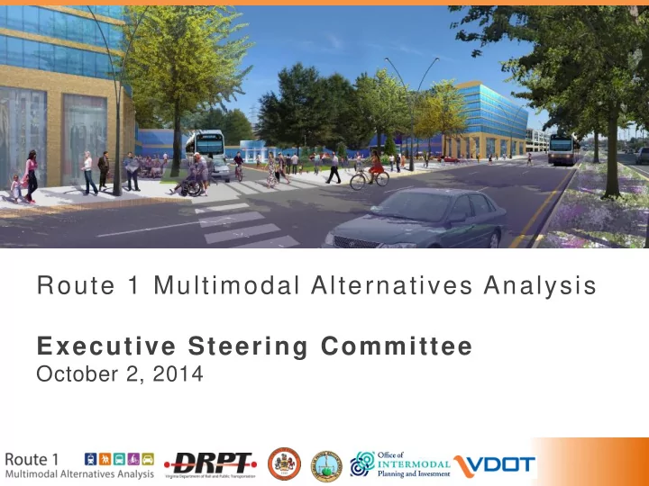
Route 1 Multimodal Alternatives Analysis Executive Steering Committee October 2, 2014 Agenda 1. Study Overview 2. Preliminary Recommendation 3. Project Feasibility and Timing Phasing Population and Employment Growth Traffic
Agenda
- 1. Study Overview
- 2. Preliminary Recommendation
- 3. Project Feasibility and Timing
– Phasing – Population and Employment Growth – Traffic Capacity – Funding
- 4. Next Steps
2
3
Study Schedule: Major Activities
We are here
Upcoming Public Meetings October 8: Prince William County (6-8pm, presentation at 7pm) Belmont Elementary October 9: Fairfax County (6-8pm, presentation at 6:30pm) South County Center
4
Where We’ve Been and Upcoming Meetings
ESC Meeting #1 (Summer2013)
- Study introduction
- Existing Conditions
- Goals and Objectives
ESC Meeting #2 (Fall 2013)
- Initial alternatives
- Evaluation measures
- Land use analysis
ESC Meeting #3 (Spring 2014)
- Evaluation of alternatives
- Preliminary Findings
- Action item: Phasing and implementation plan
- Action item: Financial analysis
- Action item: Additional traffic analysis
ESC Meeting #4 (Today)
- Present results of phasing exercise and financial feasibility
- Discuss public meeting #3
ESC Meeting #5 (Oct 27, 4:30-6:30pm)
- Endorse final recommendations
5
Alternatives Under Evaluation
10’ multiuse path (both
- 1. Identified a preferred bike/ped facility design: 10-foot shared use paths on both sides of street
- 2. Identified number of vehicular lanes (2035): 3 general purpose travel lanes in each direction
- 3. Identified 4 refined transit configurations to study in detail; each assumed two 10-foot multiuse paths
and six vehicular travel lanes Four Transit Alternatives (which include recommendations from above): Alternative 1: Bus Rapid Transit 1- Curbside Alternative 2: Bus Rapid Transit 2- Median Alternative 3: Light Rail Transit Alternative 4: Metrorail- BRT Hybrid
6
Alternatives Evaluation Process
Ability to Meet Goals & Objectives
Four Multimodal (Transit, roadway, bike/ped) Alternatives Evaluation of Alternatives
Recommendation and Action Items Implementation and Funding Considerations
1. Corridor growth 2. Roadway infrastructure 3. Funding plan
7
Summary of Key Indicators
Based on Scenario 1 Land Use (COG 2035 Forecast) Alt 1: BRT- Curb Alt 2: BRT- Median Alt 3: LRT Alt 4: Metro/BRT Hybrid Average Weekday Ridership (2035)
15,200 16,600 18,400 26,500
(BRT 10,600; Metro 22,900)
Conceptual Capital Cost
$832 M $1.01 B $1.56 B $2.46 B*
(Metro $1.46B; BRT $1 B)
Annual O&M Cost
(Each Alternative includes $5 M annual cost for Ft. Belvoir shuttle service)
$18 M
(BRT $13M; Ft Belvoir Shuttle $5M)
$17 M
(BRT $12M; Ft Belvoir Shuttle $5M)
$24 M
(LRT $19M; Ft Belvoir Shuttle $5M)
$31 M**
(Metro $17M; BRT $8M; Ft Belvoir Shuttle $5M)
Cost Effectiveness
(Annualized capital + operating cost per rider)
$19 $20 $27 $28**
(Metrorail: $28; BRT: $29)
* This figure represents full BRT construction between Huntington and
Woodbridge, then Metrorail extension from Huntington to Hybla Valley ** These figures assume operation of Metrorail between Huntington and Hybla Valley, and BRT between Hybla Valley and Woodbridge
8
Evaluation of Alternatives: Findings
- –
–
–
- Slide in Progress
9
Draft Recommendation
Evaluation results suggest:
- Median running Bus Rapid Transit (BRT) in the
near-term would provide a cost effective transportation solution to support economic development plans.
- Metrorail extension to Hybla Valley in the long-
term has potential to provide a higher level of local and regional mobility and support long- term corridor development, contingent upon increased future land use density.
10
Hybla Valley with BRT
11
Hybla Valley with BRT and Metrorail
12
Project Phasing
Bus Rapid Transit elements – schedule considerations Metrorail extension – indicators of readiness Potential implementation schedule
13
Phasing Approach
Phase I-III: Implement Multimodal Improvements and BRT (Median Running) Phase IV: Extend Metrorail to Hybla Valley, contingent upon future land use
3.1 mi. 7.3 mi 4.6 mi. 3.1 mi.
Note: contingent upon future land use
14
Phasing Approach
4.6 mi.
Phase I +II:
- Potentially competitive for federal New
Starts/Small Starts funding
- Highest population and employment
- Highest ridership potential
Phase IV:
- Potentially competitive for federal New Starts/Small
Starts funding in 2040
- Requires significant population and employment
growth, development density, and higher ridership
15
Comprehensive Plan Planning Scoping/ NEPA PE Final Design Right of Way Utilities Relocation Construction Operation
Approach: BRT and Long-Term Metrorail Implementation (2040)
Potential Implementation Timelines
Legend: General Project Development Sequence
15 16 17 18 19 20 21 22 23 24 25 26 27 28 29 30 31 32 33 34 35 36 37 38 39 40 Roadway Widening, Bike/Ped, BRT Phase I Comprehensive Plan Revisions
Phase II: Hybla Valley to Fort Belvoir
Bike/Ped, BRT Phase II Comprehensive Plan Revisions Roadway Widening, Bike/Ped, BRT Phase III Comprehensive Plan Revisions
Phase IV: Huntington to Hybla Valley Metrorail Extension
Metrorail Phase IV Comprehensive Plan Revisions Years (2015-2040)
Phase I: Huntington to Hybla Valley + Roadway Widening Phase III: Fort Belvoir to Woodbridge Improvements Note: Timelines assume a funding stream to support projects implementation. *Contingent upon increased future land use density.
*
16
Comprehensive Plan Planning Scoping/ NEPA PE Final Design Right of Way Utilities Relocation Construction Operation
Potential Implementation Timelines
Legend: General Project Development Sequence
15 16 17 18 19 20 21 22 23 24 25 26 27 28 29 30 31 32 33 34 35 36 37 38 39 40 Roadway Widening, Bike/Ped, BRT Phase I Comprehensive Plan Revisions
Phase II: Hybla Valley to Fort Belvoir
Bike/Ped, BRT Phase II Comprehensive Plan Revisions Roadway Widening, Bike/Ped, BRT Phase III Comprehensive Plan Revisions
Phase IV: Huntington to Hybla Valley Metrorail Extension
Metrorail Phase IV Comprehensive Plan Revisions Years (2015-2040)
Phase I: Huntington to Hybla Valley + Roadway Widening Phase III: Fort Belvoir to Woodbridge Improvements
Note: Timelines assume a funding stream to support projects implementation. *Contingent upon increased future land use density. *
FTA NEW STARTS PROJECT DEVELOPMENT PROCESS FTA SMALL STARTS PROJECT DEVELOPMENT PROCESS
Typical New Starts Funding Steps/Sequence:
17
Key Schedule Elements for Project Development
Implementation Steps Duration Schedule Considerations
- 1a. Comprehensive Plan
Updates 2+ years
- Add specific station locations
- Assess density levels
- Include supporting infrastructure
- 1b. Environmental
Clearance (NEPA) 2+ years
- Procurement
- Class of Action
- Public involvement
- 2. Right of Way Acquisition
2 years
- Property impacts
- Relocations
- 3. Utility Relocation
1-2 years
- Third party agreements
- Modernize infrastructure
- 4. Design
2 years
- Procurement
- Coordinate transit and roadway
- 5. Construction
3+ years
- Procurement
- Phase to keep Route 1 open
Total 10+ years
Recent Experience:
- Metroway BRT: 10 years from planning to operation
- Purple Line LRT: 10 years from planning to expected opening
- Silver Line Metro: 10 years since NEPA Clearance (25+ years total development)
Strategies to Expedite Process
Secure funding for environmental phase of work Initiate conversations with landowners early Evaluate alternative delivery methods
18
BRT (Phases I+II) potentially competitive for 50% Federal grant
1. Plan adoption in local and regional plans 2. Evaluate Comprehensive Plans and update as necessary − Transit Oriented Development (TOD) station area planning (finalize station locations) − Continue strong economic development and affordable housing policies − Supporting infrastructure (streets, schools, parks, etc.)
BRT: Steps Toward a Competitive Project by 2026-2028
19
Key Considerations for Metrorail Extension
- Metrorail Core Capacity: Metro has significant core capacity
constraints that need to be addressed before any potential extension (est. completion: 2025)
- Competitiveness for Federal Funding: Currently, a Metrorail
extension would not be competitive for federal funding until: − Ridership increases − Population and employment increase and land use changes
- County Land Use and Infrastructure Planning:
- Identify Comprehensive Plan updates
- Assess and develop infrastructure (streets, schools,
parks, etc.) to accommodate increased population and employment
- Attract growth through developer incentives and public
investment
Competitiveness for Federal Funding
- The Project would need an
additional 40,000 to 60,000 daily riders to receive a medium Cost Effectiveness rating
- In FY15, a 3.9 mile subway
extension in Los Angeles was granted entry into New Starts Project Development. The average population of a station area is 14,000; Route 1 averages 4,300. In LA, parking averages $9 a day.
- Station area and growth
planning will only strengthen Economic Development and Land Use ratings
20
Metrorail: Steps Toward a Competitive Project by 2040
Metrorail extension requires 50% Federal grant (New Starts) 1. Plan adoption in local and regional plans 2. Increase population and employment densities
– Assess market absorption rate – Attract additional County growth to the Route 1 corridor
- 3. Evaluate and update Comprehensive Plans
─ Tie project development milestones to density thresholds ─ Transit Oriented Development (TOD) station area planning (finalize station locations) ─ Supporting infrastructure (streets, schools, parks, etc.)
21
Project Context and Readiness
Population and employment growth Traffic capacity Project funding
22
Population and Employment Growth
Development Densities Supportive of Transit and other infrastructure requirements
23 P-6 (70+) P-4 (14-34) P-3 (7-14) P-5 (34-70)
Station Activity Density
(Population + Employment per Acre) Ballston-Rosslyn Norfolk LRT
(End of line station) (End of line station)
24
Station Activity Density Levels
(Population + Employment per Acre)
25
Land Use: Population and Employment Forecast
(Population + Employment per Acre)
15 17 18 21 24 26 20 24 28 34
2010 2015 2020 2030 2035 2040
Regional (COG) Projection for 3 Proposed Metro Stations along Route 1 3 Proposed Metro stations, Assuming 3.0- 3.5% growth rate (Ballston-Rosslyn Corridor Growth Rate Average over 30 years)
26
Traffic Capacity
Growth Scenarios and Roadway Requirements
27
Traffic Analysis Approach: Growth Scenarios
- Purpose:
– Assess potential “worst case” traffic impacts and define need for roadway and intersection capacity
- Measures:
– Intersection Level of Service (LOS) – Theoretical additional roadway capacity needed – Theoretical local street capacity + increased transit share + walk and bike trips
28
Traffic Analysis Findings: Scenario 1
- Addition of median transit lanes:
– Improves transit travel time – Increases automobile travel time – Does not degrade overall intersection performance – Left turns impacted
12.1 14.6 16.8 13.6 4 8 12 16
1 2
Segment Travel Time (min) 2035 No Build 2035 Build
Transit travel time Auto travel time
(Janna Lee Ave. to Huntington)
29
- Population and employment Growth
+15-25% over Scenario 1
Time Time
70 AD (+160%) 50 AD (+80%)
Population and employment growth up to 160% over Scenario 1
For highest density proposed station areas: Beacon Hill and Hybla Valley
Scenario 2 Share of trips: transit, walk, bike, internal, and peak spreading
20% 25% Widen Route 1
From 6 lanes to 8 lanes From 6 lanes To 8 lanes
OR Add parallel local streets
One new 2-lane street One new 2-lane street Scenario 3 Share of trips: transit, walk, bike, internal, and peak spreading
25% 40% to 50% Widen Route 1
From 6 lanes to 12 lanes From 6 lanes to 10 lanes
OR Add parallel local streets
Six new 2-lane streets Three new 2-lane streets
Traffic Analysis Findings: Scenarios 2 and 3
Street Infrastructure Required to Accommodate Growth
+15-25%
30
Traffic Analysis Conclusions
- Major growth is anticipated in the
Route 1 corridor in all scenarios, including COG 2035 forecast
- To accommodate growth, recommended
Route 1 transportation investment must be complemented by other major features (streets, schools, public safety, parks):
– Network of local streets – Mixed use development – Walkable, pedestrian friendly environment
- Metrorail supportive growth levels
require significantly more infrastructure investment than BRT levels
31
Project Funding
Financial Feasibility Analysis
32
Discussion: Funding Analysis
- Early assessment; considered broad range of potential funding sources
- Funding levels assume:
− Route 1 continues to be a high priority for local, regional and state investment − Major segments of Route 1 corridor could be competitive for Federal transit grant funding
- Need to further assess capacity of each funding source, given other
priority corridors and projects ─ Evaluate absorption rate and potential for major private land development ─ Seek “new” sources, such as private financing through P3
33
FTA Evaluation Criteria for New Starts/Small Starts
Economic Development (17%) Mobility Improvements (17%) Environmental Benefits (17%) Congestion Relief (17%) Land Use (17%) Reliability/ Capacity (50%) Commitment of Funds (25%) Current Conditions (25%)
Summary Rating
Cost Effectiveness (17%)
50% 50% Project Justification Local Financial Commitment
34
Phasing Considerations
3.1 mi. 7.3 mi 4.6 mi.
- Expedite segments that are most competitive for federal funding
- Reflect County and VDOT plans for Route 1 widening
- Reflect County funding priorities
3.1 mi. 7.3 mi 4.6 mi. 3.1 mi.
Note: contingent upon future land use
35
Funding by Phase
Phase Total Cost
Phase I $306 Phase II $224 Phase III $472 Phase IV $1,460
36
Discussion: Potential for P3 Project Delivery and Financing
- Several current major transportation projects are being
financed and implemented using public-private partnerships
− MTA Purple Line - DBOM with finance payments using a statewide transportation-specific fund − VA I-95 HOT lanes, I-495 - toll facilities − Denver Eagle P3
- With expanded access to private capital and private sector
efficiencies, P3 approaches can expedite project delivery
- P3 capital is effectively a “loan”, to be repaid over time through
some stream of revenue (or more literally, it is equity with the expectation of a return on investment)
37
7.3 mi
Transit Funding Assumptions by Geographic Segment
Phase I+II : Huntington to Fort Belvoir
- Potentially competitive for federal
New Starts/Small Starts funding
- Highest population and employment
- Highest ridership potential
Phase III: Fort Belvoir to Woodbridge
- Less competitive for federal funding
- Lower population and employment
- Consistent with planned VDOT
widening
50% 33% 8% 9%
Federal State Regional Local
10% 33% 20% 22% 15% Federal State Regional Local Unidentified
38
7.3 mi
Funding by Geographic Segment
Phase IV: Huntington to Hybla Valley
- Potentially competitive for federal
New Starts funding in 2040
- Contingent upon increased future
land use density.
50% 33% 8% 9%
Federal State Regional Local
39
Next Steps
40
Action Plan for Implementation
41
Next Steps: Adopt Study Findings and Continue
Toward Implementation
-
- Study team completes
Alternatives Analysis Local and state officials adopt findings and recommendations Project team completes environmental documentation and concept engineering
Conduct Market Studies, Identify Comprehensive Plan Updates
Process Overview
Project team refines cost estimates and funding plans
Coordination with public stakeholders and state and federal agencies