
SLIDE 1
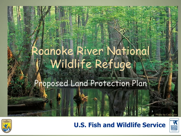
Roanoke River National Wildlife Refuge
Proposed Land Protection Plan
Photo by Carl Galie
Roanoke River National Wildlife Refuge Proposed Land Protection - - PowerPoint PPT Presentation
Roanoke River National Wildlife Refuge Proposed Land Protection Plan Photo by Carl Galie U.S. Fish and Wildlife Service . Welcome and Good Evening Information Session Agenda Introductions Purpose of Session Background on USFWS
Photo by Carl Galie
The Roanoke River is a 442- mile-long river with 9,875 square miles of drainage in North Carolina and Virginia. This project focuses on the lower reach of the river.
Sea Level Rise Simulation: Shows increases in 4 inch increments up to 32 inches. Estimates of how long this will take vary. Current rate = 200 years Fastest case = 150 years
Document generated by Rua Mordecai on August 12, 2013
Legend
Probability of Urbanization in 2010 Urban in 2009 0-2.5 2.5-5 5-10 10-20 20-30 30-40 40-50 50-60 60-70 70-80 80-90 90-95 95-97.5 97.5-100
We are recognizing that the entire lower reach of the Roanoke River is important to wildlife and the people of the region. Pressures from sea-level rise and projected urban growth will result in less habitat for wildlife and more stress placed on the habitat left. The Roanoke River National Wildlife Refuge can help to protect and sustain the health of the Roanoke River. Right now, land owners do not have the option to donate, sell
Roanoke River. The Proposed Conservation Partnership Area will expand the options and opportunities of land owners and the refuge.
The Proposed Conservation Partnership Area follows the course of the lower Roanoke
selecting parcels of land that either partially or completely fall within the footprint of a 35,000 ft3/second flood from the J.H. Kerr Dam. The area covers the existing Roanoke River NWR, other conservation areas, and private lands along the river. Simply highlights an area that is especially important for wildlife.
Lands are prioritized by location and significance to wildlife. The Service is limited to fee-title purchase
the Proposed Conservation Partnership Area (CPA). The Service is limited to easements and cooperative agreements on no more than 100,000 acres within the Proposed CPA.
l Conservation easements limit certain types of uses or
prevent development in perpetuity, while the underlying fee-title remains in private ownership.
l Individually tailored to meet a landowner's needs while
fulfilling specific conservation needs.
l Taxes may be reduced in the future based on owner
retained use.
Fee-title is absolute title to land, free of any conditions, limitations, restrictions, or other claims against the title, unless an indication to impose conditions or limitations is clearly stated.
do on your land.
anyone you choose, just like now. However NOW you may also:
easement to the U.S. Fish and Wildlife Service.
agreement with the U.S. Fish and Wildlife Service for certain purposes.
Fish and Wildlife Service if you choose.
The Service’s policy is to work with willing sellers only. Nothing changes for you, unless:
manages the land much like Roanoke River NWR is managed now. Or
managed by the Service as part of Roanoke River NWR. Or
with the Service for a purpose that is agreeable to you and the Service. Then you share responsibilities on your land for the specific purposes
You still choose if you want to sell your land, who you wish to sell to, and what you do on your property.
inclusion in the Conservation Partnership Area.
your property.
U.S. Fish and Wildlife Service, the property would be managed much like the Roanoke River National Wildlife Refuge is now.
photography, wildlife observation, interpretation and environmental education as long as they do not interfere with the purposes for which the refuge was established.
township, county and state governments, is exempt from taxation.
the tax losses by annually paying each county an amount that
from taxes if the land was left in private ownership.
Sharing Payments and Payments in Lieu of Taxes.
that payments be made to counties, for all land purchased by the Service in fee title. These payments will be based
v ¾ of 1 percent of the fair market value, or v 25 percent of the net receipts collected for products
v 75 cents per acre
was public land before becoming part of the Refuge and had never been private land. It is calculated based on 25%
Year Acres Assessment Payment % of Due 2007 21,062 $13,337,000 $41,669 41.66% 2008 21,062 $13,337,000 $32,329 32.32% 2009 21,062 $16,470,000 $37,515 30.37% 2010 21,062 $16,470,000 $26,433 21.40% 2011 20,562 $16,470,000 $28,326 22.93% 2012 20,562 $16,470,000 $26,617 21.55% 2013 20,562 $27,750,000 $52,632 25.29% 2014 20,562 $27,750,000 $49,262 23.67% 2015 20,562 $27,750,000 $51,794 24.88%
Service receives from products or privileges like timber sales, grazing fees, or right-of-way permit fees from all refuges.
lands owned in fee title by the Service within each respective county.
100% distribution, each county will receive a proportional share based on the national funding available each year.
appropriate funds for this purpose.
assessed on present use which may qualify the landowner for a reduced tax bill based on a present use tax
horticulture, and forestry can qualify under this program.
use does not apply to Service
Sharing Payment is based on the full market value not a use value.
will change just like the assessments
Service reappraises the market value
years.
county may use this money. The money may be used for any governmental purpose.
never been in private ownership and have never generated tax in the past.
Ø Nationwide 46.5 million people visited National Wildlife Refuges in 2011. Ø These visitors generated $2.4 Billion in sales for regional economies. Ø Non-residents accounted for 77% of expenditures by visitors. Ø Refuge recreational spending generated about $342.9 million in tax revenue at the local, county, state and Federal level. Not including refuge revenue sharing or payment in lieu of taxes. Ø The southeast had the highest visitation of any area in the country. Ø 72% of spending was on recreation that was non-consumptive.
USFWS Banking on Nature 2013
Alligator River NWR Total Visitors in 2011 – 51,793 Total Visitor Expenditures - $1,339,600 Non-Residents – 24,412 Total Tax and Revenue - $174,300 Residents – 27,381 Pea Island NWR Total Visitors in 2011 – 603,150 Total Visitor Expenditures - $16,208,300 Non-Residents – 362,755 Total Tax and Revenue - $2,928,000 Residents – 240,395 Pocosin Lakes NWR Total Visitors in 2011 – 70,150 Total Visitor Expenditures - $1,988,700 Non-Residents – 42,305 Total Tax and Revenue - $311,000 Residents – 27,845
USFWS Banking on Nature 2013
Balancing Nature and Commerce in Northeastern North Carolina “Connecting Our Region”
Purpose: Cultivate the creation of a regional identity that fosters sustainable economic development and regional partnerships and builds awareness of the value of the Region’s assets
What is the Northeastern North Carolina Balancing Nature & Commerce IniEaEve
participants in a regional workshop held in October, 2015 focused on developing ecotourism in the region.
Council of Government was selected as the Program Manager for the Initiative
and work across county lines whenever possible to grow ecotourism and support services.
maintenance of waterways in order to attract users.
designed to attract professionals to locate to the area but is evolving more broadly into community
Infrastructure Across the Region
Access Points
Your input into the planning for this project is important.