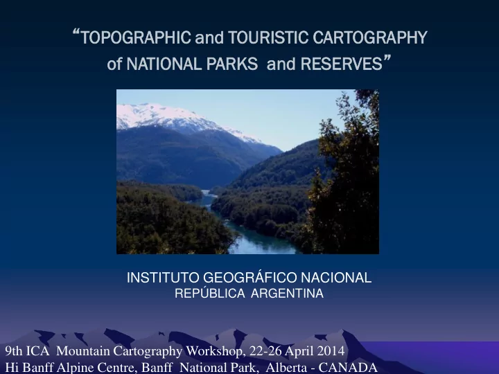
RESU ESUME ME THIS PRESENTATION WILL SHOW YOU THE METHODOLOGY THAT - - PowerPoint PPT Presentation

resu esume me
SMART_READER_LITE
LIVE PREVIEW

RESU ESUME ME THIS PRESENTATION WILL SHOW YOU THE METHODOLOGY THAT - - PowerPoint PPT Presentation

TOPOG OPOGRAP APHIC HIC and TOUR URIS ISTIC TIC CART ARTOGRA OGRAPH PHY VES of NATIONA ONAL L PARKS and d RESER ERVES INSTITUTO GEOGRFICO NACIONAL REPBLICA ARGENTINA 9th ICA Mountain Cartography Workshop, 22-26 April


slide-1
SLIDE 1

“TOPOG

OPOGRAP APHIC HIC and TOUR URIS ISTIC TIC CART ARTOGRA OGRAPH PHY

  • f NATIONA

ONAL L PARKS and d RESER ERVES VES”

9th ICA Mountain Cartography Workshop, 22-26 April 2014 Hi Banff Alpine Centre, Banff National Park, Alberta - CANADA INSTITUTO GEOGRÁFICO NACIONAL

REPÚBLICA ARGENTINA

slide-2
SLIDE 2

RESU ESUME ME

  • THIS PRESENTATION WILL SHOW YOU THE METHODOLOGY THAT

INSTITUTO GEOGRÁFICO NACIONAL (IGN) IS BEGINNING TO EMPLOY THIS YEAR FOR THE PRODUCTION OF TOPOGRAHIC AND TOURISTIC MAPS OF NATIONAL PARKS AND RESERVES.

  • THE MAP WAS POSSIBLE THANKS TO THE PARTICIPATION OF THE

NATIONAL PARKS ADMINISTRATION (APN). THEY ADDED GEOGRAPHICAL INFORMATION REGARDING TOURISTIC ACTIVITIES AND SOME NICE PICTURES

  • THE BACK OF THE MAP HAS A LANDSAT 8 SATELLITE IMAGE AND

SOME INFORMATION PROVIDED BY THE APN

  • THE RESULT IS A PROTOTYPE OF A TOPOGRAPHIC AND TOURISTIC

MAP OF “LOS ALERCES NATIONAL PARK AND RESERVE” AT 1:100,000 SCALE

slide-3
SLIDE 3

OB OBJECTIVES ECTIVES

  • To develop the methodology for the production of the topographic

and touristic official maps of all national parks and reserves located in mountain regions

  • To design these maps with the participation of the

National Parks Administration, who will provide us with different

information about touristic activities in different formats included in both sides of the map.

  • To make the map in an appropriate size, easy for transportation and

printed in water-proof folding paper

  • To offer tourists updated information to easily find their way

through the park

slide-4
SLIDE 4

NA NATIONAL TIONAL PARKS KS ADMI MINI NISTRA TRATI TION ON

  • IS THE NATIONAL ORGANISM RESPONSIBLE FOR THE PROTECTION OF

THE NATURAL AREAS THAT ARE UNDER ITS CONTROL

  • IT IS RESPONSIBLE FOR 34 PROTECTED AREAS, 20 OF THEM LOCATED IN

MOUNTAIN REGIONS

  • THE SMALLEST HAS AN AREA OF 10 HECTARES AND THE BIGGEST HAS AN

AREA OF 727,000 HECTARES

slide-5
SLIDE 5

CHOSEN OSEN PAR ARK

“LOS ALERCES NATIONAL PARK AND RESERVE”

AS OUR FIRST PROTOTYPE REASONS:

  • IT IS ONE OF THE MOST BEAUTIFUL PARKS VISITED BY TOURISTS FROM MANY

COUNTRIES

  • THIS PARK WAS REPRESENTED FOR LAST TIME IN 1977 BY THE IGM. WE

UNDERSTAND IT IS INMEDIATELLY NECESARY TO GENERATE A NEW UPDATED AND BETTER QUALITY VERSION

  • THERE ARE OLD CARTOGRAPHY AVAILABLE
slide-6
SLIDE 6

LOC OCATI TION ON

Chubut in Argentina The Park in Chubut Los Alerces NP THE PARK IS LOCATED IN THE: PATAGONIA REGION CHUBUT PROVINCE (at the NW)

36’ 57’’ in West-East direction 37’ 20’’ in North-South direction

slide-7
SLIDE 7

IT WAS CREATED ON MAY 11, 1937 IT COVERS AN AREA OF 263.000 HAS. IT IS THE FOURTH IN SIZE COMPARED TO THE OTHER PARKS THE MAIN OBJECTIVE IS TO SPECIALLY PROTECT THE ANCIENT LARCH SPECIMEN OF THE NATURA ANDINIAN PATAGONIA IN ITS LANDSCAPES THERE ARE SOME VIRGIN FORESTS, LAKES, FALLS, RIVERS, MOUNTAIN CHAINS AND HIGH MOUNTAIN GLACIERS

PARK RK HISTOR ORY AND ND SOM OME E DET ETAILS AILS

slide-8
SLIDE 8

SPECIAL FORMAT:

A map of the park’s area Made by the IGM:

PARQUE Y RESERVA NACIONAL LOS ALERCES

  • Edition year:

1977

  • Scale:

1:150.000

  • Contour interval:

150 meters

  • It has a group of touristic

cartographic signs specially designed for this map

PR PREVIOUS EVIOUS CARTOGRAPHY OGRAPHY I

slide-9
SLIDE 9

PR PREVIOUS EVIOUS CARTOGRAPHY OGRAPHY II

STANDARD CARTOGRAPHY Longitude: 30’, Latitude: 20’

5 maps at 1:100.000 scale Made by the IGM:

4372-9, Cerro Chato, 1981 4372-10, Lago Rivadavia, 1981 4372-15, Paso Navarro, 1981 4372-16, Villa Futalaufquen, 1981 4372-22, Complejo Hidroeléctrico Futaleufú, 1982 Contour interval: 50 y 100 meters

slide-10
SLIDE 10

PR PREVIOUS EVIOUS CARTOGRAPHY OGRAPHY III

INTERNATIONAL BOUNDARY CARTOGRAPHY

6 topographic maps at 1:50.000 scale Made by: International Boundaries National Commission CONALI Edition Year: 1995 This is not public information Only a few National Organisms can use it IGN had to respect the boundary line that this Commission defined Section VII-10 Section VII-9 Section VII-8 SectionVII-7 Section VII-6 Sección VII-5

Contour interval 50 meters

slide-11
SLIDE 11

SCALE ALE DEF EFINI INITION TION

THE PARK SIZE Measures of the park are: Longitude direction: 50 km Latitude direction: 69 km The park area at 1:100.000 scale: Width: 50 cm High: 69 cm Plus the small border: Width: 56 cm High: 76 cm The map size:

60 x 80 cm

Folded map size:

12 x 20 cm

slide-12
SLIDE 12

INF NFORMA ORMATI TION ON USED ED FROM OM NE NEW TECHNOL ECHNOLOGIES OGIES

DIGITAL ELEVATION MODEL: Argentine DEM of 45 meters pixel size SATELLITE IMAGE: LandSat 8, merged between: Multispectral, 30 meters (Feb 19, 2014) Panchromatic, 15 meters GIS APN: Different shapes regarding touristic information and forest areas

slide-13
SLIDE 13

DEF EFINI INITION TION OF OF REF EFERENC ERENCE E AND ND PR PROJECTION OJECTION SYSTEMS TEMS TO O USE

PROJECTION SYSTEM: Gauss Kruger, 1st strip Transversal Mercator, Meridian tangency: 72 º W REFERENCE SYSTEM: POSGAR 07 (Argentine Geodetic Positioning, 2007) ELIPSOID: WGS 84 ALTIMETRIC DATUM: Referred to the medium see level as hypsometric horizon, adopted in 1924 for the tide instrument located in Mar del Plata City

slide-14
SLIDE 14

PR PREVIOUS EVIOUS CARTOGRAPHY OGRAPHY

GEO GEO–REF REFERE ERENC NCIA IATION ION (HOMOGE GENIZA NIZATION) ION)

Transf ansformation

  • rmation of Differen

rent t Proje jection ction and Referen rence e Systems ems

MAP OF THE PARK (made by the IGM in 1977) Unknown data Referenced by similar terrain details STANDARD CARTOGRAPHY AT 1:100.000 SCALE (made in 1981/2) These have been made in the same parameters that we chose for the new map BOUNDARY CARTOGRAPHY (made by CONALI IN 1995) For this case, the 6 maps are en two different reference systems The parallel of 43° is that separated both systems With the known parameters it was possible to adjust these maps in the selected system

slide-15
SLIDE 15

SATTELITE TTELITE IMA MAGES ES

THE SATTELITE IMAGES WERE USED FOR THE CAPTURE OF: Lakes Rivers Streams Roads Snow Areas FOR MORE DETAILS: We also used the Imagery package provided by ESRI Company through ArcGis 10 software for the capture of more details when it was necessary:

The Buildings’ Position Some Parts of Thin Trails into the Forest The Secondary Streets in Little Villages And a Few More Things.

slide-16
SLIDE 16

DIGIT GITAL AL EL ELEV EVATION TION MO MODEL EL

ORIGINAL DATA: The original DEM is from the SRTM (Shuttle Radar Topography Mission) with 30 meters cell size. FROM THAT THE IGN CREATED OTHER DEM: Resolution: 45 meters DEM SUB - PRODUCTS:

  • CONTOUR LINES
  • SHADOW RELIEF MODEL
  • FOREST AND SNOW AREAS (*)

(*) With polygons previously vectorized from the satellite image The contour lines generated from this model has a contour interval of 100 meters

slide-17
SLIDE 17

COM OMPARISON: ARISON: Cont

  • ntour
  • ur li

lines wi with th th the sat atell llit ite e ima mage

In general: good results A few mistakes specially in: big slopes flat areas All mistakes were corrected by handly vectorization from the old cartography

slide-18
SLIDE 18

GIS APN PN

The most important geographical elements that we represented in this map have to do with touristic information All this data was provided by the APN Examples: Park ranger offices Geographical names Trails into the forests Forest areas Names of farms

slide-19
SLIDE 19

PL PLACEM CEMENT ENT OF OF GEO EOGRAPHICAL RAPHICAL NA NAME MES

The criteria was to place all geographical names the way they were in our

  • ld cartography.

Except when they don’t coincide with the information from APN. In these cases we respect their information SOME CHANGES: Regarding the names of the peaks and their height, in this opportunity these sizes were incremented so the users could read them better than in our

  • fficial cartography
slide-20
SLIDE 20

CAR ARTOGRA OGRAPHY PHY SIGNS NS

In general, most of the cartography signs are the same as our orthodoxies signs for the rest of the cartography Regarding touristic signs, we took the design of the special format map of Los Alerces National Park and Reserve made in 1977. This signs were printed only in black. After vectorize it, we took other aesthetic signs and filled them with different colors

slide-21
SLIDE 21

SHADO DOW

The DEM was processed to generate the hill shading Parallel to this we created 2 new color ramps in ArcMap One of them for the shadow and the other for the ilumination These ramps are algorithmic ramps They are divided in 5 sectors Some of them are in white colour

slide-22
SLIDE 22

GREY EY RAMP MP COL OLOUR OUR

The grey ramp colour represents the shadow: The dark grey colour (medium grey: 50% black) starts on the left. Along the four first sectors, it turns into white. The last sector (fifth) is completely white After that, we applied a 10% contrast and 40% of transparency

slide-23
SLIDE 23

YEL ELLOW W RAMP MP COL OLOUR OUR

The yellow ramp colour represents the illumination: The ramp begins (from left to right) with three sectors in white color Then, along the last two sectors, it starts in white and in lineal form and it is converted into a medium yellow color After that, we applied 50 % contrast and 88 % of transparency

slide-24
SLIDE 24

GREY EY RAMP MP COL OLOUR OUR II

Above the last two layers, we added another one, also in grey color, but with different values of contrast and Transparency The objective with this is to highlight the darkest areas in a small touch

  • f dark grey

The contrast applied is 30 % and its transparency is 80 %

slide-25
SLIDE 25

SNO NOW W AREAS EAS

A new raster image was generated from the shadow model for the cartographic representation of the snow areas Then it was processed, we applied another custom light blue ramp colour And finally a contrast of 15 % and a transparency of 70 % It is necessary to place a mask in white color below this

slide-26
SLIDE 26

FOR ORES EST T AREAS EAS

These areas were represented the same way as the snow areas but in green colour For the case of forest areas we took a determination: There are five representative kinds of different forests We decided to highlight the most representative of them all: larches areas After that, we selected two tones of green, one of them for the larches and the other, in a clear green, for the rest of the forest The forest areas ramp colour is composed in lineal form It starts on the left with a very light blue and finishes in a dark green color Start: Cyan 14 %, magenta 4 % and yellow 9 % Finish: Cyan 87 %, magenta 40 % and yellow 87 % The Larches areas ramp colour is composite in lineal form It starts on the left with a medium green and it finishes in white colour The darker green: cyan 87 %, magenta 60 % and yellow 80 %

slide-27
SLIDE 27

FOR ORES EST T AREAS EAS

Forest

est areas Larches es areas

slide-28
SLIDE 28

PR PROCESSING OCESSING IN N PH PHOTOSH OSHOP OP

To finish the raster file, it is necessary to applied some filters in a design software In Photoshop we have to apply two kinds of filters:

  • 1. Surface blur

Ratio: 2 Umbral: 10

  • 1. Gaussian blur

Ratio: 0.5

slide-29
SLIDE 29

MA MARGINA GINALIA LIA INF NFORMA ORMATION TION

As the Chilean territory wasn’t represented, there is an area out of the map, where users can find all complementary information to be able to understand all aspects of the map. It includes: Tittle of the map (name of the park) What kind of map it is The logos of the participant organisms Geographical situation of the park References about cartographic signs Abbreviations Initials Data used Date of edition Out of the work area, there are coordinate values, main contour lines values and the places names where the routes conduct out of the map

slide-30
SLIDE 30

SHEET EET FOL OLDED ED AND ND BA BACK INF NFORMA ORMATION TION

The final product, is presented by a folded form Its final size is 12 x 20 cm On the other map’ side, there is very interesting information:

  • 1. A satellite image of the park area, at 1:200.000 scale
  • 2. Information regarding:
  • 1. Geographic Aspects
  • 2. Generalities
  • 3. Useful Data
  • 4. Touristic Services
  • 5. Recreation Activities
  • 6. Some of its History
  • 7. Valuable Species
  • 8. Regulation and habits for your safety
  • 9. Institutional information and contacts
slide-31
SLIDE 31

FINISHED NISHED MA MAP

The map on the front Back information

slide-32
SLIDE 32

DISTRIBUTI TRIBUTION ON

2500 maps will be printed at the IGN printer press to begin

  • with. 1000 of them will be given to the APN so it could

distribute them as it better considers. The rest will remain in the IGN distributed among what it will be sent to the public from the sales department and a few

  • f them to give as gifts in fairs, congresses and exhibitions.
slide-33
SLIDE 33

PLEASE…

  • The map that I have presented today is not the

final version, it is only a prototype, we still have some aspects to work on.

  • I would really appreciate it if you can take a

look at the map and give me some feedback. This is very important for us because it would be our first product revised by the Commission on Mountain Cartography

slide-34
SLIDE 34

CONCL ONCLUTIO UTIONS NS

We were able to make our first topographic and touristic map with the colaboration of the APN and with modern representation techniques We believe our product will have great acceptance and tourists will definitelly use it when the time comes to plan their visit to the park. A lot of work awaits us and we need to study each case in particular because each park is unique, not only because

  • f its ecosystem but also because of its size and available

information

slide-35
SLIDE 35

THA HANK NK YO YOU U VE VERY Y MU MUCH! H!

Carlos Osvaldo NELSON

Instituto Geográfico Nacional

República Argentina