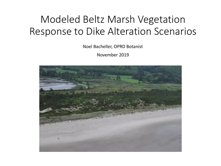
Response to Dike Alteration Scenarios Noel Bacheller, OPRD Botanist - - PowerPoint PPT Presentation

response to dike alteration scenarios
SMART_READER_LITE
LIVE PREVIEW

Response to Dike Alteration Scenarios Noel Bacheller, OPRD Botanist - - PowerPoint PPT Presentation

Modeled Beltz Marsh Vegetation Response to Dike Alteration Scenarios Noel Bacheller, OPRD Botanist November 2019 Exis xistin ing Vegetation patterns Existing vegetation types as of 2015 are well documented Broad habitat types in


slide-1
SLIDE 1

Modeled Beltz Marsh Vegetation Response to Dike Alteration Scenarios

Noel Bacheller, OPRD Botanist November 2019

slide-2
SLIDE 2

Exis xistin ing Vegetation patterns

  • Existing vegetation types as of 2015 are well

documented

  • Broad habitat types in Beltz Marsh and Sand Lake

follow predictable patterns based on elevation and the amount of tidal inundation areas receive

slide-3
SLIDE 3

Vegetation patterns and modelin ing pot

  • tentia

ial fu futu ture sce cenarios

  • Vegetation was first modelled in 2015 for

preliminary scenarios, which have changed significantly in the past 2 years

  • 2015 modeling was based on water surface

elevation modeling done by Waterways, Inc for the scenarios: existing tide gate, tide gate flap removal, 18ft active channel width breach

  • Past vegetation modeling methods and code were

easily adapted to new scenarios under consideration today

  • This 2019 vegetation modeling is based on a 7.5

month tidal simulation period produced by ESA during the surface and groundwater modeling project of 2017-2019 for the scenarios: existing tide gate, modern tide gates, 40’ breach, and setback dike.

slide-4
SLIDE 4

Vegetation patterns ou

  • uts

tside th the dik ike

Ft NAVD88

  • Ft. Relative to

MHHW 12 3.4 11.8 3.2 11.6 Forested Wetland 3 11.4 2.8 11.2 2.6 11 2.4 10.8 Scrub-Shrub Wetland 2.2 10.6 2 10.4 1.8 10.2 1.6 10 1.4 9.8 1.2 9.6 Freshwater Marsh 1 9.4 0.8 9.2 0.6 9 0.4 8.8 High Saltmarsh 0.2 8.6 8.4

  • 0.2

8.2

  • 0.4

8

  • 0.6

7.8

  • 0.8

7.6 Low Saltmarsh

  • 1

7.4

  • 1.2

7.2

  • 1.4

7

  • 1.6

6.8

  • 1.8

6.6

  • 2

6.4

  • 2.2

6.2

  • 2.4

6 Water/Mud

  • 2.6

5.8

  • 2.8

5.6

  • 3

5.4

  • 3.2

Current pattern outside dike Classification Tree trained on known vegetation

  • A common way of predicting vegetation by

elevation in estuaries is to refer to vegetation type boundaries relative to Mean Higher High Water (MHHW)

slide-5
SLIDE 5

Application of

  • f vegetation patterns ou
  • utsid

ide th the dik ike to

  • pot
  • tentia

ial fu future sce scenarios: Mod

  • dern tid

tide gates

Current pattern outside dike Applying outside pattern to modeled modern tide gate

  • Using the known pattern of vegetation relative

to MHHW, we can shift the “bathtub rings” of vegetation downward according to the predicted new MHHW

  • This is overly simplistic, but gives an easy way to

approximately visualize it.

  • MHHW for Sand Lake=8.6
  • MHHW for inside dike with modern tide gates

=7.2

  • MHHW for the existing condition = 7.3

Ft NAVD88

  • Ft. Relative to

MHHW_SL Ft NAVD88

  • Ft. Relative to

MHHW_MG 12.6 (Upland) 4 12.6 5.4 12.4 3.8 12.4 5.2 12.2 3.6 12.2 5 12 3.4 12 4.8 11.8 3.2 11.8 4.6 11.6 Forested Wetland 3 11.6 4.4 11.4 2.8 11.4 (Upland?) 4.2 11.2 2.6 11.2 4 11 2.4 11 3.8 10.8 Scrub-Shrub Wetland 2.2 10.8 3.6 10.6 2 10.6 3.4 10.4 1.8 10.4 3.2 10.2 1.6 10.2 Forested Wetland 3 10 1.4 10 2.8 9.8 1.2 9.8 2.6 9.6 Freshwater Marsh 1 9.6 2.4 9.4 0.8 9.4 Scrub-Shrub Wetland 2.2 9.2 0.6 9.2 2 9 0.4 9 1.8 8.8 High Saltmarsh 0.2 8.8 1.6 8.6 8.6 1.4 8.4

  • 0.2

8.4 1.2 8.2

  • 0.4

8.2 Freshwater Marsh 1 8

  • 0.6

8 0.8 7.8

  • 0.8

7.8 0.6 7.6 Low Saltmarsh

  • 1

7.6 0.4 7.4

  • 1.2

7.4 High Saltmarsh 0.2 7.2

  • 1.4

7.2 7

  • 1.6

7

  • 0.2

6.8

  • 1.8

6.8

  • 0.4

6.6

  • 2

6.6

  • 0.6

6.4

  • 2.2

6.4

  • 0.8

6.2

  • 2.4

6.2 Low Saltmarsh

  • 1

6 Water/Mud

  • 2.6

6

  • 1.2

5.8

  • 2.8

5.8

  • 1.4

5.6

  • 3

5.6

  • 1.6

5.4

  • 3.2

5.4

  • 1.8

5.2

  • 3.4

5.2

  • 2

5

  • 3.6

5

  • 2.2

4.8

  • 3.8

4.8

  • 2.4

4.6

  • 4

4.6 Water/Mud

  • 2.6

4.4

  • 4.2

4.4

  • 2.8

4.2

  • 4.4

4.2

  • 3

4

  • 4.6

4

  • 3.2
slide-6
SLIDE 6

Appli lication of

  • f veg

egetation patterns ou

  • uts

tsid ide e th the e dik ike e to

  • pot
  • tentia

ial fu futu ture e scen cenarios: Br Breach

Current pattern outside dike Breach prediction

  • Because the breach scenario results in the same

water levels inside the dike as outside the dike at all times, the vegetation patterns seen outside the dike should be the same as those that would

  • ccur inside the dike
  • This is overly simplistic, but gives an easy way to

approximately visualize it.

  • There are also considerations of vegetation

resiliency that need to be factored in

Ft NAVD88

  • Ft. Relative to

MHHW_SL 12.6 (Upland) 4 12.4 3.8 12.2 3.6 12 3.4 11.8 3.2 11.6 Forested Wetland 3 11.4 2.8 11.2 2.6 11 2.4 10.8 Scrub-Shrub Wetland 2.2 10.6 2 10.4 1.8 10.2 1.6 10 1.4 9.8 1.2 9.6 Freshwater Marsh 1 9.4 0.8 9.2 0.6 9 0.4 8.8 High Saltmarsh 0.2 8.6 8.4

  • 0.2

8.2

  • 0.4

8

  • 0.6

7.8

  • 0.8

7.6 Low Saltmarsh

  • 1

7.4

  • 1.2

7.2

  • 1.4

7

  • 1.6

6.8

  • 1.8

6.6

  • 2

6.4

  • 2.2

6.2

  • 2.4

6 Water/Mud

  • 2.6

5.8

  • 2.8

5.6

  • 3

5.4

  • 3.2

5.2

  • 3.4

5

  • 3.6

4.8

  • 3.8

4.6

  • 4

4.4

  • 4.2

4.2

  • 4.4

4

  • 4.6
slide-7
SLIDE 7

Appli lication of

  • f veg

egetation patterns ou

  • uts

tsid ide e th the e dik ike e to

  • pot
  • tentia

ial fu futu ture e scen cenarios: im improved mod

  • deli

ling meth thods

  • Shifting vegetation elevation “bathtub rings”

downward might work OK for the upper elevations, but probably not for lower elevations.

  • This is because the lower limit of water level is

controlled and cannot go below 5.5ft NAVD88.

  • This may imply reduced ranges for the lower-

lying vegetation zones than would be predicted with a simple shift.

  • There are gray areas between the vegetation

zones where vegetation types can overlap in inundation tolerance range… simplistic maximum likelihood models give sort of a winner takes all output

  • Reality will likely mean that there will be some

uncertainty in what vegetation will win out in

  • verlapping niches
  • There will be an incumbent advantage for

vegetation types that are already in place

  • Allowances needed for:
  • resiliency of existing vegetation
  • chance

Current pattern outside dike Applying outside pattern to modeled modern tide gate

Ft NAVD88

  • Ft. Relative to

MHHW_SL Ft NAVD88

  • Ft. Relative to

MHHW_MG 12.6 (Upland) 4 12.6 5.4 12.4 3.8 12.4 5.2 12.2 3.6 12.2 5 12 3.4 12 4.8 11.8 3.2 11.8 4.6 11.6 Forested Wetland 3 11.6 4.4 11.4 2.8 11.4 (Upland?) 4.2 11.2 2.6 11.2 4 11 2.4 11 3.8 10.8 Scrub-Shrub Wetland 2.2 10.8 3.6 10.6 2 10.6 3.4 10.4 1.8 10.4 3.2 10.2 1.6 10.2 Forested Wetland 3 10 1.4 10 2.8 9.8 1.2 9.8 2.6 9.6 Freshwater Marsh 1 9.6 2.4 9.4 0.8 9.4 Scrub-Shrub Wetland 2.2 9.2 0.6 9.2 2 9 0.4 9 1.8 8.8 High Saltmarsh 0.2 8.8 1.6 8.6 8.6 1.4 8.4

  • 0.2

8.4 1.2 8.2

  • 0.4

8.2 Freshwater Marsh 1 8

  • 0.6

8 0.8 7.8

  • 0.8

7.8 0.6 7.6 Low Saltmarsh

  • 1

7.6 0.4 7.4

  • 1.2

7.4 High Saltmarsh 0.2 7.2

  • 1.4

7.2 7

  • 1.6

7

  • 0.2

6.8

  • 1.8

6.8

  • 0.4

6.6

  • 2

6.6

  • 0.6

6.4

  • 2.2

6.4

  • 0.8

6.2

  • 2.4

6.2 Low Saltmarsh

  • 1

6 Water/Mud

  • 2.6

6

  • 1.2

5.8

  • 2.8

5.8

  • 1.4

5.6

  • 3

5.6

  • 1.6

5.4

  • 3.2

5.4

  • 1.8

5.2

  • 3.4

5.2

  • 2

5

  • 3.6

5

  • 2.2

4.8

  • 3.8

4.8

  • 2.4

4.6

  • 4

4.6 Water/Mud

  • 2.6

4.4

  • 4.2

4.4

  • 2.8

4.2

  • 4.4

4.2

  • 3

4

  • 4.6

4

  • 3.2
slide-8
SLIDE 8

Appli lication of

  • f veg

egetation patterns ou

  • uts

tsid ide e th the e dik ike e to

  • pot
  • tentia

ial fu futu ture e scen cenarios: im improved mod

  • deli

ling meth thods

  • 1. Use topography and surface water model to

create predictor variable maps of

  • Average daily maximum depth of water

by month

  • Monthly maximum depth of water
  • Average daily duration of inundation by

month

  • Monthly maximum duration of

inundation Water Surface Elevation Hydrograph Digital Elevation Model February average daily maximum duration of inundation

slide-9
SLIDE 9

Appli lication of

  • f veg

egetation patterns ou

  • uts

tsid ide e th the e dik ike e to

  • pot
  • tentia

ial fu futu ture e scen cenarios: im improved mod

  • deli

ling meth thods

  • 1. Use topography and surface water model to

create predictor variable maps of

  • Average daily maximum depth of water

by month

  • Monthly maximum depth of water
  • Average daily duration of inundation by

month

  • Monthly maximum duration of

inundation

  • 2. Extract values from these predictor maps to

known vegetation types outside the dike

slide-10
SLIDE 10

Appli lication of

  • f veg

egetation patterns ou

  • uts

tsid ide e th the e dik ike e to

  • pot
  • tentia

ial fu futu ture e scen cenarios: im improved mod

  • deli

ling meth thods

  • 1. Use topography and surface water model to

create predictor variable maps of

  • Average daily maximum depth of water

by month

  • Monthly maximum depth of water
  • Average daily duration of inundation by

month

  • Monthly maximum duration of

inundation

  • 2. Extract values from these predictor maps to

known vegetation types outside the dike

  • 3. Create a database of vegetation type vs

hydrological values

slide-11
SLIDE 11

Appli lication of

  • f veg

egetation patterns ou

  • uts

tsid ide e th the e dik ike e to

  • pot
  • tentia

ial fu futu ture e scen cenarios: im improved mod

  • deli

ling meth thods

  • 1. Use topography and surface water model to

create predictor variable maps of

  • Average daily maximum depth of water

by month

  • Monthly maximum depth of water
  • Average daily duration of inundation by

month

  • Monthly maximum duration of

inundation

  • 2. Extract values from these predictor maps to

known vegetation types outside the dike

  • 3. Create a database of vegetation type vs

hydrological values

  • 4. Use the database to create classification tree(s)

that can be used to predict vegetation type given a new set of depth and duration of inundation values

slide-12
SLIDE 12

Appli lication of

  • f veg

egetation patterns ou

  • uts

tsid ide e th the e dik ike e to

  • pot
  • tentia

ial fu futu ture e scen cenarios: im improved mod

  • deli

ling meth thods

  • 1. Use topography and surface water model to

create predictor variable maps of

  • Average daily maximum depth of water

by month

  • Monthly maximum depth of water
  • Average daily duration of inundation by

month

  • Monthly maximum duration of

inundation

  • 2. Extract values from these predictor maps to

known vegetation types outside the dike

  • 3. Create a database of vegetation type vs

hydrological values

  • 4. Use the database to create classification trees

that can be used to predict vegetation type given a new set of depth and duration of inundation values

  • 5. Use the predictor rasters to model vegetation

under each scenario INSIDE the dike based on

  • bserved vegetation/hydrology relationships

OUTSIDE the dike

  • Compare existing veg inside the dike to

predicted values with changed hydrology

  • If existing veg type has >=30% probability of
  • ccurring in that niche, assume resilience
  • Otherwise, assign veg type prediction according

to probabilities

slide-13
SLIDE 13

Appli lication of

  • f veg

egetation patterns ou

  • uts

tsid ide e th the e dik ike e to

  • pot
  • tentia

ial fu futu ture e scen cenarios: im improved mod

  • deli

ling meth thods

Overlapping niches & successional types 7 class model 4 class model 1= mud/water; 2=low saltmarsh; 3=high saltmarsh; 4=freshwater wetland/marsh 5= scrub-shrub; 6=forested wetland; 7=non-wetland

slide-14
SLIDE 14

Appli lication of

  • f veg

egetation patterns ou

  • uts

tsid ide e th the e dik ike e to

  • pot
  • tentia

ial fu futu ture e scen cenarios: im improved mod

  • deli

ling meth thods

We can still use 7 classes if we incorporate uncertainty into the predictions to make maps that speckle uncertain zones with patches of habitats that could occur in that niche according to their probabilities of occurrence Highest prob class wins version – with resiliency. “Stochastic model”: Speckled according to probabilities, and with resiliency

Resiliency method: compare predictions against existing vegetation. If existing veg has >=30% chance of occurrence it is the winner, even if another class has a much higher

  • probability. This accounts for the competitive benefit of already being there.
slide-15
SLIDE 15

Appli lication of

  • f veg

egetation patterns ou

  • uts

tsid ide e th the e dik ike e to

  • pot
  • tentia

ial fu futu ture e scenarios: results… 7 class predictions

slide-16
SLIDE 16

Appli lication of

  • f veg

egetation patterns ou

  • uts

tsid ide e th the e dik ike e to

  • pot
  • tentia

ial fu futu ture e scenarios: results… 4 class predictions

  • r non-tidal/upland
slide-17
SLIDE 17

Appli lication of

  • f veg

egetation patterns ou

  • uts

tsid ide e th the e dik ike e to

  • pot
  • tentia

ial fu futu ture e scen cenarios: res esults ts

Habitat Acreages Existing Modern gates Breach Setback Mud/water 6.8 2.2 9.6 9.6 Low saltmarsh 4.6 5.8 44.6 40.2 High saltmarsh 17.5 3.6 11.0 10.1 Freshwater marsh 29.5 12.1 5.7 6.5 Scrub-shrub 5.2 12.4 4.7 5.3 Forested wetland 15.4 13.1 3.2 4.3 Not tidally influenced 2.9 31.9 2.3 5.2

Existing

Mud/water Low saltmarsh High saltmarsh Freshwater marsh Scrub-shrub Forested wetland Not tidally influenced

slide-18
SLIDE 18

Stu tudy Lim Limitations

  • This is just an approximation to give an idea of

potential change

  • Surface water model based only – does not incorporate

currently unknown groundwater discharge locations

  • Cannot predict locations or abundance of potential

future influences like beaver dams, woody debris, etc.

  • Based on LiDAR, not absolute elevation of the rooted

area of vegetation

  • Relatively short-term – does not explicitly incorporate

sea level rise, accretion, subsidence, erosion

  • Succession – habitats change over time through

colonization and competition. Things won’t be static. The predictions depicted in the maps for freshwater habitats are approximately mid-successional (which is

  • ften the average condition in areas prone to periodic

disturbances).

  • Model improvement would be expected by

incorporating:

  • A longer period of record for water surface

elevation data with relative salinity at each time series point

  • Flow accumulation modeling and topographic

moisture for approximating freshwater and groundwater contribution hotspots

slide-19
SLIDE 19

Thanks for

  • r you
  • ur attention!

Ques esti tions?

noel.bacheller@oregon.gov