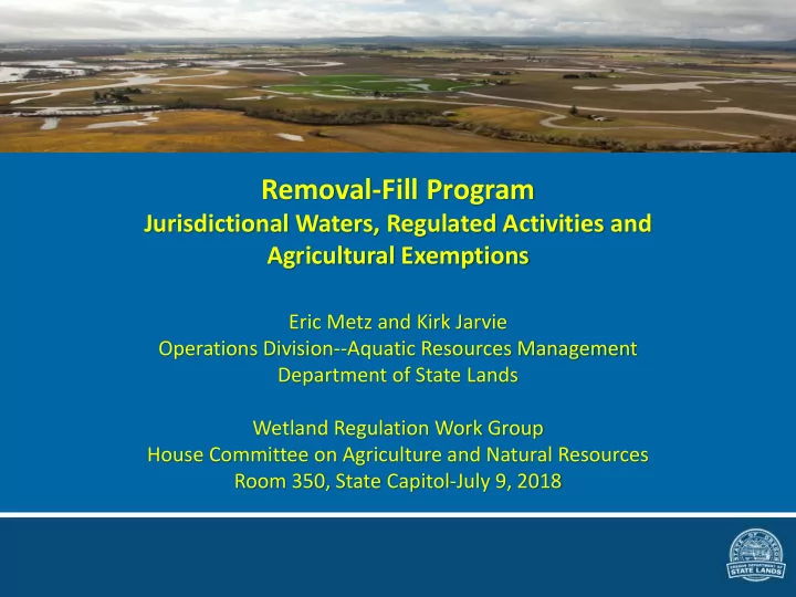
SLIDE 1 Removal-Fill Program
Jurisdictional Waters, Regulated Activities and Agricultural Exemptions
Eric Metz and Kirk Jarvie Operations Division--Aquatic Resources Management Department of State Lands Wetland Regulation Work Group House Committee on Agriculture and Natural Resources Room 350, State Capitol-July 9, 2018
SLIDE 2 Three part test for when permit is required:
- 1. Is the activity a “water of the state”
- 2. Does the activity exceed the volume
threshold?
- a. 50 cubic yards in most cases
- b. Any amount in some cases
- 3. Is the proposed project a regulated activity
type? (There are many exempt activities)
SLIDE 3
What are “waters of the state?”
Definitions (ORS 196.800(14)) and (OAR 141-085-0515)
SLIDE 4 Waters of the state include:
(ORS 196.800(14)) and OAR 141-085-0515)
All naturally occurring waters*
- Tidal bays and estuaries
- Rivers
- Perennial streams
- Intermittent streams
- Lakes and ponds
- Wetlands
- The Pacific Ocean (out 3 miles)
*Except ephemeral streams Some artificially created waters
- Reservoirs
- Wetlands/ponds that are
greater than one 1-acre and created in jurisdictional waters
created in part or whole in jurisdictional waters, or, created from uplands and contain food and game fish and have free and open connection
- Designated Mitigation sites
SLIDE 5 Jurisdictional waters & boundaries
(OAR 141-085-0515—jurisdiction by type of water)
5
Pacific Ocean Extreme low tide to 3 miles out Tidal Bays, Tidal Rivers and Estuaries Highest Measured Tide (HMT) or upper edge of wetland Rivers, Perennial and Intermittent Streams, Lakes and Ponds Ordinary High Water Line (OHWL) Wetlands Wetland boundary Reservoirs Normal operating pool level or upper edge of adjacent wetland
SLIDE 6 Artificially created wetlands or ponds constructed entirely from upland that are not jurisdictional
(OAR 141-085-0515—jurisdiction by type of water)
- Wastewater treatment
- Settling of sediment
- Stormwater detention and/or treatment
- Agricultural crop irrigation or stock watering
- Fire suppression
- Cooling water
- Surface mining, even if the site is managed for interim
wetlands functions and values
- Log storage
- Aesthetic purposes (e.g., golf course ponds)
SLIDE 7 Ditches that are not jurisdictional
(OAR 141-085-0515—jurisdiction by type of water)
– Operated and maintained for irrigation; and – Dewatered for the non-irrigation season except for stock water runs, fire suppression or storm water collection
- Certain Roadside and Railroad Ditches
– Ten feet wide or less at OHWL; – Artificially created from upland or wetlands; – Not adjacent, connected or contiguous with wetlands; and – Do not contain food or game fish
SLIDE 8
Tidal waters with and without adjacent wetlands
SLIDE 9
Ordinary high water line usually determined in the field based on signs of inundation
SLIDE 10 How are wetlands identified?
- Wetland determination—Only assesses
presence/absence of wetland conditions
- Wetland delineation—Identifies the boundaries of
wetland within a study area –1987 US Army Corps of Engineers Wetland Delineation Manual –Regional supplements –Typically performed by consultants in the private sector and approved by DSL
SLIDE 11
Reservoir example--Detroit Dam
SLIDE 12 Reservoir
Normal operating pool or upper edge of adjacent wetland (source: Journal of Hydrologic Engineering)
SLIDE 13 Regulated activities
(ORS 196.800 and OAR 141-085-0520—Jurisdiction by volume of material)
Fill—Depositing > 50 CY organic or inorganic material by artificial means Removal—Taking inorganic and LWD
- r moving by artificial means > 50 CY
SLIDE 14
Volume thresholds
50 cubic yards or more (additive) of removal and/or fill in waters of the state: ➢ Fill is organic or inorganic material ➢ Removal is inorganic and large woody debris Any amount (except prospecting)—of removal and/or fill in designated: ➢ State Scenic Waterways ➢ Essential Indigenous Anadromous Salmonid Habitat Mitigation sites
SLIDE 15
Measuring removal volumes on a stream bank excavation
SLIDE 16 Why were the agricultural exemptions put in place?
- The exemptions were put in place to minimize
the affect of wetlands regulation on farming and ranching
- It was recognized that most farming and
ranching occurs on “converted” wetlands; not pristine wetlands
- These activities generally do not permanently
convert wetland to upland
SLIDE 17
What are converted wetlands?
(ORS 196.905(6) and OAR 141-085-0510(21))
Converted Wetlands” means agriculturally managed wetlands that, on or before June 30, 1989, were brought into commercial agricultural production by diking, draining, leveling, filling or any similar hydrologic manipulation and by removal or manipulation of natural vegetation, and that are managed for commercial agricultural purposes. “Converted wetlands” does not include any stream, slough, ditched creek, spring, lake or any other waters of this state that are located within or adjacent to a converted wetland area.
SLIDE 18
When do the agricultural exemptions apply? Step 1—Is the water jurisdictional? Step 2—Will the project trigger the regulatory thresholds? Step 3—Do any of the exemptions apply? Step 4—If yes then:
(a) If one or more exemptions apply then the project is determined to be exempt, in whole or in part (b) If not, the activity requires a GA waiver or authorization
SLIDE 19
Exemptions specific to agricultural activities
(ORS 196.905 and OAR 141-085-0535) Drainage/maintenance of farm/stock ponds on EFU Maintenance of existing farm roads on EFU Subsurface drainage by deep ripping, tiling or moling, on converted wetlands Agricultural activities in ESH <50 CY Drainage ditch maintenance Push-up dams Normal farming/ranching on converted wetlands: ➢Plowing ➢Grazing ➢Seeding ➢Planting ➢Cultivating ➢Conventional crop rotation ➢Harvesting
SLIDE 20 How does the agricultural drainage ditch exemption work?
➢ Many drainage channels were created from naturally
➢ Agricultural drainage ditches can be maintained under OAR 141-085-0535(7)and includes disposal of dredged material in a thin layer on converted wetlands ➢ Disposal may not convert wetland to upland ➢ “Ditch” means a manmade water conveyance channel (OAR 141-085-0510(28))
SLIDE 21 Maintenance/reconstruction of certain agricultural- related activities such as water control structures
(ORS 196.905 and OAR 141-085-0530(4) and (8)) ➢ Drainage ditches ➢ Irrigation ditches ➢ Tile drain systems ➢ Culverts ➢ Dikes ➢ Dams ➢ Levees ➢ Groins ➢ Riprap ➢ Tidegates
In-kind replacement of an existing culvert in same footprint
SLIDE 22 Conditions for maintenance or reconstruction exemptions
- The project meets the definition of maintenance;
- r
- The project meets the definition of
reconstruction;
- The structure was serviceable within the past five
years; and
- The maintenance or reconstruction would not
significantly adversely affect wetlands or other waters to a greater extent than original construction
SLIDE 23 Change in point of diversion
(OAR 141-085-0530(8)) Exempt if:
change in the location of the surface water; and
Oregon Water Resources Department.
SLIDE 24 Push-up dams
(OAR 141-085-0535(8))
- Push-up dams that were built prior to September
13, 1967, are exempt if they meet the following tests:
– Are reconstructed, serviceable and used within the past five years; and, – Have the same effect as when first constructed (i.e., size and location); and, – Are operated in a manner consistent with the water right certificate and ORS 540.510(5).
- Push-up dams less than 50 cubic yards used for
agricultural purposes in ESH are exempt
SLIDE 25 Than hanks ks for r yo your ur attention! tention!
Contact information
Department of State Lands 775 Summer St. NE, Suite 100 Salem, OR 97301-1279 eric.metz@dsl.state.or.us
503-986-5266 kirk.jarvie@dsl.state.or.us
503-986-5320 Eric D. Metz, PWS, Planning & Policy Manager Kirk D. Jarvie, Southern Field Operations Manager Crown Point at Columbia River Gorge