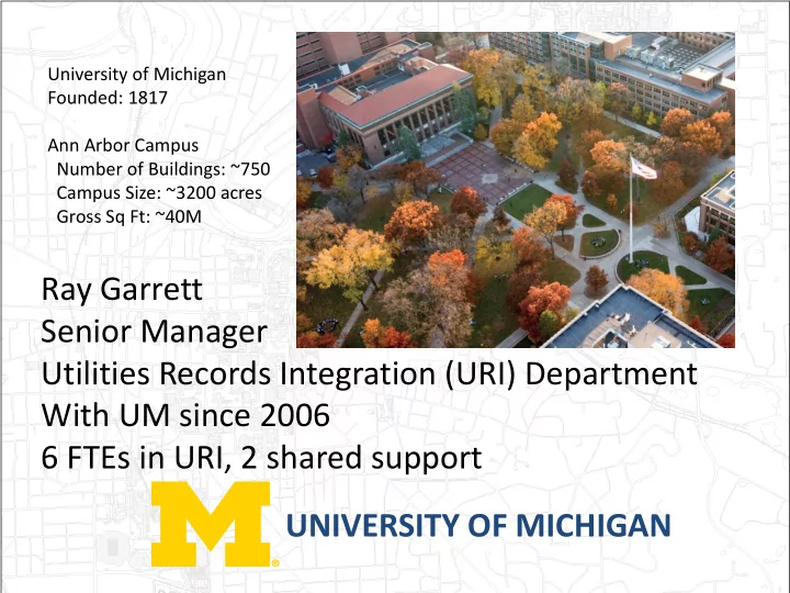
SLIDE 1 UNIVERSITY OF MICHIGAN Ray Garrett Senior Manager Utilities Records Integration (URI) Department With UM since 2006 6 FTEs in URI, 2 shared support
University of Michigan Founded: 1817 Ann Arbor Campus Number of Buildings: ~750 Campus Size: ~3200 acres Gross Sq Ft: ~40M
SLIDE 2 UNIVERSITY OF MICHIGAN 300+ miles of underground services
Utilities Department Power Plant Medium Voltage Low Voltage Water Sanitary Storm Chilled Water Tunnels Steam Condensate Compressed Air DWS & DWR
Other Departments Fiber Fire Service
SLIDE 3 Utilities Records Integration (URI)
Mapping Electrical Documentation FMS Web Miss Dig Administration Distribution Management System
SLIDE 4
UNIVERSITY OF MICHIGAN
How do you start a Utility GIS System?
Determine the benefits Management’s Commitment Authoritative Data Source Implementation Plan
Involve the trades! Maintenance Plan Involve the trades!
SLIDE 5
UNIVERSITY OF MICHIGAN
Benefits
Single source of truth – Authoritative data source
Reduction in documentation costs by elimination of duplicate systems
Data Federation Consolidation of institutional knowledge Better Panning Lower Miss Dig costs
Fewer Miss Dig hits
Consistent & wider distribution of knowledge
SLIDE 6 GIS Organizational Structure
AEC URI- Utilities ITcomm - Fiber OSEH-EP3 AEC-REO
De partme nt GI S Staff GI S De partme nt/GI S Co o rdinato r
Grounds Building Services Fire Safety PTS
SLIDE 7
UNIVERSITY OF MICHIGAN GIS Standards Committee Talk with the Shops and Trades Jumpstart with Total Station locations of Water/Sanitary/Storm Transfer Electrical from CAD Involve the Trades for data correction 80/20 rule
Implementation Plan
SLIDE 8
UNIVERSITY OF MICHIGAN
Resolved duplication of efforts Security Coordination Data Federation
Data interchange guidelines Established Spatial Reference
Meta data guidelines Resolution of differences Exchange of ideas
Implementation Plan
GIS Standards Committee
SLIDE 9
UNIVERSITY OF MICHIGAN
Find out what would truly save the trades time and money Solicit their help in correcting the data Assure them that we are not going to take any paper away Borrow and return redlines stashed in trucks and shop Meet with them regularly
Implementation Plan
Talk with the Shops and Trades
Only promise what you can do and do what you say
Deliver results that benefit the trades
SLIDE 10
UNIVERSITY OF MICHIGAN
Implementation Plan
SLIDE 11
UNIVERSITY OF MICHIGAN
Routinely solicit feedback on correcting the data Help them in a timely manner If you are unable to implement a suggestion or update in a timely manner let them know a realistic time frame
Maintenance Plan
Talk with the Shops and Trades
Updates should be timely and routine Plan for measured growth
SLIDE 12
UNIVERSITY OF MICHIGAN
How do you get the information to the end user?
Paper – 2% ArcMap -2% Web – 98%
SLIDE 13
URI GIS Website
Responsive Design Multi-Platform Desktop/Laptop
Windows, Mac
Mobile
iOS 8+, Android 4.4+ MS Surface
UNIVERSITY OF MICHIGAN
SLIDE 14
UNIVERSITY OF MICHIGAN
Web Technologies
HTML, CSS, JavaScript
ESRI ArcGIS API for JavaScript, Dojo Toolkit Backbone.js, Marionette.js, Underscore.js Bootstrap, JQuery
ESRI ArcGIS for Server ASP.NET WebAPI
SLIDE 15
UNIVERSITY OF MICHIGAN
Website Demonstration
SLIDE 16
UNIVERSITY OF MICHIGAN
Other areas we are working on
SLIDE 17
UNIVERSITY OF MICHIGAN
ArcFM ArcMap GIS to DMS
SLIDE 18
DSM
UNIVERSITY OF MICHIGAN
SLIDE 19
IR
UNIVERSITY OF MICHIGAN
SLIDE 20
IR
UNIVERSITY OF MICHIGAN
SLIDE 21
UNIVERSITY OF MICHIGAN
High Quality Aerials
SLIDE 22 CityEngine Campus
Why 3D? To accurately represent:
Buried Utilities Tunnels Building Light Locations
Help with Miss Dig Help with project planning Reduce Engineering Costs BIM Integration
Join us Friday August 14, 2015 9:45am at the CFTA annual conference hosted at Michigan State University, East Lansing, MI
SLIDE 23 Tunnels
Join us Thursday August 13, 2015 9:30 am at the CFTA annual conference hosted at Michigan State University, East Lansing, MI
Point cloud to BIM to GIS BIM to AiM (CMMS)
SLIDE 24
UNIVERSITY OF MICHIGAN
CFTA 2015 Silver Anniversary Conference @ Michigan State University in East Lansing, Michigan August 11-14
Registration @ http://www.cfta.org/
SLIDE 25
UNIVERSITY OF MICHIGAN
Questions?