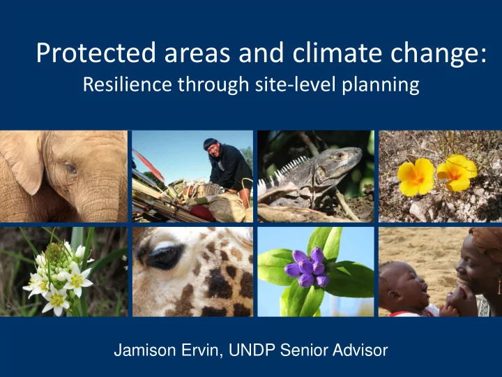
SLIDE 1
Jamison Ervin, UNDP Senior Advisor
Protected areas and climate change:
Resilience through site-level planning
SLIDE 2
NBSAPs
PA resilience Biodiversity resilience PA valuation studies Biodiversity valuation studies PoWPA reporting 5th National Report PoWPA Action Plans Climate resilience and adaptation plans Incentives Valuation studies
SLIDE 3
CLIMATE CHANGE IS BECOMING PERSONAL…
SLIDE 4
SLIDE 5 www.regimeshifts.org
- Regime shift
- Tipping point
- Resilience
- Adaptation
- Mitigation
Key Concepts
“…large, persistent changes in the structure and function of ecological systems”
SLIDE 6 www.regimeshifts.org
- Regime shift
- Tipping point
- Resilience
- Adaptation
- Mitigation
Key Concepts
SLIDE 7 Key Concepts
- Regime shift
- Tipping point
- Resilience
- Adaptation
- Mitigation
Definition: The point at which a driver causes a significant regime shift that is considered unalterable,
- r recoverable on only very long
timescales Drivers: Overfishing, disease, invasive species, climate-related event
SLIDE 8 Key Concepts
- Regime shift
- Tipping point
- Resilience
- Adaptation
- Mitigation
www.reefresilience.org
Definition
“….the ability of an ecosystem to maintain key functions and processes in the face of stresses, or pressures, by either resisting or adapting to change”
SLIDE 9 Key Concepts
- Regime shift
- Tipping point
- Resilience
- Adaptation
- Mitigation
www.reefresilience.org
SLIDE 10 Key Concepts
- Regime shift
- Tipping point
- Resilience
- Adaptation
- Mitigation
www.reefresilience.org
Principles of reef resilience:
- Representation, replication,
redundancy and risk spreading
- Critical habitats for replenishment
and recovery
- Connectivity among reefs
- Effective management by
reducing threats
SLIDE 11
Healthier reefs showed more resilience (faster recovery) from 1997-98 bleaching event
SLIDE 12 Key Concepts
- Regime shift
- Tipping point
- Resilience
- Adaptation
- Mitigation
- Nature’s ability to adapt to
climate impacts (often through human intervention); and….
SLIDE 13 Key Concepts
- Regime shift
- Tipping point
- Resilience
- Adaptation
- Mitigation
- Human’s ability to adapt
to climate impacts (often through nature’s buffering and provisioning services)
SLIDE 14 Key Concepts
- Regime shift
- Tipping point
- Resilience
- Adaptation
- Mitigation
...reducing the scope and magnitude of climate change and its impacts…
SLIDE 15
Strengthening resilience by incorporating climate into site-level PA management:
Management planning Threat assessments Restoration plans Capacity needs assessments Management effectiveness Research and monitoring Participation and benefits
SLIDE 16
Management Planning
SLIDE 17 Management Planning
- About 90,000 (>2/3) of the world’s protected areas
do not have management plans
- Of those plans that do exist, only a miniscule fraction
incorporate climate change issues
SLIDE 18 Management Planning – typical elements
- Specific goals and objectives
- Important areas and species
- Identification and prioritization
- f key threats
- Identification and prioritization
- f critical actions
- Identification of protected area
zones and regulations
measuring biodiversity
SLIDE 19 Management Planning for resilience
- Develop specific goals and objectives for
improving climate resilience
- Identify areas and species of particular
importance to climate adaptation, mitigation and resilience
- Identify and prioritize threats that
exacerbate climate impacts
- Identify and prioritize critical actions for
strengthening resilience
- Identify areas important for climate
change adaptation and mitigation into protected area zones and regulations
- Develop indicators of climate resilience
SLIDE 20 Management Planning
Discussion questions:
- How well do the management plans in your
country incorporate climate resilience and adaptation?
- What is the single most important thing you
could do to incorporate climate resilience and adaptation into management plans in your country?
SLIDE 21 Threats Assessment
- Threat assessment: An assessment of the degree
to which human activities impact the integrity of biodiversity
SLIDE 22 Threats Assessment
- Typical protected area threat assessments are a
- ne-page (or a one-paragraph) summary of
existing threats within the protected area
√ √ √ √ √
SLIDE 23 Threat assessments – incorporating climate
- Identify species and systems that
enable resilience and adaptation
thresholds and principles into threat assessments
- Assess the synergies between a
variety of threats
- Conduct species and ecosystem
climate vulnerability assessments
SLIDE 24 Assessing threats with climate in mind
Discussion questions:
- What are the threats to your protected areas
that will likely be exacerbated by climate change?
- Which threats are most likely to lead to a
regime shift?
SLIDE 25 Protected Area Restoration
focus on the past, not the future
actions consider climate resilience or adaptation
SLIDE 26 Setting traditional restoration targets and priorities
- Focus on historical ranges of
variation
- Focus on areas of high threat
- Areas important for species habitat
- Restore large and potentially intact
habitat patches
- Focus on vulnerable species
SLIDE 27 Incorporating climate into restoration priorities
Focus on:
- Resilience thresholds as well as historical ranges of
variability
- Those areas most likely to have negative synergistic
threats and impacts
- Areas important for species adaptation, including
ecotones, altitudinal, latitudinal and longitudinal gradients, and riparian and connectivity corridors
- Refugia and areas important for climate resilience,
including large and intact habitat patches, particularly areas with a history of resilience and resistance to stressors
- Those species most vulnerable to the impacts of
climate change
SLIDE 28 Restoration
Discussion questions:
- How well do your restoration plans and
priorities include climate resilience and adaptation issues?
- What’s the single most important restoration
priority in your country for strengthening climate resilience and promoting climate adaptation?
SLIDE 29 Protected Area Capacity
- Inadequate capacity is one of
the most limiting factors of effective management
- Lack of capacity to effectively
address climate change impacts will further limit the effectiveness of protected areas in the future
Traditional Capacity Areas: Protected area policy Management planning Threat assessment Communication Participation Site design Resource management Monitoring and research
SLIDE 30 Protected Area Capacity
Capacity Areas: New skills needed:
Protected area policy
Designing new policies and working with new sectors to address climate change
Management planning Incorporating climate issues into management plans; assessing
species vulnerability to climate change
Threat assessment
Incorporating climate into threat assessments; understanding climate impacts and predictions
Communication
Communicating the value of protected areas in climate change resilience and adaptation
Participation
Identifying new constituencies
Site design
Adapting site design for improved resilience
Resource management
Understanding tipping points and thresholds, and managing natural resources for climate resilience
Monitoring and research
Identifying climate-related indicators for vulnerable species and ecosystems, and for affected human communities
SLIDE 31 Capacity
Discussion questions:
- What are your most important capacity
weaknesses relative to climate change resilience and adaptation?
SLIDE 32 PA Participation and Benefits
- Focus on consultation
- Focus on finding
representative and diverse community members
benefits for resource use Traditional focus on participation and benefits
SLIDE 33 PA Participation and Benefits
Emerging focus on participation:
- Providing an early detection and
warning system for climate-related threats
- Identifying localized impacts of
climate change
- Sharing traditional resource
management knowledge to promote resilience
- Participating in resource management
trials for climate resilience, adaptation
SLIDE 34 Participation and benefits
Discussion questions:
- Who has the ecological and agricultural
knowledge needed to contribute to climate change resilience?
- Who is best placed to detect climate change
impacts on the ground, monitor impacts and provide early detection services?
SLIDE 35 PA Management Effectiveness Assessments
degree to which management achieves PA objectives (biodiversity conservation)
SLIDE 36
PA Management Effectiveness Assessments
Management Effectiveness Elements Threats Planning and design Inputs (staff, funding) Processes (management planning, participation, resource management) Outputs (resource management, restoration) Outcomes (ecological integrity)
SLIDE 37 PA Management Effectiveness Assessments
PAME Elements New Questions to Consider Context & Threats
How are climate-related threats impacting, or likely to impact, biodiversity and ecosystem services within the protected area?
Planning
How suitable is the PA design for climate resilience? Do landscape/seascape linkages account for climate change?
Inputs
Are there adequate data systems for monitoring climate impacts?
Processes
How well do PA staff understand climate-related issues, and how well are these issues incorporated into management plans? Are research and monitoring priorities aimed at climate resilience?
Outputs
Are restoration efforts aimed at climate resilience?
Outcomes Is the protected area resilient to climate change? Does it enable
adaptation of human and natural communities
SLIDE 38 Management effectiveness
Discussion questions:
- What are some practical steps that you could
take to assess and improve management effectiveness for climate resilience and adaptation?
SLIDE 39 PA Research and Monitoring
focuses on current status and trends in biodiversity health
largely driven by researcher interests and funding
SLIDE 40 PA Research and Monitoring
EMERGING PRIORITIES
- Determine the potential magnitude and rate
- f climate change impacts on protected areas
- Predict ecosystem structures and functioning
and services under different climate scenarios
- Conduct cross-sectoral research on the impacts
- f climate change on human wellbeing, and on
relationships between climate and poverty
SLIDE 41 PA Research and Monitoring
EMERGING PRIORITIES
- Determine resilience thresholds for a variety of
ecosystems
- Estimate the cascading effects and negative
synergies of multiple threats
- Assess the impact of climate change on large-
scale migration patterns
SLIDE 42 Research and Monitoring
Discussion questions:
- What are the most urgent climate-related
research and monitoring needs in your protected areas?
SLIDE 43
Developing a PA climate resilience plan
Management planning Threat assessments Restoration plans Capacity needs assessments Management effectiveness Research and monitoring Participation and benefits PA climate resilience and adaptation plan
SLIDE 44 Exercise
Identify key climate research needs Review existing literature; consult with key researchers and climate experts; develop draft list of research needs Assess climate capacity needs Conduct climate needs assessment as part of overall capacity assessment; develop training program Incorporate climate into management plans Identify 5-7 most important climate issues; seek input from park managers; hold workshop; develop guide Integrate climate into restoration plans Identify key restoration needs for climate resilience; develop draft priorities; consult; develop restoration plan
SLIDE 45
Jamison Ervin, UNDP Senior Advisor
Protected areas and climate change:
Resilience through spatial and sectoral integration
SLIDE 46
WHY INTEGRATE PROTECTED AREAS?
Protected areas alone will not be enough to conserve biodiversity into the future…
SLIDE 47
WHY INTEGRATE PROTECTED AREAS?
…especially under climate scenarios….
SLIDE 48
WHY INTEGRATE PROTECTED AREAS?
….we need to look at broader landscapes, seascapes and sectors to create climate-resilient landscapes
SLIDE 49
BUT WHAT DOES PROTECTED AREA INTEGRATION MEAN?
1. Spatial integration 2. Sectoral integration
SLIDE 50
WHAT DOES PROTECTED AREA INTEGRATION MEAN?
1. Spatial integration 2. Sectoral integration
SLIDE 51
SPATIAL INTEGRATION
Ensuring that ecological processes, such as migration, can occur at landscape-level scales
Major North-South corridor
SLIDE 52
Resilience through PA spatial integration
Ridge to Reef Approach Transboundary areas Regional networks Improved gap assessments
SLIDE 53
Strengthening climate adaptation by taking a “Ridge to Reef” approach:
Ridge to Reef Example of a Ridge to Reef Approach
SLIDE 54
Ridge to Reef Approach in Japan
SLIDE 55 Elements of a Ridge to Reef Approach
- Considers the entire island,
coast, near shore and ocean as one entity
resilience of the entire set of ecosystems
- Examines upstream impacts
- n downstream and coastal
processes
SLIDE 56 Elements of a Ridge to Reef Approach
- Identifies ecological, social
and economic priorities throughout the area, including terrestrial, coastal, marine
- Includes a wide varieties of
sectors (e.g., forestry, agriculture, hotel development) and looks at a wide variety of threats
SLIDE 57
SLIDE 58
Socotra Islands, Yemen
SLIDE 59 Discussion Questions
- Is your country adopting a “Reef to Ridges”
approach? Explain
- What aspects of a “Reef to Ridges” approach
might be especially helpful in strengthening climate resilience?
SLIDE 60
Resilience through PA spatial integration
Ridge to Reef Transboundary areas Regional networks Improved gap assessments
SLIDE 61
Transboundary PAs and MPAs
SLIDE 62
Transboundary PAs and transboundary resource management
Transboundary protected area: Area of land or sea that borders two states where both parties are dedicated to the protection and maintenance of biological diversity through legal or other effective means Transboundary resource management: Any collaboration across boundaries that increases the effectiveness of achieving conservation goals
SLIDE 63 The role of transboundary protected areas in strengthening resilience
- Allows species to shift their distribution ranges
- Allows for natural processes to occur at large scales
- Increases resilience to extreme events and disturbance
- Increases species population viability
- Reduces synergistic threats
- Increases reproductive success
- Increases the likelihood of protecting areas of climate
refugia
- Expands the diversity of the population gene pool
SLIDE 64
Transboundary protected area
SLIDE 65
Transboundary MPAs: Eastern Tropical Pacific Seascape
SLIDE 66
Transboundary MPAs: Eastern Tropical Pacific Seascape
Countries: Costa Rica, Panama, Colombia, Ecuador Area: Complex geography, valuable fisheries, high diversity and endemism Important coastal habitat: mangroves, estuaries, rocky cliffs, sea grass beds, sandy beaches; major migration corridor Protection: 4 world heritage sites, numerous MPAs
SLIDE 67 Transboundary MPAs: Eastern Tropical Pacific Seascape
Rationale: Ecological connectivity; shared uses for fishing, transport, tourism; shared vulnerability to climate events Objectives:
- Establish a regional framework
- Promote multilateral cooperation
- Secure funding
- Promote multi-stakeholder
participation
SLIDE 68 Strategies that improved climate resilience
- Conducted region-wide climate
vulnerability assessments
- Documented and shared data on species
migration, range and habitat shifts
- Identified pockets of resistance and climate
refugia (e.g., to coral bleaching) and large intact areas at a transboundary scale
- Developed plans to address transboundary-
scale threats
- Restored habitat that was regionally critical
- Developed transboundary agreements on
fisheries
SLIDE 69 Discussion Questions
- What opportunities are there for you to
increase transboundary collaboration and transboundary protected areas?
- How important are these areas in your context
for strengthening climate resilience and promoting climate adaptation?
SLIDE 70
Resilience through PA spatial integration
Ridge to Reef Transboundary areas Regional networks Improved gap assessments
SLIDE 71 Regional MPA Networks
“A collection of individual MPAs or reserves
and synergistically, at various spatial scales and with a range of protection levels that are designed to meet objectives that a single reserve cannot achieve.” WCPA/IUCN, 2008
SLIDE 72 Examples of Regional MPA Networks
Reef
Bering Sea
- Scotian Shelf/Gulf of Maine
- Eastern African Marine
Ecoregion (EAME)
Network
Ecoregion
SLIDE 73 Examples of Regional PA Networks
- Key biodiversity areas and critical corridors across
the Mediterranean
SLIDE 74 Incorporating resilience principles into MPA network design:
- Plan regional MPA networks at large
landscape/seascape, national and regional scales
- Focus on protecting large, intact
functioning ecosystems that will serve as biodiversity sources
- Include pockets of marine resilience
(e.g., from bleaching events)
- Pay attention to spacing, larval
distribution, habitat patchiness
- Focus on connectivity patterns
SLIDE 75
Incorporating connectivity principles into MPA network design
SLIDE 76
Incorporating connectivity principles into MPA network design
SLIDE 77
Migratory paths: from Khram Island
SLIDE 78
Migratory paths: from Huyong Island
SLIDE 79
- Uniqueness or rarity
- Special importance for life-
history stages
- Importance for threatened
species
- Vulnerability, fragility, sensitivity
- Biological productivity
- Biological diversity
- Naturalness
Incorporating resilience principles into MPA network design: Marine EBSAs
SLIDE 80 Design the MPA network to:
from natural disasters
- Protect areas important for
food security
- Protect water resources
- Sustain livelihoods
Incorporating social resilience principles into MPA network design:
SLIDE 81
- Minimum size of MPA is 25 km2;
- ptimal is 45 – 100 km2
- Minimum shoreline of 5-10 km;
- ptimal is 10-20 km
- Extend boundary of MPA from intertidal
zone to deep waters offshore (to protect nursery, spawning and feeding areas)
- Space MPAs no greater than 50 – 100
km from each other to facilitate dispersal
Incorporating resilience principles into MPA network design: California
SLIDE 82
- The planning process explicitly included the
connectivity needs for a range of species under various climate scenarios
Improving connectivity to promote climate resilience: Jamaica
SLIDE 83
Designing for marine resilience, Kimbe Bay, PNG
SLIDE 84 Representation and risk spreading:
- 20% of each habitat type protected, and distributed these
across seascape Critical areas and key habitats:
- Areas resistant to coral bleaching
- Areas with variety of habitats in close proximity
- Turtle nesting areas
- Key fish aggregation areas
Connectivity
- Used entire ecological units (e.g., whole offshore reefs,
seamounts) and large buffers
Designing for marine resilience, Kimbe Bay, PNG
SLIDE 85 Discussion Questions
- How well is your protected area network
designed for climate resilience?
- How well does your protected area network
buffer human communities from the impacts
SLIDE 86
Resilience through PA spatial integration
Ridge to Reef Transboundary areas Regional networks Improved gap assessments
SLIDE 87
Incorporating resilience principles into gap assessments:
GAP ASSESSMENT: A comparison between the status of biodiversity and the status of protection within a country
SLIDE 88
- Focus on underlying features (e.g.,
intertidal systems, coral reefs, upwellings, sea mounts)
- Include species and ecosystems
most vulnerable to climate change
- Include species and ecosystems
most resistant to climate change
- Include goals to diversify the
distribution of protection
Incorporating resilience principles into gap assessments:
SLIDE 89 Incorporating resilience principles into gap assessments:
- Include connectivity under climate
scenarios in gap assessment
- Incorporate threats that drive
climate-related regime shifts, as well as climate-related thresholds and tipping points
- Incorporate predictive climate
modeling into gap assessment
SLIDE 90 AR4 WGI Ch. 11.
Climate Change in Pacific Islands
SLIDE 91
Climate-Ready Ecological Gap Assessment in Papua New Guinea
Existing protected areas
SLIDE 92
Land systems
Climate-Ready Ecological Gap Assessment in Papua New Guinea
SLIDE 93
Climate impacts
Climate-Ready Ecological Gap Assessment in Papua New Guinea
SLIDE 94
Resulting analysis of climate-ready gap assessment
Climate-Ready Ecological Gap Assessment in Papua New Guinea
SLIDE 95
Marine Gap Assessment for Climate Resilience
SLIDE 96 Marine Gap Assessment for Climate Resilience
- Distributed ecological units to
spread climate risk
- Considered impacts from El
Niño and included threats exacerbated by climate change
- Included systems important for
buffering humans (mangrove forests, key fisheries,)
- Included species and systems
vulnerable to climate impacts
SLIDE 97 Discussion Questions
- How well does your country’s gap assessment
incorporate issues related to climate resilience and adaptation?
- What practical steps could you take to
incorporate climate resilience and adaptation into your terrestrial and marine gap assessments?
SLIDE 98
WHAT DOES PROTECTED AREA INTEGRATION MEAN?
1. Spatial integration 2. Sectoral integration
SLIDE 99
Ensuring that related sectors minimize impacts on biodiversity within protected areas….
SECTORAL INTEGRATION
SLIDE 100
…involving many key sectors….
Land use planning Transportation Energy Tourism Wildlife policies Agriculture Grazing Forestry Agroforestry Fisheries Waste management Invasive species policies Legal environment Water management National security
SLIDE 101
Revise sectoral policies Revise PA valuation studies Integrate into NAPAs Include in threats assessment
Climate Change Adaptation through PA Sectoral Integration and Mainstreaming
SLIDE 102
- 1. Revise sectoral policies
Climate Change Adaptation through PA Sectoral Integration and Mainstreaming
ecosystem services for water to incorporate PA values into economy
- Develop biodiversity
- ffset policies for the
energy sector
- Develop land use policies
that protect coastal areas important for fisheries and storm buffers
SLIDE 103
Multiple Opportunities for Mainstreaming
SLIDE 104
climate-related issues in PA VALUATION STUDIES
Climate Change Adaptation through PA Sectoral Integration and Mainstreaming
- Incorporate food security
- Incorporate water security
- Incorporate carbon
storage
- Incorporate human health
- Incorporate national
security issues
SLIDE 105 Integrating climate into PA valuation studies
EXAMPLE OF ETHIOPIA Assessed the value of protected areas for:
carbon stocks
- Food security and wild food
protection
- Water supplies in drought
conditions
SLIDE 106
- Carbon Storage in Forests
Water Yield
Carbon Storage in PAs up to 155 T/ Ha as opposed to 80 tons for unprotected land
Integrating climate into PA valuation studies
SLIDE 107 Climate Change Adaptation through PA Sectoral Integration and Mainstreaming
RANGE OF ADAPTATION ACTIONS:
- Health
- Early warnings
- Food security
- Infrastructure
- Insurance
- Tourism
- Energy
- Ecosystem-based management
- 3. Incorporate
into PAs into NAPAs
SLIDE 108 Types of ecosystem-based NAPA actions:
Integrate protected areas into NAPAs
- Establish new forest reserves
- Create buffer zones and
corridors
- Restore and protect critical
fisheries habitat
- Eradicate invasive species likely
to exacerbate climate impacts
- Expand existing protected
areas
actions that are ecosystem-based: <25%
that reference protected areas: <8%
budget for protected area actions: <4%
SLIDE 109 Types of ecosystem-based NAPA actions:
Integrate protected areas into NAPAs
- Establish new forest reserves
- Create buffer zones and
corridors
- Restore and protect critical
fisheries habitat
- Eradicate invasive species likely
to exacerbate climate impacts
- Expand existing protected
areas
Yemen: Develop coastal watershed management (3.2mm) Sudan: biodiversity restoration in northern Kordofan State (2.4 mm)
SLIDE 110
climate into PA and biodiversity threat assessments
Climate Change Adaptation through PA Sectoral Integration and Mainstreaming
- Include an assessment of threat
synergies with climate change (e.g., fire, invasives, logging)
ecosystem services vulnerable to climate impacts
environmental impact assessments (EIAs) and strategic environmental assessments (SEAs)
SLIDE 111 Incorporate climate into regional PA and biodiversity threat assessments
A regional threat assessment in the Himalayas incorporated climate issues:
- Water supplies, floods, drought
- Impacts on livelihoods
- Changes in invasive species
distribution
- Changes in ecosystem health
- Protected area implications
SLIDE 112 Questions for Reflection
- 1. What are some opportunities for
strengthening climate resilience through sectoral integration in your country?
SLIDE 113
Climate resilience through PA spatial integration Ridge to Reef Transboundary areas Regional networks Improved gap assessments
SLIDE 114
Revise sectoral policies Include in valuation studies Integrate into NAPAs Include in threats assessment Climate resilience through PA sectoral integration
SLIDE 115 Exercise
Increase connectivity between Konashen and Kaieteur parks Identify options for connectivity corridors; consult with key stakeholders; develop incentives for land conservation Develop a ridge to reef plan Assess opportunities Create new transboundary protected area in northeast Identify potential boundaries; consult with bordering countries; create legal document
SLIDE 116 Exercise
Include climate in threats assessment Develop climate threats assessment instrument; pilot test; roll out with protected area managers Revise sectoral policies for water management Develop climate thresholds for water management; develop draft guidelines Include PAs in NAPA Consult with NAPA coordinator; develop a range of possible actions; incorporate into NAPA
SLIDE 117
Jamison Ervin, UNDP Senior Advisor
Protected Area Integration
An overview
SLIDE 118
We know that integration is important…
Mainstreaming Protected Areas– J. Ervin, UNDP
SLIDE 119
- “By 2020…biodiversity values have been integrated into
national and local development and poverty reduction strategies and planning processes...
Aichi Target #2
- “Integrate, as far as possible and as appropriate, the
conservation and sustainable use of biological diversity into relevant sectoral or cross-sectoral plans, programs and policies.”
Article 6b:
Mainstreaming Protected Areas– J. Ervin, UNDP
…and we know that we should do it…
PoWPA Goal 1.2
- “Integrate protected areas into landscapes, seascapes and
sectoral plans and strategies.”
SLIDE 120
But what does protected area integration really mean?
SLIDE 121
Definition of Protected Area Integration
“Integrating protected areas into sectoral plans and policies using a variety of methods and approaches”
Mainstreaming Protected Areas– J. Ervin, UNDP
SLIDE 122
Definition of Protected Area Integration
“Integrating protected areas into sectoral plans and policies using a variety of methods and approaches”
Mainstreaming Protected Areas– J. Ervin, UNDP
SLIDE 123
“Integrating protected areas into sectoral plans and policies using a variety of methods and approaches”
Mainstreaming Protected Areas– J. Ervin, UNDP
Definition of Protected Area Integration
SLIDE 124
“Integrating protected areas into sectoral plans and policies using a variety of methods and approaches”
Mainstreaming Protected Areas– J. Ervin, UNDP
Definition of Protected Area Integration
SLIDE 125 Defining biodiversity mainstreaming
Integrating protected areas… …into sectoral plans and policies… …using a variety
Integrating the components of biodiversity in order to achieve specific biodiversity goals…. …into the plans, policies and practices of natural resource sectors, and economic/social development sectors at all levels… …through approaches that rely on changes in policies and plans, on economic instruments and on education, among other methods.
Mainstreaming Protected Areas– J. Ervin, UNDP
SLIDE 126 Identifying specific components of biodiversity….
- Genetic diversity
- Species and their habitats
- Populations
- Ecological processes,
functions
- Landscapes, ecosystems
- Ecosystem goods and
services
Mainstreaming Protected Areas– J. Ervin, UNDP
SLIDE 127
- Minimize or mitigate threats
- Restore, improve or maintain
ecological integrity
- Improve protection status
- Ensure ecological resilience
and adaptation
- Maintain ecosystem services
…and identifying specific goals of biodiversity use and conservation…
Mainstreaming Protected Areas– J. Ervin, UNDP
SLIDE 128
- Agriculture
- Forestry
- Fisheries, marine
- Freshwater, rivers
- Grazing, grassland
- Wildlife management
…and integrate these into natural resource sectors
Mainstreaming Protected Areas– J. Ervin, UNDP
SLIDE 129
- Transportation
- Poverty alleviation
- Health
- Tourism, recreation
- Energy
- Climate adaptation
- Private businesses
- Food and water security
…and into economic and social development sectors
Mainstreaming Protected Areas– J. Ervin, UNDP
SLIDE 130
- Reform or create policies, plans,
laws
- Create new protected areas,
buffer zones, corridors
- Modify management plans and
practices
- Incorporate into strategic
environmental assessments (SEAs)
- Incorporate into spatial and land-
use planning
…using a variety of approaches, such as by creating or modifying policies and plans…
Mainstreaming Protected Areas– J. Ervin, UNDP
SLIDE 131
- Public-private partnerships
- Market-based certification
- Voluntary best practices
- Economic valuation
- Payments for ecosystem services
- Communication, education
- Biodiversity offsets
…and/or by using economic instruments, education, incentives, partnerships
Mainstreaming Protected Areas– J. Ervin, UNDP
SLIDE 132
SLIDE 133
- 1. Mainstreaming biodiversity into private
game reserve management in South Africa
SLIDE 134
Biodiversity aspect: Improve habitat connectivity for wide-ranging species
SLIDE 135
MAJOR CHALLENGE: Landscape
linkages between formal
protected areas MAJOR OPPORTUNITY:
Landscape linkages between
formal protected areas and
private game ranches
SLIDE 136
Game reserves provide potential landscape connectivity in KZN Province
SLIDE 137 Approach to biodiversity mainstreaming: public-private partnership
- KZN Wildlife helped develop a game ranchers’ association
- KZN Wildlife helped create a legal framework to support
private ownership of land and wildlife
- KZN Wildlife provided technical support and financial
incentives to private game reserve owners
- KZN helped to remove physical barriers between reserves
- Game reserve owners used income from tourism to help
fund protected areas
SLIDE 138
- 2. Mainstreaming biodiversity into shipping
policies and practices
SLIDE 139 Steps in Mainstreaming
- Form partnerships between biodiversity and
sectoral stakeholders
- Explicitly identify stakeholders’ interests
- Identify mutually beneficial outcomes
- Identify conflicts and tradeoffs, and work
toward mutually acceptable solutions
- Identify win-win strategies and embed into
policies, agreements, programs
Biodiversity within an MPA is highly threatened by various sectors
SLIDE 140
Including by transportation and shipping
SLIDE 141 Mainstream by reforming policies
Transportation: a) created new regulations on ballast water exchange; b) developed Coast Guard guidance
- n MPA avoidance, mammals, discharges; c)
developed monitoring protocol
SLIDE 142
- 3. Mainstreaming biodiversity into sport
fishing and recreation policies
SLIDE 143
Biodiversity issue: Protect the health and genetic diversity of native fish populations Sector: Recreational fisheries were stocking streams with invasive alien species, causing disease, displacement and genetic erosion
SLIDE 144 Approach: Legal and Policy Reform
Laws and policies to:
- Monitor all released fish
for disease
exams of brood stock
hatcheries
placement of fish stock
SLIDE 145
- 4. Mainstreaming biodiversity into oil and
gas drilling
SLIDE 146
Biodiversity issue: Protecting habitat for key species, including sage grouse
SLIDE 147
Sector: Oil and gas (Jonah Field gas exploration, BP)
SLIDE 148 Approach: Biodiversity Offsets
- An environmental NGO shared information with
BP on areas of high biodiversity value
- BP developed a voluntary biodiversity offset
program and paired with the NGO to measure and mitigate impacts on biodiversity
- BP incorporated connectivity and biodiversity
issues into environmental assessments and standard operating procedures
- BP contributed $25 million in mitigation funding,
protecting 80,000 new acres of habitat
SLIDE 149
SLIDE 150
Improving habitat connectivity by creating public-private partnerships with game reserve owners
SLIDE 151
Improving habitat connectivity by creating public-private partnerships with game reserve owners
SLIDE 152
Improving habitat connectivity by creating public-private partnerships with game reserve owners
SLIDE 153
Improving habitat connectivity by creating public-private partnerships with game reserve owners
SLIDE 154
Safeguarding key marine habitat by reforming policies for ballast discharge of cargo container ships
SLIDE 155
Safeguarding key marine habitat by reforming policies for ballast discharge of cargo container ships
SLIDE 156
Safeguarding key marine habitat by reforming policies for ballast discharge of cargo container ships
SLIDE 157
Safeguarding key marine habitat by reforming policies for ballast discharge of cargo container ships
SLIDE 158
Protecting native fish species from invasive alien rainbow trout by reforming policies on fish stocking for recreational fisheries
SLIDE 159
Protecting native fish species from invasive alien rainbow trout by reforming policies on fish stocking for recreational fisheries
SLIDE 160
Protecting native fish species from invasive alien rainbow trout by reforming policies on fish stocking for recreational fisheries
SLIDE 161
Protecting native fish species from invasive alien rainbow trout by reforming policies on fish stocking for recreational fisheries
SLIDE 162 Mitigating the impacts
by working with gas companies to create biodiversity offsets in
protected areas
SLIDE 163 Mitigating the impacts
by working with gas companies to create biodiversity offsets in
protected areas
SLIDE 164 Mitigating the impacts
by working with gas companies to create biodiversity offsets in
protected areas
SLIDE 165 Mitigating the impacts
by working with gas companies to create biodiversity offsets in
protected areas
SLIDE 166
Jamison Ervin, UNDP Senior Advisor
Protected Area Integration
Developing strategies and actions
SLIDE 167
- Cases where biodiversity is
particularly threatened
restoration is most critical
- Cases where climate resilience
and adaptation are most important
- 1. Most important aspects of biodiversity
to be mainstreamed
Mainstreaming Protected Areas– J. Ervin, UNDP
SLIDE 168
damage to biodiversity
potential to conserve biodiversity in the future
- Sectors with the strongest
linkages to national agendas
- 2. Most important sectors in which
protected areas should be integrated
Mainstreaming Protected Areas– J. Ervin, UNDP
SLIDE 169
- 2. Most important sectors in which
protected areas should be integrated
SLIDE 170
record of success in the country or region
- Approaches that are feasible
given the political context
consistent with the national context
- 3. Most important approaches to
integrating protected areas
Mainstreaming Protected Areas– J. Ervin, UNDP
SLIDE 171
record of success in the country or region
- Approaches that are feasible
given the political context
consistent with the national context
- 3. Most important approaches to
integrating protected areas
Airport departure tax in Belize funds protected area system
Mainstreaming Protected Areas– J. Ervin, UNDP
SLIDE 172 STRATEGY: Safeguard the integrity of mangrove forests and critical fish nursery habitats by working with shrimp farmers and land use planners to develop an integrated coastal zone plan and new PAs SECTOR: Shrimp farming industry BIODIVERSITY: Mangrove forests APPROACH: Coastal zone planning, protected areas
- 4. Developing strategies and action plans
Mainstreaming Protected Areas– J. Ervin, UNDP
SLIDE 173 STRATEGY: Minimize threats to marine habitats by working with the transportation agency to develop policies related to ballast discharge SECTOR: Marine transportation and shipping because they are causing the most damage to marine habitats BIODIVERSITY: Marine habitats important for fisheries (because they are threatened by ship ballast) APPROACH: Policy reform (because there is an
- pportunity to revise transportation policies and good
marine governance)
- 4. Developing strategies and action plans
Mainstreaming Protected Areas– J. Ervin, UNDP
SLIDE 174
EXERCISE 1
SLIDE 175 EXERCISE 1
- Fill in the template, including rationale
SLIDE 176 EXERCISE 1
Protect mangroves They are among the most threatened ecosystem, and are critical for maintaining fisheries, an important food source. They are threatened by conversion to shrimp farms Shrimp farming Shrimp farming has already converted most of the coastal mangroves, and threatens to convert remaining mangroves within the next 10 years Policies – create coastal zone management plan, new coastal reserves The country has a public commitment to increase marine protected areas, and there is a strong history of integrated terrestrial management
SLIDE 177 EXERCISE 1
- Develop at least one strategy for mainstreaming biodiversity,
based on the previous exercise
- Identify at least 2-3 specific action plans
SLIDE 178 Developing specific strategies and action plans for integration
STRATEGY ACTION PLANS
Minimize threats to marine habitats by working with the transportation agency to develop policies related to ballast discharge
Mainstreaming Protected Areas– J. Ervin, UNDP
SLIDE 179 Developing specific strategies and action plans for integration
STRATEGY ACTION PLANS
Minimize threats to marine habitats by working with the transportation agency to develop policies related to ballast discharge
Mainstreaming Protected Areas– J. Ervin, UNDP
SLIDE 180 Developing specific strategies and action plans for integration
STRATEGY ACTION PLANS
Minimize threats to marine habitats by working with the transportation agency to develop policies related to ballast discharge
- Revise shipping ballast policies to prohibit
ballast discharge near or within marine protected areas
- Educate key shipping stakeholders about new
policy
- Revise monitoring protocol to include
monitoring of ballast discharge
Mainstreaming Protected Areas– J. Ervin, UNDP
SLIDE 181 Developing specific strategies and action plans for integration
STRATEGY ACTION PLANS
Minimize threats to marine habitats by working with the transportation agency to develop policies related to ballast discharge
- Revise shipping ballast policies to prohibit
ballast discharge near or within marine protected areas
- Educate key shipping stakeholders about new
policy
- Revise monitoring protocol to include
monitoring of ballast discharge Protect the genetic diversity
- f wild crop relatives into
food security plans through land use planning, protected areas and buffer zones
Mainstreaming Protected Areas– J. Ervin, UNDP
SLIDE 182 Developing specific strategies and action plans for integration
STRATEGY ACTION PLANS
Minimize threats to marine habitats by working with the transportation agency to develop policies related to ballast discharge
- Revise shipping ballast policies to prohibit
ballast discharge near or within marine protected areas
- Educate key shipping stakeholders about new
policy
- Revise monitoring protocol to include
monitoring of ballast discharge Protect the genetic diversity of wild crop relatives into food security plans through land use planning, protected areas and buffer zones
Mainstreaming Protected Areas– J. Ervin, UNDP
SLIDE 183 Developing specific strategies and action plans for integration
STRATEGY ACTION PLANS
Minimize threats to marine habitats by working with the transportation agency to develop policies related to ballast discharge
- Revise shipping ballast policies to prohibit
ballast discharge near or within marine protected areas
- Educate key shipping stakeholders about new
policy
- Revise monitoring protocol to include
monitoring of ballast discharge Protect the genetic diversity
- f wild crop relatives into
food security plans through land use planning, protected areas and buffer zones
- Identify areas important for wild crop relatives
- Include areas within core protection zones
- Work with local communities to incorporate
these areas into buffer zones and corridors
- Develop ‘wild tourism’ program to help pay for
protection
Mainstreaming Protected Areas– J. Ervin, UNDP
SLIDE 184
Protected area integration doesn’t just happen in a vacuum…
SLIDE 185
…there are many factors that can either facilitate or inhibit protected area integration
SLIDE 186
- Political will, leadership
- Lobbying by interest
groups
- Public media, perception
- Good governance
- Inter-sectoral
coordination
- Public participation
- Information about values
- Utilization of GEF funding
Enabling factors
CHALLENGE
- A government lacks political will
to mainstream biodiversity; does not place biodiversity high
OPPORTUNITY
- A new government is elected
- A politician commits to
ambitious goals at a high-level meeting
Mainstreaming Protected Areas– J. Ervin, UNDP
SLIDE 187
- Political will, leadership
- Lobbying by interest
groups
- Public media, perception
- Good governance
- Inter-sectoral
coordination
- Public participation
- Information about values
- Utilization of GEF funding
Enabling factors
CHALLENGE
- Powerful interests (e.g., mining)
do not acknowledge the value
- f biodiversity, and lobby
against it OPPORTUNITY
- Powerful interests (e.g.,
tourism) recognize and promote the value of biodiversity to their industry
Mainstreaming Protected Areas– J. Ervin, UNDP
SLIDE 188
- Political will, leadership
- Lobbying by interest
groups
- Public media, perception
- Good governance
- Inter-sectoral
coordination
- Public participation
- Information about values
- Utilization of GEF funding
Enabling factors
CHALLENGE
biodiversity issues, and biodiversity is not covered by local media OPPORTUNITY
- The public understands key
biodiversity issues, and is supportive of biodiversity conservation
Mainstreaming Protected Areas– J. Ervin, UNDP
SLIDE 189
- Political will, leadership
- Lobbying by interest
groups
- Public media, perception
- Good governance
- Inter-sectoral
coordination
- Public participation
- Information about values
- Utilization of GEF funding
Enabling factors
CHALLENGE
- Corruption within government
agencies and law enforcement prevents effective decisions about biodiversity OPPORTUNITY
upholds biodiversity-related laws and policies , and is transparent about the costs and tradeoffs of decisions
Mainstreaming Protected Areas– J. Ervin, UNDP
SLIDE 190
- Political will, leadership
- Lobbying by interest
groups
- Public media, perception
- Good governance
- Inter-sectoral
coordination
- Public participation
- Information about values
- Utilization of GEF funding
Enabling factors
CHALLENGE
- There is competition between
sectors (e.g., mining vs. forestry
- vs. biodiversity), and little or no
coordination OPPORTUNITY
- There is an effective multi-
sectoral working group in place, and sectors coordinate information well
Mainstreaming Protected Areas– J. Ervin, UNDP
SLIDE 191
- Political will, leadership
- Lobbying by interest
groups
- Public media, perception
- Good governance
- Inter-sectoral
coordination
- Public participation
- Information about values
- Utilization of GEF funding
Enabling factors
CHALLENGE
- There are no effective means of
engaging the public in key biodiversity decisions OPPORTUNITY
procedures and mechanisms are developed and fully used
Mainstreaming Protected Areas– J. Ervin, UNDP
SLIDE 192
- Political will, leadership
- Lobbying by interest
groups
- Public media, perception
- Good governance
- Inter-sectoral
coordination
- Public participation
- Information about values
- Utilization of GEF funding
Enabling factors
CHALLENGE
- The government and public are
unaware of the true value of biodiversity to their societal goals and agenda OPPORTUNITY
- There is clear and compelling
information about the value of biodiversity, and the government is aware of these values
Mainstreaming Protected Areas– J. Ervin, UNDP
SLIDE 193
- Political will, leadership
- Lobbying by interest
groups
- Public media, perception
- Good governance
- Inter-sectoral
coordination
- Public participation
- Information about values
- Utilization of GEF funding
Enabling factors
CHALLENGE
strategically and fully take advantage of GEF and other funding OPPORTUNITY
- All funding proposals to GEF
and other sources are fully aligned with national priorities for biodiversity and mainstreaming
Mainstreaming Protected Areas– J. Ervin, UNDP
SLIDE 194
EXERCISE 2 – Challenge and opportunities
SLIDE 195 EXERCISE 2 – Challenge and opportunities
- Identify whether each factor is a challenge or opportunity in your
country (or both)
SLIDE 196 EXERCISE 2 – Challenge and opportunities
- Then, identify the most critical challenges for protected area
integration, and some strategies to overcome these challenges
- Identify the most critical opportunities for protected area
integration, and some strategies to take advantage of these
SLIDE 197 CHALLENGE --
- A government does not appreciate the value of biodiversity,
and places biodiversity low on the government agenda STRATEGY --
- Conduct a biodiversity valuation study, focusing on the
issues most important to the government’s agenda (e.g. job creation, food security)
Developing strategies to address challenges and take advantage of opportunities
Mainstreaming Protected Areas– J. Ervin, UNDP
SLIDE 198 Developing strategies to address challenges and take advantage of opportunities
OPPORTUNITY --
- There is effective inter-sectoral coordination, and a multi-
sectoral advisory committee STRATEGY --
- Involve key sectoral leaders in the process of developing
protected area integration strategies
Mainstreaming Protected Areas– J. Ervin, UNDP