
SLIDE 1
Forging opportunities through earth science partnerships
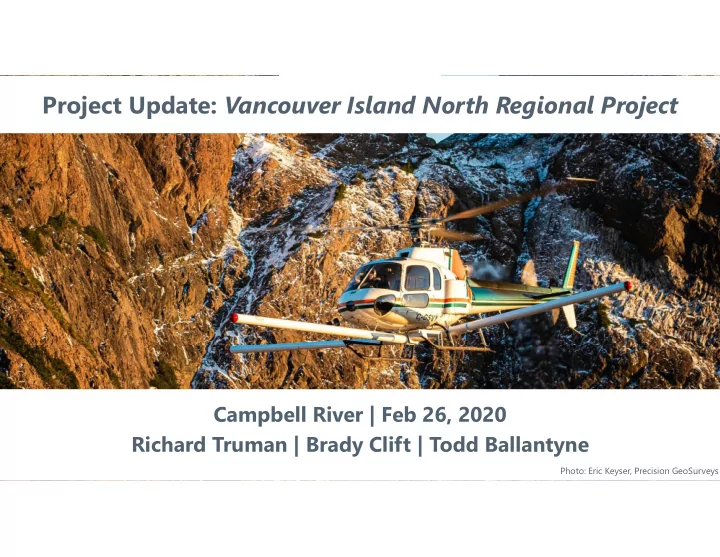
Project Update: Vancouver Island North Regional Project
Campbell River | Feb 26, 2020 Richard Truman | Brady Clift | Todd Ballantyne
Photo: Eric Keyser, Precision GeoSurveys
Project Update: Vancouver Island North Regional Project Campbell - - PowerPoint PPT Presentation
Project Update: Vancouver Island North Regional Project Campbell River | Feb 26, 2020 Richard Truman | Brady Clift | Todd Ballantyne Forging opportunities through earth science partnerships Photo: Eric Keyser, Precision GeoSurveys The Project
Forging opportunities through earth science partnerships
Photo: Eric Keyser, Precision GeoSurveys
Forging opportunities through earth science partnerships
2
Forging opportunities through earth science partnerships
VIN 2019 NVI 2012 Regional Magnetics
3
Forging opportunities through earth science partnerships
… improves our collective level of geoscience knowledge … informs responsible natural resource decisions …. catalyzes socio-economic opportunities … stimulates innovation and geoscience technologies Non-profit organization Generate and share high quality, unbiased earth science research and data Collaboration between governments, communities, Indigenous groups, resource sectors, academia
Forging opportunities through earth science partnerships
4
Forging opportunities through earth science partnerships Forging opportunities through earth science partnerships
*2005 to September 2018. Assessment Report Index System (ARIS) reports mentioning Geoscience BC: $211.9 million. Geoscience BC minerals research: $32.1 million
5
Forging opportunities through earth science partnerships
6
Forging opportunities through earth science partnerships
Survey area:
Island (6,127 km2)
113km2 staked since data release on Jan 21, 2020 Orange: New minerals claims Jan 21 to Feb 24, 2020 Grey: Existing active minerals claims
7
Forging opportunities through earth science partnerships
Greg Neeld, President & CEO, Hawkeye Gold and Diamond Inc. (TSX.V: HAWK) “This high-resolution airborne geophysical data… will be key to new mineral exploration and potential discovery creating economic benefits to communities, businesses and First Nations.” Kendra Johnston, President & CEO, AME “The publicly available data from this project is used and valued by all types of AME members, from grassroots prospectors to multinational mining corporations – as well as by the communities and Indigenous groups in the research area.” Dallas Smith, President, Nanwakolas Council Board of Directors "I am confident that Geoscience BC’s Vancouver Island North Regional Project’s high-resolution, public geoscience data will bring new mineral exploration interest and investment to the Island.”
500 550 600 650 700 750 800 850 900 250 270 290 310 330 350 370 390
Area of Claims (km2) Number of Claims
Number of Claims Area of Claims (km2)
Project announced Data published Feb 10
8 Forging opportunities through earth science partnerships
Forging opportunities through earth science partnerships
9
Forging opportunities through earth science partnerships
Forging opportunities through earth science partnerships
*regional data from Geosoft DAP server
VIN 2019 NVI 2012 Campbell River Regional Magnetics
Forging opportunities through earth science partnerships
Magnetic Data
Forging opportunities through earth science partnerships
Total Count data
radioelement data for potassium, thorium and uranium
their ratios can help us interpret the near surface geology
Radiometric Data – Total Count
Forging opportunities through earth science partnerships
data composed of potassium, thorium and uranium radioelements
elements generate different colours which in turn help with mapping geology
Radiometric Data – Ternary
Forging opportunities through earth science partnerships
different colours which in turn help with mapping optimum taste factor
then we would map out white areas.
Prospect: Pancake Mountain Budget: 3 forkful’s Objective: maximize Taste Factor
Syrup Butter Pancake
Forging opportunities through earth science partnerships
** Disclaimer: This slide will make no sense unless you attended the talk
Forging opportunities through earth science partnerships
250 m MAG data at nominal 80 m survey height Historical Regional GSC MAG data (1971, 800 m lines)
Forging opportunities through earth science partnerships
250 m lines data at nominal 80 m survey height Historical Regional GSC MAG data (1971, 800 m lines)
Forging opportunities through earth science partnerships
Forging opportunities through earth science partnerships
histogram linear
Forging opportunities through earth science partnerships
histogram
Forging opportunities through earth science partnerships
histogram
Forging opportunities through earth science partnerships
0 m depth to top and 200 m thickness
filtering attempts to isolate responses from approximate depth regions. A quick method to visualize regional geology without modelling.
regional structures imagine the magnetic survey being flown at 2000 m above ground…only deep prominent sources would be measured.
Forging opportunities through earth science partnerships
100 m depth to top and 300 m thickness
high-frequency responses can distract or interfere with visualization of deeper features and structure
focus on the near surface only and remove the long wavelength regional trends in the data.
Forging opportunities through earth science partnerships
500 m depth to top and 500 m thickness
magnetic features first, but equally valid for mapping geology are the regions of low magnetic intensity: faults/non-magnetic sources.
role that topography or erosion plays in the magnetic responses we measure in mountainous surveys.
Forging opportunities through earth science partnerships
1000 m depth to top and 1000 m thickness
Forging opportunities through earth science partnerships
2000 m depth to top and 2000 m thickness
Forging opportunities through earth science partnerships
4000 m depth to top and 4000 m thickness
can map regions and faults to enhance our understanding of the geology
visualize three layers (shallow, intermediate and deep) together using a ternary image
Forging opportunities through earth science partnerships
different depth inferences in a single ternary image? 0-200 m 500-1000 m 2000-2000 m
response to depth appear as white
magnetic features, but equally we need to consider non- magnetic regions
Forging opportunities through earth science partnerships
500-500 m 1000-2000 m 4000-4000 m
Forging opportunities through earth science partnerships
linear trends/breaks
be used to map different geology
feature filtered products for highlighting structure, trends, texture and domains
topographic effect or both?
Forging opportunities through earth science partnerships
linear trends/breaks
be used to map different geology
feature filtered products for highlighting structure, trends, texture and domains
regional residual separation
effect of topography will diminish
Forging opportunities through earth science partnerships
linear trends/breaks
be used to map different geology
feature filtered products for highlighting structure, trends, texture and domains
regional residual separation
Forging opportunities through earth science partnerships
explorers the big picture
context that is missing at the project scale
features that would help in understanding the local scale observations?
modelling is a helpful step in answering these questions and moving exploration forward
Forging opportunities through earth science partnerships
histogram normal linear
Magnetic susceptibility inversion model
Forging opportunities through earth science partnerships
is used to consider/solve for the possibility of magnetic remanence contributing to the measured survey data Magnetization vector intensity inversion model Histogram colour bar Normal colour bar
Forging opportunities through earth science partnerships
inversion models: SUS vs. MVI
to understand differences between the two model results
space is a series of models that can reproduce the
however, all may not be reasonable…
Magnetic susceptibility Magnetic MVI
** the inversion models are not a Geoscience BC product
Forging opportunities through earth science partnerships
Download data: www.geosciencebc.com We gratefully acknowledge the financial support of the province of British Columbia Deep features vs. Regional MAG Inversion Highs (video)
Forging opportunities through earth science partnerships
39
Forging opportunities through earth science partnerships
map-staked claim, a mineral tenure holder needs to either conduct work or pay cash in lieu of work done.
claim.
dwelling house (interpreted as generally being a 75 metre distance around a residence where the land is defined by gardens, lawns or other clear sign of use by that residence), land under cultivation and land
loss or damage caused by accessing or using mineral tenure on private land.
natural-resources-and-industry/mineral-exploration-mining/documents/mineral-titles/notices-mineral- placer-titles/information-updates/infoupdate7.pdf.
Forging opportunities through earth science partnerships
Forging opportunities through earth science partnerships