
SLIDE 1
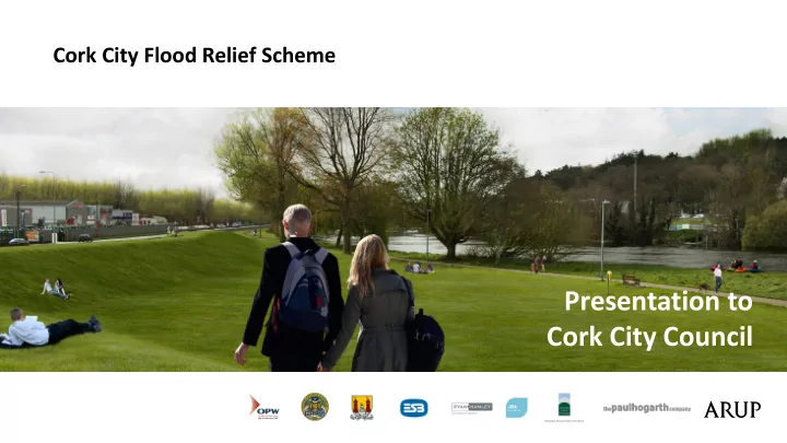
Presentation to Cork City Council
Cork City Flood Relief Scheme
Presentation to Cork City Council Process and Timeline 2006 2007 - - PowerPoint PPT Presentation
Cork City Flood Relief Scheme Presentation to Cork City Council Process and Timeline 2006 2007 2008 2009 2010 2011 2012 2013 2014 2015 2016 2017 2018 2019 Lee CFRAMS Study Lower Lee Flood Relief Scheme July 2013 Early PID at
Cork City Flood Relief Scheme
C o r k C i t y F l o o d R e l i e f S c h e m e
Process and Timeline
2006 2007 2008 2009 2010 2011 2012 2013 2014 2015 2016 2017 2018 2019
Lee CFRAMS Study Lower Lee Flood Relief Scheme July 2013 Early PID at outset July 2013 to July 2014 Options Development and Appraisal July 2014 Emerging Preferred Option PID July 2014 to Dec 2016 Refinement and detailing of scheme Dec 2016 to April 2017 Statutory Public Exhibition of the Scheme April 2017 to Nov 2017 Consideration of Public Submissions Nov 2017 to June 2018 Part 8 Planning App & tendering for Morrison’s Island July 2018 to July 2019 Morrison’s Island Construction Works December 2018 Statutory Confirmation of Overall Flood Scheme Mid 2019 Construction of First Phase of Overall Scheme commences
C o r k C i t y F l o o d R e l i e f S c h e m e
Ongoing Consultation
Chamber)
processes ongoing
Public Realm (display project plans and visuals at key points around the City)
C o r k C i t y F l o o d R e l i e f S c h e m e
C o r k C i t y F l o o d R e l i e f S c h e m e
Tidal Barrier Key Considerations are:
Sites
C o r k C i t y F l o o d R e l i e f S c h e m e
Tidal Barrier Location Little Island Tidal Barrier Location
C o r k C i t y F l o o d R e l i e f S c h e m e
Tidal barrier Location Great Island Barrier Great Island Barrier
C o r k C i t y F l o o d R e l i e f S c h e m e
Navigation and Navigational Safety
potentially unsafe conditions for significant periods - Circa 1m/s to over 3m/s
Existing Little Island Concept Barrier
C o r k C i t y F l o o d R e l i e f S c h e m e
Environmental Impacts
significantly alter velocities in and adjoining SAC and SPA and therefore potentially significant risk of adverse effect on designated sites
which would be very unlikely to succeed
C o r k C i t y F l o o d R e l i e f S c h e m e
Environmental Impacts
C o r k C i t y F l o o d R e l i e f S c h e m e
Climate Change Adaptability
Criteria Barrier Location
Little Island & North Channel Great Island – Monkstown & Marlogue
Upstream Storage Capacity (Present Day) Sufficient Sufficient Upstream Storage Capacity (MRFS) Marginal Sufficient Upstream Storage Capacity (HEFS) Insufficient Sufficient Areas defended Excludes Midleton, Ballincurra and Passage West Includes Midleton, Ballincurra and Passage West Road Works Required to National Route 500m road raising on N25 None required. Road Works Required to railway line embankment construction required along railway None required. Environmental Effects SPA/SAC. Significant risk to designated zones. Located considerable distance outside of the designated sites with significantly less risk to environmental receptors
Great Island likely to represent optimum future Barrier Location
C o r k C i t y F l o o d R e l i e f S c h e m e
Resilience, Reliability & Risks
Navigation is seen as a
significantly restricted (Without incurring large compensation at least) Barriers require a high level of redundancy due to the high risk associated with their
gates is safer. North Channel Bypass – A barrier at Little Island will require significant ancillary works due to a possible
the North of Little Island Environmental Impacts – Little Island Barrier located in or adjacent to SCA/SPA. Significant assessments would be
very long lead in time. Deep Harbour – Increased risk and cost Almost all International Tidal Barriers that facilitate inland navigation have 2 or more Navigation Gates Barriers of this scale require significant maintenance Reduced storage capabilities at Little Island – Barrier at this location will not be sufficient for High End Future Scenarios for Climate Change.
C o r k C i t y F l o o d R e l i e f S c h e m e
Resilience, Reliability & Risks
Navigation is seen as a
significantly restricted (Without incurring large compensation at least) Barriers require a high level of redundancy due to the high risk associated with their
gates is safer. North Channel Bypass – A barrier at Little Island will require significant ancillary works due to a possible
the North of Little Island Environmental Impacts – Little Island Barrier located in or adjacent to SCA/SPA. Significant assessments would be
very long lead in time. Deep Harbour – Increased risk and cost Almost all International Tidal Barriers that facilitate inland navigation have 2 or more Navigation Gates Barriers of this scale require significant maintenance Reduced storage capabilities at Little Island – Barrier at this location will not be sufficient for High End Future Scenarios for Climate Change. Walls still needed in city – To protect against fluvial flooding. And to reduce the number of possible barrier closures
C o r k C i t y F l o o d R e l i e f S c h e m e
Cost Estimate
Wallingford Cost Estimate Report High level cost estimate of a concept barrier (not a feasibility report) It notes sensitivity of cost to gate sizes Costs
Not considered technically viable
Little Island Option
Submitted at exhibition
Little Island Option
Technically Amended Version
Great Island
Estimated Minimum Project Construction Cost (Barrier Only) €291m €656m €1,206m. Estimated NPV Total Cost including Fluvial Defences, Maintenance, Ancillaries and Contingency/Optimism Bias €519m €1,074m €1,868m
C o r k C i t y F l o o d R e l i e f S c h e m e
C o r k C i t y F l o o d R e l i e f S c h e m e
Natural Flood Management
Lee catchment completed.
potential measures combined would
by 1-4%, i.e will not remove need for direct defences
Shournagh to actually increase flood risk at Cork
C o r k C i t y F l o o d R e l i e f S c h e m e
Submissions which suggest that the existing dams have sufficient storage to avoid defences entirely are flawed. These assertions are premised on a number
proposed operating regime which would jeopardise dam safety (significant increase in risk of overtopping) Existing Dam Storage
C o r k C i t y F l o o d R e l i e f S c h e m e
Multiple options to increase storage by raising existing dams have now been assessed, taking account of real-world constraints. All technically viable options have:
properties
land
defence walls still needed
Potential Raising of Existing Dams
C o r k C i t y F l o o d R e l i e f S c h e m e
C o r k C i t y F l o o d R e l i e f S c h e m e
Management of Groundwater Flood Risk
groundwater beneath the island and cause flooding/damage
being assessed in detail
analysis is ongoing
groundwater flood risk will be manageable
groundwater regime
C o r k C i t y F l o o d R e l i e f S c h e m e
C o r k C i t y F l o o d R e l i e f S c h e m e
North Mall – Existing
C o r k C i t y F l o o d R e l i e f S c h e m e
North Mall – Exhibited Scheme
C o r k C i t y F l o o d R e l i e f S c h e m e
Final Design being developed with landscape and conservation architect in close collaboration with CCC
C o r k C i t y F l o o d R e l i e f S c h e m e
C o r k C i t y F l o o d R e l i e f S c h e m e
Sullivan’s Quay – Existing
C o r k C i t y F l o o d R e l i e f S c h e m e
Sullivan’s Quay – Exhibited Scheme
C o r k C i t y F l o o d R e l i e f S c h e m e
Final Design being developed with landscape and conservation architect
C o r k C i t y F l o o d R e l i e f S c h e m e
C o r k C i t y F l o o d R e l i e f S c h e m e
Exhibition Report and Responses
Publish Exhibition Report End of November 2017 Issue individual responses End of January 2018 Finalise Confirmation Documents and Issue to Minister Mid 2018 Ministerial Confirmation Process End 2018
It will also set out proposed changes to the Scheme on foot
The report addresses all issues raised including; potential alternatives, technical concerns, potential impacts, project delivery and site specific issues.
Cork City Flood Relief Scheme
including Morrison's Island Public Realm Project