
SLIDE 1
1
Presentation Background what, why, where, who Overview of proposed - - PowerPoint PPT Presentation
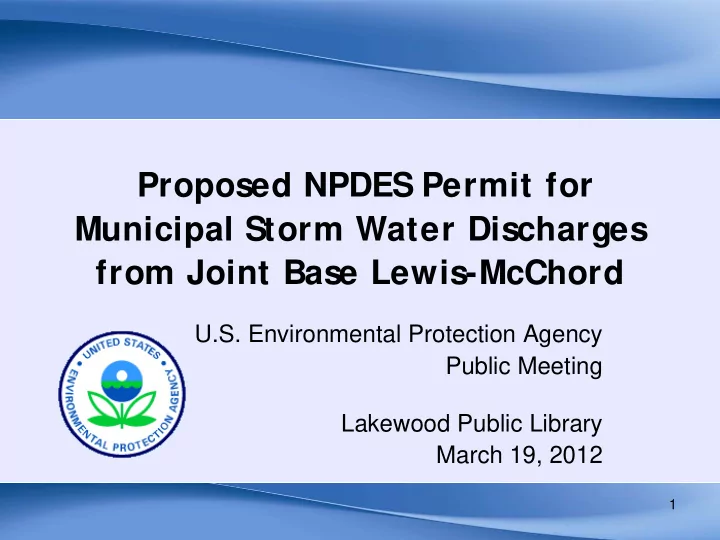
Proposed NPDES Permit for Municipal Storm Water Discharges from Joint Base Lewis-McChord U.S. Environmental Protection Agency Public Meeting Lakewood Public Library March 19, 2012 1 Presentation Background what, why, where, who
1
2
3
..is a conveyance or system of conveyances... owned by a State, city, town, or other public entity, which discharges to waters of the U.S., and
MS4s include …roads with drainage systems, municipal streets, catch basins, curbs, gutters, ditches, manmade channels, and/or storm drains….. 4
Includes Fort Lewis Army & McChord Air Force Bases
Includes military personnel, their families, civilian employees & visitors
( 142 sq. miles)
draining to the MS4 = 5,707 acres
5
6 The MS4 in the cantonment area considered…. ..Discharges to these receiving waters: JBLM Main Murray Creek; Bell & Hamer Marshes JBLM North American Lake American Lake Marsh Elliot Marsh McChord Field Clover Creek If a MS4 exists in the JBLM Training Areas,* the MS4 may discharge to.... Muck Creek, Nisqually River, and/or Puget Sound
7
Clover Creek Fecal coliform Dissolved Oxygen pH No American Lake Total Phosphorus No
8
9
“…Develop, implement, and enforce a storm water management program (SWMP), designed to:
maximum extent practicable (MEP),
Water Act.”
Address “minimum control measures” Comply with more stringent permit requirements which the permit authority determines are needed to protect water quality.
10
1. Public Education 2. Public Involvement 3. Illicit Discharge Detection and Elimination 4. Construction Site Runoff Control at Sites Disturbing 1 or more acres 5. Post-Construction (Permanent) Storm Water Management in New and Redevelopment for projects that disturb 1 acre or more 6. Pollution Prevention/Good Housekeeping for Municipal Operations Program Evaluation, Recordkeeping and Reporting Standard NPDES permit requirements Address waters not meeting State WQ standards & protect water quality
– Explicit requirements for treatment, onsite SW management & flow control
– Retrofit plan for reducing existing discharges and volumes – Monitoring for SW discharges, water quality & biological baselines
11
12
(See Fact Sheet, Appendix C)
13
14
– Conduct public education programs to reduce behaviors that contribute to adverse water quality impacts – Engage the “public” (ie, tenants, staff, contractors w/in fenceline) – Coordinate SWMP implementation across JBLM
15
16
17
18
19
20
Healthy Watersheds Sustainable Communities
Adding impervious cover shifts the hydrologic cycle, resulting in increased surface runoff.
0% 20% 40% 60% 80% 100% Predevelopment Unmitigated
Percentage Development Scenario
Evaporation Groundwater Interflow Surface Runoff
Dispersion and infiltration BMPs consistent with the SMMWW apply. Does the project disturb 5,000 square feet or more? Does the project create or replace 2,000 square feet but less than 5,000 square feet of hard surface? On-site Storm Water Management lawn and landscape soil quality BMPs requirements apply.
Yes Yes No
Does the project create or replace 5,000 square feet or greater of hard surface? 95% volumetric standard requirements apply.
8% of 2-year to 50% of 2-year peak flow Hydrologic Performance requirements apply.
Yes Yes
Does the project create 10,000 square feet or more of hard surface?
Next Question
50% of 2-year to 100% of 50-year peak flow Hydrologic Performance requirements apply. On-site Stormwater Management and Hydrologic Performance requirements do not apply.
No
Part II.B.5.e (bullet 1) Part II.B.5.e (bullet 2) Part II.B.5.e (bullet 3) Part II.B.5.f
Summary of EPA’s Proposed Hydrologic Performance Standard Requirements (Permit Part II.B.5.e & 5.f)
Next Question
24
Infiltration BMPs
Standard
Performance Standard 1 2 3
25
No Performance Standard Disturbs area greater than 5,000 ft2 Adds 2,000 - 5,000 ft2 hard surface No additional treatment is required assuming soil suitability criteria are met
26
Part II.B.5.e (bullet 1) Part II.B.5.e (bullet 2)
27
Performance Standard based on Historical Design Storm Disturbs area greater than 5,000 ft2 Adds greater than 5,000 ft2 hard surface Existing Ecology Treatment Requirements apply
28 1 2 3 4 5 6 0% 10% 20% 30% 40% 50% 60% 70% 80% 90% 100%
Rainfall depth (inches) Percentile Olympia Airport (1948-2012) 95th = 1.28" Volume of rain that would cover site footprint to a depth of the 95th percentile precipitation event (1.28 inches) This volume must be retained on site
29
Part II.B.5.e (bullet 1) Part II.B.5.e (bullet 3)
30
Performance Standard based on Predevelopment Hydrology Predevelopment: 17 acres Forested A/B soils Flat Average Yearly Runoff Volume: ~5,700 Gallons
31
Performance Standard based on Predevelopment Hydrology Average Yearly Runoff Volume: ~5,600,000 Gallons Existing Ecology Treatment Requirements apply
32
Part II.B.5.e (bullet 1) Part II.B.5.f
0.001 0.002 0.003 0.004 0.005 0.006 0.007 0.001 0.01 0.1 1 10 100
Runoff (cfs) Percent Time Rate Exceeded
Predevelopment Flow Duration Curve 50% of 2-year peak flow 8% of 2-year peak flow range of peak flows portion of flow duration curve to match with LID
33
0.001 0.002 0.003 0.004 0.005 0.006 0.007 0.001 0.01 0.1 1 10 100
Runoff (cfs) Percent Time Rate Exceeded Flows that fail standard Flows that pass standard
Predevelopment Flow Duration Curve
34
35
1 3 2 4
36
0.002 0.004 0.006 0.008 0.001 0.01 0.1 1 10 100
Runoff (cfs) Percent Time Rate Exceeded
8% of 2-year peak flow 50% of 2-year peak flow 100% of 50-year peak flow
37
0.002 0.004 0.006 0.008 0.001 0.01 0.1 1 10 100
Runoff (cfs) Percent Time Rate Exceeded
Predevelopment
8% of 2-year peak flow 50% of 2-year peak flow 100% of 50-year peak flow
1
38
0.002 0.004 0.006 0.008 0.001 0.01 0.1 1 10 100
Runoff (cfs) Percent Time Rate Exceeded
Predevelopment Unmitigated
8% of 2-year peak flow 50% of 2-year peak flow 100% of 50-year peak flow
1 2
39
0.002 0.004 0.006 0.008 0.001 0.01 0.1 1 10 100
Runoff (cfs) Percent Time Rate Exceeded
Predevelopment Unmitigated
8% of 2-year peak flow 50% of 2-year peak flow 100% of 50-year peak flow
Detention Pond
1 2 3
40
0.002 0.004 0.006 0.008 0.001 0.01 0.1 1 10 100
Runoff (cfs) Percent Time Rate Exceeded
Predevelopment Unmitigated
8% of 2-year peak flow 50% of 2-year peak flow 100% of 50-year peak flow
Detention Pond LID
1 2 3 4
41
Include name & contact info; Cite specific permit provision, as appropriate; Describe basis & facts supporting the comment, include suggested text revision.
42
43
44
Unmitigated: ~175,000 gal Bioretention only: ~6,000 gal Porous Pavement only: ~5,500 gal 95% Volumetric Standard: ~15,000 gal Average Predevelopment Runoff Volume: ~150 gal
45
46
Predevelopment: ~5,700 gal Unmitigated: ~5,600,000 gal Mitigation Scenarios: Pond: ~41,000 gal LID: ~700 gal Using combination of LID BMPs, runoff can be effectively reduced and treated