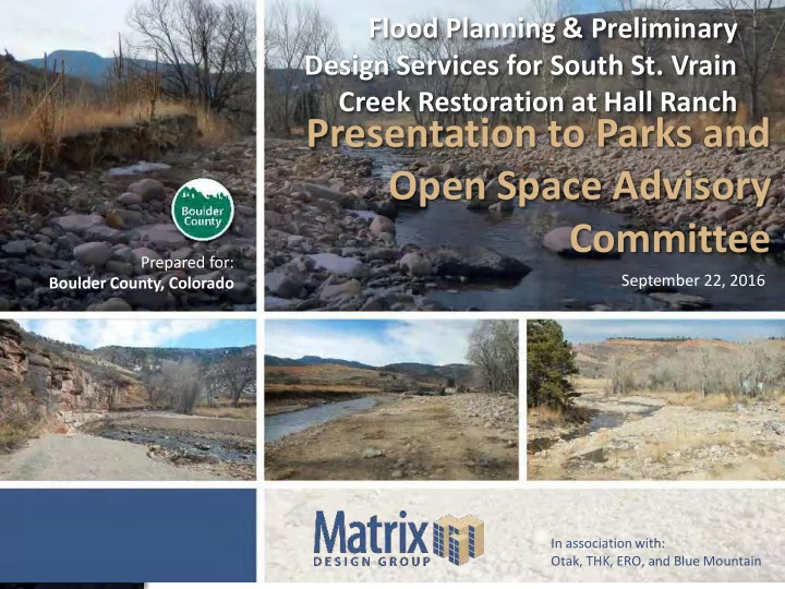
SLIDE 1 Flood Planning & Preliminary Design Services for South St. Vrain Creek Restoration at Hall Ranch
September 22, 2016 Prepared for: Boulder County, Colorado
In association with: Otak, THK, ERO, and Blue Mountain
Presentation to Parks and Open Space Advisory Committee
SLIDE 2 Introductions
Introduction History of project Planning area: 3.2 Mile Reach from Canyon to Bridge Project sponsors and funding: DOLA/BCPOS
- 30% Report and Designs
- EWP Eligible Construction
Project website
- Information and comment
- www.BoulderCountyOpenSpace.org/ssv
SLIDE 3
SLIDE 4
Matrix Team
SLIDE 5 Project Schedule
Design schedule
- Notice to proceed: May 2016
- Alternative analysis: June 2016
- Preferred alternative: July 2016
- 30% design: September 2016
- EWP Permitting and 80% Design: Fall/Winter
2016
- EWP Construction: Winter/Spring 2017
SLIDE 6 Public Engagement
Extensive Public Engagement
- South St. Vrain Working Group – May 11
- St. Vrain Creek Coalition – May 25, June 29,
July 20, and August 17
- General Public Meetings (Lyons) – May 24 and
June 30
- Individual Land Owner Meetings – June 22
- Public Preferred Alternative Site Tour – July 28
- Various on-line comments, phone calls, and
field visits
Comments since 2013
SLIDE 7
Pre Flood Aerial: 2012
SLIDE 8
Post Flood Aerial: 2013
SLIDE 9
Post Flood Aerial: 2014
SLIDE 10
Post Flood Aerial: 2015
SLIDE 11
Pre Flood Aerial: 2012
SLIDE 12
Post Flood Aerial: 2013
SLIDE 13
Post Flood Aerial: 2014
SLIDE 14
Post Flood Aerial: 2015
SLIDE 15
Pre Flood Aerial: 2012
SLIDE 16
Post Flood Aerial: 2013
SLIDE 17
Post Flood Aerial: 2014
SLIDE 18
Post Flood Aerial: 2015
SLIDE 19 Project Goals Statement
Provide a conceptual design for the entire South Saint Vrain Creek project area that restores and improves the channel and surrounding floodplain areas to a safe, natural, resilient, functioning, and ecologically rich habitat. This project will use qualitative research, quantitative data, and community input to inform resilient design that shall utilize natural system principles and onsite materials to expedite recovery from the 2013 floods and set up for better performance in future flood events. Components to meet goals include incorporating natural channel diversity and character, re-establishing floodplain benches for lateral connectivity, reducing longitudinal connectivity constraints, improving flow conveyance and sediment transport to maintain environmental values, promote naturally functioning stream processes, protect public and private infrastructure, improve public safety, repair unstable erosion scars in high-risk areas, and revegetate denuded areas.
SLIDE 20 Decision Making Process
Comments/Concerns Core Values Project Goals Prioritization Criteria
SLIDE 21
Prioritization Criteria
Alternatives evaluated in matrices to determine most effect (preferred) alternative
SLIDE 22
Alternative: Floodplain Connectivity
SLIDE 23
Alternative: Channel Complexity
SLIDE 24 Alternative: Revegetation
Riparian Woodlands/ Fringe Wetlands Open Water Channel Cottonwood Gallery Shrub/ Grassland Riparian/ Fringe Wetlands Cottonwood Gallery Shrub/ Grassland 100 Year Floodplain Residual Terrace Third Terrace Second Terrace Floodplain Bench Floodplain Bench First Terrace Second Terrace Third Terrace Cotton Wood Gallery Wetland/Riparian Bench Grassland Meadow
SLIDE 25 Alternative: Infrastructure Protection
Root Wad Stabilization Boulder Toe Protection Utility Armoring Vegetated Geogrid
SLIDE 26 Additional Design Aspects Evaluated
Existing infrastructure aspects investigated to provide future recommendations Old St Vrain Road Bridge
- Required capacity and road overtopping
Longmont Diversion
- Relocation of diversion and floodplain
conveyance
South Ledge/Meadows Ditch
Woody Vegetation Management
SLIDE 27 Geomorphology Geomorphic Assessment
- Data Review
- Desktop Analysis
- Field Assessment
Sediment Transport
- Stability Analyses
- Trajectory determination
- Structure design
What questions are we trying to answer?
- What are prevailing processes and how do we use them
to achieve the project goals?
- What is the channel trajectory and what does that
mean for the project goals?
- Is the channel stable? Is the design stable?
SLIDE 28
Geomorphology - Assessment
SLIDE 29
Geomorphology - Assessment
SLIDE 30 Geomorphology - Assessment
River Styles
SLIDE 31
Geomorphology – Sediment Transport
Base Bed Mobility
SLIDE 32 Geomorphology – Sediment Transport
Effective Discharge
- Qeff – flow that transports most sediment over
time
- Qh – discharge associated with cumulative 50%
- f sediment yield
SLIDE 33 Geomorphology – Sediment Transport
Sediment Transport Capacity and Balance
Capacity-Supply Ratio (CSR)
- Reach capacity/supply
- 1 is good
SLIDE 34
Geomorphology – Sediment Transport
Sediment Transport Capacity and Balance
SLIDE 35 Geomorphology – Sediment Transport
Sediment Transport Capacity and Balance
25yr Stream Power
SLIDE 36
Geomorphology - SEM
Stream Evolution Model
SLIDE 37 Geomorphology - Summary Stream is generally featureless, over-widened and likely to degrade disconnecting further from the existing floodplain Restoration and Flood Mitigation Strategies:
- Establish equilibrium channel geometries that
promote/maintain floodplain connection
- Control sediment supply with aggressive revegetation
- Establish geomorphic complexity to manage sediment
load, improve habitat
SLIDE 38 Design Process
Understand Hydraulics with Development of Design Models
- 1-D HEC-RAS
- Regulatory floodplain modeling
- 2-D Sedimentation and River Hydraulics
- Final design parameters and sediment transport
Iterative Process
- EC Topography and Modeling
- PC Grading and PC Modeling
- Refine PC Topography
- Verify Capacity-Supply Ratio
- Structure and Revegetation Design
SLIDE 39 30% Design
Channel Geometry
- Function of hydraulic geometry, and constraints
Main Channel and Overflow Planform
- Pre-Flood or Existing Alignments
Channel Profile
- Equilibrium bed slope analysis (0.8 – 2% range)
SLIDE 40 30% Design
Channel and Floodplain Dimensions
SLIDE 41
1.5 and 5 Year Overflow Channels
Along Existing and/or Pre-Flood Channel Alignments to stretch implementation funds On Average 25’ Bottom Width with Gentle Side Slopes Vegetation Lined and/or Stream Substrate
SLIDE 42
Riffle Structure Design
SLIDE 43 Large Woody Material and Vegetation
Geomorphic, Biologic and Ecologic Benefits Implementation Guidance
- Site Visit with Boulder County Emergency
Management (OEM)
- OEM Decision Process
- Focused on hazard trees in the vicinity of
infrastructure
- National Guidance Documents on the Design
- f Engineered Log Structures
SLIDE 44
Large Wood Structure Design
SLIDE 45
Large Wood Structure Design
SLIDE 46
Bank Stabilization
SLIDE 47
Bank Stabilization
SLIDE 48
Bank Stabilization
SLIDE 49
Revegetation: Goals
Preserve Existing Vegetation Planting Diversity Based Upon Proximity to Water Table (Iterative Design Process) Match existing plant species and ecosystem types to historical character and onsite conditions.
SLIDE 50 Revegetation Assessment
Evaluate onsite plant communities Utilize State and National Resources
- National Wetland Inventory Wetlands Mapper
- Colorado Wetland Inventory Mapping Tool
- The CNHP Field Guide to Wetland and Riparian
Plant Associates
SLIDE 51 Revegetation Recommendations
Re-establish upland, riparian, wetland environments through:
- Seeding (Riparian and Upland)
- Perennial Tubelings
- Wetland Sod
- Tree and Shrub Plantings
- Willow Staking
SLIDE 52
Revegetation Results
SLIDE 53 30% Design Plans and Report
Posted to Boulder County Project Website
- http://www.bouldercounty.org/ssv
30% Design Plans
- 62 Sheets
- Plan and Profile of Main and Overflow Channels
- Channel Design Details
- Revegetation Plans
- Revegetation and Bio-Engineering Details
- Additional Planning Elements
30% Preliminary Basis of Design Report
SLIDE 54 Next Steps
80% Design Drawings
- Working with EWP and Boulder County
Currently to contract for additional services
Permitting
- 404 CWA, Floodplain, Land Use, Stormwater
Construction
- Bid Support
- Construction Oversight and Closeout