october 9 2013 tonight s agenda 6 00 welcome 6 15
play

October 9, 2013 Tonights agenda 6:00 Welcome 6:15 Presentation 6:45 - PowerPoint PPT Presentation

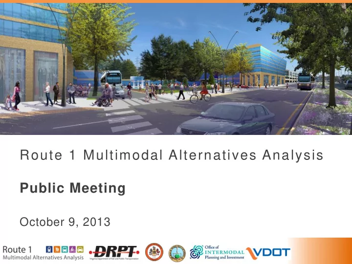
Route 1 Multimodal Alternatives Analysis Public Meeting October 9, 2013 Tonights agenda 6:00 Welcome 6:15 Presentation 6:45 Question and Answer Period 7:00 Share your Ideas 2 2 What you will learn from the presentation: 1. Project


  1. Route 1 Multimodal Alternatives Analysis Public Meeting October 9, 2013

  2. Tonight’s agenda 6:00 Welcome 6:15 Presentation 6:45 Question and Answer Period 7:00 Share your Ideas 2 2

  3. What you will learn from the presentation: 1. Project introduction Who is leading? What is the project? What is the schedule? What is transit-supportive development? 2. Goals and needs of the project What are the transportation challenges? What are we trying to improve? 3. Public and stakeholder involvement How can I provide input and stay involved? 3

  4. 02 Study Corridor 01 Project introduction 4

  5. What is a multimodal alternatives analysis? An alternatives analysis is a study that examines different options to address a transportation problem. Multimodal means that a range of different transportation types will be evaluated. 5

  6. Who is leading the study? The Virginia Department of Rail and Public Transportation (DRPT) in coordination with: • Fairfax County • Prince William County • Virginia Office of Intermodal Planning and Investment (OIPI) • Virginia Department of Transportation (VDOT) 6

  7. Where is the project located? • 15-mile section of Route 1 • From I-95/I-495 Beltway, through Fairfax County, to Route 123 at Woodbridge in Prince William County • Also includes area near Huntington Metrorail Station 7

  8. How did the study get started? • Corridor residents, businesses, and travelers seek improvements to transportation infrastructure and services • Recent planning efforts have identified needs for transit and roadway improvements • Planners recognize the need for mixed land use and local connectivity • Decision makers have called for an alternatives analysis to test the viability of specific transportation and land use alternatives 8 8

  9. Existing Conditions 9 9

  10. Key Past Studies • Route 1 Centerline Study (VDOT ,1998) • Route 1 Transit Improvement Study (DRPT, 2003) • Richmond Highway Public Transportation Initiative (2004) • Route 1 Location Study (VDOT, 2004) • Fairfax County Transit Development Plan (2009) • Woodbridge Station Plan (Prince William County, 2009) • Super NoVa Transit & TDM Vision Plan Study (DRPT, 2010) • Route 1 Improvements at Fort Belvoir (ongoing) • Fairfax Countywide Transit Study (ongoing) • Route 1/Route 123 Interchange (ongoing) 10 10

  11. Fort Belvoir: Traffic Conditions In the peak hour, 4800 cars enter Average Daily Traffic along Route 1 the Fort; 1600 cars pass through Fort Belvoir the entrance gate 2001 2012 Segment at Kingman Road South Segment 32,000 38,600 North Segment 40,000 41,000 Sources: VDOT Count Stations; Fort Belvoir Real Property Master Plan 11

  12. Fort Belvoir: Transportation Plan • Significant employment growth • Goal: Reduce reliance on commuting by automobile • Goal: Improve transit connectivity to the region Year Employment Growth 2012 39,000 - 2017 42,500 +3,500 2030 56,000 +17,000 Source: Fort Belvoir Real Property Master Plan, Long Range Component, Dept. of Defense, US Army Corps of Engineers 12

  13. Planned Improvements 13

  14. What is the purpose of the project? • Increase transportation choices and safety for both local and commuter trips • Increase carrying capacity of the roadway by introducing higher quality transit service • Support and enable growth and transit-oriented development on the corridor • Improve access to local and regional activity centers Study Process 14

  15. What is the project schedule? 15

  16. Who lives and works along Route 1? 108,570 48,842 64,042 30,448 2010 2010 2040 2040 18,394 new jobs 44,528 new residents within ½-mile of Route 1 within ½-mile of Route 1 69% increase 60% increase (2010 – 2040) (2010 – 2040) Source: MWCOG Round 8.2 Land Use Forecast 16

  17. What ways do they travel? 182,634 Transit Mode Share for Study Area (average weekday) = 5000 drivers = 5000 transit riders “Mode share”: number of people using a particular type of transportation 15,282 Source: WMATA Model 17

  18. What is transit supportive development? • A mix of housing and commercial development • Walkable neighborhoods • Focused activity around transit stations Walkable Street Mixed-Use in Bethesda, MD Development in Dallas, TX 18

  19. Why is Transit Supportive Development Important? • Walkable places that people desire • Transit service supported by adequate ridership • Environmentally friendly regional growth Green, Walkable Mixed-Use Street in Los Development in Angeles, CA Alexandria, VA 19

  20. Example: Arlington, VA (MetroRail) 20

  21. Example: Charlotte, NC (Light Rail) 21

  22. Example: Cleveland, OH (Bus Rapid Transit) 22

  23. Priorities for creating transit-friendly places • High quality transit works well where jobs, housing, and retail activities are close together. • For a safe and comfortable pedestrian experience, streets can’t be too wide, and sidewalks and crosswalks are important. 23

  24. New development with active street life Santa Barbara, CA Albany, NY Chicago, Portland, IL OR 24

  25. New development at a range of scales Kentlands, MD Fairfax, VA King Farm, MD Washington, DC 25

  26. 02 Study Corridor 02 Goals and needs of the Project 26

  27. Summary of major transportation needs on Route 1 • Attractive and competitive transit service • Viable multimodal travel options • Efficient and affordable access to employment, workforce, and major destinations • Congestion relief and emissions reductions • Transportation support for local land use plans Source: Based on a review of existing studies 27

  28. Project goals Goal 1: Improve multimodal travel options Goal 2: Improve safety; Increase accessibility Goal 3: Increase the economic competitiveness and vitality of the corridor Goal 4: Preserve community, health, and the environment Source: Based on a review of existing studies 28

  29. Goal 1: Improve multimodal travel options 29

  30. NEED: Improve transit frequency and service Bus service can be infrequent, particularly as you move farther south along Route 1 Peak Wait Off-Peak Route Time Frequency (Rush Hour) (non-Rush Hour) REX 11 min 30 min (Metrobus) 20 min 30 min 171 (FCC) 30 min 60 min P-MD (PRTC) Common Bus Routes on Route 1 30

  31. NEED: Improve transit travel time Transit (bus) travel time between activity centers along the corridor is not competitive compared to driving Mode Travel Time Car 20 minutes Bus 35 minutes Bus Travel Time vs. Vehicle Travel Time 31

  32. NEED: Improve transit travel time Transit (bus) travel time between activity centers along the corridor is not competitive compared to driving Mode Travel Time Car 15 minutes Rail and 40 minutes* Bus Bus Travel Time vs. Vehicle Travel Time *Only 4 trains per day for this option 32

  33. NEED: Improve bicycle networks There are few bicycle routes along Route 1, and no convenient continuous bicycle alternatives to Route 1 Dedicated Bike Path Primary Bike Route Secondary Bike Route Bicycle Routes (green) adjacent to Route 1 33

  34. Goal 2:Improve safety; Increase accessibility 34

  35. NEED: Provide accessible pathways Pedestrian Desire Lines at crosswalks are Lockheed Blvd Bus Stop infrequent and unsignalized Accessibility Challenges at Huntington Avenue 35

  36. NEED: Improve pedestrian crossings Crosswalks Intersections Crosswalks are infrequent along Route 1 and “jaywalking” is common Intersections with Crosswalks (blue) 36

  37. NEED: Decrease congestion Congested Areas (AM) There are traffic delays at key “pinch point” locations along Route 1 during rush hour Intersections with Greatest Delay, Weekday AM 37

  38. Goal 3: Increase the economic competitiveness and vitality of the corridor 38

  39. NEED: Improve access for low-income populations Corridor Bus Riders Significant transit - earn less than $ 55% $30,000 annually dependent $$ 85% earn less than population along $70,000 annually Richmond Highway no auto in 47% household ? no auto available 72% for this trip Source: Fairfax County Transit Development Plan (2009) 39

  40. NEED: Increase and improve connectivity to regional activity centers Future growth in jobs and housing will be focused in regional activity centers Source: Washington Metropolitan Council of Governments, 2013 40

  41. NEED: Support compact, mixed use development Fairfax and Prince William Counties have identified redevelopment areas along Route 1 Nodes for future Mixed-Use Development and Growth Community Business Center’s (CBC’s) 41

  42. Goal 4: Preserve community, health, and the environment 42

  43. NEED: Reduce energy consumption and greenhouse gas emissions Increasing transit efficiency will decrease greenhouse Source: CTA rendering of bus rapid transit on in Chicago gases 43

  44. NEED: Increase opportunities for affordable living Annual Household Savings from taking Public Transit comparison of 1 and 2 car households The ability to travel by public transit can save the average household over $6,000 EVERY YEAR Source: Public Transportation and Petroleum Savings Report 44

  45. NEED: Increase opportunities for “active transportation” Walking or biking to school or work can help us be more active and improve our overall health 45

Download Presentation
Download Policy: The content available on the website is offered to you 'AS IS' for your personal information and use only. It cannot be commercialized, licensed, or distributed on other websites without prior consent from the author. To download a presentation, simply click this link. If you encounter any difficulties during the download process, it's possible that the publisher has removed the file from their server.

Recommend


More recommend