
SLIDE 1
Southwest Fisheries Science Center
NMFS Report SWFSC Activities Coastal Pelagic Species Gerard - - PowerPoint PPT Presentation
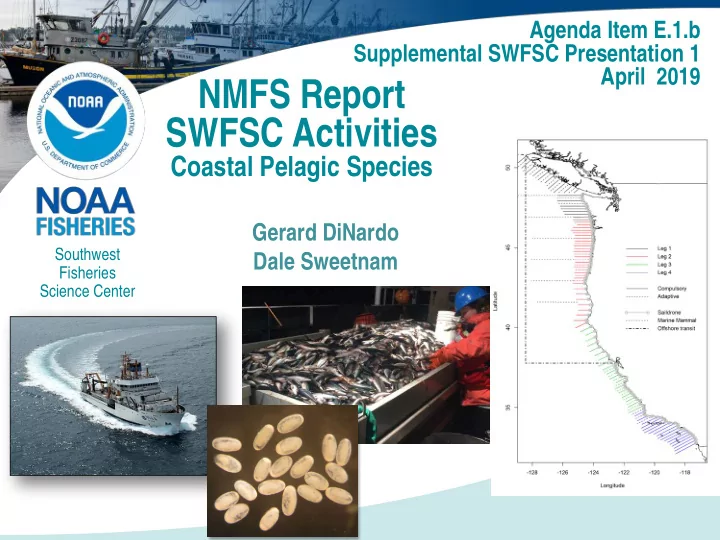
Agenda Item E.1.b Supplemental SWFSC Presentation 1 April 2019 NMFS Report SWFSC Activities Coastal Pelagic Species Gerard DiNardo Southwest Dale Sweetnam Fisheries Science Center Presentation Outline 1. CPS Stock Assessments 2.
Southwest Fisheries Science Center
U.S. Department of Commerce | National Oceanic and Atmospheric Administration | NOAA Fisheries | Page 2
data;
preliminary data;
ENS landings to NSP;
composition from the summer 2017 AT survey;
composition from the summer 2018 AT survey;
U.S. Department of Commerce | National Oceanic and Atmospheric Administration | NOAA Fisheries | Page 3
U.S. Department of Commerce | National Oceanic and Atmospheric Administration | NOAA Fisheries | Page 4
Stratum Transect Trawls Biomass (t) Number Area (nmi2) Number Distance (nmi) Cluster number Number
Sardine Point Lower CI95% Upper CI95% SD CV (%) 2 6,201 12 657 7 202 2,002 419 4,246 1,021 51 3 17,240 37 1,778 13 2,324 33,475 3,563 86,297 25,875 77 4 335 19 213 3 20 23 31 42 3 11 All 23,776 68 2,648 20 2,546 35,501 5,169 89,103 25,975 73
July 2019 B1+=27,547 mt
Projected 2019 Biomass < Minimum Stock Size Threshold (MSST)
U.S. Department of Commerce | National Oceanic and Atmospheric Administration | NOAA Fisheries | Page 6
Stratum Transect Trawls Biomass (t) Number Area (nmi2) Number Distance (nmi) Cluster number Number
Sardine Point Lower CI95% Upper CI95% SD CV (%) 1 9,017 15 918 9 6,270 33,093 8,957 65,417 14,561 44 All 9,017 15 918 9 6,270 33,093 8,957 65,417 14,561 44
U.S. Department of Commerce | National Oceanic and Atmospheric Administration | NOAA Fisheries | Page 7
U.S. Department of Commerce | National Oceanic and Atmospheric Administration | NOAA Fisheries | Page 8
Summer 2015 Spring 2017 Summer 2016 Summer 2017 Summer 2018
U.S. Department of Commerce | National Oceanic and Atmospheric Administration | NOAA Fisheries | Page 9
U.S. Department of Commerce | National Oceanic and Atmospheric Administration | NOAA Fisheries | Page 10
CONTENTS
Demography, and Biomass
NS Pacific Sardine SS Pacific Sardine NS Northern Anchovy CS Northern Anchovy Pacific Mackerel Jack Mackerel Pacific Herring Biomas s (t) CV (%) Biomass (t) CV (%) Biomass (t) CV (%) Biomass (t) CV (%) Biomass (t) CV (%) Biomass (t) CV (%) Biomass (t) CV (%) Summer 2017* 14,103(30) 22,709 (64) 153,460 (45) 41,139 (26) 128,313(22) 63,418 (31) Summer 2018 25,148 (67) 33,093 (44) 24,419 (38) 723,826 (17) 31,211 (22) 202,471(17) 79,053 (37)
* Incomplete Sampling
U.S. Department of Commerce | National Oceanic and Atmospheric Administration | NOAA Fisheries | Page 11
U.S. Department of Commerce | National Oceanic and Atmospheric Administration | NOAA Fisheries | Page 13
Northern stock anchovy Lasker – 22,607 t (CV=64%) Lisa Marie – 102 t (CV=34%) 0.5% more anchovy nearshore NS Anchovy Planned Transects
U.S. Department of Commerce | National Oceanic and Atmospheric Administration | NOAA Fisheries | Page 14
U.S. Department of Commerce | National Oceanic and Atmospheric Administration | NOAA Fisheries | Page 15
Stratum Transect Trawls Biomass (t) Number Area (nmi2) Number Distance (nmi) Cluster number Number
Anchovy Point Lower CI95% Upper CI95% SD CV (%) 1 815 12 42 5 86,143 45,446 454 48,240 13,634 30 All 815 12 42 5 86,143 45,446 454 48,240 13.634 30
Central Stock of Northern Anchovy
Planned Transects Central Stock Anchovy Central stock anchovy Lasker – 716,887 t (CV~17%) Saildrone – 6,939 t (CV=71%) 1% more anchovy nearshore
U.S. Department of Commerce | National Oceanic and Atmospheric Administration | NOAA Fisheries | Page 16
U.S. Department of Commerce | National Oceanic and Atmospheric Administration | NOAA Fisheries | Page 17
50m
30m 20m Lasker Lasker & Saildrone Saildrone Los Angles DEPTH PLATFORM 2017 – Lasker only to 50m depth 2018 – Lasker and Saildrone to approximately 30m depth, Saildrone to approximately 20m depth
1. Distances were calculated for the projections of each transect to the 5-m isobath. 2. The biomass densities along these unsampled transect extensions were assigned the values measured along the sampled transects, equal distances from the eastern ends of the transects. Central Stock Northern Anchovy
U.S. Department of Commerce | National Oceanic and Atmospheric Administration | NOAA Fisheries | Page 18
The biomass density data used to calculate the abundance in the nearshore strata are taken from an interval in the nearest acoustic transects, with a length equal to the distance between the transect endpoint and the 5-m isobath.
The intervals in red have the same length as the distance to the 5-m isobath – their density is assumed to reflect the near-shore density
U.S. Department of Commerce | National Oceanic and Atmospheric Administration | NOAA Fisheries | Page 19
NS Pacific Sardine SS Pacific Sardine NS Northern Anchovy CS Northern Anchovy Pacific Mackerel Jack Mackerel Pacific Herring Biomass (t) CV (%) Biomass (t) CV (%) Biomass (t) CV (%) Biomass (t) CV (%) Biomass (t) CV (%) Biomass (t) CV (%) Biomass (t) CV (%) Summer 2017 142 (57) 19 (42) 45,446 (28) 548 (43) 971 (38) 7,372 (64 ) Summer 2018 308 (86) 1,870 (74) 1,310 (84) 4,110 (56) 1,320 (75) 9,954 (75) 8,449 (52 )
The extrapolated values depend on the nearest measurements (acoustic and trawl samples) to the unsampled areas, which primarily depend on the stock distributions at the time of the survey.
U.S. Department of Commerce | National Oceanic and Atmospheric Administration | NOAA Fisheries | Page 20
SD1024 Repeat of Lasker Transect 34 (~ 8 km), Monterey Bay Monterey Bay 4-Day “Repeated” Transect
When and where you sample matters! Especially important at low population levels.
Day 1 Day 2 Day 3 Day 4
U.S. Department of Commerce | National Oceanic and Atmospheric Administration | NOAA Fisheries | Page 21
coastal pelagic fishes in the California Current Ecosystem during Summer 2017 based on acoustic-trawl sampling. NOAA Technical Memorandum NMFS, NOAA-TM-NMFS-SWFSC-610. 93 pg.
coastal pelagic fishes in the California Current Ecosystem during Summer 2018 based on acoustic-trawl sampling. NOAA Technical Memorandum NMFS, NOAA-TM-NMFS-SWFSC-613. 81 pg.
2019 for U.S. management in 2019-20. PFMC April 2019. 116 pgs.
assessment for U.S. management in the 2019-20 and 2020-21 fishing
environmental dependence of Pacific sardine recruitment. Fisheries Research.
U.S. Department of Commerce | National Oceanic and Atmospheric Administration | NOAA Fisheries | Page 22
April 3-29 – FSV Reuben Lasker
13-Sept. 9 (~ 75 days) – FSV Reuben Lasker CPS Acoustic Trawl Survey with unmanned system, Industry, etc.
U.S. Department of Commerce | National Oceanic and Atmospheric Administration | NOAA Fisheries | Page 23
U.S. Department of Commerce | National Oceanic and Atmospheric Administration | NOAA Fisheries | Page 23