1
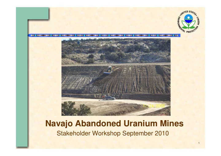
Navajo Abandoned Uranium Mines Stakeholder Workshop September 2010 - - PowerPoint PPT Presentation
Navajo Abandoned Uranium Mines Stakeholder Workshop September 2010 1 2 Northeast Church Rock Mine Largest underground uranium mine in country and highest priority mine for Navajo Nation 2006-2008: Completed extensive site investigations
2
3 3
Northeast Church Rock Mine
Largest underground uranium mine in country and highest priority mine for Navajo Nation 2006-2008: Completed extensive site investigations 2007: Completed cleanup of 1 structure and 4 yards 2009: Completed Engineering Evaluation of cleanup options 2010: Completed the removal
- f 100,000 cubic yards of
contaminated material
Northeast Church Rock 2007 Excavation
4 4
Northeast Church Rock Mine – Next Steps
Complete an evaluation
- f area groundwater in
2010 Continue community participation and the healing process involving more than the NECR Site Goal to select a cleanup alternative for the NECR site in 2010
Northeast Church Rock and UNC Sites : South View
Insert NECR planning map
5
NECR UNC Mill Site Red Water Pond Road Area - Conceptual Plan
Quivira & UA#2 Soils RWPR NECR IRA Complete 2010 NECR Mine Soils
Quivira 1E Quivira 1
Downstream Well Mill Well Mine Well Friendship Well Pipeline Well Zone 3 Plume (R6) migrating/ decision under re- evaluation Zone 1 Plume (R6) under control SW Alluvium Plume (R6) under control NECR Residential Removal Completed 2007
Quivira Mines – Church Rock
Signed an Administrative Order on Consent with Rio Algom September 3 Pave Red Water Pond Road, fix fences and stabilize the waste pile this Fall
6 6 6
Screening at NE Church Rock 1 mine
Quivira Mines – Next Steps
Characterize soil contamination Quivira Mines and downstream arroyos Identify cleanup options Continue working closely with Red Water Pond Road Community Association
7 7 7
Screening – comparison to background
8 8 8
Mariano Lake Mine
From 1977 to 1982, Gulf Mineral mined site Single shaft approximately 519 feet deep Stope leaching process solution pumped to a dewatering pond in the western area Approximately 31 acres near seven residences Some surface areas appear reclaimed, but there are notable exceptions
Horses inside the Mariano Lake Mine fence line
9 9 9
Mariano Lake Mine – Next Steps
Emergency Response is working with one family to replace contaminated home items and ensure no one builds on former parking lot Work with Potentially Responsible Party to investigate and cleanup the site Site Assessment conducting Preliminary Assessment
Mariano Lake Mine
10
Summary
Real results at the NECR site Positive starts at Skyline, Quivira and Mariano Lake using model process and documents EPA has the benefit of lessons learned EPA will continue to tackle new sites in consultation with the Navajo Nation and the affected communities
10
Questions?
Andrew Bain Remedial Project Manager USEPA Region 9 75 Hawthorne St. (SFD-6-2) San Francisco, CA 94105 (415) 972-3167 bain.andrew@epa.gov Michele Dineyazhe Remedial Project Manager Navajo Nation EPA PO Box 2946 Window Rock, AZ 86515 (928) 871-7820 dineyazhe.michele@epa.gov
11
Here is website with a short video that EPA's region 9 office produced
- n some of the response actions that were taken to address
radioactive contamination in homes. http://www.epa.gov/region9/superfund/navajo-nation/contaminated- structures.html Here is a fact sheet that provides an overview of the site, contaminants present, and progress that has been made. http://yosemite.epa.gov/r9/sfund/r9sfdocw.nsf/3dec8ba325236842882 5742600743733/9beb6aeaf2fa058a88257353002bf7d6 Here is a website on Gallup New Mexico which would be closest hotel location, since its close to the sites that you visited. Unfortunately, its about 2 hours from the Albuquerque airport. The regional staff usually stay in this city. http://en.wikipedia.org/wiki/Gallup,_New_Mexico Here is a website for Albuquerque New
- Mexico. http://en.wikipedia.org/wiki/Albuquerque,_New_Mexico