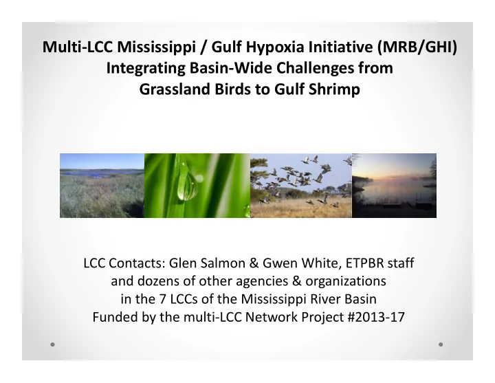
SLIDE 1
Multi‐LCC Mississippi / Gulf Hypoxia Initiative (MRB/GHI) Integrating Basin‐Wide Challenges from Grassland Birds to Gulf Shrimp
LCC Contacts: Glen Salmon & Gwen White, ETPBR staff and dozens of other agencies & organizations in the 7 LCCs of the Mississippi River Basin Funded by the multi‐LCC Network Project #2013‐17
SLIDE 2
A crisis is brewing on the prairie …
High commodity prices are great for farmers… Not so great for grassland birds and pollinators. From 2008‐2012, plowed under 7.2 million acres for crops. These are the highest rates of loss since the Dust Bowl.
Is this another Silent Spring?
SLIDE 3 …and downstream in the Big Rivers
As farmers retire over the next 20 years, about 400 million acres will change hands – some to international investors. [all national cropland = 442 million acres]
From: Oakland Institute 2014. Down on the Farm. Wall Street: America’s New Farmer.
SLIDE 4
Climate Stationarity is Dead. When Illinois is East Texas… How will Agriculture & Wildlife Adapt?
SLIDE 5 ʺUpstr
eam is wher e you gr ew up, wher e you c ame fr
Downstr eam is what you leave behind, your legac y."
mstr
's offic e
Map of degree of human modification (darker areas)
SLIDE 6
- 1. Plains & Prairie Potholes LCC
Rick Nelson
- 2. Upper Midwest & Great Lakes LCC
John Rogner, Brad Potter
- 3. Eastern Tallgrass Prairie & Big Rivers LCC ‐ Glen Salmon, Gwen White
- 4. Great Plains LCC – Nicole Athearn, James Broska
- 5. Gulf Coastal Plains & Ozarks LCC – Greg Wathen, Todd Jones‐Farrand
- 6. Appalachian LCC – Jean Brennan
- 7. Gulf Coast Prairie LCC – Bill Bartush, Cynthia Edwards, Ben Kahler
22 Landscape Conservation Cooperatives (LCCs) 7 span the Mississippi Basin
SLIDE 7
Who are the typical Steering Committee members in a Midwest LCC (example below from ETPBR)?
SLIDE 8
Mission Possible: Restore & Connect Wildlife with People on the Rich Soils of a Functional Working Landscape Must be pragmatic, scalable/regional, collaborative, transparent, and value‐added to ongoing restoration efforts!
What do we want to accomplish?
SLIDE 9
How c an we tar get wildlife ac tions to also benefit water quality and agr ic ultur e?
SLIDE 10 p g The LCD process guides adaptive management:
- Where are we now? Where are we headed?
– assess current and projected landscape
- Where do we want to be headed?
– define desired future conditions
- How can we get there most efficiently?
– weigh & select strategies to align actions
- Where do we focus actions?
– map high priority opportunities on the landscape
- How could drivers change the outcome?
– model scenarios and tradeoffs
- What if we’re missing something?
– implement, evaluate and refine strategies
SLIDE 11 Gulf Hypoxia Initiative ‐ Components
1) What to Do? Fact Sheets for 14 High Impact Ag Conservation Practices 2) Where? Online Mapping Tool to target conservation investments 3) Why? Estimation of multi‐ sector benefits 4) How? Demonstration projects for emerging practices 5) Evaluation? Multi‐sector landscape‐scale monitoring system 6) Research? Future directions “Focused action is going to be more inspiring than perfect planning.” –
Eric Schenck, DU / ETPBR LCC Steering Committee
SLIDE 12 How can we align & target our actions through a “Collective Impact” approach?
- 1. Common agenda: Seek
- ut and c onvene a networ
k
- f c hange agents who want
to explor e solutions to c r itic al lar ge-sc ale pr
einfor c ing Ac tivities: Develop a systematic por tfolio of r esear c h that c an’t be done alone bec ause of sc ope or sc ale.
ganization: Matc h new sour c es that c an c ontr ibute r esour c es and tr aining on emer ging issues and tec hnologies.
edit, pr
ate the gr eat wor k being done by par tner s!
ed measur ement: Design ac c essible systems for tar geting, measur ing and c ompar ing outc omes.
SLIDE 13 Who are the multi‐sector stakeholders that are involved?
Universities:
- Kansas State University
- Mississippi State University
- Ohio State University
- Louisiana University Marine Consortium
- University of Illinois
- University of Minnesota
- University Wisconsin‐Madison
NGOs:
- Agricultural Watershed Institute
- Mississippi River Network
- Ducks Unlimited
- Enviroscapes Ecological Consulting
- Fishers & Farmers Fish Habitat Partnership
- Gulf Hypoxia Task Force
- Illinois Council on Best Management Practices
- KGregg Consulting
- Lower Mississippi River Committee
- Midwest Conservation Biomass Alliance
- Mississippi Interstate Cooperative Resource
Association
- National Wildlife Federation
- Natural Land Institute
- Oak Ridge National Laboratory
- Ohio River Basin Fish Habitat Partnership
- Practical Farmers of Iowa
- The Conservation Fund
- The Nature Conservancy
- Wildlife Management Institute
State agencies:
- Indiana DNR
- Iowa Dept of Agriculture
- Minnesota Pollution Control Agency
- Missouri Dept of Conservation
- Nebraska Game & Parks Commission
- Tennessee Wildlife Resources Agency
Federal agencies:
- Army Corps of Engineers
- Dept of Energy
- Dept of Transportation
- EPA (OWOW, Hypoxia Task Force)
- Fish & Wildlife Service (ES, Partners, EA, NCTC)
- USDA Forest Service
- US Geological Survey (NAWQA, HTF)
- National Park Service
- NOAA (HTF)
- South Central Climate Science Center
- USDA Farm Service Agency
- USDA National Institute of Food & Agriculture
- USDA NRCS (AR, IN, TN, MRBI)
50 people in Memphis. Over 250 in the contact list and counting…
SLIDE 14 A YEAR‐LONG FRAMEWORK DISCUSSION CULMINATED
IN A WORKSHOP IN MEMPHIS, TN, AUG 2014
2014 MRB/GHI Decision Making Workshop Report (i.e., “The Memphis Report”) identifies:
5 Farm Production Systems
- Species that may indicate
progress in each system
Farming System
- Prioritized list of Cost‐
Effective Strategies
- Initial list of barriers,
science needs & programs
SLIDE 15
WHAT IS THE COMMON GOAL?
We are seeking broad consensus on how and where to best design and implement conservation delivery throughout the Mississippi Basin in a way that benefits wildlife, while simultaneously reducing the nutrient loading to Gulf hypoxia and balancing agricultural interests.
SLIDE 16 What are the shared multi‐sector objectives?
Decrease Gulf Hypoxia Increase Wildlife Benefits Forested Riparian Prairie Bottomland Hardwood Increase Agricultural Productivity Decrease Regulatory Uncertainty Increase Net Returns Modified Headwater
Decrease Implementation costs
Species (abundance, life history
Decrease Risk Ave $/acre Ave $/acre Soil health Input costs Water quantity Local nutrient load Watershed nutrient load Surface water Ground water N & P load Increase or maintain productivity (ecosystem services) Maximize Resilience
What are the shared performance metrics?
SLIDE 17 Objective – Increase Wildlife Benefits Forested Riparian Mid‐sized Streams Prairie (Grazing) Mainstem Floodplains
American woodcock American redstart Belted kingfisher Blue‐gray gnatcatcher Red‐eyed vireo Black redhorse Pugnose minnow River redhorse Shovelnose sturgeon Smallmouth bass Copper‐bellied watersnake Mussels Cyanobacteria Macroinvertebrate IBI Fish IBI Acadian flycatcher (forest breeding songbirds) Cerulean warbler Kentucky warbler Prothonotary Warbler Red‐headed Woodpecker Swainson’s warbler Swallow‐tailed kite Tree or Barn Swallows Wood Duck (wintering waterfowl) Wood thrush Alligator gar Mudpuppy Mussels Palaemonetes shrimp Blue‐winged teal Bobolink Dickcissel Gadwall Grasshopper sparrow Henslow’s sparrow Horned lark Killdeer Loggerhead shrike Meadowlarks Upland sandpiper Prairie vole Plains pocket gopher Monarch butterfly Topeka shiner Floristic Quality Index
Modified Headwaters (Row Crop Fields)
American golden plover Blue‐winged teal Leopard frog Crawfish frog Blackside darter Brown trout Creek chub Johnny darter Sculpin Topeka shiner Monarch butterfly Pollinators (native bees) Wild rice Macroinvertebrate IBI Fish IBI
Which Focal Species indicate outcomes for these multi‐sector conservation practices?
SLIDE 18 What is the relationship between potential Actions and leverage points for achieving Objectives?
Example Influence Diagram: Modified Headwaters - Hydrology
Terrestrial Species Aquatic Species Gulf Hypoxia Agricultural Production Regulatory Uncertainty Terrestrial Habitat Quantity Aquatic Habitat Quantity Nutrients Subsurface Tile Drainage Modified Hydrology Erosion Flashy Hydrograph Runoff Channelization Head-cutting Land use Sediment Surface inlets Drainage Management Surface Drainage (ditching wetlands) Bank erosion Wetland restoration Stream restoration Bed De- stabilization Acquisition/ easement Two-stage ditches
SLIDE 19
What is an example of a multi-benefit conservation practice in a row crop production system?
Drainage Water Management - American Golden-Plover
SLIDE 20 Which Actions are most cost‐effective for achieving Objectives? – evaluated by practitioners.
Headwaters & Working Lands Practices Effectiveness (1‐high; 5‐low) Cost (1‐low; 5‐high) Combined Ranks Mean Std Dev Rank Mean Std Dev Rank Cropland for invertebrates 3.20 1.40 3 1.67 0.71 3 6 Drainage layout for management 2.67 0.98 2 1.83 0.83 4 6 In‐field prairie STRIPS 4.00 8 1.00 1 9 Soil health 3.58 1.62 5 1.75 0.75 5 10 Constructed wetlands 2.50 1 5.00 10 11 Oxbow restoration 5.00 10 1.00 2 12 Alternative crops (i.e., biomass) 3.62 0.96 6 1.92 0.76 6 12 Drainage water management 3.38 1.19 4 2.54 0.52 9 13 Buffers 3.92 1.19 7 1.92 0.49 7 14 Habitat restoration 4.42 1.16 9 2.50 0.52 8 17 Nutrient criteria 5.00 11 5.00 11 22
SLIDE 21 Strategies to Achieve Multiple Objectives
Riparian Forest Mid‐sized Streams Prairies Grazing Lands Floodplain Ag Lower Miss Valley (Cotton & Rice)
Low cost / effective Buffers in headwaters Soil health Medium cost Bank stabilization Livestock fencing High cost Restore connectivity Hydrologic restoration Remeandering Sediment removal Infiltration Dam removal Easements Acquisition Wetlands Low cost / effective Vegetation diversity Convert marginal land Medium cost Wetland reforestation Regulate diversions Invasive control High cost Re‐open channels Dredge wetlands Acquisition (forest) Water diversion Connectivity Market drivers Low cost / effective Conversion incentive Grazing BMPs Medium cost Prescribed fire Grassed wetland buffer Drought mgt Prairie STRIPS High cost Compensate services Riparian habitat Restore savanna/oaks Native seed mix
Headwaters & Corn & Soybean Row Crops
What was the initial list of highly effective practices, arrayed by relative cost?
Low cost / effective Soil health Crop land for inverts Drainage lay out Oxbow restoration No till Crop rotation Medium cost Buffers Alt crops (biomass) Cover crops Native contour STRIPS Stream fencing High cost Habitat restoration Drainage water mgt Treatment wetlands Nutrient standards
Floodplain Ag Midwest (Corn & Beans)
Low cost / effective Veg restoration Medium cost Vegetation control Levee breaks Remove tiles Stop log structure Carp grates Reforestation High cost Connectivity Backwaters Control structures
SLIDE 22 During 2015, Work Teams Developed Fact Sheets for 13 High Impact Conservation Practices
– Which species respond to each practice with multi‐sector benefits? – Do we have population
- bjectives and monitoring?
– Will redesign of the practices maximize multiple benefits?
– Which programs implement, research and/or design these practices? – What are the socioeconomic implications?
– How do we deliver this information to programs?
SLIDE 23
How do we Scale Down the spatial analysis for Local Delivery?
Stakeholders Identify Which Habitats & Practices Resonate in their Area of Interest
Grassed Wetland Buffers
Prairie STRIPS in Row Crops
SLIDE 24
Putting a Plan into Action:
Delivery Tools Design & Research Forum
March 1‐3, 2016, Indianapolis
Purpose: Reconvene 40‐80 multi‐ sector participants to examine the research outcomes, spatial analysis, monitoring data, and other tools to determine: 1) How can we immediately influence program targeting? 2) What further work is needed to integrate models & research?
SLIDE 25 Design & Research Forum Objectives & Process
Invitation to 282 interested researchers & managers. Anticipating a working group of 40-80 people. Process: Breakouts & group work to focus on key implementation questions/actions. Implementation Questions organized within Strategic Habitat Conservation (SHC) to determine next steps and required resources:
1) Planning -- What are the national-level program and policy barriers to implementing these 13 practices? 2) Design -- How do we format the 13 agricultural practices and spatial analysis as an accessible tool to drive targeted investment in existing programs? 3) Delivery -- Which critical emerging practices require demonstration sites in target watersheds to test design and evaluate cross-sector cost and impacts? 4) Monitoring -- How can we integrate Mississippi basin-level cross-sector monitoring to track change relative to large-scale drivers?
SLIDE 26
1) Planning ‐‐ What are the national‐level program and policy barriers to implementing these practices?
SLIDE 27
2) Design ‐‐ How do we present the spatial analysis as an accessible tool to drive how, what and where to align actions in existing programs?
SLIDE 28
3) Delivery ‐‐ Which critical emerging practices require demonstration sites in target watersheds to test design and evaluate cross‐sector cost and impacts?
SLIDE 29 4) Monitoring ‐‐ How can we integrate Mississippi basin‐level cross‐sector monitoring to examine landscape‐scale impacts
- n all three sectors and assess resilience to future change?
SLIDE 30 Research Questions for future exploration: What do we need to know about climate change?
Impacts on wildlife
- Species vulnerability – range shifts, timing of pollination?
- River and prairie system hydrology & termperature?
- How to design landscape corridors for future climate conditions?
- What to use for performance metrics (end points of success)?
Impacts on land use
- Agricultural production systems (choice of crops & livestock)?
- Water resource demands & infrastructure?
- Renewable energy demands & opportunities?
- Ecosystem services from wildlife conservation (pollination, soils)?
SLIDE 31 Gulf Hypoxia Initiative ‐ Components
1) What to Do? Fact Sheets for 14 High Impact Ag Conservation Practices 2) Where? Online Mapping Tool to target conservation investments 3) Why? Estimation of multi‐ sector benefits 4) How? Demonstration projects for emerging practices 5) Evaluation? Multi‐sector landscape‐scale monitoring system 6) Research? Future directions “Focused action is going to be more inspiring than perfect planning.” –
Eric Schenck, DU / ETPBR LCC Steering Committee
SLIDE 32 Collaborative Power of Multiple LCCs pulling conservation partners together in a Collective Impact approach
Contact us: Staff of 7 LCCs in the MRB Glen Salmon, Coordinator Gwen White, PhD www.tallgrassprairielcc.org
Conservation agencies can piece together a landscape that works for wildlife, water quality and people.