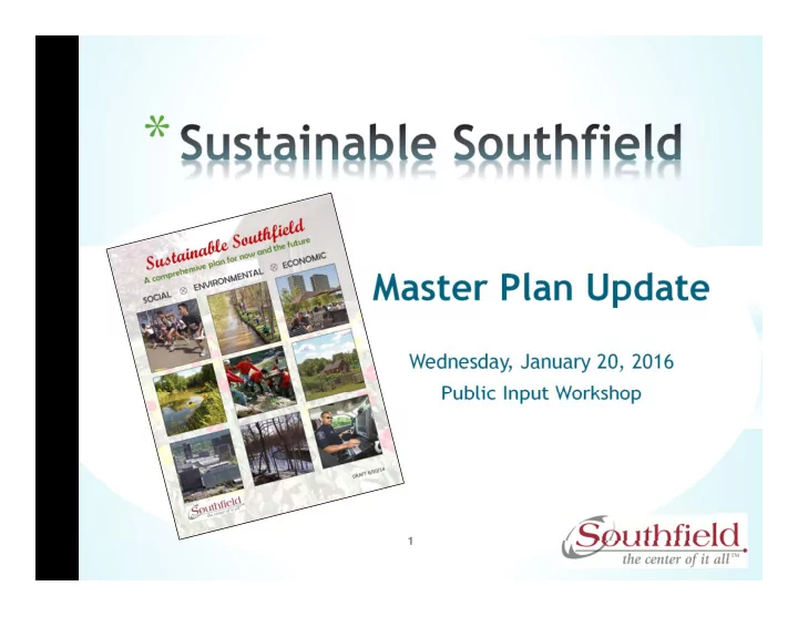
* Master Plan Update Wednesday, January 20, 2016 Public Input - - PowerPoint PPT Presentation

master plan update wednesday january 20 2016 public input
SMART_READER_LITE
LIVE PREVIEW

* Master Plan Update Wednesday, January 20, 2016 Public Input - - PowerPoint PPT Presentation

* Master Plan Update Wednesday, January 20, 2016 Public Input Workshop 1 * Master Plan last adopted April 2009 5 year update required by the S tate of Michigan Update approved by Council 2014 Phase I: Inventory &


slide-1
SLIDE 1

Master Plan Update

Wednesday, January 20, 2016 Public Input Workshop

*

1

slide-2
SLIDE 2
  • Master Plan last adopted April 2009
  • 5 year update required by the S

tate of Michigan

  • Update approved by Council 2014
  • Phase I: Inventory & analysis
  • Phase II: Public input
  • Phase III: Draft plan review/ public comment period
  • Phase IV: Adoption by Council

2

*

Time Table: Jan 20 Public Workshop Jan 21-Feb 4 Final revisions to the draft plan Feb 8 Presentation of the draft plan to Council at their COW Feb 29 Authorization of City Council to release the draft plan to the public for the mandatory 63-day review period Mar 4 Distribution to adj acent communities, Oakland County and required entities (post draft plan to website) May 25 Public Hearing and recommendation by the Planning Commission June 20 Adoption by City Council

slide-3
SLIDE 3

*

S ust ainable communit ies are places t hat balance t heir economic asset s, nat ural resources, and social priorit ies so t hat resident s’ diverse needs can be met now and in t he f ut ure.

S ust ainable S

  • ut hf ield will take a holistic

approach to land use and community planning, which will include environmental, social and economic sustainability.

3

slide-4
SLIDE 4

*

S ust ainable S

  • ut hf ield will strive to incorporate the

following six principles compiled from a review of leading comprehensive plans by the AP A S ustaining Places Task Force:

  • Livable Built Environment
  • Harmony with Nature
  • Resilient Economy
  • Interwoven Equity
  • Healthy Community
  • Responsible Regionalism

4

slide-5
SLIDE 5

*

“ ACTIVE LIVING ENVIRONMENTS ARE PLACES WHERE ALL PEOPLE ARE

ABLE AND INS PIRED TO US E THEIR FEET TO GET THEM PLACES. THEY ARE PLACES WHERE PEOPLE OF ALL AGES, INCOMES AND ABILITIES CAN WALK AND BIKE-BOTH FOR RECREATION AND FOR TRANS PORTATION.” –

MICHIGAN GOVERNOR’ S COUNCIL ON PHYS

ICAL FITNES S, HEALTH AND

S

PORTS

5

slide-6
SLIDE 6

*

6

slide-7
SLIDE 7

*

  • Healthy Community Design

Researchers f ound t hat people living in [communit ies] marked by sprawling development were less likely t o walk, weighed more, and were more likely t o have high blood pressure. (Relat ionship bet ween Urban S prawl and Physical Act ivit y, Obesit y, and Morbidit y Ewing et al., 2003)

  • Healthy Foods & Good Nutrition
  • Climate Change
  • Social Capital

The fabric of a community and the community pool of human resources available to it are often called “ social capital.”

7

slide-8
SLIDE 8

*

  • Transportation Systems
  • Land Use and Community Development
  • Local Health Professionals Partners
  • Identified Health Needs and Concerns

S JPHS prepared the 2012 Community Health Needs Assessment (CHNA) and Implementation plan, which is required to be performed every three years.

8

slide-9
SLIDE 9

*

  • Healthy Initiatives Partnerships
  • Public Health Checklist
  • Green Infrastructure
  • Using Green Infrastructure to Manage

Stormwater Runoff

  • Smart Growth
  • Urban Agriculture
  • Principles of a Healthy, Sustainable Food System
  • Active Living

9 Act ive living is a way of life t hat int egrat es physical act ivit y int o daily rout ines. The goal is t o accumulat e at least 30 minut es of [heart healt hy] act ivit y each day. Individuals may achieve t his by walking or biking f or t ransport at ion, exercise or pleasure; playing in t he park; working in t he yard; t aking t he st airs; and using recreat ion facilit ies. (A Primer on Act ive Living by Design, Robert Wood Johnson Foundat ion, 2004)

slide-10
SLIDE 10

*

  • Aging in Community Policy
  • Hazard Mitigation
  • Parks and Recreation
  • Nature Preserves and

Open Space

  • Historical and

Cultural Sites

  • Arts Commission

10

slide-11
SLIDE 11

*

11

  • The current population of Southfield is 75,768
  • Between 2010-2040, the age distribution (and

most likely median income due to increase in retirees) will shift dramatically as we see an aging baby boomer population

slide-12
SLIDE 12

*

12

  • Aging baby boomers are driving the need for more

condos and urban townhomes (less single family detached housing)

  • Homeownership and occupancy rates have

decreased slightly

  • Southfield has a much

higher share of rental units than the metro area

  • Southfield rents are also

much higher compared to the metro area

slide-13
SLIDE 13

*

13

Between 2010-2040:

  • The Private Education and Health Care job sector are

forecasted to have the biggest growth (48% )

  • There is expected to be a 15%

increase in total number of jobs in Southfield

  • Targeted businesses

include those from the Technology, Health Care & Wellness, and Automotive sectors

  • Southfield attracted three large companies from

within these sectors in 2015: Hello World, Durr, and Great Expressions (1,100 jobs)

slide-14
SLIDE 14

*

14

  • Social media engagement tool Mindmixer was

utilized to obtain public input with great success

  • Mindmixer site allowed: Southfield to solicit ideas

and receive input from the public on a variety of 20 topics between January-July 2015 on a weekly basis

  • Results have compiled, quantified, and are being

used for the Master Plan update

slide-15
SLIDE 15

*

15

Mindmixer offered a catalog of possible questions (or we could create our own) in four different formats:

  • Instant Poll – participants answer a question and are

able to receive immediate results

  • Survey – S

eries of open-ended questions answered by participants

  • Photo Share – participants submit a photo
  • Idea Submissions (open ended) – participants submit

their own open-ended ideas which can be commented on by others

slide-16
SLIDE 16

*

16

  • 486 total participants
  • Average participant: 37 year old female in 48075
  • 45.4%
  • f respondents were <35 years old
  • 5,534 unique visits
  • 20,250 page views
  • 650 unique ideas
  • 175 photos shared
  • Shared on other social

media sites:

Facebook (99); Email (81); LinkedIn (15) Twitter (13); & Google+ (5)

0.00% 5.00% 10.00% 15.00% 20.00% 25.00% 30.00% 35.00%

slide-17
SLIDE 17

*

17

The top three ideas that became consistent throughout the 20-week process were:

  • Walkability & connectivity throughout the City

(i.e. sidewalks, bike paths, increased pedestrian amenities, etc.)

  • Street and road repair
  • Redevelopment and/or renovation
  • f older commercial properties
slide-18
SLIDE 18

*

18

Several public workshops and meetings were held to

  • btain feedback for incorporation into the Master Plan:
  • S
  • uthfield Road Workshop: Wednesday, March 20, 2013 at 6:30 p.m.
  • Valley Woods Workshop: Wednesday, April 16, 2014 at 6:30 pm
  • Valley Woods Public Hearing: Wednesday, April 23, 2014 at 6:30 pm
  • Valley Woods Public Hearing #2: Monday, May 19, 2014 at 7:00 pm
  • S
  • uthfield Public S

chools Administrators Retreat - Wednesday, August 7, 2014

  • S
  • uthfield Public S

chools Administrators Retreat – S aturday, January 17, 2015

  • LTU S

tudent Council: February 3, 2015

  • S
  • uthfield Historic S
  • ciety: March 3, 2015
  • S
  • uthfield Homeowner's Coalition - Wednesday, March 11, 2015 at 6:30 pm
  • Cranbrook Village Homeowners Association - Wednesday, April 22, 2015 at 7:00 pm
  • Magnolia S

ubdivision Association - Wednesday, April 29, 2015 at 7:00 pm

  • S
  • uthfield Lathrup High S

chool - Tuesday, May 12 at 8:30 am

  • S
  • uthfield Clergy Roundtable- May 18, 2015
  • Greentrees North Homeowners Association - Monday, May 18, 2015 at 6:30 pm
  • S
  • uthfield High S

chool - Tuesday, May 19, 2015 at 8:30 am

  • S
  • uthfield Public S

chool District Imagine 2020 presentation- S

  • ept. 24, 2015
  • S
  • uthfield University High S

chool - Thursday, October 22, 2015 at 2:00 pm

slide-19
SLIDE 19

*

19

  • Southfield is predominantly developed with only

4% vacant land

  • Single family residential homes comprise the

largest portion of land use in the City (39% )

0.00% 39.00% 8.20% 0.00% 12.50% 2.50% 8.50% 4.80% 1.40% 0.00% 4.40% 0.60% 17.90% Agriculture S ingle Family Multi Family Mobile Home Office/ Commercial Industrial/ Light Ind Public/ Institutional Recreation/ Conservation Transp/ Util/ Comm Extractive Vacant Water Rights of Way

slide-20
SLIDE 20

*

20

  • Presents an idealized future indicated by the growth

patterns in the City

  • Provides practical guidance to assist in the orderly

development and redevelopment of the City

  • S

erves as the primary policy guide for future land use decisions, investment in public improvements and coordination of public improvements and private development

  • Focus on S

ub Area Plans

slide-21
SLIDE 21

*

21

slide-22
SLIDE 22

*

The City has several sub-area planning districts and corridors:

  • Eight Mile Road Corridor
  • Infill Housing Studies: Garner Street Residential
  • North Southfield Road Corridor
  • Northwestern Highway Corridor
  • Southfield City Centre District
  • Southfield Downtown Development Area
  • Southfield SmartZone
  • Southfield Technology Corridor
  • Valley Woods Senior Campus Community Revitalization Plan

22

slide-23
SLIDE 23

*

23

  • Water, Sanitary and Storm Sewer Systems
  • Low Impact Design
  • Green Infrastructure (GI)
  • Water Reliability Study (April 2014)
  • Storm Water Master Plan
  • Roads and Bridges
  • Sidewalks and Bike Paths (Non-Motorized

Pathways

  • Safe Routes to School (SR2S)
slide-24
SLIDE 24

*

The City of Southfield offers a range of facilities & services to serve its residents and businesses.

  • City Government
  • City departments, Boards & Commissions,

Public S afety (Fire, Police, Homeland S ecurity), Human S ervices, Michigan Works

  • Library
  • Educational Facilities
  • Public S

chools K-12, Colleges & Universities

  • Religious Institutions

24

slide-25
SLIDE 25

*

25

  • To be compiled throughout the public input &

comment phase of the plan

slide-26
SLIDE 26

*

26

  • Appendix A: Mindmixer Results
  • Appendix B: AARP Livability

Index

  • Appendix C: FEMA

Mitigation Ideas

slide-27
SLIDE 27
  • In April 2015, the American Association
  • f Retired Persons (AARP) launched

their Livability index, a new online tool designed to help communities better serve the nation’s aging population.

  • To create the index, the

AARP Public Policy Institute surveyed 4,500 Americans 50 and older to determine the aspects of community most important to them.

27

*

slide-28
SLIDE 28
  • AARP developed several categories around

those results:

  • Housing
  • Neighborhood
  • Transportation
  • Environment
  • Health
  • Engagement
  • Opportunity
  • Currently, the City of S
  • uthfield has a

Livability score of 49.

28

*

slide-29
SLIDE 29

*

29

  • Jan. 21-Feb. 4th

Final revisions to the draft plan

  • Feb. 8th

Presentation of the draft plan to Council at their COW

  • Feb. 29

Authorization by City Council to release the draft plan to the public for the mandatory 63 day review period.

  • Mar. 4th

Distribution to adj acent communities, Oakland County and required entities (post draft plan to website) May 25th Public Hearing and recommendation by the Planning Commission June 20th Adoption by City Council

slide-30
SLIDE 30

*

30