
SLIDE 1
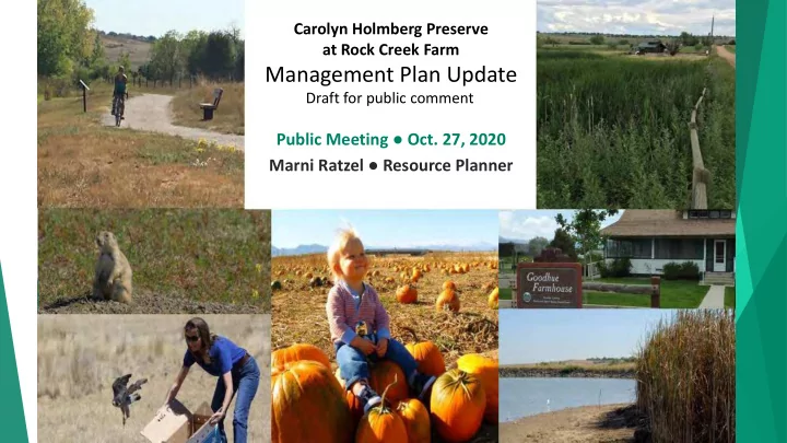
Carolyn Holmberg Preserve at Rock Creek Farm
Management Plan Update
Public Meeting ● Oct. 27, 2020 Marni Ratzel ● Resource Planner
Draft for public comment
Management Plan Update Draft for public comment Public Meeting Oct. - - PowerPoint PPT Presentation
Carolyn Holmberg Preserve at Rock Creek Farm Management Plan Update Draft for public comment Public Meeting Oct. 27, 2020 Marni Ratzel Resource Planner Chapter 1 - Introduction Management Process Plan Update Planning issues
Carolyn Holmberg Preserve at Rock Creek Farm
Management Plan Update
Public Meeting ● Oct. 27, 2020 Marni Ratzel ● Resource Planner
Draft for public comment
Chapter 1 - Introduction
Process Planning issues Previous planning efforts
Chapter 2 – Property update
Resources Uses
Chapter 3 – Management Direction
Recommendations for 13 planning issues Implementation plan
Chapter 4 – Public Engagement Chapter 5 – Glossary Appendices
Planning Area
1,124 acres Key features
Purchased to preserve the open space
buffer zone and agricultural lands
Birds of Prey Foundation rehabilitation
center
3.3 miles of public trail system Designated cultural landscape Critical wildlife habitat areas Riparian creek corridors, wetlands, and
significant natural communities
Oil and gas wells
conserve natural, cultural, and
agricultural resources and
provide public uses that reflect
sound resource management and community values
Carolyn Holmberg Preserve at Rock Creek Farm
Carolyn Holmberg Preserve at Rock Creek Farm is a working landscape of farming, ranching, irrigation features, and reservoirs, intertwined with critical wildlife, wetland, riparian, and grassland habitats, that preserves its distinct history and provides regional trail connectivity and recreational amenities for current and future generations.
Only 39% of the property has been
surveyed
Seven prehistoric sites 18 historic resources
Rock Creek Farm/Stearns Dairy Goodhue ditch segments Burlington Northern Railroad segments Sunnyside coal mine Several isolated finds
Nationally and locally important
agricultural lands
Suitable soils Adequate irrigation water
About 5.7 miles of riparian corridors
Rock Creek Buffalo Gulch
Wetlands
along Stearns Lake and the riparian
corridors
Alkali wetlands in NE area of property
Native grasslands
In Habitat Conservation Area (HCA) MOA lands in southern areas of
property
Deciduous woodland Deciduous dwarf-shrubland Evergreen shrubland 12 species of perennial graminoid
vegetation
Critical wildlife habitats
#36 is the 40-acre burrowing owl preserve #78 along Buffalo Gulch and Rock Creek
Wildlife habitat supports
Diverse array of raptors, including a pair of bald eagles
Burrowing owls
Black tailed prairie dogs
Northern leopard frogs
Migratory birds
Waterfowl
10 existing oil & gas well sites
3 producing wells 5 abandoned 2 plugged and abandoned
Mineral rights ownership
County owns some Leased out before county acquired
rights
County has no decision-making role in
management or extraction
No known plans for new or refined
production on CHP/RCF
Cropland sited in northern
part of the property
Rangeland grasslands
situated in the southern portions of the property.
East side
Agricultural operations Goodhue Farmhouse Birds of Prey Flight Cages
West side
Stearns Lake Trailhead Birds of Prey Intensive Care Unit Mary Miller and Cradleboard trail
Brainard Rd. access gate
Trail Use in 2019 Stearns Lake Trailhead 35,691 Mary Miller Trail 15,877 Loc Amora Link 15,425 Cradleboard Trail2 8,960 Total 75,953
Data Point Primary Second Third N= 2019 Hiking (43%) Biking (24%) Fishing (11%) 1,535 2018 Biking (38%) Running (29%) Hiking (15%) 721 2017 Biking (37%) Hiking (29%) Fishing (15%) 719
Top three activities
2015 Visitor Study1 (N=80)
Broomfield (28%) Lafayette (21%) Louisville (15%)
12015 Visitor Study includes system-wide demographics and satisfaction survey. 2The Cradleboard Trail was closed from mid-April to late July to protect sensitive wildlife in the area.
1.
Designation and use of 40-acre burrowing owl preserve and field 65
2.
Grassland health and restoration
3.
Prairie dog management
4.
Riparian habitat health
5.
Seasonal wildlife closures of regional trail
6.
Recreation and visitor access
7.
Cultural and paleontological resources
8.
Agricultural use of historic buildings and structures
9.
Irrigation/water resources improvements
10.
Buffalo Gulch
11.
Invasive Weed management
12.
Birds of Prey Foundation facilities
13.
Standard operating procedures
Recommendation
Field 7
Change designation and use to NPD cropland Relocate prairie dogs to suitable areas within BCPOS lands
Field 65
Discontinue crop production as part of the agricultural
Temporarily defer livestock grazing until the plant
community recovers
Prescriptive grazing plan after two to five year respite
2. Grassland health and restoration
Recommendations vary by field based
Existing vegetation type Adjacent uses Natural barriers to help with
containment/encroachment
Prairie dog management Livestock grazing management Thin density Rolling removals Removal Status quo Prescriptive Plan Eliminate Status quo
Prairie dog management Livestock grazing management Thin density Rolling removals Removal Status quo Prescriptive Plan Eliminate Status quo
Recommendations
Maintain the current NPD, MOA and HCA designations
Exception is Field 7 as described in #1
Install barriers to prairie dog dispersal along the field 44 Complete deferred maintenance along field 42
4. Riparian Health
Remove grazing from areas of past restoration
projects in fields 78 and 66 until willows are above browse height
Establish a prescriptive grazing plan that
prioritizes riparian habitat and native plant communities
regional trail
accessibility
east of 104th Street to Stearns Lake
west of 104th Street to Brainard Rd.
west of 104th Street to Brainard Rd.
and Accessibility Trailheads
At the end of South 104th Street
Develop a new trailhead with vehicle
and horse trailer parking
Redesign to easily identify the trail Provide trailhead kiosk and area for
rest and enjoyment of the scenic vistas. At Brainard Road near Cradleboard Trail
Develop a new trailhead with vehicle
parking spaces and a trailhead kiosk
Thursday, November 5, 6 p.m.
Input to POSAC on cultural & historic resources
Thursday, November 19, 6:30 p.m.
Recommendation to BOCC
Tuesday, Dec. 15, 1 p.m.
Consider Plan Adoption
Parks & Open Space Advisory Committee Board of County Commissioners Historic Preservation Advisory Board
Register, view the plan and provide comments at boco.org/CHPplan
Marni Ratzel, Resource Planner mratzel@bouldercounty.org 303-678-6271