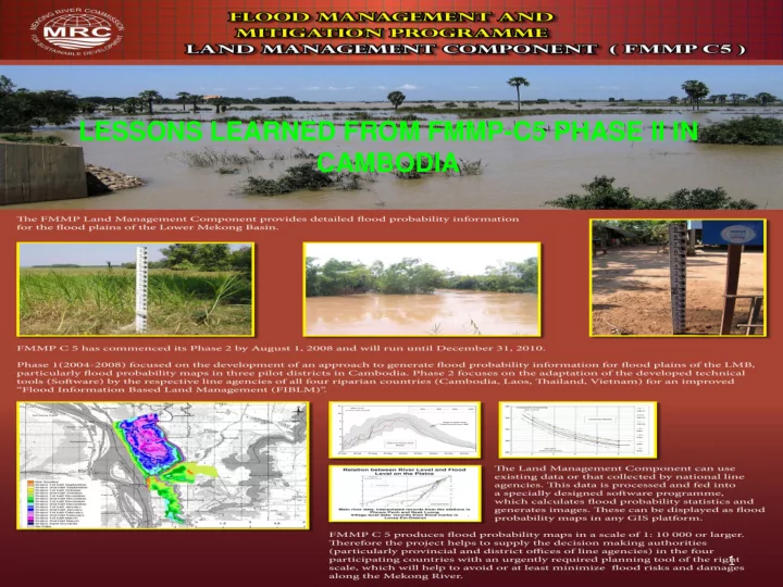
SLIDE 1 1
LESSONS LEARNED FROM FMMP-C5 PHASE II IN CAMBODIA
SLIDE 2 CONTENT
1.
Products of FMMP-C5
2.
NSTE’s Role
3.
Capacity Building
4.
Use of Products-FPMs
5.
The Advantages of those Products
6.
Future plans for the pilot districts
7.
Capability and challenge of DHRW in early warning and FPMs production
8.
Suggestion and Recommendations
9.
Cost Estimate for Future Early Warning System
SLIDE 3
FMMP-C5 has produced 5 different flood probability maps like:
- Probability of flooding map
- Start of flooding map
- Maximum depth of flooding map
- Duration of flooding map
- Completion of draining map
Based on the FMMP-C5 products, we have generated another map called flood extent map
SLIDE 4
Probability of Flooding Map Start of Flooding Map Maximum Depth of Flooding Map Duration of Flooding Map
SLIDE 5
Completion of draining Map flood extent Map
SLIDE 6
Follow up the flood plain water level collection and flood
forecasting
Build capacity of all relevant line agencies at National and
Local levels through learning by doing method. The topics to be trained are also different according to their responsibilities like:
- DHRW – train on how to produce, update, analyze and use of
FPMs.
- National line agencies: CNMC, CRC, MOE, MIME, MOWRM,
MAFF, MLMUPC, MRD, MPWT and NCDM – train on how to analyze and use of FPMs in all relevant fields
- Province, district, commune and village at pilot areas – train
- n how to read FPMs and use of FPMs in all relevant fields.
Develop training manuals Provide guidance to internship students’ studies Promote the use of FPMs in all relevant sectors Prepare database for FPMs production Assist the preparation of regional study tour and regional
workshop
SLIDE 7 3.Capacity Building
Capacity buildings were conducted for 3 different levels by NSTE. The topics to be trained are also different according to their responsibilities like:
- DHRW
- Province, district, commune and village at pilot areas
- National line agency: CNMC, CRC, MOE, MIME,
MOWRAM, MAFF, MLMUPC, MRD, MPWT and NCDM
SLIDE 8
3.1 Local Level
Two trainings were conducted for the pilot districts Peam Ro and Leuk Dek. Participants invited for the trainings are village chiefs, commune council, district staff, all relevant technical offices at those districts and representative from province. Topics of training for the pilot districts were designed to fit the local knowledge and available equipment at the local level: The first training focused on the introduction and the application of FPMs in a simple way The Second training focused on the FPMs application in early warning system, flood disaster management and agricultural zoning and planning.
SLIDE 9 3.2 National Levels
Capacity building at National Level was focused
agencies and divided into 2 categories according their role and responsibility, i.e. FPM generation - DHRW and FPM user - CNMC, CRC, MOE, MIME, MOWRAM, MAFF, MLMUPC, MRD, MPWT and NCDM . The topics for training are different from FPM producer and users.
how to produce, analyze and Update FPMs
to use and analyze FPMs
SLIDE 10
FPMs were promoted to use in:
- Flood confirm policy formulation for flood plain
management
- Provincial flood disaster preparedness and early
warning system
- Rural infrastructure planning and design
- Irrigation planning and design
- Agricultural planning and programming
SLIDE 11 4.1 Flood confirm policy formulation for flood plain management
We use probability of flooding, maximum depth
- f flooding and duration of
flooding maps for land management zoning. These maps provide us the capability in zoning according to criteria we
beside map shows 4 zones
policy for each zone was defined.
SLIDE 12 4.2
Provincial flood disaster prepar- edness and early warning system
We use probability of flooding, maximum depth of flooding and duration flooding for flood disaster preparedness and early warning system. These maps provide the capability in flood management like:
- Identify vulnerable villages,
safety areas and evacuation roads
- Alert Vulnerable villages
- Prepare equipments and
material needed for evacuation during big flood.
through what means should be used for evacuating people.
- Prepare early warning systems
- Food supply and etc.
SLIDE 13 4.2 Provincial flood disaster prepar- edness and early warning system (con)
We use probability of flooding and flood extent maps for the early warning system.
- Probability of flooding shows
vulnerable villages, safety areas and evacuation roads
- Flood extent map shows when
and where will be flooding according to the forecast of mainstream water level.
SLIDE 14 4.3 Rural infrastructure planning & design
Probability of flooding and maximum depth of flooding provide the capability in planning and design of rural infrastructure like:
centers or safety areas
SLIDE 15 4.4 Irrigation planning and design
Probability of flooding, maximum depth of flooding, duration of flooding and completion of draining provide the capability in preparing irrigation systems master plan which compose of:
- Main canal
- Secondary canal
- Tertiary canal
- Dam (submerge dam, flood
protection dam etc.)
SLIDE 16
4.5 Agricultural planning and programming
Probability of flooding, start of flooding, maximum depth of flooding, duration of flooding and completion of draining provide the capability in land use zoning, agricultural planning and preparing crop calendar.
SLIDE 17
- 5. The Advantages of Those Products
The flood probability data can be used to analyze and produce many useful products like:
- Analyze and define zones for other development sectors
- Prepare plans and arrange schedule for other
development activities
- Flood extent map
- DTM (it can be used for design rural infrastructures
such as road, irrigation etc.)
SLIDE 18
- 6. Future Plans for the Pilot Districts
DHRW will take responsible for the FPM in the 3 pilot districts in the future. A-Activities to be continued in the future are:
- Collect hydrological data in the
flood plain
- Maintain flood marks and billboards
- Conduct flood forecasting
- Update FPM which include
hydrology and DTM
SLIDE 19
- 6. Future Plans for the Pilot Districts
(Continue)
B-Proposed mechanism takes responsible in future activities in early warning system in 3 pilot districts:
- Trained observers (village chiefs) will responsible in
collecting and posting water level and flood forecast on the billboards in their villages. The data will be sent to DCDM through CCDM and DCDM send the data to DHRW by cell phone and they will keep a copy.
- DHRW collect water level data from DCDM assigned staff
- DHRW conduct long (6 months) and medium (3 months)
forecasting – low accuracy, and short term (5 days) forecasting (acceptable accuracy) of water level in flood plain back to DCDM
- DCDM has to disseminate the flood forecast to observers
(village chiefs) to post on the billboards.
SLIDE 20 Flow Chart of Water Level and Flood Forecast Transfer
DCDM DHRW CCDM
Observer-Village Chief Observer-Village Chief Observer-Village Chief Flood Forecast from DHRW to villages Water Level Transfer to DHRW
SLIDE 21
- 7. Capability and Challenge of DHRW in
Early Warning and FPMs Production
- 1. Capability
- DHRW has experienced cooperation observers in
reading water level and posting water level and flood forecast on billboard at pilot villages.
- DHRW has capable staff for flood forecast and FPM
update and generation
- Software for updating and generating FPM are available
at the DHRW
DHRW will face two challenges in the Future:
- a. Flood plain hydrological data collection and flood
forecasting mechanism is not concrete at the moment
- b. Finance
- Collecting hydrological data from the pilot flood plain
- Maintaining flood marks and billboards
- Updating topography (DTM)
SLIDE 22
- 8. Suggestion and Recommendations
- Improve the Flood plain hydrological data collection and
flood forecasting mechanism
- Continue to support DHRW in early warning system
which includes water level collection, maintenance of flood marks, billboards and communication networks
- Build capacity for the extended pilot areas
- Extend the pilot areas to other flood plain
SLIDE 23
- 9. Cost Estimate for Future Early Warning
System in 3 districts: PR, LD & LE
Description Total Cost (USD) Annual operating and maintenance cost for total 25 stations (3 pilot districts) 12,426 Rehabilitate the existing flood marks and billboards in 2 districts (3 in Peam Ro and 8 in Lvea Em) 9,230 Grand Total 21,656