Latitude and Longitude Latitude and Longitude The earth is divided - - PowerPoint PPT Presentation

latitude and longitude latitude and longitude
SMART_READER_LITE
LIVE PREVIEW

Latitude and Longitude Latitude and Longitude The earth is divided - - PowerPoint PPT Presentation

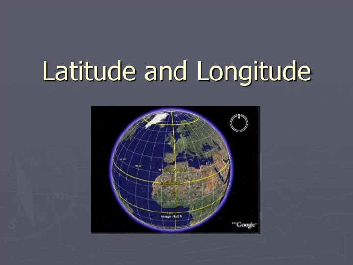
Latitude and Longitude Latitude and Longitude The earth is divided into lots of lines called latitude and longitude . Together they form a grid pattern on a map or globe Lines of longitude only Other lines of lat Latitude added (Equator )


slide-1
SLIDE 1

Latitude and Longitude

slide-2
SLIDE 2

Latitude and Longitude

►The earth is divided into lots of lines

called latitude and longitude.

slide-3
SLIDE 3

Together they form a grid pattern

  • n a map or globe
slide-4
SLIDE 4

Lines of longitude only Latitude added (Equator ) Other lines of lat & long added

slide-5
SLIDE 5
slide-6
SLIDE 6

Lines of Latitude

http://plantwatch.sunsite.ualberta.ca/library/images/lat.jpg

These parallel lines on the globe are lines

  • f latitude.
slide-7
SLIDE 7

Latitude

North Pole South Pole Lines of latitude are numbered from 0° at the equator to 90° N.L. at the North Pole. Lines of latitude are numbered from 0° at the equator to 90° S.L. at the South Pole.

] [

90 80 70 60 50 40 20 30 10 90 80 70 60 50 40 20 10 30

slide-8
SLIDE 8

Latitude

The North Pole is at 90° N The South Pole is at 90° S

The equator is at 0°

  • latitude. It

is neither north nor

  • south. It is

at the center between north and south. 40° N is the 40° line of latitude north

  • f the equator.

40° S is the 40° line of latitude south of the equator.

slide-9
SLIDE 9

Lines of Latitude

►Lines of latitude run east and west. ►Latitude measures distance from the

Equator towards the North or South pole

►Lines of latitude never meet (circles

around the globe)

►The lines measure distances in degrees

from the center of the earth.

slide-10
SLIDE 10

The Equator

Latitude is measured above and below the Equator in degrees.

http://nationalatlas.gov/articles/mapping/a_latlong.html#thre e

slide-11
SLIDE 11

Where is 0 degree latitude ?

►The equator is 0 degree latitude. ►It is an imaginary belt that runs

halfway point between the North Pole and the South Pole.

Equator

slide-12
SLIDE 12

90 degrees.. ?

►There are 90 degrees of latitude in the

Northern Hemisphere &

► 90 degrees of latitude in the south pole. ►In total there are 180 degrees of latitude. ►WHY IS THE NORTH AND SOUTH POLE AT

90 degrees anyway?? Why that number?

slide-13
SLIDE 13
slide-14
SLIDE 14

Longitude

Lines of longitude begin at the Prime Meridian. 60° W is the 60° line of longitude west

  • f the Prime

Meridian.

The Prime Meridian is located at 0°. It is neither east or west

60° E is the 60° line of longitude east of the Prime Meridian. W E

slide-15
SLIDE 15

Prime Meridian

The Prime Meridian (0°) and the 180° line split the earth into the Western Hemisphere and Eastern Hemisphere.

Prime Meridian Western Hemispher e Eastern Hemisphere Places located east of the Prime Meridian have an east longitude (E) address. Places located west of the Prime Meridian have a west longitude (W) address.

slide-16
SLIDE 16

INTERNATIONAL DATE LINE 180°

► SEPARAT

RATES ES 2 CALENDAR ENDAR DAYS. S. Ameri rica ca to Asia ia – gain n a day Asia ia to Ameri rica ca – lose se a day

slide-17
SLIDE 17

A location’s coordinates (____° N or S, ____ ° E or W)

slide-18
SLIDE 18

By combining latitude and longitude, any location can be pinpointed

slide-19
SLIDE 19
slide-20
SLIDE 20

Lines of Longitude…

►Lines of longitude run north and south. ►Longitude meet at the North and South

poles.

►Longitude measures distance East and West

  • f the Prime Meridian

►The lines measure distances in degrees

from the center of the earth.

slide-21
SLIDE 21

Lines of Longitude

http://plantwatch.sunsite.ualberta.ca/library/images/long.jpg

slide-22
SLIDE 22

Where is 0 degree longitude ?

►The prime meridian is 0 degrees

longitude.

►It is located in Greenwhich England. ►From this point, Longitude runs 180 degrees

East or West

►There are 360 meridians of Longitude in

total

slide-23
SLIDE 23

Longitude Angles

  • Longitude is measured in

degrees east or west of the Prime Meridian

  • Angles are measured from

the centre of the earth (vertex of angle) east or west of the Prime Meridian

http://www.csmate.colostate.edu/cltw/cohortpages/viney/latitude.html

slide-24
SLIDE 24

Orange cut through lines of longitude Orange cut through lines of latitude

slide-25
SLIDE 25

Latitude and Longitude combined

Latitude and longitude measurements are based on angle measurements as shown in this diagram and previous two diagrams

http://cache.eb.com/eb/image?id=64904&rendTypeId=4

slide-26
SLIDE 26

What is the Lat and Long

  • f this point?

http://www.digitalgeography.co.uk/wp-content/uploads/2007/07/grid.jpg

slide-27
SLIDE 27
slide-28
SLIDE 28

Hemispheres

►By using the equator and prime

meridian, we can divide the world into four hemispheres, north, south, east, west

►Hemi= half ►Sphere = circle

slide-29
SLIDE 29

Latitude lines run east/west but they measure north or south of the equator (0°) splitting the earth into the Northern Hemisphere and Southern Hemisphere.

slide-30
SLIDE 30
slide-31
SLIDE 31

Time Zones

►The Earth is divided into 24 time

zones, corresponding to 24 hours in a day.

►As the earth rotates, the sun shines in

different areas, moving from east to west during the course of a day.

►Places that have the same longitude

will be in the same time zone.

slide-32
SLIDE 32
slide-33
SLIDE 33

LONGITUDE AND TIME

►The world rotates (spins) 360° in 24 hours.

360° / 24 hours = 15° per hour

►The world has 24 time zones, each l5°

apart.

THERE IS A 1 HOUR TIME DIFFERENCE FOR EVERY 15° OF LONGITUDE

slide-34
SLIDE 34
slide-35
SLIDE 35

Time Zones: Daylight Savings

slide-36
SLIDE 36

Earth rotates west to east Solar time is based on the position

  • f the sun

NIGHT IS FALLING ON EARTH

Look at the East Coast of the United

  • States. The lights are already lit.

California the sun is still visible.

slide-37
SLIDE 37

This pictures shows AMERICAN CITIES at night.

slide-38
SLIDE 38

Saguenay

Ottawa Sept-Iles Mexico City Québec Montréal St.John Those light are Boston, New York, Philadelphia and Washington. Toronto Detroit Miami Havana Puerto Rico Houston Dallas

It’s still daylight in California

Thunder Bay Port-au-Prince

slide-39
SLIDE 39

NIGHT IS FALLING ON EARTH. Look at Paris and Barcelona, the lights are already lit, meanwhile in London, Lisbon and Madrid the sun is still visible. Looking south, we can see the islands in the middle of the ocean. We have a perfect view of the British Islands, Iceland and Canada.

slide-40
SLIDE 40

France Spain

AFRICA

Italy England Iceland

Atlantic Ocean