
SLIDE 1
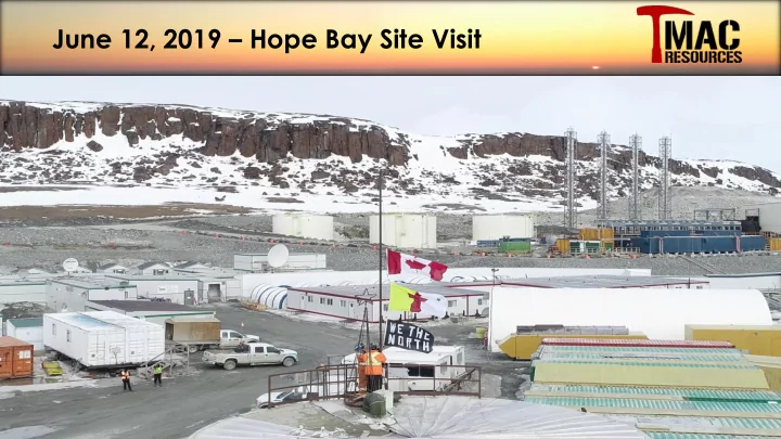
June 12, 2019 Hope Bay Site Visit Doris Mine and Plant Caution - - PowerPoint PPT Presentation
June 12, 2019 Hope Bay Site Visit Doris Mine and Plant Caution Regarding Forward-Looking Information Readers are cautioned that we will be making forward-looking comments. To fully understand the risks inherent in our comments, forecasts
2
3
4
5
Dan Gagnon General Manager Jerome Girard
Manager
Vacant Surface Operations Manager Mike Monk Projects Manager Chad Parent Process Plant Manager Doug Brown Health and Safety Manager Jason Nickel Mining Manager
6
10 20 30 40 50 60 70 80 90 10 20 30 40 50 60 70 Yellowknife Hemlo Red Lake Kirkland- Larder Lake Noranda Cadillac-Val- D'Or Timmins- Matheson Hope Bay Strike Length (km) Cumulative Resource (Moz)1 Cumulative Resources (M oz Au) Strike Length (km)
1 “Cumulative Resource” refers to the estimated sum of historical production and current resource
Madrid North Naartok, Suluk, Spur, Rand Madrid South Wolverine, Patch
7
8
Red Lake Kirkland Lake Hope Bay Hemlo
9
10
(1) Computation of AISC is in accordance with the World Gold Council guidelines
(1)
11
12
13
14
15
(1) Stated grade relates to feed grade.
(1)
16
17
Grind/Flotation Feed Surge bins (2) Removed Cleaner Jigs Moved Spinners to Crushing Circuit Falcon SB1350 (2) Knelson XD20 (2) Replaced Regrind Cyclones (2) Falcon C2000 (2)
Gold Solution Scavenger Column (2)
18
Q1-19 = 1,600tpd @ 10.2 g/t
(1) Mine production includes incremental ore.
(1)
19
Doris North Doris Connector Doris Central Extension East Limb BTD Connector BTD Central Doris North BTD N
Subject to ongoing exploration success
(1) Includes development ore. (1)
20
Permitted Waste Rock Pad Naartok West Deposit Suluk Deposit 7 km Ore Haulage to Doris Mill
Naartok East Deposit
New Permitted Waste Haulage Road Naartok East Crown Pillar Trench 500 m Scale New Madrid Portal Location N
21
22
MADRID
DORIS BOSTON
Yellowknife Red Lake Hemlo Timmins Kirkland Lake Noranda Val-d’Or
Hope Bay
Greenstone Belts Nunavut
1,000 km
Meadowbank Meliadine
23
24
25
Red Lake Kirkland Lake Hope Bay Hemlo
expected level as compared to similar Archean belts
vertical continuity and extent
shallow depths
Doris $6 mm Madrid $3 mm Boston $6 mm Regional $5 mm ❑ Expansion of high grade BTD Extension, with Q3 2019 access to another 100 m strike length ❑ Infill and expand Connector ❑ Advance Naartok East, Naartok West and Suluk towards development ❑ Current Suluk winter program with objective to grow resource and support metallurgical testing ❑ Lateral extension at Doris ❑ Madrid regional to south along route of permitted road to Boston ❑ Proximal to Boston deposit ❑ Summer 2019 program: test high-grade plunge near surface and explore south from Boston along 6 km alteration trend ❑ Winter 2019/20 program: test high-grade plunge ~1,000 m Total 2019 Exploration Budget: ~$20 mm
26
❑ High priority on defining and expanding the Doris North BTD Extension zone to sustain high grade source to supplement Doris Connector and Doris Central production. ❑ High exploration potential at depth below the diabase dyke. Investment in efficient exploration development and diamond drilling to grow Doris Reserves and Resources. ▪ BTD Connector 2020 onward ▪ BTD Central 2020/2021 onward
❑ Suluk Deposit – high potential to grow underground reserves below the 300m level. The advanced exploration decline and associated development will provide underground platforms that will allow efficient, year-round diamond drilling below the current Reserves. ❑ Naartok Deposit – has the potential to be developed as both and Open Pit and Underground mine. Continue diamond drilling to grow and define resources to support development scenarios. ❑ High grade Reserve and Resource base currently established at Patch 14 and Wolverine associated with intrusive margins, which is open to depth. ❑ Explore for similar high grade zones along the intrusive margin to grow Resource base. ❑ High exploration potential between Suluk and Patch 14 zones. Strategic Patch 14 access ramp development and additional exploration development will provide efficient, year-round diamond drilling platforms. ❑ Tremendous exploration potential below the current M&I Resources, with historical high grade intersections to ~1000m level. ❑ Priority to establish sustained exploration at Boston to grow Resources and Reserves that can inform belt wide infrastructure decisions. ❑ High exploration potential, with historical near surface high grade drilling intersections, along ~6 km alteration trend extending south from the Boston Deposit. ❑ >90 exploration targets defined on the Hope Bay belt by TMAC and past owners. ❑ Prioritize, advance and test targets, with an emphasize on those proximal to existing and planned infrastructure.
27
❑ Continue definition and expansion of high grade BTD Extension zone ❑ Exploration development south towards BTD Connector to establish drilling platforms to define and expand M&I Resources below the dyke ❑ Exploration development from Doris Central to establish drilling platforms below the dyke and south of Alpha fault
Exploration Priorities Mine Production Timeline1
Subject to ongoing exploration success
1 Includes development ore.
2019 2020 2021 Q1 Q2 Q3 Q4 Q1 Q2 Q3 Q4 Q1 Q2 Q3 Q4 Doris North Hinge Doris Connector Doris North BTD Doris Central Doris BTD Connector Exploration 2019+ Coris BTD Central Exploration 2020+
Doris North Doris Connector Doris Central Extension East Limb BTD Connector BTD Central Doris North BTD ? ? Open Open Open
28
TM50156 11.3 g/t Au/16.2 m Including 26.2 g/t Au/5.6 m TM50168 126.5 g/t Au/0.7 m And 38.2 g/t Au/9.7 m
❑ BTD Extension remains open to the north ❑ BTD ramp development will provide drill platforms for drilling on additional ~100 m strike to the north of Q1 2019 drilling ❑ Initial access into high grade area of the BTD Extension in late Q1/Q2 2019
TM50175 24.2 g/t Au/10.9 m And 57.8 g/t Au/1.5 m
0 m
TMDBE-19-50018 207.0 g/t Au/0.9 m TMDBE-19-50031 682.9 g/t Au/1.4 m
Diabase Q1 2019 Drill Bay
Mineralized Zone 2019 Planned Development 2018 Drillhole 2019 Drillhole
BTD East Limb BTD Extension
TMDBE-19-50005 407.0 g/t Au/1.1 m TMDBE-19-50018 154.5 g/t Au/0.6 m
2019 Drill Hole Pre-2019 Drill Hole
29
30
25 metres
TM50025 26.7 g/t Au/13.2 m TM50022 532.0 g/t Au/0.6 m TM50169 7.0 g/t Au/1.2 m TM00303 154.0 g/t Au/1.8 m TM50173 18.8 g/t Au/2.0 m And 29.3 g/t Au/1.0 m TM50134 13.2 g/t Au/2.0 m TM50177 NSV TM50175 24.2 g/t Au/10.9 m And 57.8 g/t Au/1.5 m TM50172 3.1 g/t Au/5.0 m And 16.4 g/t Au/6.5 m TM50171 55.1 g/t Au/1.9 m And 4.6 g/t Au/6.0 m TM50170 19.9 g/t Au/3.4 m And 3.3 g/t Au/1.0 m
Legend
Quartz Vein Fe-Ti Basalts Mg Basalts Potassic Alteration Breccia
❑ Looking north, view corridor 15 m ❑ Using XRF at site to define productive contact in real time ❑ Overall hinge structure appears to widen as we move north ❑ Quartz vein is thinner, however grade remains high, especially the west limb (commonly >100 g/t)
30
12
1.1 g/t Au/0.5m 0-2 2-4 4-10 10-20 20-30 30-60 60-90 90-120 >120 Au g/t
(un-capped)
12 2019 Development High Grade Plunge Inferred (approximate) Indicated (approximate) Q1 2019 Drill Bay TMDBE-19-50031 682.9 g/t Au/1.4 m
50 m
TM50148 261.0 g/t Au/7.1 m And 6.6 g/t Au /10.5m TM50239 379.4 g/t Au/1.7 m TMDBE-19-50005 407.0 g/t Au/1.1 m TMDBE-19-50018 207.0 g/t Au/0.9 m
N
2019 Drill Hole 2018 Drill Hole Q1 2019 Development on 4690 Level Development Face April 30, 2019 Q1 2019 Drilling focused on Upgrading Inferred Resource Q2/Q3 Drilling will focus on Expanding Resources
31
1.1 g/t Au/0.5m
3 12
506 g/t Au/0.8m 13.5 g/t Au/0.6m 2.9 g/t Au/0.5m 1.9 g/t Au/0.5m 0.9 g/t Au/0.4m 1.0 g/t Au/0.7m 1.1 g/t Au/0.5m 3.5 g/t Au/0.7m 166.0 g/t Au/1.0m 22.0 g/t Au/1.0m 75.9 g/t Au/1.0m 10.5 g/t Au/1.0m
59.0 g/t Au/6.0m 1.9 oz/t 5.0 g/t Au/2.8m 7.7 g/t Au/1.6m 11.5 g/t Au/1.7m 17.6 g/t Au/3.2m 19.3 g/t Au/1.5m 88.0 g/t Au/3.0m 2.8 oz/t 322.0 g/t Au/0.9m 10.4 oz/t 505.0 g/t Au/0.8m 16.2 oz/t 119.8 g/t Au/2.1m 3.9 oz/t 71.3 g/t Au/1.2m 2.3 oz/t 506.0 g/t Au/0.8m 16.3 oz/t 103.0 g/t Au/0.6m 3.3 oz/t 1220.0 g/t Au/0.7m 39.2 oz/t 10.5 g/t Au/0.8m 3.6 g/t Au/0.8m 6.0 g/t Au/1.6m
506 g/t Au/0.8 m 13.5 g/t Au/0.6m 2.9 g/t Au/0.5 m 1.9 g/t Au/0.5m 0.9 g/t Au/0.4m 1.0 g/t Au/0.7m 1.1 g/t Au/0.5m
10.8 g/t Au/2.0m 5m N 4690 Back Mapping ❑ 50% of vein face samples >30 g/t Au ❑ 33% of vein face samples >100 g/t Au current model capping level 4690-West Limb Access Development Chip Sample Results 23.0 g/t Au/4m (100 g/t Au Cap) 104.2 g/t Au/4m (un-capped) 4690-West Limb Rnd 13 Development Chip Sample Results Vein Grade 66.0 g/t Au/3m (100 g/t Au Cap) 88.0 g/t Au/3m (un-capped)
32
Structural Repetition?
Production Scale Mine Scale
Quartz Vein Doris BTD Theoretical Structural Pattern
33
34
0m Surface Quartz Vein: 113.14 g/t Au, 62.50 g/t Au
Gabbro Variolitic Volc. Felsic Intrusives Mg Basalts
Geology Legend
Mafic Volc. Madrid Deposit Variolitic Basalt Madrid Deformation Zone
Mineralized Breccia
Madrid North – Naartok 3D View
❑ Looking NW, plunge 60°
35
Portal OP Potential
TM00434 4.9 g/t Au/29.5 m Including 10.9 g/t Au/10.5 m
Structural Trend TM00443 4.9 g/t Au/27.6 m Including 12.9 g/t Au/5.5 m
0 m
TM00441 11.0 g/t Au/12.5 m TM00422 10.4 g/t Au/9.6 m TMMNE-19-00011 11.5 g/t Au/9.0 m and 10.1 g/t Au/27.0 m TMMNE-19-00013 10.6 g/t Au/27.0 m TMMNE-19-00008 12.8 g/t Au/11.5 m
2019 Drill Hole Pre-2019 Drill Hole Location Highlight Mineralized Zone
36
TM00381 7.4 g/t Au/65.7 m Including 14.4 g/t Au/26.1 m TM00392 17.1 g/t Au/1.5 m And 12.6 g/t Au/15.5 m
0 m
TM00396 6.6 g/t Au/42.2 m Including 32.9 g/t Au/5.0 m PMD094 35.8 g/t Au/19.9 m And 9.5 g/t Au/16.9 m 05PMD296 18.7 g/t Au/19.9 m
2018 Drill Hole Pre-2019 Drill Hole Location Highlight Mineralized Zone
37
Naartok East Naartok West Rand Suluk Inferred Inferred N 0 m
250 m Crown Pillar Beneath Patch Lake Indicated 03PMD227 16.4 g/t Au/26.5 m 2019 winter drill program to increase and upgrade mineral resources to support decision to proceed with advanced exploration and underground bulk sample, and ultimately future development decision
2019 Drill Hole Pre-2019 Drill Hole Location Highlight Mineralized Zone TMMSU-19-00002 11.3 g/t Au/7.4 m And 9.6 g/t Au/10.0 m TMMSU-19-00003 13.9 g/t Au/3.2 m And 20.3 g/t Au/13.8 m And 4.7 g/t Au/4.3 m TMMSU-19-00007 97.9 g/t Au/4.9 m And 26.2 g/t Au/6.1 m And 22.0 g/t Au/4.4 m And 7.9 g/t Au/4.2 m TMMSU-19-00008 11.4 g/t Au/18.9 m And 6.5 g/t Au/38.0 m PMD170 16.7 g/t Au/51.0 m Advanced Exploration/Bulk Sample Target Area
38
2019 Patch Lake Program 17.3 g/t Au/3.0 m 14.4 g/t Au/3.0 m 30.9 g/t Au/3.1 m Patch 14 & Wolverine Naartok Suluk Patch 7 Suluk South 2019 Winter Drill Program ~10 km N S 21.8 g/t Au/5.5 m 1 km Block Model 20 g/t 10 g/t 5 g/t 3 g/t Steep high grade plunges to South Untested below ~500m elevation Historical intersections in P7 area south of Suluk No current resource defined. Approximately 2 km highly prospective stratigraphy untested below ~200m elevation
39
40
Road to Airstrip Ore Stockpile Primary Fuel Tank Farm Sewage Treatment Plant (New) Geology Office Burn Pit Core Storage Area Workshop Crusher Enclosure Helipad Jet Fuel Storage Containment Pond Portal Landfarm Camp Offices AIMAOKATALOK LAKE Sewage Settling Tanks/Lift Station Generator Core Logging Building Incinerator
❑ Existing ~60 person camp, last operated in 2017, currently opening for 2019 exploration program. ❑ Tremendous exploration potential below the current M&I Resources, with historical high grade intersections to ~1000m level. ❑ Priority to establish sustained exploration at Boston to grow Resources and Reserves that can inform belt wide infrastructure decisions. ❑ High exploration potential, with historical near surface high grade drilling intersections, along ~6 km alteration trend extending south from the Boston Deposit.
Boston Exploration
11SBD411A 12.46m @ 10.16 g/t Au 12.38m @ 10.62 g/t Au 2.7m @ 16.1 g/t Au (-820m level) 94NOD118 9.1m @ 16 g/t 93NOD047 2.5m @ 238 g/t Au S00243 5.7m @ 35.1 g/t Au B3/Newton Intersection N S B2 Zone 250 m
11SBD414 7.1m @ 28.5 g/t Au 4.8m @ 17.3 g/t Au 7.8m @46.6 g/t Au (-600m level) S04-322 3.7m @ 36.3 g/t Au 1 Km Boston Deposit Alteration Trend 25.6 g/t Au/1.2m 37.5 g/t Au/1.0m SO-293 8.7m @56.6 g/t Au (-1020m level) Surface Sample >10 g/t Au >30 g/t Au
Significant Growth Potential of Established Deposit High Priority Regional Targets
Boston Mineral Resources Indicated 3.5 Mt @ 8.9 g/t Au, 1.02 Moz Au (~3,100 oz/ vertical metre) Inferred 1.9 Mt @ 7.2 g/t Au, 0.45 Moz Au
41
42
N S
1 km Miksa Domani South Boston Domani N 28.0 g/t Au over 1.1m 37.5 g/t Au over 1.0m
16.8 g/t Au over 1.5m 25.2 g/t Au over 8.1m 46.2 g/t Au over 9.1 m 36.3 g/t Au over 10.3 m 10.2 g/t Au over 12.5m 10.6 g/t Au over 12.4 m 16.1 g/t Au over 2.7 m 56.6 g/t Au over 8.7 m Steep high grade plunges to South >5 km strike untested deeper than 200 m Surface up to 181 g/t Au Surface up to 128 g/t Au
43
44
Doris Madrid Au > 10 g/t High-Resolution Gravity Image 1st order Structure 2nd order Structure Gold Deposit Pogey Kamik North Doris Qaiqtuq
Au > 30 g/t Surface Samples TM00023 14.1 g/t Au/0.5 m And 3.3 g/t Au/6.4 m Airborne geophysics Geological mapping Magnetic Outcrop sampling Electro-magnetic Gold in glacial till sampling High-resolution gravity gradiometry Diamond drilling Ground geophysics RC drilling Magnetic Induced polarization Seismic
Exploration Datasets
❑ More than 25 years of modern exploration ❑ Four owners ❑ More than 1 million metres of historic drilling with at least 95% occurring on established deposits ❑ Enormous amount of high-quality data available ❑ More than 90 exploration targets identified
45
Geological and structural mapping SkyTEM EM CGG Falcon Gravity Airborne Mag Satellite Imagery Till Results
❑ Integration of all available datasets into a single 3D modeling program (GOCAD) ❑ Working with Ken Williamson (3Dgeo- solutions). ❑ Structural interpretation and modeling. ❑ Basis for constrained geophysical inversions of the various geophysical datasets. ❑ Could form the basis for “prospectivity” mapping, or machine learning.
Target Generation and Prioritization
46
Qaiqtuq Doris Naartok Boston Pogey/Kamik
10 km HB Au deposit 2019 Exploration target Domani Too Spyder West Arm N ❑ Doris-Naartok Corridor – drill test deep valleys with till anomalies ❑ Qaiqtuq – untested intrusive contact (2.13 g/t over 3m at RC EOH), Au in glacial till dispersal trend ❑ Pogey/Kamik – follow-up TM00023 (0.5m @ 14.05 g/t and 6.35m @ 3.3 g/t Au) ❑ Spyder Lake West Arm – significant Au in glacial till anomalies on mafic volcanic-metasediment contact ❑ Domani - >10 g/t surface samples, identify Boston “look alike” ❑ Too – detailed map and till sample along trend with >10 g/t surface samples over 150m ❑ Elu - Ground truth EM anomalies. Follow-up 2018 till results from Kent Claims. Prospecting and reconnaissance till sampling ❑ ~800 sample regional Au in glacial till sampling in mid-belt, South and West of Boston as well as reconnaissance work on Elu belt, building on previous years programs
Drill Ready Targets Advancing Targets
47
48
(4) Refer to non-IFRS measures section of the Management Discussion and Analysis for further information on these measures. (5) Computation of AISC is in accordance with the World Gold Council guidelines, as updated in November 2018.
49
50
(1) Assumes extension of each facility.
Quarterly Amortization(1) Previous Amended Q2-19 - Q1-20 $6.5M/Q $0/Q Q2-20 - Q3-20 $6.5M/Q $2.5M/Q Q4-20 - Q2-21 $5.5M/Q $2.5M/Q Q3-21 - Q3-22 $5.5M/Q n/a Initial Maturity July 31, 2020 Dec 31, 2020 Extended Maturity July 31, 2022 June 30, 2021
51
52
Common shares 112,944,709 Options 4,506,777 Restricted share rights 1,391,793 Warrants 2,333,834 Fully diluted shares 121,177,113
Resource Capital Funds 34.7 million 30.7% Newmont 32.2 million 28.5% BlackRock(1) 15.2 million 13.4% Directors and Officers 6.6 million 5.8% KIA (Inuit Landowner) 1.0 million 0.9%
(1) Based on data from Bloomberg and FactSet
As of May 31, 2019
Feb-17: First Gold Poured Jul-17: Announce Plant issues 2015-2016: Exploration and development Nov-17: CEO Retires Aug-17: Gil Lawson joins as COO Feb-18: Jason Neal joins as CEO April 2018 Hiring: Sr Director, Metallurgy Director, Strategic Mine Planning Assistant General Manager (Metallurgist) Jul-15: IPO Oct-17: Hired new General Manager
53
* Quarterly payments made first day of months of January, April, July, and October
54
Category/Deposit Tonnes (t 000) Grade (g/t Au) Contained Au (oz 000) Proven Stockpiles 121 5.4 21 Doris 197 13.9 88 Madrid North
1,072 8.2 282 Total Proven 1,390 8.7 391 Probable Doris 1,840 6.6 391 Madrid North 10,819 6.2 2,168 Madrid South 690 10.9 242 Boston 1,756 7.0 369 Total Probable 15,105 6.6 3,197 Total P & P Stockpiles 121 5.4 21 Doris 2,037 7.3 479 Madrid North 10,819 6.2 2,168 Madrid South 690 10.9 242 Boston 2,828 7.5 678 Total P & P 16,495 6.8 3,588
55
Category/Deposit Tonnes (t 000) Grade (g/t Au) Contained Au (oz 000) Measured Doris 141 28.9 131 Madrid North Madrid South Boston 1,109 10.3 368 Total Measured 1,250 12.4 499 Indicated Doris 1,754 9.6 540 Madrid North 11,983 7.4 2,835 Madrid South 605 14.8 287 Boston 2,436 8.3 648 Total Indicated 16,777 8.0 4,310 Measured and Indicated Doris 1,894 11.0 671 Madrid North 11,983 7.4 2,835 Madrid South 605 14.8 287 Boston 3,545 8.9 1,017 Total Measured and Indicated 18,027 8.3 4,809 Inferred Doris 1,566 7.4 371 Madrid North 3,359 6.2 671 Madrid South 490 8.3 131 Boston 1,934 7.2 448 Total Inferred 7,349 6.9 1,621 56
Notes 1. CIM definitions were followed for the statement of Mineral Resources and Mineral Reserves. 2. Mineral Resources are estimated at a cut-off grade of 4.0 g/t Au except for Boston which was estimated at a cut-off of 4.5 g/t Au. 3. Mineral Resources are estimated using a long-term gold price of US$1,400 per ounce, and a US$/C$ exchange rate of 0.80. 4. A minimum mining width of approximately 1.5 metres was used for Mineral Resources. 5. A 50-metre crown pillar allowance was applied to resources located below lakes. 6. Doris North has been depleted based on surveyed mining cavities up to the end of December 2018. 7. Mineral Resources are inclusive of those resources converted to Mineral Reserves. 8. Mineral Resources that are not Mineral Reserves do not have demonstrated economic viability. 9. Mineral Reserves for individual deposits were estimated using a cut-off grades between 4.0 g/t and 4.6 g/t to account for assumed variable process recoveries, operating costs and ore haulage costs.
US$/C$ exchange rate of 0.80.
applied for Mineral Reserves.
factor and 15% external dilution factor was applied to drift and fill mining.
Scientific and Technical Information in this presentation has been reviewed and approved by Dave King, P. Geo, VP Exploration and Geoscience, an employee of TMAC Resources.
57
58