
SLIDE 1
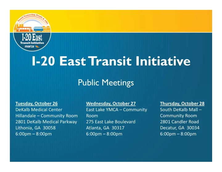
I-20 East Transit Initiative
Public Meetings Public Meetings
Tuesday, October 26 DeKalb Medical Center Hillandale – Community Room 2801 DeKalb Medical Parkway Lithonia, GA 30058 6:00pm – 8:00pm Thursday, October 28 South DeKalb Mall – Community Room 2801 Candler Road Decatur, GA 30034 6:00pm – 8:00pm Wednesday, October 27 East Lake YMCA – Community Room 275 East Lake Boulevard Atlanta, GA 30317 6:00pm – 8:00pm