
SLIDE 1
Compass4D
Site Montesquieu - 2 allée Isaac Newton, 33650 Martillac +33 (0)5 57 96 11 66 www.geolocsystems.com
HOW? Interactions Communication Communication driver-system V2V - - PDF document
Compass4D Site Montesquieu - 2 alle Isaac Newton, 33650 Martillac +33 (0)5 57 96 11 66 www.geolocsystems.com PRESENTATION The Cooperative Intelligent Transport Systems (C-ITS) represent today a domain in full excitement in the sector of
Site Montesquieu - 2 allée Isaac Newton, 33650 Martillac +33 (0)5 57 96 11 66 www.geolocsystems.com
Cars communicate they enter information on the speed, the trajectory and the braking. The installation is the least intrusive possible via a communicating case, an antenna
the windscreen and the smartphone
Communicating cases (sensors ITS-G5) installed along the targeted ways, allow the drivers to receive relevant information
(accidents, slowing down, works) in real time. The application gives indications and advice to the driver such as: his current speed and its GPS position, the optimal speed to be adopted to cross the intersections, alerts of emergency vehicles
public works in approach and alerts of dangerous situations on the road.
The Cooperative Intelligent Transport Systems (C-ITS) represent today a domain in full excitement in the sector of
(V2I). The C-ITS services also notify the driver on the attitude to be adopted in specific situations.
The Compass4D services were put to the test during one year in seven cities: Bordeaux, Copenhagen, Helmond, Newcastle, Thessalonica, Verona and Vigo. Before the experimental operations, the phase of implementation lasted more than year and is the result of a teamwork involving all the partners of the consortium. Geoloc Systems is in charge
Bordeaux Métropole, SDIS33, Mairie de Bordeaux, GT Location, Geodis, Stef, CEREMA Dter Sud-Ouest, DIR Atlantique
« The cooperative systems join the era of "quite connected" and allow unmistakably to improve the experience of driving for the road users. The C-ITS also allows to impact positively on the quality of the urban services, as long on the redundancy, economic plans, that environmental.» André PERPEY, CEO at Geoloc Systems. Goals
Improve road savety Optimize the management
freight Join a logic of sustainable development
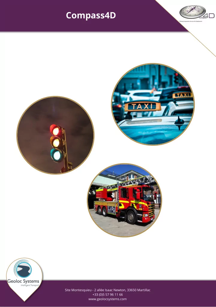
Information on the state of traffic lights. Information about accidents in the real time. Alert public and emergency transport vehicles in approach and in intervention.
delivery.
the consumption of fuel and costs in energy.
thinning of main highway.
consumption, the pollutant emissions in town and the CO2 impact. Reduction of the accidents and their severity Decrease of the bottlings Positive impact at the levels: Economic Social Environmental Estimation of the reduction of fuel of 10 %
Encouragement
international cooperation
Use of short-range communications dedicated (ETSI G5) and of cellular networks (3G, LTE) by adopting the standards ETSI TC ITS. Implementation of a link between the road events with the European standard DATEX 2 and the standard STI-C DENM for the management of events.
Benefits
Green Light Optimal Speed Advice is a service which indicates to the driver the optimal speed permitting to have a green light. It is quite easy, when your car is about 300 meters away from the traffic light, it will send the speed advice at which you should drive in order to reach the light at green. Like this, you will consume less fuel, CO2 and your global driving time will be
When your car stops at a red light and it is equipped with the start/stop idling option it is sometimes frustrating to have to re-start the engine just a few seconds after you stopped. Furthermore, stopping the engine is profitable if it lasts more than 7 seconds. Our smartphone application will tell you if it is worthwhile to cut the engine. This will be the case if the time to green is superior to 7 seconds.
When an emergency vehicle belonging to the fire department from Bordeaux and equipped with Compass4D approaches and is on intervention it will send an alert signal which can be received by another vehicle equipped by Compass4D. An alert message saying that an emergency vehicle is approaching will appear on the smartphone.
You will receive in real time road events located on the ring road of Bordeaux. Accidents, traffic jams, roadworks, incidents, weather events are part of the numerous types of events managed and provided by the Traffic Management System TIPI managed by the CEREMA dTerSO and the French Ministry of Transport (Medde). The smartphone application proposes 3 views (map view, radar view and proximity event alert).
The FULLWEB platform permits the management and supervision of all the elements used for the operation of cooperative systems in Bordeaux. Especially the supervision of the Road Side Units and On Board Units but also the connections with the different data servers like TIPI for the road events and GERTRUDE for the information concerning the traffic lights. Another module permits the management of statistics and the evaluation of the efficiency of the system. THE CONSORTIUM
Associated Partners Associated Cities Consortium
Geoloc Systems and Bordeaux city participate since 2013 in the European operation Compass4D, with six other European cities.
Access : Contact details : Site Montesquieu 2, allée Isaac Newton – 33 650 MARTILLAC +(33) 5 57 96 11 66 www.geolocsystems.com
Exit 1 : Martillac, St Médard d’Eyrans
Into Cadaujac Into Bordeaux Into Toulouse
Into La Brède
Into Léognan Martillac Into Saucats
contact@geolocsystems.com facebook.com/geolocsystems