Green Valley Trail Parks Commission August 6, 2015 PLAN SCOPE AND - - PowerPoint PPT Presentation
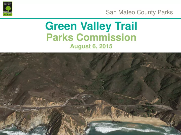
San Mateo County Parks Green Valley Trail Parks Commission August 6, 2015 PLAN SCOPE AND SCHEDULE Data Gathering Community Engagement Plan Development CEQA/Permitting - Fall 2015 Final Design Fall-Winter 2015 Green
Green Valley Trail
PLAN SCOPE AND SCHEDULE
- Data Gathering
- Community Engagement
- Plan Development
- CEQA/Permitting - Fall 2015
- Final Design – Fall-Winter 2015
Green Valley Trail
COMMUNITY OUTREACH
- Public Workshop
- County Parks Website
- Interactive Survey
- Mapping Tool
- Comment Cards
COUNTY PARKS WEBSITE
Green Valley Trail
INTERACTIVE MAP
Green Valley Trail
WEB COMMENTS
- Southernmost point of the Old Colma Rd
- Inlcude connection to historic Old Colma Bike Road visible on map
- Thank you for allowing input. I really believe linking up as many trails as possible is optimal for
hikers and bikers to have different options. Especially if they are frequent hikers and bikers like
- me. :) Thank you again for this opportunity!! mahalo, John Collins
- This is a cool spot to start the trailhead
- While your catching your breath mine as well take in the view
- The route I marked is the Old Colma Rd, future link to compliment the Green Valley trail and
Devils Slide trail. The old Colma rd is 10-15 ft wide the entire length, although coastal brush has
- vertaken most of it.
- This shows the Old Colma Rd, 15-20 feet wide along its entire length. Coastal scrub has
- vergrown most of it, but it is there and would provide a fantastic option for more able walkers-
bicyclists.
- Northernmost access point of the Old Colma Rd-Trail
- Southernmost point of the Old Colma Rd
- Bench + Overlook = trail success
- Top of the hill would be a good place to catch your breath
- While your catching your breath mine as well take in the view
- This is a cool spot to start the trailhead
- Improve existing parking lot
Green Valley Trail
PUBLIC WORKSHOP MAY 11, 2015
- Approximately 20 people
Comments:
- Use rolling dips and other tools to slow bikes down-tear up trail surface
- Provide turnouts and passing areas
- Consider providing a composting latrine in parking area
- Where will equestrians park? (lower parking area is not part of this project)
- Multijurisdictional parking study is underway to assess regional parking options
- How will equestrians get in? (McNee Ranch, Corral de Tierra)
- What is the profile of a typical user?
- What is the total trail length?
- Concerns regarding elevation gain
- Connect to Old Colma Road
- Provide multiple options for users, use service road
- Colma Trail is not part of project, but users would like to see it paid attention to
- What are the funding commitments and what will it cost?
- What easements are needed? (Caltrans, private, State Parks)
- Will there be retaining walls? (yes, at switchbacks)
Green Valley Trail
TRAIL SEGMENTS/60% DESIGN
Changes from 30% design:
- Consolidate trail alternatives to one route, 4 segments
- Remove Highway 1 segment from project (Caltrans
responsibility)
- Reroute trail away from frog pond and wetland
- Pin Pier foundation design for boardwalks/bridges
- Incorporate use of Sutter walls to minimize cut slopes
Green Valley Trail
SEGMENT 1
Revegetation Area Upper Slope
Sutter Wall
Green Valley Trail
SEGMENT 2
Drainage Crossing Existing Social Trail
Puncheon Crossing
Green Valley Trail
SEGMENT 3
Riparian corridor Green Valley Creek Typical Boardwalk
Pin Pier Foundation
Green Valley Trail
SEGMENT 4
Existing Access Road (looking east) Existing Access Road (looking southwest)
Green Valley Trail
UPPER PARKING LOT
Green Valley Trail
UPPER PARKING AREA SURFACE
Contech GeoCell Turfstone Paver
Green Valley Trail
CEQA/PERMITTING
Initial Study Mitigation/Issues:
- A. Air Quality – construction BMPs
- B. Biological Resources
- Permit requirements (Interagency presentation)
- Sensitive species avoidance (fencing/monitor)
- Species surveys
- Wetland protection/mitigation/restoration—fill
removal
- Trail use/management
C.Cultural Resources/Consultation D.Geology/Hydrology
- Design features (rolling dips, outslope, drainage,
surface)
- Erosion control, revegetation
- Construction staging and implementation BMPs
Green Valley Trail
SENSITIVE SPECIES
Potentilla hickmanii (Hickman’s Cinquefoil) Amsinckia lunaris (Bent-flowered Fiddleneck) Polemonium carneum (Oregon polemonium) Rana draytonii (California red-legged frog) Thamnophis sirtalis tetrataenia (San Francisco Garter Snake) Neotoma fuscipes annectens (San Francisco dusky-footed woodrat)
Green Valley Trail
NEXT STEPS
- Prepare/Refine Design Documents
- Prepare Environmental Assessment and Permits
- Present Project at September 2015 Interagency Meeting (Corps of
Engineers, CA Dept of Fish and Wildlife, RWQCB)
- Present Project at County Planning Commission
- County will secure Encroachment Permit and Director’s Easement
with Caltrans to allow future building of trail