
SLIDE 1
OTCQB: TLRS ǀ TSX.V: TBR
D I S C O V E R I N G ǀ D E V E L O P I N G ǀ D E L I V E R I N G
August, 2019
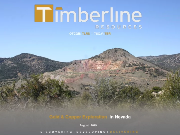
Gold & Copper Exploration in Nevada August, 2019 D I S C O - - PowerPoint PPT Presentation
OTCQB: TLRS TSX.V: TBR Gold & Copper Exploration in Nevada August, 2019 D I S C O V E R I N G D E V E L O P I N G D E L I V E R I N G Cautionary Statements OTCQB: TLRS TSX.V: TBR Forward Looking
OTCQB: TLRS ǀ TSX.V: TBR
D I S C O V E R I N G ǀ D E V E L O P I N G ǀ D E L I V E R I N G
August, 2019
D I S C O V E R I N G ǀ D E V E L O P I N G ǀ D E L I V E R I N G
OTCQB: TLRS ǀ TSX.V: TBR
2
Forward Looking Statements Statements contained herein that are not based upon current or historical fact are forward-looking in nature and constitute forward-looking statements within the meaning of Section 27A of the Securities Act of 1933 and Section 21E of the Securities Exchange Act of 1934. Such forward-looking statements reflect the Company's expectations about its future operating results, performance and opportunities that involve substantial risks and uncertainties. These statements include but are not limited to: statements regarding the Eureka Project resources and exploration targets, statements regarding future extraction operations, monetizing non-core assets, enhancing management team and board, and leveraging dual listing. When used herein, the words "anticipate," "believe," "estimate," “upcoming,” "plan," “target”, "intend" and "expect" and similar expressions, as they relate to Timberline Resources Corporation, its subsidiaries, or its management, are intended to identify such forward-looking statements. These forward- looking statements are based on information currently available to the Company and are subject to a number of risks, uncertainties, and other factors that could cause the Company's actual results, performance, prospects, and
differences include, but are not limited to, risks related to exploration projects, risks related to mining activities, risks related to potential future transactions, risks related to the Company continuing as a going concern, risks related to the ability to finance any payments due, risks related to project development decisions, risks related to mineral resource estimates and other such factors, including risk factors discussed in the Company's most recent Annual Report on Form 10-K and Quarterly Reports on Form 10-Q. Except as required by Federal Securities law, the Company does not undertake any obligation to release publicly any revisions to any forward-looking statements.. Cautionary Statements Cautionary note to United States Investors Regarding Estimates of Resources: This presentation uses the terms "Measured Resources", "Indicated Resources", "Measured & Indicated Resources" and “Inferred Resources” We advise U.S. investors that while these terms are defined in and required by Canadian regulations under Canadian National Instrument 43-101, these terms are not defined terms under United States Securities and Exchange Commission (“SEC”) Industry Guide 7 and are normally not permitted to be used in reports and registration statements filed with the SEC. Under SEC Industry Guide 7 standards, a “final” or “bankable” feasibility study is required to report reserves, the three-year historical average price is used in any reserve or cash flow analysis to designate reserves and all necessary permits and governmental authorizations must be filed with the appropriate governmental authority. Investors are cautioned not to assume that any part or all of mineral deposits in these categories will ever be converted into reserves. “Inferred Mineral Resources” have a great amount of uncertainty as to their existence, and great uncertainty as to their economic and legal feasibility. It cannot be assumed that all or any part of an Inferred Mineral Resource will ever be upgraded to a higher category. Under Canadian rules, estimates of inferred mineral resources may not form the basis of feasibility or pre-feasibility studies, except in rare cases. Investors are cautioned not to assume that all or any part of an inferred mineral resource exists or is economically or legally mineable. Disclosure of “contained ounces” in a resource is permitted disclosure under Canadian regulations; however, the SEC normally only permits issuers to report mineralization that does not constitute “reserves” by SEC Industry Guide 7 standards as in place tonnage and grade without reference to unit measures. For Lookout Mountain resources, refer to Updated Technical Report on the Lookout Mountain Project effective March 1, 2013 and filed on SEDAR April 12, 2013. For Elder Creek and Paiute, refer to the Technical Reports effective and filed on SEDAR on November 28, 2018 . Steven Osterberg, Ph.D., P.G., Timberline’s President and CEO, is a Qualified Person as defined by NI 43-101 and has reviewed and approved the technical contents of this presentation.
D I S C O V E R I N G ǀ D E V E L O P I N G ǀ D E L I V E R I N G
OTCQB: TLRS ǀ TSX.V: TBR
Experienced Management and Board Tight Capital Structure Nevada: World-Class Mining Jurisdiction Drill Discovery Success: Gold, and Copper-Gold Exploration
− Measured & Indicated: 508,000 ounces − Inferred: 141,000 ounces − Associated high-grade gold Carlin-type intercepts(2) at Lookout Mountain Fully Funded Lookout Mountain Joint Venture Agreement
(1) Refer to Updated Technical Report on the Lookout Mountain Project, MDA, Effective March 1, 2013, Filed on SEDAR April 12, 2013 (2) See Press Release dated November 26, 2018, October 2, 2018, August 8, 2018, July 10, 2018, and June 12, 2018 at http://timberline-resourc es.co/press-releases (3) See Press Releases dated October 19, 2018, September 27, 2018, and June 8, 2018, at ‘http://timberline-resources.co/press-releases; and Technical Reports on the Elder Creek and Paiute Projects, Thomas Bidgood, Effective November 28, 2018, Filed on SEDAR November 28, 2018.
Lookout Mountain: High-Grade Gold Intercepts(4)
Drill Hole Length (feet) 4 Length (meters)4 Gold (opt) Gold (g/t) BH05-01 65 19.8 0.344 11.79 including 25 7.6 0.641 21.98 BH05-03 3 0.9 2.250 77.14 BH06-02 27 8.2 0.364 12.48 BH06-07 92 28.0 0.217 7.44 BH06-13 3 0.9 1.470 50.40 BR-19 15 4.6 0.323 11.07 BR-19 75 22.9 0.283 9.70 BR-26 20 6.1 0.323 11.07 RTR-134 55 16.8 0.345 11.83 RTR-180 10 3.0 0.345 11.83 RTR-181 15 4.6 0.197 6.75 RTR-258 10 3.0 0.430 14.74 BHSE-126C 15 4.6 0.967 33.15 BHSE-151C 8.6 2.6 1.023 35.07 BHSE-152 10 3.0 0.165 5.66 BHSE-171 20 6.10 0.160 6.10 BHSE-172 40 12.20 0.143 4.89
4Drill thickness - True widths of intercepts have not been determined
Elder Creek Drill Intercepts(4)
Total1 Total 4 Cu Mo Au Ag (feet) (meters) (g/t) (g/t) CCEC18-02 657 200.3 1,450 ppm 730 ppm
including: 46.5 14.2 1.20 % 0.31 % 3 0.126 25.5 RCEC18-01 500 152.4 0.21 % 3 including: 270 82.3 0.28 % 4 110 33.5 0.44 % 5 15 4.6 0.55 % 0.331 13
D I S C O V E R I N G ǀ D E V E L O P I N G ǀ D E L I V E R I N G
OTCQB: TLRS ǀ TSX.V: TBR
4
Steven Osterberg, President, CEO & Director
exploration, permitting, development, and closure
Knight Piésold, and Tetra Tech
Donald McDowell, Vice President, Director
resource development primarily in Nevada, including 17 years with majors (Santa Fe Pacific Gold, Kennecott Exploration, Nippon Mining)
in Nevada, including recent instrumental role in the Carlin Vanadium deposit
Ted Sharp, Chief Financial Officer, C.P.A.
which provides CFO services to the exploration and mining resource sector
European Operations, and Corporate Controller for Key Tech- nology, Inc., a publically traded manufacturer of capital goods.
industry.
Leigh Freeman, Director, Chairman
executive positions
Dakota School of Mines. Past Chief Geophysicist at Placer (Barrick)
Paul Dircksen, Director
development, and mining
the Cordex Syndicate, Brett Resources and Bravo Venture Group
David Mathewson, Director
in Nevada
at Tess, Northwest Rain, Saddle, South and Emigrant, Gold Quarry and Mike deposits
Ventures where he led consolidation of the Railroad-Pinion District and the North Bullion and Bald Mountain discoveries
Capital Markets, Exploration, Development, Permitting & Production
D I S C O V E R I N G ǀ D E V E L O P I N G ǀ D E L I V E R I N G
OTCQB: TLRS ǀ TSX.V: TBR
5
Capital Structure Common Shares Common Shares Outstanding 67.4 M Options (US$0.26 weighted average exercise price) 3.3 M Warrants: (US$0.21 weighted average strike price) 44.1 M Fully Diluted 114.8 M Market and Financial Information (US$) Market Capitalization $ 4.8 M 52-week Closing Price Range $ 0.06 - $ 0.24 Recent Price $ 0.08 3-Month Avg. Daily Volume 45,000 Share Ownership % Directors, Management, and Insider Associates 30% Retail 65% American Gold Capital 5%
D I S C O V E R I N G ǀ D E V E L O P I N G ǀ D E L I V E R I N G
OTCQB: TLRS ǀ TSX.V: TBR
6
Nevada: 2018 Top-ranked Global Mining Investment Jurisdiction
the Fraser Institute Investment Attractiveness Index
Battle Mountain-Eureka Trend Hosts Several Multi- Million Ounce Gold Districts, Mines, and Projects District-scale Properties Pipeline
early-stage discovery opportunities
D I S C O V E R I N G ǀ D E V E L O P I N G ǀ D E L I V E R I N G
OTCQB: TLRS ǀ TSX.V: TBR
7
Historic Production, Gold Trends, and Targets
District-scale: 23 mi2 (60 km2) Land Package remains largely under-tested; multiple target areas
Mine
Carlin-type Gold system with three mineralized trends each with ≥ 5 km strike length Lookout Mountain Gold Resources(1)
expansion
Windfall Project:
Oswego Trend
g/t) gold in outcrop(2)
(1)) Refer to Updated Technical Report on the Lookout Mountain Project, MDA, Effective March 1, 2013, Filed on SEDAR April 12, 2013 (2) Refer to Timberline Press Releases dated April 20, 2015, June 12, 2018, and August 8, 2018
Gold Trends: Rock and Soil Geochemistry
Windfall Target Oswego Mine Target
NI 43-101 Resource 508,000 oz, M&I 141,000 oz, Inf
D I S C O V E R I N G ǀ D E V E L O P I N G ǀ D E L I V E R I N G
OTCQB: TLRS ǀ TSX.V: TBR
8
Gold Mineralization and Magnetics(1)
Multi-mile Carlin-type gold system with NI43-101 Gold Resource(2) and an associated high-grade trend 250 line-miles of detailed ground magnetic coverage
district-prominent N/NW-S/SE magnetic anomaly
Historic IP/resistivity and CSAMT at Lookout Mountain 2018 Gravity Survey
(1) Refer to Timberline Press Release dated October 2, 2018 (2) Refer to Updated Technical Report on the Lookout Mountain Project, MDA, Effective March 1, 2013, Filed on SEDAR April 12, 2013
W E
SE - trending high-grade Au zone
See page 26 for detailed map view
D I S C O V E R I N G ǀ D E V E L O P I N G ǀ D E L I V E R I N G
OTCQB: TLRS ǀ TSX.V: TBR
9
Joint Venture Agreement with PM & Gold, Inc.
Increase Resource, Advance to Feasibility, and Production Area of Interest: Lookout Mountain and Oswego
Stage I: Earn-In 51% for $6-million over 2 years
− Drilling, IP/Resistivity, geologic modeling − Focus on near-surface oxide and high-grade gold mineralization − Exploration to expand and upgrade (NI43-101) existing resource
Stage 2: Earn-In to 70% (total) for completion of Feasibility Study within 3 additional years
Options to Dilute Ownership Share:
interest to a 10% NPI or 2% NSR, or sell to partner per ROFR
Mutual Right of First Refusal (ROFR) PM & Gold Private Placement Participation: 4.99% Ownership of Timberline at above-market pricing
(1)) Refer to Updated Technical Report on the Lookout Mountain Project, MDA, Effective March 1,
2013, Filed on SEDAR April 12, 2013
(2) Refer to Timberline Press Releases dated April 20, 2015, June 12, 2018, and August 8, 2018
D I S C O V E R I N G ǀ D E V E L O P I N G ǀ D E L I V E R I N G
OTCQB: TLRS ǀ TSX.V: TBR
Lookout Mountain High Grade (multi-gram/tonne) Target
10
1Refer to Updated Technical Report on the Lookout Mountain Project, MDA, Effective March 1, 2013, Filed on SEDAR April 12, 2013 and the Company’s April 20, 2015 press release 2Refer to Timberline Press Release dated June12, 2018
Recognition of SE-trending high-grade gold (up to multi-oz) zone flanking district-prominent magnetic anomaly, major structural zone, and low-grade gold mineralization Hosted in flat-lying multi-staged collapse-style breccias, and structures Alteration: Carbonate dissolution, silica and iron addition Introduction of Au with brassy and sooty sulfides and As, Sb, Hg, Th, and Zn pathfinder elements
Drill Hole(2) Gold
Feet Gold g/t Meters BH05-01 0.353 65 12.1 19.82 BH05-03 2.25 3 77.1 0.91 BH05-03 0.229 70 7.85 21.34 BH06-02 0.364 27 12.5 8.23 BH06-07 0.222 92 7.61 28.05 BH05-13 0.201 3 6.89 0.91 BH06-13 0.284 24.5 9.74 7.47 BH06-13 1.47 3 50.5 0.91 BHSE-152 0.138 15 4.73 4.57 BHSE-171 0.160 20 5.47 6.10 BHSE-172 0.143 40 4.89 12.20
D I S C O V E R I N G ǀ D E V E L O P I N G ǀ D E L I V E R I N G
OTCQB: TLRS ǀ TSX.V: TBR
11
High-grade Target Detail: Geophysical Data(1)
Magnetics, IP, CSAMT Survey Data
(1) Refer to Timberline Press Release dated October 2, 2018 (2) Refer to Updated Technical Report on the Lookout Mountain Project, MDA, Effective March 1, 2013, Filed on SEDAR April 12, 2013
D I S C O V E R I N G ǀ D E V E L O P I N G ǀ D E L I V E R I N G
OTCQB: TLRS ǀ TSX.V: TBR
Lookout Mountain High Grade Gold in Drill Core
12
BH05-03: 195 ft BH06-13: 150 ft BH06-02: 456 ft BHSE-173: 976 ft 2.5 opt (85.7 g/t) 0.51 opt (17.5 g/t) 3.6 opt (123.4 g/t) 0.16 opt (5.1 g/t)
D I S C O V E R I N G ǀ D E V E L O P I N G ǀ D E L I V E R I N G
OTCQB: TLRS ǀ TSX.V: TBR
Gold Mineralization Plan and Section(1)
13
100% Timberline Ownership Windfall Mine (1975-1984)
2.7 km (1.7 mile) major structural zone and coincident gold mineralized trend Target expansion of historic open pits
(1) See Press Releases dated July 10, 2018 and August 8, 2018, at http://timberline-resources.co/press-releases
BHWF-037 27.4 m @ 2.20 g/t incl. 13.7 m @ 3.68 Rustler Pit: ~50,000 Ounces Produced Windfall Pit: 32,077 Ounces Produced South Paroni Pit: ~31,800 Ounces Produced BHWF-036 12.2 m @ 1.26 g/t BHWF-039 10.7 m @ 0.46 g/t BHWF-038 24.4 m @ 0.32 g/t BHWF-041 18.3 m @ 1.24 g/t
W E
400 m
N
BHWF-040 24.4 m @ 3.04 g/t incl. 6.1 m @ 8.79
1,500 ft
(2) 15.6 m – 16.7 m tons @ 0.024 - 0.027 opt. The potential quantity and grade are conceptual in nature and there has been insufficient exploration to define a mineral
resource, and it is uncertain if further exploration will result in the target begin delineated as a mineral resource. A block model was established covering the length of the Windfall fault zone and gold grades were estimated using 10-foot down hole composites from drill data
Breccias and structural zones reflecting multiple gold mineralizing events
D I S C O V E R I N G ǀ D E V E L O P I N G ǀ D E L I V E R I N G
OTCQB: TLRS ǀ TSX.V: TBR
Gold Mineralization: Drilling and Surface Sampling
14
Drill Hole From (feet) Length(2) (feet) Gold (oz/ton) From (meters) Length (meters) Gold (g/t) BHWF-036 290 40 0.04 88.4 12.2 1.26 BHWF-037 185 90 0.06 56.4 27.4 2.20 including 185 45 0.11 56.4 13.7 3.68 BHWF-040 290 80 0.09 88.4 23.4 3.04 including 305 20 0.26 93.0 6.1 8.79 BHWF-041 230 60 0.04 70.1 18.3 1.24
40 gold-bearing surface samples(3) within and south of historic Windfall Pit
1 see Press Release dated April 20, 2015 for additional detail; 2. true widths of the drill intercepts have not been determined 3 see Press Release dated August 8, 2018 for additional detail
Surface Sample(3) Gold (oz/ton) Gold (g/t) Surface Sample Gold (oz/ton) Gold (g/t) 18WF-009 0.05 1.72 18WF-047 0.225 7.71 18WF-011 0.031 1.05 18WF-049 0.008 0.275 18WF-013 0.036 1.25 18WF-051 0.011 0.386 18WF-034 0.009 0.303 18WF-053 0.018 0.61 18WF-035 0.088 3.02 18WF-054 0.089 3.06 18WF-036 0.382 13.1 18WF-055 0.094 3.22 18WF-037 0.021 0.711 18WF-056 0.074 2.52 18WF-039 0.012 0.408 18WF-062 0.119 4.08 18WF-041 0.027 0.927 *Assays were determined by ALS USA Inc. from grab samples. The samples were crushed and pulverized and a fraction was selected for analyses. Gold was determined by 30 g Fire Assay with an Atomic Adsorption finish. Samples assaying
W E
Cross-section between Rustler and Windfall Pits
D I S C O V E R I N G ǀ D E V E L O P I N G ǀ D E L I V E R I N G
OTCQB: TLRS ǀ TSX.V: TBR
15
Lookout Mountain:
mineralization
area
high-grade mineralization
permitting
Windfall:
D I S C O V E R I N G ǀ D E V E L O P I N G ǀ D E L I V E R I N G
OTCQB: TLRS ǀ TSX.V: TBR
16
Location: Battle Mountain Gold - Copper District
Battle Mountain District
billion lbs. copper
3 Producing Mines & 1 Cu-Au Development Project
Elder Creek Cu-Au-Mo-Ag Porphyry Project
participation
& Copper Basin Project
Paiute Cu-Au Porphyry & Structural Au Project
subsidiary (Lac Minerals)
Elder Creek Paiute
Lone Tree 7 Moz Au Copper Basin 1.2 Moz Au 164 Mlbs Cu 2.3 Moz Ag Newmont Mine Buckingham Moly 1.0 Bt @0.06% Mo Phoenix Mine Complex 14.0 Moz Au 1.65 Blbs Cu 15 Moz Ag Buffalo Canyon 1.4 Moz Au Converse 4 Moz Au Marigold Mine Complex 5 Moz Au Trenton/ Valmy
1.2 Moz
5 miles
D I S C O V E R I N G ǀ D E V E L O P I N G ǀ D E L I V E R I N G
OTCQB: TLRS ǀ TSX.V: TBR
17
Airborne Magnetics and Exploration Targets
Geologic Setting
Resource Targets *
Copper and 0.003-0.03 oz/ton (opt) Gold
– 0.04 opt
Elder Creek: Copper-Gold Porphyry System
km diameter non-magnetic center
Favorable size Comparison to Major Porphyry- hosted Copper (gold) Deposits
Secondary Gold - (Cu/Au) Structural Targets (Lone Tree – type)
* Resource target estimates based on intrusive size, magnetic signature, rock sample assays, and comparison to known mines of this deposit type.
Reduced to Pole Magnetics
D I S C O V E R I N G ǀ D E V E L O P I N G ǀ D E L I V E R I N G
OTCQB: TLRS ǀ TSX.V: TBR
18
Magnetics and Gravity Anomalies
Magnetics: Reduced to Pole Tilt Derivative Gravity: Horizontal Gradient
D I S C O V E R I N G ǀ D E V E L O P I N G ǀ D E L I V E R I N G
OTCQB: TLRS ǀ TSX.V: TBR
19
Geology, Alteration, and Copper Geochemistry
(1) See Press Releases dated June 8, 2018, at http://timberline-resources.co/press-releases
Porphyry Copper – Gold Target
porphyry phases
strong structural control (“Lone Tree-type”)
feldspathic-sandstones and shales, locally calcareous (metamorphosed to quartzite and hornfels)
mineralized fragments
work quartz veining
(see pg 19)
Bingham Canyon, Utah)
D I S C O V E R I N G ǀ D E V E L O P I N G ǀ D E L I V E R I N G
OTCQB: TLRS ǀ TSX.V: TBR
20
IP/Resistivity Survey
Induced Polarization/Resistivity Survey(1)
mineral concentrations
(456 m depth)
Very Large IP “Chargeability” Anomaly
Clear association with Porphyry Copper Deposit - indicators
alteration
(1) See Press Releases dated January 8, 2019, at http://timberline-
resources.co/press-releases
D I S C O V E R I N G ǀ D E V E L O P I N G ǀ D E L I V E R I N G
OTCQB: TLRS ǀ TSX.V: TBR
2018-2019 Initial Drilling Results
21
(1) See Press Releases dated October 19, 2018 and November 26, 2018 at http://timberline-resources.co/press-releases
Hole: RCEC18-01 From To Total1 From To Total 1 Cu Mo Au Ag
(feet) (feet) (feet) (meters) (meters) (meters) (g/t) (g/t)
500 500 0.0 152.4 152.4 0.21 % 3
270 270 0.0 82.3 82.3 0.28 % 4 160 270 110 48.8 82.3 33.5 0.44 % 5 195 210 15 59.5 64.0 4.6 0.55 % 0.331 13 Hole: CCEC18-02 840 1497 657 256.1 456.4 200.3 1,450 ppm 730 ppm 2
1313.5 1360 46.5 400.5 414.6 14.2 1.20 % 0.31 % 3 0.126 25.5 Hole: RCEC19-01 270 1960 1690 82.3 597.6 515.3 731 ppm 212 ppm 2 475 680 205 144.8 207.3 62.5 0.12% 222 4 1115 1180 65 339.9 359.8 19.9 0.25% 181 5 1630 1615 15 492.4 497 7.6 0.21% 233 5
1True thickness of drill intercepts is unknown; 2 0.13% MoS2(calculated); 30.52% MoS2 (calculated)
biotite, K-feldspar, with pyrite-chalcopyrite (Cu-sulfide), and molybdenite (Mo sulfide)
clots, to web-like replacement and cross-cutting, high-grade sulfidic breccia
disseminated iron-, copper-, and molybdenum-sulfides
D I S C O V E R I N G ǀ D E V E L O P I N G ǀ D E L I V E R I N G
OTCQB: TLRS ǀ TSX.V: TBR
22
Drill Testing of IP Anomalies
IP Drill Testing: Zoned geology and alteration from RCEC19-01 (core) to CCEC18-02 (lateral)
alteration; strong pyrite ± chalcopyrite (Cu)-molybdenite (Mo)
sericite alteration; strong mineralization including late, cross-cutting breccia with high-grade copper-molybdenite-silver + gold
Drill Holes PDH-2 (breccia) and PDH-3 (lateral) — pending Priority Drill Targets PDH - 1, - 2
Follow-up Targets
Vertical Cross-Sections: Detailed IP (Chargeability Anomaly)
L3600N
Plan View of IP Anomaly
D I S C O V E R I N G ǀ D E V E L O P I N G ǀ D E L I V E R I N G
OTCQB: TLRS ǀ TSX.V: TBR
2018 Core Drill-Hole CCEC18-02:(1) Porphyry Textures
23
(1) See Press Releases dated October 19, 2018, at http://timberline-resources.co/press-releases
D I S C O V E R I N G ǀ D E V E L O P I N G ǀ D E L I V E R I N G
OTCQB: TLRS ǀ TSX.V: TBR
24
Airborne Magnetics and Exploration Targets
District Geologic Porphyry Copper-Gold District
Resource Targets *
Copper and 0.003-0.03 oz/ton (opt) Gold
0.025 – 0.04 opt
Paiute Copper-Gold Porphyry System
~1.5 km diameter non-magnetic center
Secondary Gold - Silver Structural Targets (Lone Tree – type)
* Resource target estimates based on intrusive size, magnetic signature, rock sample assays, and comparison to known mines of this deposit type.
Reduced to Pole Magnetics
Copper Basin Mine 1.2 M oz Au 164 Mlbs Cu 2.3 Moz Ag
D I S C O V E R I N G ǀ D E V E L O P I N G ǀ D E L I V E R I N G
OTCQB: TLRS ǀ TSX.V: TBR
25
Geology, Geochemistry, and Targets(1)
Gold-Silver Structural Target
structural gold-silver
Gold-Copper Porphyry System
Gold Mineralization in Outcrop
g/t (0.029 oz/ton) in 10 (of 21) 2018 samples(1)
(1) See Press Releases dated May 28, 2018, at http: timberline-resources.co/press-releases, and Technical Report on the Elder Creek Project, Thomas Bidgood, Effective November 28, 2018, Filed on SEDAR November 28, 2018.
Historic drill hole 96-5: 1.45 g/t Au and up to 1- 2% visible Cu sulphides)
D I S C O V E R I N G ǀ D E V E L O P I N G ǀ D E L I V E R I N G
OTCQB: TLRS ǀ TSX.V: TBR
Multiple-phase Porphyry Intrusions with Gold-enrichment Marginal to Magnetic Donut-anomaly in similar relative position as Copper Basin Mine DH96-5 Discovery Hole:
including: − 178.35-179.88: 1.5 m @ 1.45 g/t Au
− 1-2% chalcopyrite (Cu-sulfide) in some drill cuttings (no assays)
Priority Drill Target
Cross-section Geology, Historic Drilling, and Gold Assays
26
D I S C O V E R I N G ǀ D E V E L O P I N G ǀ D E L I V E R I N G
OTCQB: TLRS ǀ TSX.V: TBR
Elder Creek:
venture partnership(s)
margin (PDH-3), and system core (PDH-4)
Paiute
system,
27
D I S C O V E R I N G ǀ D E V E L O P I N G ǀ D E L I V E R I N G
P H O N E 2 0 8 . 6 6 4 . 4 8 5 9 ǀ F A X 2 0 8 . 6 6 4 . 4 8 6 0 ǀ I N F O @ T I M B E R L I N E – R E S O U R C E S . C O M T I M B E R L I N E – R E S O U R C E S . C O M
OTC QB: TLRS ǀ TSX.V: TBR
D I S C O V E R I N G ǀ D E V E L O P I N G ǀ D E L I V E R I N G
OTCQB: TLRS ǀ TSX.V: TBR
29
District-Scale on the Battle Mountain-Eureka Gold Trend
(1)) Refer to Updated Technical Report on the Lookout Mountain Project, MDA, Effective March 1, 2013, Filed on SEDAR April 12, 2013 (2) Refer to Timberline Press Releases dated April 20, 2015, June 12, 2018, and August 8, 2018
South end of Battle Mountain- Eureka Gold Trend Trend Hosts Several Multi- Million Ounce Gold Mines and Projects
Carlin-type gold system District-scale: 23 mi2 (60 km2) land package remains largely untested
Lookout Mountain
Ruby Hill & Archimedes
Gold Bar
Gold Pick
Buckhorn Cortez Tonkin Springs Pipeline Goldrush
Windfall
4 km
N
D I S C O V E R I N G ǀ D E V E L O P I N G ǀ D E L I V E R I N G
OTCQB: TLRS ǀ TSX.V: TBR
30
Regional Geology
District Control: ~15,000 acres Favorable Cambrian to Ordovician host strata:
Shale, Hamburg Dolomite, Secret Canyon Shale, Geddes Limestone
trap architecture in collapsed fold belts − Anticline folds over blind thrusts − Reactivated high-angle faults − Associated intrusive centers − Collapse breccias
Open on-strike and at depth with under-explored deeper, feeder- related, high-grade gold mineralization
D I S C O V E R I N G ǀ D E V E L O P I N G ǀ D E L I V E R I N G
OTCQB: TLRS ǀ TSX.V: TBR
31
Lookout Mountain Pit: High-grade Gold Mineralization
Lookout Mountain Historic Open-Pit
drill intercepts
(1)) Refer to Updated Technical Report on the Lookout Mountain Project, MDA, Effective March 1, 2013, Filed on SEDAR April 12, 2013 (2) Refer to Timberline Press Releases dated April 20, 2015, June 12, 2018, and August 8, 2018
Lookout Mountain: High-Grade Gold Intercepts(4)
Drill Hole Length (feet) 4 Length (meters)4 Gold (opt) Gold (g/t) BH05-01 65 19.8 0.344 11.79 including 25 7.6 0.641 21.98 BH05-03 3 0.9 2.250 77.14 BH06-02 27 8.2 0.364 12.48 BH06-07 92 28.0 0.217 7.44 BH06-13 3 0.9 1.470 50.40 BR-19 15 4.6 0.323 11.07 BR-19 75 22.9 0.283 9.70 BR-26 20 6.1 0.323 11.07 RTR-134 55 16.8 0.345 11.83 RTR-180 10 3.0 0.345 11.83 RTR-181 15 4.6 0.197 6.75 RTR-258 10 3.0 0.430 14.74 BHSE-126C 15 4.6 0.967 33.15 BHSE-151C 8.6 2.6 1.023 35.07 BHSE-152 10 3.0 0.165 5.66 BHSE-171 20 6.10 0.160 6.10 BHSE-172 40 12.20 0.143 4.89
4Drill thickness - True widths of intercepts have not been determined
D I S C O V E R I N G ǀ D E V E L O P I N G ǀ D E L I V E R I N G
OTCQB: TLRS ǀ TSX.V: TBR
Windfall Target
Windfall Mine (1975-1984) (incl. Windfall, Paroni, and Rustler Pits)
pit, heap leach operation in Nevada
Rustler Pits: ~83,400 oz
32
D I S C O V E R I N G ǀ D E V E L O P I N G ǀ D E L I V E R I N G
OTCQB: TLRS ǀ TSX.V: TBR
33
Windfall Targeting
Windfall Fault: multi-km strike length of mineralized rock
Dunderberg contact zone
Un/under Tested Footwall
Open Pit and Underground Opportunities
D I S C O V E R I N G ǀ D E V E L O P I N G ǀ D E L I V E R I N G
OTCQB: TLRS ǀ TSX.V: TBR
Windfall – Recent Drilling
34
4.5 km mineralized trend with historic open pit, heap leach gold mining Recent drill holes confirm historic assays in internal resource, including deep high grade intercepts
Rustler Pit: ~50,000 Ounces Produced Windfall Pit: 32,077 Ounces Produced South Paroni Pit: ~31,800 Ounces Produced
BHWF-036 12.2 m @ 1.26 g/t BHWF-039 10.7 m @ 0.46 g/t BHWF-038 24.4 m @ 0.32 g/t BHWF-041 18.3 m @ 1.24 g/t
B B`
375 m
N
BHWF-040 24.4 m @ 3.04 g/t incl. 6.1 m @ 8.79 BHWF-037 27.4 m @ 2.20 g/t incl. 13.7 m @ 3.68
Drill Hole From (meters) Length (meters)(1) Gold (g/t) From (feet) Length (feet)(1) Gold (opt) BHWF-001 36.6 9.1 1.44
120 30 0.042
BHWF-002 57.9 13.7 0.82
190 45 0.024
BHWF-003 41.2 13.7 0.69
135 45 0.020
BHWF-004 76.2 15.2 7.58
250 50 0.221
including 80.8 7.6 13.58
265 25 0.396
BHWF-012 44.2 3.1 0.85
145 10 0.025
BHWF-036 88.4 12.2 1.26
290 40 0.040
BHWF-037 56.4 27.4 2.20
185 90 0.060
including 56.4 13.7 3.68
185 45 0.110
BHWF-038 128 24.4 0.32
420 80 0.010
including 150.9(2) 15.5 1.45
495(2) 51 0.045
BHWF-039 115.8 10.7 0.46
380 35 0.010
BHWF-040 88.4 24.4 3.04
290 80 0.090
including 93 6.1 8.79
305 20 0.260
BHWF-041 70.1 18.3 1.24
230 60 0.040
(1) Drill thickness - True widths of drill intercepts have not been determined (2) Intercept at end of hole
D I S C O V E R I N G ǀ D E V E L O P I N G ǀ D E L I V E R I N G
OTCQB: TLRS ǀ TSX.V: TBR
35
3d – Stacked IP Depth Sections
IP Anomaly
clipped west edge of anomaly core
breccia; terminated above strong anomaly
historic drilling Copper-oxide in breccia at RCEC18-01
Sections represent 2d Smooth-Model Inversion of IP data (Zonge, 2018)
D I S C O V E R I N G ǀ D E V E L O P I N G ǀ D E L I V E R I N G
OTCQB: TLRS ǀ TSX.V: TBR
36
Geophysics: IP and Resistivity—2d Inversion; 1,300 m Elevation
D I S C O V E R I N G ǀ D E V E L O P I N G ǀ D E L I V E R I N G
OTCQB: TLRS ǀ TSX.V: TBR
37
Historic Gold and Silver Production
Property Location
Historic Production
early 20th century
mining history (1.2 oz/ton (41 g/t) gold and 4 oz/ton (137 g/t) silver)
Act
cover Seven Troughs
visible gold in quartz
D I S C O V E R I N G ǀ D E V E L O P I N G ǀ D E L I V E R I N G
P H O N E 2 0 8 . 6 6 4 . 4 8 5 9 ǀ F A X 2 0 8 . 6 6 4 . 4 8 6 0 ǀ I N F O @ T I M B E R L I N E – R E S O U R C E S . C O M T I M B E R L I N E – R E S O U R C E S . C O M
OTC QB: TLRS ǀ TSX.V: TBR