1
GIS Steering Committee Meeting July 15, 2005 Barney Krucoff, GIS - - PowerPoint PPT Presentation
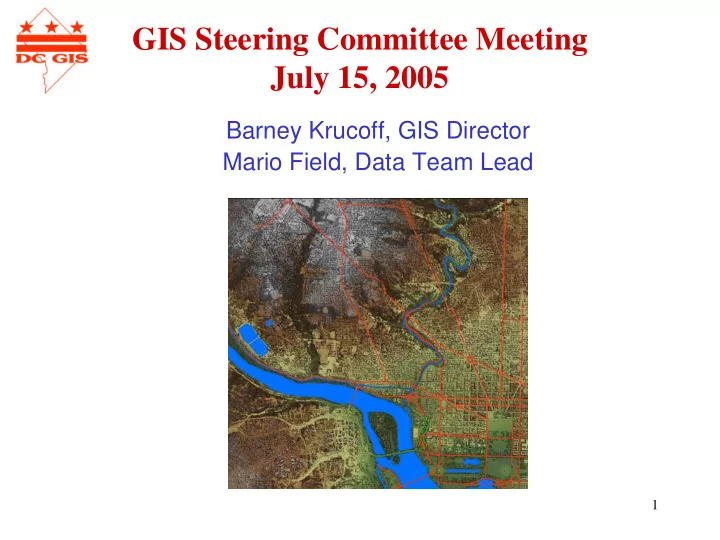
GIS Steering Committee Meeting July 15, 2005 Barney Krucoff, GIS Director Mario Field, Data Team Lead 1 Updated DC GIS Data CAMA Data 3/2005 Places of Worship 4/2005 Owner Points 4/2005 Sale Points 4/2005 Libraries
2
Updated DC GIS Data
- CAMA Data
3/2005
- Places of Worship
4/2005
- Owner Points
4/2005
- Sale Points
4/2005
- Libraries
5/2005
- Embassies
5/2005
- Street Centerlines
5/2005
- Military Areas
5/2005
- NAVTEQ Regional Data
6/2005
3
Regional Data
4
Regional Data
NAVTEQ data
- 31 feature classes
- Roads, Airports, Cemeteries, Golf
Courses, Hospitals, Military Bases, Parks, National Monuments, Public Use Areas, Shopping Centers, Sports Complexes, University/Colleges, and woodlands
- Geographic Coordinate System –
reproject with other DC GIS data
5
Regional Data
6
- Address Points
- Zoning Data (Nyambi’s Presentation)
- Aging Services
- Correctional Halfway House
- University Areas
- Businesses
- DC Quadrants
- DDOT-UFA Trees
- LIDAR Data
- PictometryData
» July 2005 publication
Current DC GIS Data Update
7
- Format – GeoTIFF
– Digital Elevation Model (dem) – 32-bit floating point gridded matrix – First Return DEM – designated by a1 – Last Return DEM – designated by a2 – Intensity Image (int) – 8-bit – Color Coded Shaded Relief Image (clr) – 24-bit – Merged Intensity-Color Coded Shaded Relief Image (mrg) – 24-bit – 1-meter gridded bare earth DEM (32-bit GeoTIFF)
- Resolution – 1 meter for all files
- Flown – October 2004
- Projection – Universal Transverse Mercator (UTM)
- Datum – World Geodetic System 1984 (WGS84) G1150 ellipsoid
for both the horizontal and vertical datum (not Mean Sea Level)
- Accuracies – approximately 0.5 meter CE90 absolute
horizontal and 0.3 meter LE90 absolute vertical
- Distribution – District Government Only, USGS 3M resample
for public coming
LIDAR 2004
8
LIDAR 2004
9
LIDAR 2004
10
LIDAR 2004
11
LIDAR 2004
12
LIDAR 2004
13
LIDAR 2004
14
LIDAR 2004
15
LIDAR 2004
16
Applications
- Terrain Mapping and Analysis
- Site Planning
- Viewshed Analysis
- Forest Management
- Environmental Monitoring
- Watershed Studies
- Flood Plain Mapping
- Source for 3D Urban Mapping
LIDAR 2004
17
Pictometry
18
- Flown March 22, 2005
- EFS 2.6 Version 3
– Improved GIS file performance – Spatial Indexing – New Navigation Tools – New DRG scans
- Training/PR - August 11, 2005, 9:30AM @
OJS (preliminary)
- Sector orthos delivered at time of
training
- Distribution: Digital Data District only,
hard copy and PDF public.
Pictometry
19
Master Address Repository WEB SERVICE DEMONSTRATION
20
Master Address Repository
- Coming 1st week of August (or very close)
- Last meeting
– Difference between address points and owner points – Desktop tools
- Maintenance Application (DCRA)
- Batch Tool
- ArcGIS Plug-in (Coming with OP Tools)
- Related improvements to the Street Spatial Database
– Additional streets – Updated address ranges
- Actual
- Theoretical
21
What is still being worked on
- Campuses (Federal and University)
- Place Names
- Public Housing
- Zip Plus + 4
- Intersection Table, Block Table
- Anomaly Checking
- Web Services Development and Testing
22
MAR Web Services
- Many MAR Web Services
– Address Service – Intersection Service – Block Service – AID Service – SSL Service – Place Name Service – Wrapper Services
- Inside DC Locations (All above except SSL)
- Inside or Outside DC Addresses and Intersections Only
– Tracking and Error Reporting Web Page
23
Verify DC Address -- 1
- The Verify DC Address operation parse, standardize,
and verify an DC address. The MAR VW_ADDRESS view will be used for verification.
- Address number and street name are required.
24
Verify DC Address -- 2
- General Process
– Strip out non-alphanumeric characters except “’”, “/” – Whole string search look for exact match – Parse components – Standardize street type and quadrant – Standardize street name
- Search street name lookup
- Search street alias lookup
- Search similar street name
- Spell check
– Search address number/suffix and street name – Match street type – Match quadrant – Calculate confidence level – Return candidate(s)
25
Verify DC Address -- 3
Address Information – Standardized full address – AID – Address Number – Address Number Suffix – Street Name – Street Type – Quadrant – Zip Code + Plus 4 – SSL (discuss) – Block Name – Status Confidence Level
- Score
Geographic Information – ANC – Neighborhood Cluster
– Voting Precinct
– Police Service Area – Police District – Police Regional Office – Census Tract – SMD – Ward – Neighborhood Coordinates – X, Y coordinates – USNG Link to reporting/tracking web page
- Accepts
– One concatenated address string – Five address components (address number, address number suffix, street name, street type, and quad)
- Returns (for each candidate)
26
Verify DC Address -- 4
- Also Returns
– Verification explanation – Example:
Verified 441 4TH STREET NW Full Address Valid 441 4TH STREET Address Number/Street Name/Street Type Valid 441 4TH Address Number/Street Name Valid 4TH Street Name Valid NW Quad Valid STREET Street Type Assessment Parsed & Normalized Component
27
Confidence Level Calculation
- Each returned address string will be compared with the user
entered string to get the confidence level for that record.
- Assigned weight to each address component.
- Calculate the closeness of each address component by edit
distance algorithms (based on similar characters, transpositions)
- The formula below will then be used to get the confidence level
for each return record.
- Confidence Level = 0.4 * score_addressIDSuffix + 0.3 *
score_streetName + 0.15 * score_streetType + 0.15 * score_Quad
0.15 Quadrant 0.15 Street Type 0.3 Street Name 0.4 Address Number & Address Number Suffix Weight Component
28
Spell Checker
- A spell checking engine called NetSpell.
- NetSpell’s suggestions for a misspelled word are
generated using phonetic (sounds like) matching and ranked by a typographical (looks like) score.
- NetSpell’s dictionaries are based on the OpenOffice Affix
compression format. We created our own en-DC.dic, the DC street names dictionary from the street name lookup
- table. Place names still need to added to the dictionary.
29
Verify DC Intersection -- 1
- The Verify DC Intersection operation parse,
standardize, and verify an DC Intersection. The MAR VW_INTERSECTION (In the creating process) view will be used for verification.
- “AND” or “&” are required.
30
Verify DC Intersection -- 2
- General Process
– Strip out non-alphanumeric characters except “’”, “/”, “&” – Whole string rough search – Parse components – Standardize street types and quadrants – Standardize street names
- Search street name lookup
- Search street alias lookup
- Search similar street name
- Spell check
– Search the two street names – Match street type – Match quadrant – Calculate confidence level – Return records
31
Verify DC Intersection -- 3
– Standardized intersection names – Intersection ID – Street ID – Cross street ID – Standardized full street – Street Name – Street Type – Street quadrant – Standardized full cross street – Cross street name – Cross street type – Cross street quadrant – X,Y coordinates – Confidence Level – USNG
- Accepts
– One concatenated intersection string (contains “&” or “AND”) – Two streets
- Returns (2)
32
Verify DC Block -- 1
- The Verify DC Block operation parse, standardize,
and verify an DC block. The MAR VW_BLOCK (from DDOT) view will be used for verification.
- “BETWEEN” and “AND” or “&” are required.
33
Verify DC Block -- 2
- General Process
– Strip out non-alphanumeric characters except “’”, “/”, “&” – Whole string rough search – Parse components – Standardize street types and quadrants – Standardize street names
- Search street name lookup
- Search street alias lookup
- Search similar street name
- Spell check
– Search the three street names – Match street type – Match quadrant – Calculate confidence level – Return records
34
Verify DC Block -- 3
– Standardized block by cross streets – Block ID – Block name (range-street name- street type-quad) – Intersection ID 1 – Intersection ID 2 – Street ID 1 – Street ID 2 – Street ID 3… – Standardized on street – Standardized from street – Standardized to street – On/From/To street Name – On/From/To street Type – On/From/To street quadrant – Address Ranges
- Actual Left (High & Low)
- Actual Right (High & Low)
- Theoretical Left (High & Low)
- Theoretical Right (High &
Low) – X, Y coordinates for block centroid – Confidence Level – Block bounding box x,y coordinates
- Accepts
– One concatenated block string (contains “BETWEEN” and “&” or “AND”) – Three streets – Block name, i.e. 400 block of 4th st nw
- Returns
35
Verify AID -- 1
- The Verify AID operation find a DC address by AID.
The MAR VW_ADDRESS view will be used for verification.
36
Verify AID -- 2
- General Process
– Strip out all non-numeric characters – Search the AID – Return records
37
Verify AID -- 3
- Accepts
– Numeric AID
- Returns same as address service, plus:
– Metadata ID – Type – Reason – Agency – Creation date – Created by – Change date – Changed by – Inactive date – Comments – Unit number (many) – Unit type (many) – Unit SSL (many)
38
Verify SSL -- 1
- The Verify SSL operation find a DC address by SSL. The MAR
VW_ADDRESS view will be used for verification.
- The SSL is the base SSL of the address, it is not the SSL for the
unit.
- Square is required. It can be alpha (“RES” or “PAR”), numeric,
but not empty.
- Suffix can be numeric, alpha, or empty.
- Lot can be numeric or empty.
39
Verify SSL -- 2
- General Process
– Strip out all non-alphanumeric characters – Add leading zeros to numeric square, suffix, or lot until it reaches 4 digits in length – Search SSL – Return records
40
Verify SSL -- 3
- Accepts
– Square, suffix and lot
- Returns same as address service (0, 1, or Many addresses)
41
Verify Place -- 1
- The Verify DC place operation find a DC address by
place name. The MAR VW_ADDRESS & ADDRESSALIAS views will be used for verification.
42
Verify Place -- 2
- General Process
– Strip out special characters – Rough match the whole string – Parse the string into components using space – Search place name that matches all components – Search place name that matches any components – Spell check each non-numeric component – Search place name that matches all spell checked components – Search place name that matches any spell checked components – Get address information through the matched AID – Return records
43
Verify Place -- 3
- Accepts
– Place name
- Address Aliases
- Other major buildings without standard addresses
- Returns Same as address service plus
– Place Name
44
Wrapper -- Find DC Location -- 1
- The Find DC Location operation can find any DC
address, intersection, block, AID, or place name.
45
Wrapper -- Find DC Location -- 2
- General Process
– Strip out non-alphanumeric characters except “’”, “/”, “&” – AID test (all numeric) – Block test (“BLOCK”, “BLK”, “BETWEEN” and “AND” or “&”) – Intersection test (“&” and “AND”) – Address test (Contain number) – Place name search – Redirect to the proper operation
46
Wrapper -- Find DC Location -- 3
- Accepts
– One string.
- Returns
– Name of service called plus – See description of that service
47
Wrapper -- Find Address/Intersection -- 1
- Find Addresses or Intersections only. Works inside
- r outside DC.
48
Wrapper -- Find Address/Intersection -- 2
- General Process
– Find out if it is the address or intersection is inside DC by:
- Zip code in DC?
- City, state, zip are empty?
- City, state is Washington, DC?
– Outside DC uses TeleAtlas data and ArcIMS Route Server – Find out if it is an address or an intersection by:
- Search for “&” or “AND”
– Redirect to the proper operation
49
Wrapper -- Find Address/Intersection -- 3
- Accepts
– Address string, city, state or zip code.
- Returns
– Name of service called – Depends on which operation get called – Outside DC Addresses or Intersections get:
- Standardized full address or intersection
- X,Y coordinates
- ESRI score
50
Address Submission App -- 1
- Follow link to testing page (or come directly)
- Allow user to test and submit a valid, but not verified
address into the MAR UN-VERIFIEDADDRESSES table.
- An address is valid but not verified when the street
name/street type/quad is valid, and the address number doesn’t exist, but falls in the range of this street.
51
Address Submission -- 2
- General Process
– User filled in the address in the testing page. – A detailed report tells the user what is wrong with the address. – User will be able to make change to the address. – When the address become valid, but not verified, a link to submission page appears. – User enter contact information into the submission page. – User click on the submit button on the submission page. – If the address exists in the UNVERIFIEDADDRESSES table, the record will be returned. – If not exist, the address will be stored and user will be issued a ticket number.
52
Address Submission -- 3
- Address Tracking
– User will be able to search an submitted address through ticket number.
53
DC GIS Metadata
- FGDC Standard
– Identification – Data Quality – Spatial Data Organization – Spatial Reference – Entity and Attribute – Distribution – Metadata Reference
- Minimum Requirement -
Encouraged to do more
54
DC GIS Metadata
Identification
- Originator
- Title
- Abstract
- Purpose
- Publication Date
- Currentness Reference
- Progress
- Update Frequency
- Supplemental Information
- Keywords (Place and Theme)
- Access Constraints
- Use Constraints
- Contact Information
- Data Set Credit
55
DC GIS Metadata
Data Quality
- Attribute Accuracy
- Logical Consistency
- Completeness
- Horizontal Positional Accuracy
- Vertical Positional Accuracy
- Process Step Information
- Source Information
56
DC GIS Metadata
Spatial Data Organization
- Spatial feature type
- Feature count
- ESRI automatically populates this section in
ArcCatalog when creating or updating metadata.
57
DC GIS Metadata
Spatial Reference
- Spatial Reference or Projection of the Data Set
- Projection Name
- Horizontal Datum and Units
- ESRI automatically populates this section in
ArcCatalog when creating or updating metadata if the spatial reference has been defined.
58
DC GIS Metadata
Entity and Attribute
- Attribution of the Data Set
- Each column in the data set needs a description
clarifying the contents of the column.
- Users are encouraged to enter the value domain
information for columns to help users translate the contents of the column where needed.
59
DC GIS Metadata
Distribution
- Distributor Contact Information
- Distribution Liability
- Ordering Instructions
60
DC GIS Metadata
Metadata Reference
- Metadata Date
- Metadata Contact Information
- Metadata Review Date
61
DC GIS Metadata
- DC GIS will offer templates on intranet site
- Several templates offered for flexibility
- Profile added to Federated Model