GEOLOGIC HISTORY OF SKAGIT VALLEY Years Ago Volcano Event - - PowerPoint PPT Presentation

geologic history of skagit valley
SMART_READER_LITE
LIVE PREVIEW

GEOLOGIC HISTORY OF SKAGIT VALLEY Years Ago Volcano Event - - PowerPoint PPT Presentation

GEOLOGIC HISTORY OF SKAGIT VALLEY Years Ago Volcano Event 6,000,000 Cascade Mountain range began to uplift. 8 2,000,000 Northern Washington was buried by several continental ice sheets.8 Oldest known deposits are in the White Chuck River


slide-1
SLIDE 1

1

GEOLOGIC HISTORY OF SKAGIT VALLEY

Years Ago Volcano Event

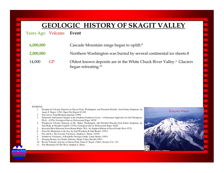
6,000,000 Cascade Mountain range began to uplift.8 2,000,000 Northern Washington was buried by several continental ice sheets.8 14,000 GP Oldest known deposits are in the White Chuck River Valley.1 Glaciers began retreating.10

SOURCES: 1. Postglacial Volcanic Deposits at Glacier Peak, Washington, and Potential Hazards from Future Eruptions, by James E. Beget, (1982, Open File Report 82-830 2. Soil survey TransMountain pipeline (1989). 3. Prehistoric Settlement Changes in the Southern Northwest Coast: A Functional Approach, by Gail Thompson, Ph.D.., (1978), Geological Survey Professional Paper 1022C 4. Postglacial Volcanic Deposits at Mt.. Baker, Washington, and Potential Hazards from Future Eruptions, by Jack Hyde & Dwight Crandell, (1978), Geological Survey Professional Paper 1022C 5. Increased Heat Emission From Mount Baker, WA., by Stephen Malone & David Frank (Post 1975) 6. From the Mountains to the Sea, by Saul Weisberg & John Riedel, (1991) 7. Fire and Ice, The Cascade Volcanoes, Stephen L. Harris, (1976) 8. Northwest Volcanoes, A Roadside Geologic Guide, Lanny Ream, (1983) 9. Sleeping Beauty, by Charles Siderius, Skagit Valley Herald (1991) 10. Recent Volcanic Activity at Glacier Peak, James E. Beget, (1982), Science Vol.. 215 11. Fire Mountains Of The West, Stephen L. Harris

G la c ie r P e a k

slide-2
SLIDE 2

2

GEOLOGIC HISTORY OF SKAGIT VALLEY

Years Ago Volcano Event

13,000 Sea level was 600 ft above present location. Deposition of estuarine and deltaic sediments began. Discharge of sediment materials would have begun around Hamilton.3 12,000 GP Violent eruption depositing widespread layers of ash.7 12-11,000 Sea level drops rapidly and becomes relatively stable.3

SOURCES: 1. Postglacial Volcanic Deposits at Glacier Peak, Washington, and Potential Hazards from Future Eruptions, by James E. Beget, (1982, Open File Report 82-830 2. Soil survey TransMountain pipeline (1989). 3. Prehistoric Settlement Changes in the Southern Northwest Coast: A Functional Approach, by Gail Thompson, Ph.D.., (1978), Geological Survey Professional Paper 1022C 4. Postglacial Volcanic Deposits at Mt.. Baker, Washington, and Potential Hazards from Future Eruptions, by Jack Hyde & Dwight Crandell, (1978), Geological Survey Professional Paper 1022C 5. Increased Heat Emission From Mount Baker, WA., by Stephen Malone & David Frank (Post 1975) 6. From the Mountains to the Sea, by Saul Weisberg & John Riedel, (1991) 7. Fire and Ice, The Cascade Volcanoes, Stephen L. Harris, (1976) 8. Northwest Volcanoes, A Roadside Geologic Guide, Lanny Ream, (1983) 9. Sleeping Beauty, by Charles Siderius, Skagit Valley Herald (1991) 10. Recent Volcanic Activity at Glacier Peak, James E. Beget, (1982), Science Vol.. 215 11. Fire Mountains Of The West, Stephen L. Harris

G la c ie r P e a k

slide-3
SLIDE 3

3

GEOLOGIC HISTORY OF SKAGIT VALLEY

Years Ago Volcano Event

11,500 GP White Chuck assemblage Lahar travels 100 km (62 miles) down Stillaguamish River Valley to Arlington. Changed the flow of the Sauk River near Darrington from the Stillaguamish River to the Skagit River. Lahar can be observed 1.8 miles west of Arlington.1 Volcano remains dormant for approximately 5,700 years. 10,350 BAKER Mount Baker erupts. Grayish brown to black ash. Prior to eruption large mudflow moves down Sulphur Creek Valley.4 10,000 BAKER Boulder Creek valley was free of ice below 4,000 ft.4

SOURCES: 1. Postglacial Volcanic Deposits at Glacier Peak, Washington, and Potential Hazards from Future Eruptions, by James E. Beget, (1982, Open File Report 82-830 2. Soil survey TransMountain pipeline (1989). 3. Prehistoric Settlement Changes in the Southern Northwest Coast: A Functional Approach, by Gail Thompson, Ph.D.., (1978), Geological Survey Professional Paper 1022C 4. Postglacial Volcanic Deposits at Mt.. Baker, Washington, and Potential Hazards from Future Eruptions, by Jack Hyde & Dwight Crandell, (1978), Geological Survey Professional Paper 1022C 5. Increased Heat Emission From Mount Baker, WA., by Stephen Malone & David Frank (Post 1975) 6. From the Mountains to the Sea, by Saul Weisberg & John Riedel, (1991) 7. Fire and Ice, The Cascade Volcanoes, Stephen L. Harris, (1976) 8. Northwest Volcanoes, A Roadside Geologic Guide, Lanny Ream, (1983) 9. Sleeping Beauty, by Charles Siderius, Skagit Valley Herald (1991) 10. Recent Volcanic Activity at Glacier Peak, James E. Beget, (1982), Science Vol.. 215 11. Fire Mountains Of The West, Stephen L. Harris

G la c ie r P e a k

slide-4
SLIDE 4

4

GEOLOGIC HISTORY OF SKAGIT VALLEY

Years Ago Volcano Event

9,000-5,000 Sea level lowers 30 to 60 feet. The Skagit Delta builds out first into Samish Bay.3 This area is referred to as the Northern Lobe and has been inactive for 5,000 years.6 8,700 BAKER Pyroclastic flows, mudflows, and two lava flows moved down Boulder Creek valley. Some of the flows reached Baker River.4,8 8,400 GP Trees grew at elevation 5,700 feet. Charcoal deposits carbon dated. Sub- alpine fir trees grow today up to a few hundred feet above this level.1

SOURCES: 1. Postglacial Volcanic Deposits at Glacier Peak, Washington, and Potential Hazards from Future Eruptions, by James E. Beget, (1982, Open File Report 82-830 2. Soil survey TransMountain pipeline (1989). 3. Prehistoric Settlement Changes in the Southern Northwest Coast: A Functional Approach, by Gail Thompson, Ph.D.., (1978), Geological Survey Professional Paper 1022C 4. Postglacial Volcanic Deposits at Mt.. Baker, Washington, and Potential Hazards from Future Eruptions, by Jack Hyde & Dwight Crandell, (1978), Geological Survey Professional Paper 1022C 5. Increased Heat Emission From Mount Baker, WA., by Stephen Malone & David Frank (Post 1975) 6. From the Mountains to the Sea, by Saul Weisberg & John Riedel, (1991) 7. Fire and Ice, The Cascade Volcanoes, Stephen L. Harris, (1976) 8. Northwest Volcanoes, A Roadside Geologic Guide, Lanny Ream, (1983) 9. Sleeping Beauty, by Charles Siderius, Skagit Valley Herald (1991) 10. Recent Volcanic Activity at Glacier Peak, James E. Beget, (1982), Science Vol.. 215 11. Fire Mountains Of The West, Stephen L. Harris

G la c ie r P e a k

slide-5
SLIDE 5

5

GEOLOGIC HISTORY OF SKAGIT VALLEY

Years Ago Volcano Event

6,000 BAKER

Very large mudflow moved 17.5 miles down the Nooksack Valley, large mudflow (lava) moved at least 7.2 miles down Sulphur Creek valley.4 The lava (Sulphur Creek) reached Baker River and forced it against its east bank.8 5,500-5,100 GP Lahar from Kennedy Creek assemblage travels 100 km (62 miles) down the Skagit. Lahar also located in Dusty Creek assemblage which also traveled down the Skagit. Very possible both lahar assemblages were affected by damning of both the White Chuck and Suiattle Rivers. Lake created on the Suiattle was at least 45' deep.1

SOURCES: 1. Postglacial Volcanic Deposits at Glacier Peak, Washington, and Potential Hazards from Future Eruptions, by James E. Beget, (1982, Open File Report 82-830 2. Soil survey TransMountain pipeline (1989). 3. Prehistoric Settlement Changes in the Southern Northwest Coast: A Functional Approach, by Gail Thompson, Ph.D.., (1978), Geological Survey Professional Paper 1022C 4. Postglacial Volcanic Deposits at Mt.. Baker, Washington, and Potential Hazards from Future Eruptions, by Jack Hyde & Dwight Crandell, (1978), Geological Survey Professional Paper 1022C 5. Increased Heat Emission From Mount Baker, WA., by Stephen Malone & David Frank (Post 1975) 6. From the Mountains to the Sea, by Saul Weisberg & John Riedel, (1991) 7. Fire and Ice, The Cascade Volcanoes, Stephen L. Harris, (1976) 8. Northwest Volcanoes, A Roadside Geologic Guide, Lanny Ream, (1983) 9. Sleeping Beauty, by Charles Siderius, Skagit Valley Herald (1991) 10. Recent Volcanic Activity at Glacier Peak, James E. Beget, (1982), Science Vol.. 215 11. Fire Mountains Of The West, Stephen L. Harris

G la c ie r P e a k

slide-6
SLIDE 6

6

GEOLOGIC HISTORY OF SKAGIT VALLEY

Years Ago Volcano Event 3,000 Western (Burlington & West Mt. Vernon) and Southern (South Mt. Vernon & Fir Island) lobes of Skagit Delta were created within last 3,000 years, first to Padilla Bay and then to Skagit Bay. The delta engulfed several islands, Burlington Hill, Bay View Ridge, & finally Pleasant Ridge.3 2,000-1,500 Anthropologist suggest Indian settlements began along Skagit River

  • tributaries. One such site has been identified along Dry Slough on Fir

Island.3

1,800 GP

Lahar reaches Sauk River down White Chuck. Believed to have been triggered by large landslide high on Glacier Peak. Clay Lahar 100 m (328 ft) thick travels down Dusty Creek Valley.1

SOURCES: 1. Postglacial Volcanic Deposits at Glacier Peak, Washington, and Potential Hazards from Future Eruptions, by James E. Beget, (1982, Open File Report 82-830 2. Soil survey TransMountain pipeline (1989). 3. Prehistoric Settlement Changes in the Southern Northwest Coast: A Functional Approach, by Gail Thompson, Ph.D.., (1978), Geological Survey Professional Paper 1022C 4. Postglacial Volcanic Deposits at Mt.. Baker, Washington, and Potential Hazards from Future Eruptions, by Jack Hyde & Dwight Crandell, (1978), Geological Survey Professional Paper 1022C 5. Increased Heat Emission From Mount Baker, WA., by Stephen Malone & David Frank (Post 1975) 6. From the Mountains to the Sea, by Saul Weisberg & John Riedel, (1991) 7. Fire and Ice, The Cascade Volcanoes, Stephen L. Harris, (1976) 8. Northwest Volcanoes, A Roadside Geologic Guide, Lanny Ream, (1983) 9. Sleeping Beauty, by Charles Siderius, Skagit Valley Herald (1991) 10. Recent Volcanic Activity at Glacier Peak, James E. Beget, (1982), Science Vol.. 215 11. Fire Mountains Of The West, Stephen L. Harris

G la c ie r P e a k

slide-7
SLIDE 7

7

GEOLOGIC HISTORY OF SKAGIT VALLEY

Years Ago Volcano Event 1,750 GP "Red" Lahar travels down White Chuck River near Crystal Creek carrying dacite-rich alluvium which underlies the town of Burlington which contains charcoal about 1,800 years old. Estimated that lahar was caused by violent eruption of Glacier Peak which produced 100 million cubic meters (130,000,000 cubic yards) of material.1 The depth

  • f volcanic material is between 3-30 feet thick.2 Several small towns

in the lower Skagit River valley are built on volcanogenic sedimentary deposits of this age.10

SOURCES: 1. Postglacial Volcanic Deposits at Glacier Peak, Washington, and Potential Hazards from Future Eruptions, by James E. Beget, (1982, Open File Report 82-830 2. Soil survey TransMountain pipeline (1989). 3. Prehistoric Settlement Changes in the Southern Northwest Coast: A Functional Approach, by Gail Thompson, Ph.D.., (1978), Geological Survey Professional Paper 1022C 4. Postglacial Volcanic Deposits at Mt.. Baker, Washington, and Potential Hazards from Future Eruptions, by Jack Hyde & Dwight Crandell, (1978), Geological Survey Professional Paper 1022C 5. Increased Heat Emission From Mount Baker, WA., by Stephen Malone & David Frank (Post 1975) 6. From the Mountains to the Sea, by Saul Weisberg & John Riedel, (1991) 7. Fire and Ice, The Cascade Volcanoes, Stephen L. Harris, (1976) 8. Northwest Volcanoes, A Roadside Geologic Guide, Lanny Ream, (1983) 9. Sleeping Beauty, by Charles Siderius, Skagit Valley Herald (1991) 10. Recent Volcanic Activity at Glacier Peak, James E. Beget, (1982), Science Vol.. 215 11. Fire Mountains Of The West, Stephen L. Harris

G la c ie r P e a k

slide-8
SLIDE 8

8

GEOLOGIC HISTORY OF SKAGIT VALLEY

Years Ago Volcano Event 1,100 GP "Remarkable" flood travels down White Chuck River creating large flood plain deposits down the Sauk River. Flood believed to have been caused by glacier-outburst. Two clay light-gray lahars travel down Dusty Creek. Lahars also travel down Chocolate Creek. Possible large flood was related to eruption but no "unequivocal evidence" to support theory.1

600 BAKER Gray and rusty brown mudflow travels down Park Creek to Baker River. Estimated volume of 2 million cubic meters (2,600,000 cubic yards). Probably caused by avalanches of hydrothermally altered rock. No fewer than four avalanches and mudflows have occurred at Baker during the last 600 years.4 Flow can be viewed where Baker Lake Road crosses Park Creek.8

SOURCES: 1. Postglacial Volcanic Deposits at Glacier Peak, Washington, and Potential Hazards from Future Eruptions, by James E. Beget, (1982, Open File Report 82-830 2. Soil survey TransMountain pipeline (1989). 3. Prehistoric Settlement Changes in the Southern Northwest Coast: A Functional Approach, by Gail Thompson, Ph.D.., (1978), Geological Survey Professional Paper 1022C 4. Postglacial Volcanic Deposits at Mt.. Baker, Washington, and Potential Hazards from Future Eruptions, by Jack Hyde & Dwight Crandell, (1978), Geological Survey Professional Paper 1022C 5. Increased Heat Emission From Mount Baker, WA., by Stephen Malone & David Frank (Post 1975) 6. From the Mountains to the Sea, by Saul Weisberg & John Riedel, (1991) 7. Fire and Ice, The Cascade Volcanoes, Stephen L. Harris, (1976) 8. Northwest Volcanoes, A Roadside Geologic Guide, Lanny Ream, (1983) 9. Sleeping Beauty, by Charles Siderius, Skagit Valley Herald (1991) 10. Recent Volcanic Activity at Glacier Peak, James E. Beget, (1982), Science Vol.. 215 11. Fire Mountains Of The West, Stephen L. Harris

G la c ie r P e a k

slide-9
SLIDE 9

9

GEOLOGIC HISTORY OF SKAGIT VALLEY

Years Ago Volcano Event

450-150 BAKER Rock debris erupts from Baker, two large mudflows moved 6.5 miles down Boulder Creek valley, large avalanche of rock debris moved at least 5.4 miles down Rainbow Creek valley.4 300-200 GP Small eruptions. Indians reported to pioneers of seeing mountain smoking.1 Evidence of a very large flood taking place in this time frame.10 >200 GP Two small lahars in Chocolate Creek.1 64 GP In 1938 a lahar buried and destroyed forests as much as 6 miles down Chocolate Creek from Chocolate Glacier. Flooding was observed far down the Suiattle and Sauk Rivers. Caused by glacier-outburst flood.1

SOURCES: 1. Postglacial Volcanic Deposits at Glacier Peak, Washington, and Potential Hazards from Future Eruptions, by James E. Beget, (1982, Open File Report 82-830 2. Soil survey TransMountain pipeline (1989). 3. Prehistoric Settlement Changes in the Southern Northwest Coast: A Functional Approach, by Gail Thompson, Ph.D.., (1978), Geological Survey Professional Paper 1022C 4. Postglacial Volcanic Deposits at Mt.. Baker, Washington, and Potential Hazards from Future Eruptions, by Jack Hyde & Dwight Crandell, (1978), Geological Survey Professional Paper 1022C 5. Increased Heat Emission From Mount Baker, WA., by Stephen Malone & David Frank (Post 1975) 6. From the Mountains to the Sea, by Saul Weisberg & John Riedel, (1991) 7. Fire and Ice, The Cascade Volcanoes, Stephen L. Harris, (1976) 8. Northwest Volcanoes, A Roadside Geologic Guide, Lanny Ream, (1983) 9. Sleeping Beauty, by Charles Siderius, Skagit Valley Herald (1991) 10. Recent Volcanic Activity at Glacier Peak, James E. Beget, (1982), Science Vol.. 215 11. Fire Mountains Of The West, Stephen L. Harris

G la c ie r P e a k

slide-10
SLIDE 10

10

GEOLOGIC HISTORY OF SKAGIT VALLEY

Years Ago Volcano Event

29 BAKER In 1975 increased steam vent activity at Sherman Crater.4 24 GP On June 20, 1980 a small lahar traveled down Dusty Creek to the Suiattle

  • River. Bark was stripped from the trees and mud was deposited on trees

and the valley walls of Dusty Creek as much as 3.3 feet above the lahar. It buried about 220,000 sq ft of riverbank and adjacent forest. The volume of material was estimated at 10,000 cubic meters (13,000 cubic yards).1 11 GP On August 17, 1993 the Skagit River ran chocolate brown. The cause, a small glacier outburst flood and resulting mudflow down Chocolate and Dusty Creek's.

SOURCES: 1. Postglacial Volcanic Deposits at Glacier Peak, Washington, and Potential Hazards from Future Eruptions, by James E. Beget, (1982, Open File Report 82-830 2. Soil survey TransMountain pipeline (1989). 3. Prehistoric Settlement Changes in the Southern Northwest Coast: A Functional Approach, by Gail Thompson, Ph.D.., (1978), Geological Survey Professional Paper 1022C 4. Postglacial Volcanic Deposits at Mt.. Baker, Washington, and Potential Hazards from Future Eruptions, by Jack Hyde & Dwight Crandell, (1978), Geological Survey Professional Paper 1022C 5. Increased Heat Emission From Mount Baker, WA., by Stephen Malone & David Frank (Post 1975) 6. From the Mountains to the Sea, by Saul Weisberg & John Riedel, (1991) 7. Fire and Ice, The Cascade Volcanoes, Stephen L. Harris, (1976) 8. Northwest Volcanoes, A Roadside Geologic Guide, Lanny Ream, (1983) 9. Sleeping Beauty, by Charles Siderius, Skagit Valley Herald (1991) 10. Recent Volcanic Activity at Glacier Peak, James E. Beget, (1982), Science Vol.. 215 11. Fire Mountains Of The West, Stephen L. Harris

G la c ie r P e a k

slide-11
SLIDE 11

11

GEOLOGIC HISTORY OF SKAGIT VALLEY

In 1792 Spanish explorers in Bellingham Bay reported "illumination and rumblings emanating from Mount Baker" and left as quickly as they possibly could. Ed Coleman, who first climbed Baker in 1866 quoted an old Indian who recalled when he was a boy the mountain burst out with a terrible fire and great smoke poisoning the fish in the Skagit River (approx. 1810). John Hiaton, Pacific Northwest Indian, claimed to have witnessed eruptions of Mt. Baker "about 1820". In 1843 Indians reported stories of an eruption that resulted in a massive fish kill in Baker River, volcanic ash, and a large forest fire east of the volcano. In 1858 local miners reported lava and apparent lahar reaching Baker River.5 Accepted dates of volcanic activity at Mt. Baker are 1843, 1854, 1858, 1859, and 1870.

SOURCES: 1. Postglacial Volcanic Deposits at Glacier Peak, Washington, and Potential Hazards from Future Eruptions, by James E. Beget, (1982, Open File Report 82-830 2. Soil survey TransMountain pipeline (1989). 3. Prehistoric Settlement Changes in the Southern Northwest Coast: A Functional Approach, by Gail Thompson, Ph.D.., (1978), Geological Survey Professional Paper 1022C 4. Postglacial Volcanic Deposits at Mt.. Baker, Washington, and Potential Hazards from Future Eruptions, by Jack Hyde & Dwight Crandell, (1978), Geological Survey Professional Paper 1022C 5. Increased Heat Emission From Mount Baker, WA., by Stephen Malone & David Frank (Post 1975) 6. From the Mountains to the Sea, by Saul Weisberg & John Riedel, (1991) 7. Fire and Ice, The Cascade Volcanoes, Stephen L. Harris, (1976) 8. Northwest Volcanoes, A Roadside Geologic Guide, Lanny Ream, (1983) 9. Sleeping Beauty, by Charles Siderius, Skagit Valley Herald (1991) 10. Recent Volcanic Activity at Glacier Peak, James E. Beget, (1982), Science Vol.. 215 11. Fire Mountains Of The West, Stephen L. Harris

G la c ie r P e a k

slide-12
SLIDE 12

12

WHAT DOES IT ALL MEAN??

Volcanic-Hazards Assessment

Future eruptions of large volume are likely to form thick fills of lahars and pyroclastic-flow deposits in the upper parts of valleys that head on the volcano. Subsequent incision of these deposits would aggrade valley floors farther downstream with sediment for many years after the eruption, thereby affecting the capacity of stream channels and locally increasing heights of floods.

THESE EFFECTS WOULD BE ESPECIALLY SIGNIFICANT FOR THE EXTENSIVE LOW-LYING AREAS OF THE SKAGIT RIVER FLOOD PLAIN AND DELTA.

SOURCE: Volcanic Hazards With Respect To Siting Nuclear Power Plants In The Pacific Northwest, USGS Open File Report 87-297 (1987)

G la c ie r P e a k

slide-13
SLIDE 13

Skagit River Basic Facts Skagit River Basic Facts

Drainage Basin = 3,140 Sq.. Miles = 2,009,600 Acres 100 Year Flood = 236,000 C.F.S. At Sedro-Woolley

  • 1 C.F.S. = 7.5 Gallons = 1,770,000 Gallons Per Second -

106,200,000 Gallons Per Minute = 6,372,000,000 Gallons Per Hour

  • One C.F.S. flowing for 24 hours will cover 2 acres to a depth of
  • ne foot

There are 68,000 acres in the Lower Skagit River Valley One Acre Foot = One acre to a depth of one foot = 325,000 Gallons

Source: U.S. Army Corps of Engineers

slide-14
SLIDE 14

Skagit River Basic Facts

  • Skagit River is potentially the most damaging river in the

Pacific Northwest.

  • November 1995 Flood - Skagit County had 25% of all FEMA

Public Assistance costs statewide, 24% of Emergency Housing, 33% Individual Grants, 29% SBA loans, 22% Flood Insurance claims.

  • 1990 Flood: Skagit County had 47% of all damages in the State
  • f Washington (COE).
  • AT LEAST 30% OF ALL SKAGIT COUNTY RESIDENTS ARE IN

AT LEAST 30% OF ALL SKAGIT COUNTY RESIDENTS ARE IN THE FLOODPLAIN VS. 6% STATEWIDE; GREATER THE FLOODPLAIN VS. 6% STATEWIDE; GREATER PERCENTAGE IN THE DELTA. PERCENTAGE IN THE DELTA.

Source: Federal Emergency Management Agency (FEMA)

slide-15
SLIDE 15

Major Flood History Major Flood History

Year Flow in Cubic Feet Per Second (C.F.S)

About 1815 400,000 at Sedro Woolley About 1856 300,000 at Sedro Woolley 1897 190,000 at Sedro Woolley 1909 220,000 at Sedro Woolley 1921 210,000 at Sedro Woolley 1951 144,000 at Mount Vernon 1975 130,000 at Mount Vernon 1990 152,000 at Mount Vernon 146,000 Concrete 1995 145,000 at Mount Vernon 160,000 Concrete 2003 129,000 at Mount Vernon 166,000 Concrete

Source: U.S. Army Corps of Engineers

slide-16
SLIDE 16

Description: General view of Reflector Bar Date: Dec 16, 1954

slide-17
SLIDE 17

Description: Skagit Damage, Davis Ranch Range Station Date: Mar 29, 1927

slide-18
SLIDE 18

Davis Ranch as it appears today. It’s under Gorge Lake where Highway 20 crosses Gorge Lake. Houses on Reflector Bar can be seen in the center background.

(Source: Picture taken 2/14/04 by Larry Kunzler)

slide-19
SLIDE 19
slide-20
SLIDE 20
slide-21
SLIDE 21

JAMES E. STEWART 1923 PRELIMINARY REPORT – FIELD JOURNAL NOTES

Page 23 Leonard Everett says 1897 flood about 9 inches lower than 1909. Says that log jam in The Dalles raised water 10 feet in 2 hours. Considerable distance and slope between 1897 and 1909 and 1921 marks. 1897 1.4 feet higher. Page 62 Measuring the lengths of rope in Dalles. Found first 100 feet only 95 feet due to shrinkage in rope. Rope probably about okay for the two Dalles sections, as it was graduated while dry but not stretched, while it was used wet and stretched. Page 69 Checks on rope graduation were made while rope was still stretched across river. It is not certain that these checks are applicable to the lower cross sections also but probably will have to be assumed so. Page 100 Ed Presentine says 1897 flood 6 inches higher than 1909 at Rockport. Says Indians claim 1897 flood highest on Sauk of all times.

(Source: James E. Stewart “Field Journal”, beginning entry November 24, 1922)

slide-22
SLIDE 22
slide-23
SLIDE 23

1894 = 15.5 1894 = 15.5 1896 = 21.6 1896 = 21.6 1897 = 21.8 1897 = 21.8 1909 = 22.2 1909 = 22.2 1921 = 21.9 1921 = 21.9 11/27/22 11/27/22 John John Larson Larson’ ’s s Place Place 1921 = 25.5 1921 = 25.5 1/28/23 1/28/23 Faber Ferry Faber Ferry 1897 = 19.2 1897 = 19.2 1909 = 18.1 1909 = 18.1 1917 = 16.2 1917 = 16.2 1921 = 19.0 1921 = 19.0 1/28/23 1/28/23 Sauk Sauk 1897 = 18.1 1897 = 18.1 1909 = 17.6 1909 = 17.6 1917 = 17.5 1917 = 17.5 1921 = 17.6 1921 = 17.6 1/28/23 1/28/23 Rockport Rockport Difference Difference btwn w/s at btwn w/s at date and date and high high-

  • water

water Date Date Place Place 1820 = 39.8 (Est) 1820 = 39.8 (Est) 1856 = 32.3 1856 = 32.3 1921 = 24.8 1921 = 24.8 1/29/23 1/29/23 At Lower At Lower End of Slope End of Slope Section Section 1820 = 45.0 (Est) 1820 = 45.0 (Est) 1856 = 36.6 (Est) 1856 = 36.6 (Est) 1921 = 21.2 1921 = 21.2 1/31/23 1/31/23 At Upper At Upper End of Slope End of Slope Section Section 1820 = 43.1 1820 = 43.1 1856 = 38.9 (Est) 1856 = 38.9 (Est) 1897 = 30.0 1897 = 30.0 1909 = 28.6 1909 = 28.6 1921 = 27.1 1921 = 27.1 11/25/22 11/25/22 At Lower At Lower End of The End of The Dalles Dalles 1820 = 53.2 1820 = 53.2 1856 = 42.1 1856 = 42.1 1897 = 36.5 1897 = 36.5 1909 = 33.3 (Est) 1909 = 33.3 (Est) 1921 = 32.0 1921 = 32.0 11/25/22 11/25/22 The Dalles at The Dalles at the Head of the Head of the Dalles the Dalles 1856 = 38.2 1856 = 38.2 1909 = 31.0 1909 = 31.0 1921 = 29.6 1921 = 29.6 11/24/22 11/24/22 1400 feet 1400 feet Above The Above The Dalles Dalles

James E. Stewart Handwritten Notes APPENDIX E

slide-24
SLIDE 24

James E. Stewart Handwritten Notes APPENDIX E

1820 = 30.0 1820 = 30.0 1856 = 26.4 1856 = 26.4 1897 = 21.2 1897 = 21.2 1906 = 21.1 1906 = 21.1 1909 = 22.9 1909 = 22.9 1917 = 20.5 1917 = 20.5 1921 = 20.7 1921 = 20.7 12/12/22 12/12/22 Sedro Sedro-

  • Woolley

Woolley 1894 = 14.4 1894 = 14.4 1897 = 17.9 1897 = 17.9 1909 & 1917 = 17.4 1909 & 1917 = 17.4 1921 = 16.2 1921 = 16.2 12/12/22 12/12/22 Cockerham Cockerham Island Island 1897 = 15.8 1897 = 15.8 1909 = 16.1 1909 = 16.1 1917 = 15.5 1917 = 15.5 1921 = 16.4 1921 = 16.4 11/27/22 11/27/22 Hamilton Hamilton 1897 = 24.0 1897 = 24.0 1909 = 22.5 (Est) 1909 = 22.5 (Est) 1921 = 21.2 1921 = 21.2 11/28/22 11/28/22 Presentine Presentine Ferry Ferry 1820 = 40.7 (Est) 1820 = 40.7 (Est) 1856 = 33.3 (Est) 1856 = 33.3 (Est) 1909 = 26.6 1909 = 26.6 1921 = 25.9 1921 = 25.9 11/28/22 11/28/22 Fessler Fessler’ ’s s Ranch Ranch

slide-25
SLIDE 25

JAMES E. STEWART 1923 REPORT 220,000 175,000 cfs 1917 260,000 185,000 cfs 1909 275,000 205,000 cfs 1897 1923 Report 1918 Report Flood year Comparison of 1918 and 1923 Flood Flows Concrete WA.

(Source: 1918 and 1923 Stewart Reports)

slide-26
SLIDE 26

H.C. Riggs & W. H. Robinson 1950 Report “Proposed Revision of Skagit River Flood Peaks”

190,000 190,000 220,000 220,000 1917 1917 210,000 210,000 240,000 240,000 1921 1921 220,000 220,000 260,000 260,000 1909 1909 230,000 230,000 275,000 275,000 1897 1897 280,000 280,000 350,000 350,000 1856 1856 400,000 400,000 500,000 500,000 1815 1815 Revision Revision 1950 1950 Stewart Stewart 1923 1923 Year Year Revision for Concrete The Revision for Concrete The Dalles Dalles 170,000 170,000 210,000 210,000 1921 1921 160,000 160,000 195,000 195,000 1917 1917 190,000 190,000 220,000 220,000 1909 1909 160,000 160,000 180,000 180,000 1906 1906 170,000 170,000 190,000 190,000 1897 1897 170,000 170,000 185,000 185,000 1896 1896 230,000 230,000 300,000 300,000 1856 1856 330,000 330,000 400,000 400,000 1815 1815 Revisions Revisions 1950 1950 Stewart Stewart 1923 1923 Year Year Revision for Sedro Revision for Sedro-

  • Woolley

Woolley

slide-27
SLIDE 27
slide-28
SLIDE 28

290,000 290,000 353,000 353,000 269,000 269,000 327,000 327,000 348,000 348,000 423,000 423,000 500 500 237,000 237,000 308,000 308,000 222,000 222,000 288,000 288,000 279,000 279,000 362,000 362,000 250 250 194,000 194,000 257,000 257,000 182,000 182,000 241,000 241,000 221,000 221,000 293,000 293,000 100 100 181,000 181,000 242,000 242,000 171,000 171,000 228,000 228,000 205,000 205,000 274,000 274,000 75 75 165,000 165,000 222,000 222,000 157,000 157,000 210,000 210,000 185,000 185,000 248,000 248,000 50 50 116,000 116,000 153,000 153,000 112,000 112,000 147,000 147,000 124,000 124,000 163,000 163,000 10 10 REG. REG. UNREG. UNREG. REG. REG. UNREG. UNREG. REG. REG. UNREG. UNREG. FLOOD FLOOD EVENT EVENT WITH STEWART WITH STEWART 1918 1918 WITHOUT STEWART WITHOUT STEWART WITH STEWART WITH STEWART FLOOD FLOW CFS RECURRENCE LEVELS FLOOD FLOW CFS RECURRENCE LEVELS[1]

[1]

(Source: Unregulated columns and Regulated With Stewart column, Corps of Engineers,

Seattle District, 2003, all other regulated columns interpolated estimates)

[1] All figures rounded to the nearest 1,000.

slide-29
SLIDE 29

REASONS FOR NOT USING STEWART DATA

  • Mr. Stewart originally calculated the 1897, 1909 and

1917 floods as floods that would occur every ten years.

(Source: Stewart Report, 1918, Page 1)

  • Mr. Stewart often recognized that his work product had

room for error and in some instances was just plain wrong.

(Sources: Stewart Report 1918, Page 11; Stewart Notes at Reflector Bar, 5/2/18; James E. Stewart “Field Journal”, beginning entry November 24, 1922; Letter to Frank Davis, Davis Ranch, from Stewart, 5/23/23; Letter to Frank Davis from Stewart, 7/6/23; Letter to Mr. T.H. Judd from Stewart, 8/22/23; Skagit River Near Sedro Woolley, Revision 1908—1922, 3/13/23; Letter to FM Veatch, District Engineer, USGS, Tacoma, WA from Stewart, 6/1/50)

slide-30
SLIDE 30

REASONS FOR NOT USING STEWART DATA

The Corps of Engineers has questioned the

accuracy of Mr. Stewart’s data. (Source: Appendix to Report

  • n Survey for Flood Control of Skagit River and Tributaries, Corps of Engineers,

2/21/52, Not For Public Release, Page 17 ¶31)

The discrepancies between calculated flows

from Mr. Stewarts 1918 and 1923 Report are never addressed. (Source: 1918 and 1923 Stewart Reports; See page

17 of Whitepaper)

His flood elevation marks are not consistent

and do not support his flow calculations.

(Source: James E. Stewart Field Log and Hand Written Notes)

slide-31
SLIDE 31

REASONS FOR NOT USING STEWART DATA

No one from USGS was ever able to reproduce

Mr. Stewarts flood flows using Stewart’s assumptions and data. (Sources: Stewart 1918 & 1923 Reports;

Proposed Revision of Skagit River Flood Peaks, H.C. Riggs & W.H. Robinson, 11/16/50; Skagit River near Concrete, Wash. – Verification Study by F.J. Flynn and M.A. Benson, 8/52; Skagit River near Sedro-Woolley, Wash., Proposed revisions of historical flood peaks, F. L. Hidaka, 1/12/54; Skagit River Flood Peaks, Memorandum

  • f Review by G. L. Bodhaine, USGS, 5/13/54)

At no time did Mr. Stewart nor USGS ever take

into consideration the log jam which Stewart documented at The Dalles which would have greatly influenced the “flood marks” located by

  • Mr. Stewart. (Sources: James E. Stewart “Field Journal”, beginning entry

November 24, 1922; Proposed Revision of Skagit River Flood Peaks, H.C. Riggs & W.H. Robinson, 11/16/50)

slide-32
SLIDE 32

REASONS FOR NOT USING STEWART DATA

During the November 21 through 25, 1990 flood

event 6 inches of rain fell at Marblemount, 15.5 inches

  • f rain fell at Reflector Bar, 11 inches of rain fell at

Glacier on the Baker River side and 11.3 inches of rain fell at Darrington on the Sauk River. The regulated peaks of 146,000 cfs and 152,000 cfs at Concrete and Mount Vernon respectively would have been 182,000 cfs and 180,000 cfs if left unregulated. One has to ask that if Stewart and USGS computations of the 1921 flood are to be believed, how did we end up with only 180,000 cfs unregulated flow with 15.5 inches of rain at Reflector Bar, and Stewart and USGS end up with 240,000 cfs and 225,000 cfs respectfully with only 10.21 inches of rain falling at Reflector Bar?

(Sources: Flood Summary Report, Nooksack, Skagit and Snohomish River Basins, November 1990 Events, Corps of Engineers, 7/18/91; (Stewart/Bodhaine Report, Geological Survey Water-Supply Paper 1527, 1961)

slide-33
SLIDE 33

HOW CAN WE RESOLVE THIS ISSUE?

  • 1. WE CAN ELIMINATE THE STEWART FLOOD

DATA AND USE THE LAST 82 YEARS WORTH OF GAGE DATA TO DETERMINE THE 100 YEAR FLOOD FLOWS.

  • 2. WE CAN TAKE OUR STATE OF THE ART

HYDRAULIC MODEL WE PAID 1.5 MILLION DOLLARS FOR, MOVE BACK THE LEVEES TO WHERE THEY WERE IN 1921, TAKE OUT THE LAND FILL AND THE FREEWAY, SIMULATE THE BREAKING OF THE LEVEES AND SEE IF THE 1990 AND 1995 FLOODS WOULD BE AS DEEP IN BURLINGTON AND CLEAR LAKE AS THEY WERE IN 1921.