foss4g foss4g seoul seoul september september 16 2015 16
play

FOSS4G, FOSS4G , Seoul Seoul September September 16, 2015 16, - PowerPoint PPT Presentation

Canton of Zrich, Switzerland Building Department, Office for Spatial Development Department of Geoinformation High-Precision Open Lidar Data of Zrich/Switzerland FOSS4G, FOSS4G , Seoul Seoul September September 16, 2015 16, 2015 1


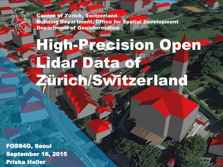
  1. Canton of Zürich, Switzerland Building Department, Office for Spatial Development Department of Geoinformation High-Precision Open Lidar Data of Zürich/Switzerland FOSS4G, FOSS4G , Seoul Seoul September September 16, 2015 16, 2015 1 Prisk Priska a Haller Haller

  2. Europe 2 https://commons.wikimedia.org/wiki/File:Blank_political_map_Europe_in_2008_WF_(with_Kosovo).svg?uselang=de

  3. Switzerland 3 https://commons.wikimedia.org/wiki/File:Blank_political_map_Europe_in_2008_WF_(with_Kosovo).svg?uselang=de

  4. Switzerland Department of Geoinformation 8’256’000 41’285 km2 German, French, Italian, Romansh Bern Confederation, consisting of 26 cantons 4 https://commons.wikimedia.org/wiki/File:Kanton_Zürich_auf_der_Schweizer_Karte.png?uselang=de

  5. Canton of Zürich Department of Geoinformation 5 https://commons.wikimedia.org/wiki/File:Kanton_Zürich_auf_der_Schweizer_Karte.png?uselang=de

  6. Canton of Zürich Department of Geoinformation 1’446’100 1729 km2 German Zürich 169 communes 6 https://commons.wikimedia.org/wiki/File:Karte_Kanton_Zürich_2010.png

  7. Department of Geoinformation About us Priska Haller Department of Geoinformation Kanton Zürich Canton of Zürich, Switzerland 7

  8. Department of Geoinformation LIDAR = Li ght d etection a nd r anging First Return Second Return Third Return Fourth Return Last Return 8

  9. Department of Geoinformation The Zürich Lidar-Project  Parent project: «Luftaufnahmen42»  Lidar  Aerial photographs  Scanning period: March / April 2014  Flight altitude: 1400 – 1800 meters a.s.l.  Helicopter + small aircraft (nightly flights above Zürich airport)  260 flight tracks, 20% overlap  62 hours flight time  Scanning angle: -20º / +20º 9

  10. Department of Geoinformation Point Classification  Ground (LAS Code 2)  Low vegetation < 50cm (LAS Code 3)  Medium vegetation < 3 m (LAS Code 4)  High vegetation > 3 m (LAS Code 5)  Buildings (LAS Code 6)  Noise, errors (LAS Code 7)  Bridges, crossings (LAS Code 10)  Overlap points (LAS Code 12)  Open wires, poles, antennas (LAS Code 15)  Other (e.g. vessels) (LAS Code 17) 10

  11. Department of Geoinformation Lidar Data and Products  Point cloud  Format: LAS 1.2 (ASPRS)  Classification: 10 classes  Point cloud of ground points, ASCII text (xyz)  Point cloud of non-ground points, ASCII text (xyz)  GeoTIFF grid for Digital Terrain Model (DTM),  GeoTIFF grid for Digital Surface Model (DSM)  Web Coverage Service DTM + DSM 11

  12. Department of Geoinformation Digital Terrain Model (DTM) / Digital Surface Model (DSM)  Digital Terrain Model (DTM)  Digital Surface Model (DSM) 12 https://commons.wikimedia.org/wiki/File:DOM_DGM.png

  13. Department of Geoinformation Calculation of DTM and DSM  Ground (LAS Code 2) DTM  Low vegetation < 50cm (LAS Code 3) DSM  Medium vegetation < 3 m (LAS Code 4)  High vegetation > 3 m (LAS Code 5)  Buildings (LAS Code 6)  Noise, errors (LAS Code 7)  Bridges, crossings (LAS Code 10)  Overlap points (LAS Code 12)  Open wires, poles, antennas (LAS Code 15)  Other (e.g. vessels) (LAS Code 17) 13

  14. Department of Geoinformation Calculation of DTM and DSM  DTM:  Triangulation of ground points (Delaunay)  LAS Code 2  0.5 m grid-model  DSM:  «Highest hit» of all first returns / grid cell  LAS Codes 2,3,4,5,6,10  Empty cells get the value of the DTM  0.5 m grid-model 14

  15. Department of Geoinformation Special Issues of the Project  Resolution & Accuracy  Scope  Repetition interval  Open Government Data 15

  16. Department of Geoinformation Resolution esolution & & Accur Accurac acy 16

  17. Department of Geoinformation Resolution & Accuracy  Resolution:  Average Point Density: 8 Points/m2  1850 GB storage  Accuracy:  horizontal: +/- 20 cm  vertical: +/- 10 cm 17

  18. Department of Geoinformation Scope Scope 18

  19. Department of Geoinformation Scope  Total coverage: 1900 km2  Area of the canton of Zürich: 1729 km2  Buffer-Zone of 500 m  Cities Zürich and Winterthur  Airport of Zürich  Permission from the Civil Aviation Authority 19

  20. Department of Geoinformation Repetition epetition inter interval val 20

  21. Department of Geoinformation Repetition Interval  Every 4 years: Laserscanning  Every 2 years: Aerial Photos  Spatiotemporal Monitoring Projects! 21

  22. Department of Geoinformation Open Da Open Data ta 22

  23. Department of Geoinformation Swiss Open Government Data Portal opendata.admin.ch WCS with DSM + DTM 23

  24. Department of Geoinformation Data downloadable at maps.zh.ch/?topic=LidarZH DSM/DTM (GeoTIFF) Lidar (laz) Point cloud ground-points (ASCII-xyz) 24

  25. Department of Geoinformation Data Download from Independent Sites 25

  26. Department of Geoinformation What does « open » mean? Licence: CC-BY 26

  27. Department of Geoinformation More about Open Government Data in Zürich / Switzerland Thursday, September 17: « Use case of a dual open strategy in the canton of Zürich, Switzerland » ( Pirmin Kalberer / Priska Haller ) 27

  28. Department of Geoinformation Some use cases … 28

  29. Department of Geoinformation 29 Thanks to Markus Schütz, potree & Martin Isenburg, rapidlasso

  30. Department of Geoinformation 30 Thanks to Markus Schütz, potree & Martin Isenburg, rapidlasso

  31. Department of Geoinformation 31

  32. Department of Geoinformation 32

  33. Department of Geoinformation 33

  34. Department of Geoinformation 34

  35. Department of Geoinformation City Model of Uster 35 Thanks to Andreas Neumann, City of Uster / Switzerland

  36. Department of Geoinformation Cada Cadastr stral al Sur Survey: ey: Detec Detection tion of of Dif Differ erent Height Le ent Height Levels els within within Buildings Buildings 36

  37. Department of Geoinformation Source: Google StreetView 37

  38. 38

  39. Department of Geoinformation Cada Cadastr stral al Sur urvey ey: : Detec Detection tion of of for orest est boun boundaries daries 39

  40. 40

  41. Department of Geoinformation Archaeology: Detection of Prehistoric Barrows 41

  42. Department of Geoinformation Forestry: Detection of Skid Trails 42

  43. Department of Geoinformation Virtual Reality as a PR Instrument Device: Oculus Rift 43

  44. Department of Geoinformation Virtual Reality as a PR Instrument Device: Oculus Rift 44

  45. Department of Geoinformation Lessons Learned  Acquiring new experience in working with very large datasets  Automatic preprocessing always needs manual postprocessing 45

  46. Department of Geoinformation Lessons Learned  Acquiring new experience in working with very large datasets  Automatic preprocessing always needs manual postprocessing  Example Prime-Tower (126 m) 46

  47. Department of Geoinformation Conclusion  Opening up the dataset was the right decision!  Development of many attractive applications and visualisations  Useful also for the authorities!  Combination of accuracy&resolution, scope, repetition interval und openness makes this dataset unique  Locational advantage for the canton of Zürich  Attractive open datasets help to promote Open Data 47

  48. Department of Geoinformation Open Your Data! 48

  49. Department of Geoinformation Questions? Priska Haller Department of Geoinformation Canton of Zürich, Switzerland priska.haller@bd.zh.ch @GISZentrumZH geoportal.zh.ch Icon credits: Noun project. Erik Johansson 49

  50. Department of Geoinformation Thank you! 50

Download Presentation
Download Policy: The content available on the website is offered to you 'AS IS' for your personal information and use only. It cannot be commercialized, licensed, or distributed on other websites without prior consent from the author. To download a presentation, simply click this link. If you encounter any difficulties during the download process, it's possible that the publisher has removed the file from their server.

Recommend


More recommend