
SLIDE 1
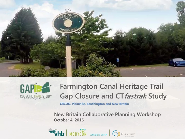
New Britain Collaborative Planning Workshop
October 4, 2016
Farmington Canal Heritage Trail Gap Closure and CTfastrak Study
CRCOG, Plainville, Southington and New Britain
Farmington Canal Heritage Trail Gap Closure and CT fastrak Study - - PowerPoint PPT Presentation
Farmington Canal Heritage Trail Gap Closure and CT fastrak Study CRCOG, Plainville, Southington and New Britain New Britain Collaborative Planning Workshop October 4, 2016 | | About CRCOG CRCOG is one of nine regional councils of
New Britain Collaborative Planning Workshop
October 4, 2016
CRCOG, Plainville, Southington and New Britain
state
– Land use planning – Transportation planning – Share municipal services – Cooperative purchasing – Hazard mitigation and more
in the Farmington Canal Heritage Trail
exercises.
solve this puzzle.
1. Close the Gap in the Farmington Canal Heritage Trail through Southington and Plainville 2. Identify a connection to the CTfastrak station in downtown New Britain
“The vision for the Farmington Canal Heritage Trail and CTfastrak Gap Closure study is to connect the communities with a world-class multi-use trail that closes the gap in the Farmington Canal Heritage Trail (FCHT) through the towns of Southington and Plainville with a connection to the CTfastrak station in downtown New Britain. These links will prioritize safety, comfort, and mobility for all users, regardless
trails that promote economic and community vitality.”
– Plainville and Southington
difficulty of Plainville section
– Active Rail Line
Britain
– Provide an alternate means for residents to access CTfastrak
the corridor)
– When complete the FCHT will traverse over 84 miles from New Haven, CT to Northampton, MA – It will serve both recreational users and commuters
design and construction
and plan for the project
as other development comes into the community
C – Charrette M – Mobile Tour PIM – Public Informational Meeting
Healthy Communities
Now that we are here … What can we do?
Is this an Complete Street?
Which focus of investment shown in the two panels to the right brings about the greatest good for a society? Places for people, or places for cars?
We have become a society that pokes fun at
sense. We have made access to housing transportation and health most available to those with wealth. These effects have raised
reduced our quality of life.
Canal Road
Orange Beach, Alabama
Canal Road
Orange Beach, Alabama
Canal Road
Orange Beach, Alabama
Canal Road
Orange Beach, Alabama
Canal Road
Orange Beach, Alabama
Canal Road
Orange Beach, Alabama
Canal Road
Orange Beach, Alabama
Canal Road
Orange Beach, Alabama
property values (CEO’s of America ($800 to $1,400/point increase)
walkability costs 1:24 of providing for the auto
with jobs than money spent on other transportation infrastructure
community they visit
Property Taxes:
Air Pollution:
Neighborhood Quality:
remaining in one's home safely, independently, and comfortably, regardless of age, income, or ability
in a familiar environment throughout one's maturing years, and the ability to enjoy the familiar daily rituals and the special events that enrich all our lives.
(National Association of Home Builders)
Most Americans contemplating a move to a new city want to know how walkable that city is, and how much choice they will have in moving about. Corporations want to retain (or hire) the best. Those families want trails.
First Mile, Last Mile: Cool Tools to Apply
First mile and last mile portions of a journey
sidewalk gaps, create place, and complete all of
are to have successful trails.
Each resident should have easy access to a recreation trail of at least 5 miles in length.
Residents (including seniors and children) should be able to have a safe and enjoyable walk
neighborhood schools, civic buildings, business areas, parks, transit stops and conservation areas.
Corridors should be designed to include restoration or enhancement of native ecological systems as well as Connecticut’s tree canopy - and provide
environmental education.
The Connecticut Greenways System should encourage social interaction within and between neighborhoods; create gathering places for social or recreational activities; and promote a sense of place for neighborhoods.
Visitors should have access to a safe and enjoyable trail of at least 5 miles in length (or about a half-day experience), as well as access to bike rentals and other amenities.
Surface (Paved or Unpaved) Storm Drainage Information Signs Historic Markers/Exhibits Bridges Emergency Telephones Bicycle Parking Event Banners Art/Sculpture Picnic/Seating Areas Crosswalks.
Trailheads Stations Signs Rest Rooms Picnic Pavilions Exhibits/Trail Maps Parking Lot Storm Drainage/Retention Landscaping / Buffers Walks Playground Bike Parking Bus Stop Site Furnishings
values that Gap Closure and CTfastrak Study will embody moving forward
– 5 Post-It notes – Write 1 word per Post-It note states a value you hold
6 9 Trip duration (minutes) S peed (mph) Access road (20- 45) Distribution road (30-50) Through road >60 15 6 unlimited
Distributor road
Access road
Call Call
Local trail users spend an average of $17 each trail use. Overnight bike tourists spend an average of $114 a day in trail communities.
1. Split up into groups 2. Push pins at trail head in north and south 3. Connect the pins with string (leave extra string) 4. Find the destinations of your assigned target group on the map, and mark them with a pin 5. Mark clusters of ~30-50 houses with a pin 6. Connect pins between houses and destinations with string
1. Briefly discuss the needs of your assigned target
2. Pin the string to the existing road network. If there are multiple roads to choose from, consider the road your target group would be most comfortable cycling. 3. How can the trail and the network fit together?
Hall, Room 504, 6-7 pm.
Tim Malone | tmalone@crcog.org | 860.522.2217 Ext. 224 Dave Head | dhead@vhb.com | 860.807.4339 Andrea Drabicki | adrabicki@vhb.com | 860.807.4357
www.gapclosurestudy.com