SLIDE 4 November-December 2015 CARGILL NEWS 37
the area where you want to capture an image. They typically charge you for a specific date and time, and if the satellite’s over the area and there are clouds, too bad—you pay anyway.” On the ground, the solar-powered, satellite-linked sensors can keep an eye on everything from illegal burning and theft to soil conditions and irrigation. “There are fires, equipment occasionally gets stolen and there are people who are going on our plantations to steal fresh palm fruit bunches and then turn around and sell them right back to us,” said
- Polski. “Better monitoring is good for the environment and it’s good
for business.” As an added bonus, some strategically chosen sensor cells can serve as internet hot spots around the plantations. Thanks to the pilot program, Poliplant’s existing network was upgraded and connected to Cargill’s technology infrastructure in just two weeks. That was a feat that was unheard of in the Indonesian palm oil industry, where plantations are often in hard-to-reach places and such efforts used to take months. Now, Poliplant employees can get
- nline without much effort and smallholders will be able to use the
network to conduct their business and exchange best practices. Ultimately, the technology should also benefit yields. Like any crop, oil palm trees depend on water, sunshine and soil conditions— variables that will be monitored by the new sensors. “This way you can predict what your crops need,” said Yogi Sookhu, founder of Gotham Analytics, the New Jersey-based firm that provided the sensors for the pilot program. “If any of the vari- ables change, you can make adjustments immediately. You’ll have advance notice of what your yield could be. Knowing that, you can plan for transportation and storage. If it’s going to be a better year than expected, you know how to manage your resources.” In a world where populations are growing and living standards are rising, higher yields are a boon for the environment. If you can grow more on the same amount of land, it’s easier to protect forests, because you simply don’t need as much new land. “Palm will yield four times a year,” said Sookhu. “It’s in con- stant harvest. So if you’re not looking at soil erosion, fertilizer and proper usage of water, you’re missing a big part of the whole sustainability story.” A telling example is the tide gate at Cargill’s PT STAL plantation in South Sumatra. The gate used to be hand-cranked, but now it’s motorized and hooked up to a soil moisture sensor. “If the sensor finds that the water has fallen below 80 percent, it will automati- cally open the gate,” Lee explained. “So we get more accurate control of our water levels. With this technology, we could precision engineer our palm plantations.”
Set for a boom
The early work with the drones and sensors shows great promise, said Cargill’s Hartmann. “It’s a complex job and there’s a lot of work still to be done, but we envision this technology really helping our work along. At the same time, as good a data gathering tool as this can be, you’ve got to remember it’s only a tool. Drones and sensors alone don’t equal sustainability. What matters is how you translate the data into actions on the ground.” “High-tech remote data-gathering is set for a boom,” said Dave McLaughlin, vice president for agriculture at World Wildlife Fund. WWF, too, now flies drones to combat illegal logging and poaching in places like Nepal and Africa. McLaughlin believes that the new technology will make it easier for Cargill to work sustainably and be transparent. “Cargill has just made zero deforestation commitments in palm
- il, so monitoring what happens in those plantations is going to be
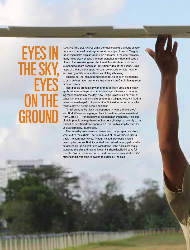
more and more important,” said McLaughlin. “Drones are a pretty inexpensive and extremely accurate way to do that in real time.” Back at the Malaysian race track, Budhi Pramono was getting ready to land his drone. “This is the most frightening moment for us as beginners,” he said. “You have to go from autopilot back to manual mode, keep the plane steady, reduce altitude continuously, fly straight to the track and, most importantly, land right on target.” With the help of this new technology, Cargill is one step closer to landing on its target: a sustainable, deforestation-free palm oil supply chain.
Prospective pilots learned the basics of drone operations: flying the planes, mapping the land and processing the data. They also spent hands-on time in the field learning how to fly the drones.