
SLIDE 1
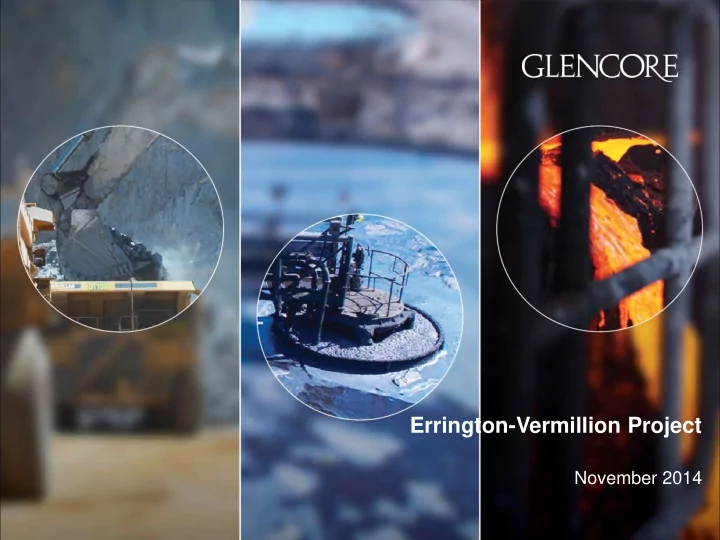
Errington-Vermillion Project
November 2014
Errington-Vermillion Project November 2014 Deposit Location and - - PowerPoint PPT Presentation
Errington-Vermillion Project November 2014 Deposit Location and Property Errington-Vermilion: A rich history The Errington-Vermilion deposits are located in the world renown Sudbury Nickel Basin, in Ontario. Both deposits were
Errington-Vermillion Project
November 2014
Deposit Location and Property
Errington-Vermilion: A rich history
in the world renown Sudbury « Nickel » Basin, in Ontario. Both deposits were discovered in the 1920’s.
began in 1924 and ended in 1928; it included three shafts and 7,925 metres of lateral development to a vertical depth of
produced from Errington;
included a 409m shaft and lateral development on 8 sub-levels totalling 5,073m. A total of 22,172 tonnes of ore were hoisted at Vermilion and stockpiled circa since 1958. The stockpile was shipped to Kidd Creek for processing in 1992.
Errington: Circa 1928
Our presence in North America
Our strong record of corporate responsibility
Erringtion-Vermilion: A polymetallic deposit:
Project Overview
Errington-Vermilion Resources: Fact Sheet
Errington Vermilion Size of orebody 10 MT 3 MT Zinc 3.8 % 4.5 % Copper 1.23% 1.46% Lead 1.06% 1.46% Silver 50.53g/t 53.77g/t Gold 0.73g/t 0.89g/t Mining Rate 4500 t/d Employment 450-500 direct jobs Yearly concentrate production Zinc: 87,800 DMT, Copper: 60,000 DMT Total Estimate Life of Mines (Errington + Vermilion) 7 years Total estimated capital cost $425-475 CADM
Errington Site Layout
Errington Site Layout
Vermilion Site Layout
Vermilion Site Layout
Geology to Tailings Management
Original Errington Deposit – Oblique View Looking North-West
Ore Lenses Historical Development, circa 1930
Oblique section looking NE
Ore Lenses Historical and newly designed development, 2014
Oblique section looking N
Actual Errington Deposit – Oblique View Looking
Original Vermilion Deposit – Oblique Section looking North-West
Ore Lenses cut by diabase dyke. Historical Development, circa 1956
Oblique section looking NW
Actual Vermilion Deposit – Oblique Section looking North-West
Ore Lenses Historical and newly designed development, 2014
Oblique section looking NW
Concentrator Process Flow
Errington Site: Water management
Ore Concentrator Tailings Storage Facility
Receiving Water Body
(Vermilion River)
Tailings Reclaim Water Discharge (145 m³/hr)
Evaporation & Precipitation
Note: All values are approximate
Raw Water Treatment Site Contact Water Domestic Water Treatment Washroom and Kitchen Water (non-potable) Sewage Treatment Plant Effluent Treatment Plant Truck Wash and Maintenance Facilites Source Water Body
Source Water Body
(Vermilion River)
Underground Mine
Fresh Water (150 m³/hr)
Capture Pond
Backfill Plant
Tailings Storage Facility
Six alternatives have been considered for tailings (and potentially-acid-generating waste rock) storage, including three different tailings storage strategies (Knight Piésold 2014). These alternatives were: Option 1: A valley impoundment for storage of a conventional tailings slurry, located approximately 750 m south of the proposed ore concentrator; Option 2: A dry stack impoundment located approximately 400 m north of the proposed ore concentrator; Option 3: A dry stack impoundment located approximately 1,100 m west of the proposed ore concentrator; Option 4: A valley impoundment for storage of a conventional tailings slurry located approximately 1,800 m south of the proposed ore concentrator; Option 5: A paddock impoundment for storage of a conventional tailings slurry located approximately 1,600 m west of the proposed ore concentrator; and Option 6: A paddock impoundment for storage of a conventional tailings slurry located approximately 3,000 m east of the proposed Plant Site. By carrying out a multi-criteria analysis that considered environmental, socio-economic, technical and economic factors, a preferred alternative has been identified. The multi-criteria analysis used a three-tiered approach, in which weightings were applied to each tier (i.e., categories, criteria and indicators).
Tailings Storage Facility – Proposed Storage Locations
Tailings Storage Facility – Proposed Storage Locations
Tailings Storage Facility – Stage 1 Elevations
Tailings Storage Facility – Final Elevations
Tailings Storage Facility – Closure Freeboard
Tailings Storage Facility - Schedule
Vermillion Site: Water management
Receiving Water Body
(Vermilion River)
Source Water Body
Source Water Body
(Vermilion Lake)
Note: All values are approximate
Raw Water Treatment
Capture Pond
Effluent Treatment Plant Backfill Plant Site Contact Water Office, Truck Wash, Sewage Treatment and Maintenance Facilities
Fresh Water (9 m³/hr)
Underground Mine
Discharge (17 m³/hr)
3
On-going Environmental Studies
A number of Baseline Studies have been conducted at the Errington site including:
assessment
Due to the change in project scope, many of the previous baseline studies require additional study
Baseline Work Completed in 2014
surveys
River below Stobie Dam/lower Whitson River, and TSF
Baseline Work Completed in 2014…/
Major Project Timelines
2012 2013 2014 2015 2016
Baseline Studies Environmental Effects Assessment Agency Review Permitting and Closure Planning Aboriginal and Stakeholder Engagement
2014 2015 2016 2017
Project Commencement
33
For more information: Brad J. Ryder
Brad.Ryder@Glencore-ca.com
Tel 416 775 1434