
SLIDE 1
IT2EC 2020 IT2EC Extended Abstract Template Presentation/Panel
Dynamic Synthetic Environments for Defence – A Service Based Approach
Andrew Churchward
Principal Engineer – XPI Simulation Ltd, UK
Abstract — The provision of a dynamic and deformable terrain which can update to reflect events occurring within a Synthetic Environment is often lacking in modelling and simulation systems and limited to standalone simulations
- r simplistic changes in terrain state. There is a need for a dynamic terrain representation in distributed simulation
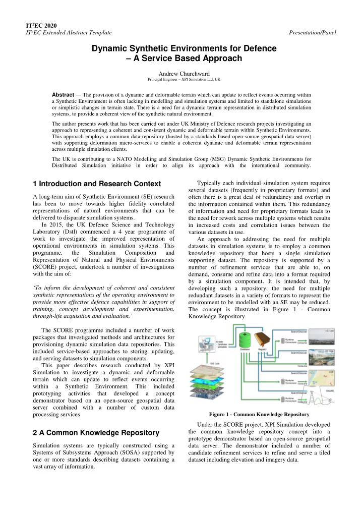
systems, to provide a coherent view of the synthetic natural environment. The author presents work that has been carried out under UK Ministry of Defence research projects investigating an approach to representing a coherent and consistent dynamic and deformable terrain within Synthetic Environments. This approach employs a common data repository (hosted by a standards based open-source geospatial data server) with supporting deformation micro-services to enable a coherent dynamic and deformable terrain representation across multiple simulation clients. The UK is contributing to a NATO Modelling and Simulation Group (MSG) Dynamic Synthetic Environments for Distributed Simulation initiative in order to align its approach with the international community.
1 Introduction and Research Context
A long-term aim of Synthetic Environment (SE) research has been to move towards higher fidelity correlated representations of natural environments that can be delivered to disparate simulation systems. In 2015, the UK Defence Science and Technology Laboratory (Dstl) commenced a 4 year programme of work to investigate the improved representation of
- perational environments in simulation systems. This
programme, the Simulation Composition and Representation of Natural and Physical Environments (SCORE) project, undertook a number of investigations with the aim of: ‘To inform the development of coherent and consistent synthetic representations of the operating environment to provide more effective defence capabilities in support of training, concept development and experimentation, through-life acquisition and evaluation.’ The SCORE programme included a number of work packages that investigated methods and architectures for provisioning dynamic simulation data repositories. This included service-based approaches to storing, updating, and serving datasets to simulation components. This paper describes research conducted by XPI Simulation to investigate a dynamic and deformable terrain which can update to reflect events occurring within a Synthetic Environment. This included prototyping activities that developed a concept demonstrator based on an open-source geospatial data server combined with a number of custom data processing services
2 A Common Knowledge Repository
Simulation systems are typically constructed using a Systems of Subsystems Approach (SOSA) supported by
- ne or more standards describing datasets containing a
vast array of information. Typically each individual simulation system requires several datasets (frequently in proprietary formats) and
- ften there is a great deal of redundancy and overlap in
the information contained within them. This redundancy
- f information and need for proprietary formats leads to