
SLIDE 1
DLA 2015 Dessau
Stephen Ervin Harvard GSD
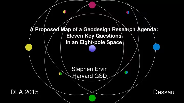
A Proposed Map of a Geodesign Research Agenda: Eleven Key Questions in an Eight-pole Space
DLA 2015 - - PowerPoint PPT Presentation
A Proposed Map of a Geodesign Research Agenda: Eleven Key Questions in an Eight-pole Space Stephen Ervin Harvard GSD DLA 2015 Dessau Why might we need a Geodesign Research
DLA 2015 Dessau
Stephen Ervin Harvard GSD
A Proposed Map of a Geodesign Research Agenda: Eleven Key Questions in an Eight-pole Space
In around 2004, Jack Dangermond, MLA, CEO of ESRI, maker of ArcInfo GIS software, asked: “Why don’t designers use our software more?”
...which led to a series of conversations and gatherings, conferences and ‘summit’s, and his coining
What to tackle:
answerable (& unanswerable?) ... Why?
language, identify voids, guide future work & engage education…
The human Society The computer
'system / toolbox'
( e.g. constraints, diagrams, simulation...)
somewhat ‘instrumental’ focus…
Miller, 2012.
Introducing Geodesign:The Concept. White paper. ESRI Press.
agenda on the framework
generates research questions?
and procedurally strong
‘who’, scale, issues
Spatial Introduces Design Explicitly…
Disciplines
into 4 poles…
Information Technologies People of the Place Design Professionals Geographic Science
Geographic Information Systems / Technology Critical GIS Computer Aided Design / Artificial Intelligence Collaboration / Participation
Information Technologies People of the Place Design Professionals Geographic Science
Collaboration / Participation Critical GIS Computer Aided Design / Artificial Intelligence Geographic Information Systems / Technology
Information Technologies Design Professionals People of the Place
Existential/Reflective Collaboration / Participation Critical GIS Computer Aided Design / Artificial Intelligence Geographic Information Systems / Technology
ERVIN FOSTER ROCHE FISHER GOODCHILD NYERGES SHEARER SHEARER SHEARER TOMLIN WITTNER WITTNER STEINITZ STEINITZ MILLER FISHER GOODCHILD WILSON
Geographic Science
What are some examples of projects - real or imagined - that clearly and convincingly serve to define what Geodesign is and, importantly, what it isn’t? — Dana Tomlin What are the relationships between “problem type/size/scale" and effective “ways of designing”? How complex do models need to be in order to properly inform and influence geodesign decisions? — Carl Steinitz What does the doing of 'critical geodesign' mean? — Matt Wilson How can GIS technology be extended to include/cover all of the elements of a geodesign ontology (including e.g. dynamics, interactions, affordances, and especially “purpose” — answers to “why?” questions)? — Mike Goodchild What role might geodesign play in addressing the "grand challenges" of our time and how might these tools and methods be more widely used in order to deal with those challenges? — Tom Fisher What distinguishes geodesign from similar processes? — Kelleann Foster What are the roles of diagrams in geodesign and how might they be digitally represented and computed with? — Stephen Ervin To what extent should (or would) geodesign approaches and practices benefit from (as well as shape) innovative smart environments in order to improve or facilitate citizen engagement? — Stephane Roche How is geodesign different from “traditional design” methods? Does the notion of "primary generator" have relevance to (or meaning in the context of) geodesign? What would be the best use(s) of AI in geodesign? — Allan Shearer
FLAXMAN FLAXMAN
How can/should 2D planning tools and 3D simulation tools interact? What are desirable attributes of ‘geodesign dashboards’? What tools/techniques are required for productive multi-party web-enabled collaboration in geodesign? — Eric Wittner & Bill Miller Which social and technical methods need to be developed to support routine geodesign use and updating of "best available science"? Mike Flaxman What system architecture(s) can form the basis of an end-to-end and top-to-bottom geodesign environment to address complex sustainable systems (decision) interventions that are theoretically sound and practically useful? — Timothy Nyerges
What are some examples of projects - real or imagined - that clearly and convincingly serve to define what Geodesign is and, importantly, what it isn’t? — Dana Tomlin What are the relationships between “problem type/size/scale" and effective “ways of designing”? How complex do models need to be in order to properly inform and influence geodesign decisions? — Carl Steinitz How can/should 2D planning tools and 3D simulation tools interact? What are desirable attributes of ‘geodesign dashboards’? What tools/techniques are required for productive multi-party web-enabled collaboration in geodesign? — Eric Wittner & Bill Miller Which social and technical methods need to be developed to support routine geodesign use and updating of "best available science"? Mike Flaxman ? What does the doing of 'critical geodesign' mean? — Matt Wilson What system architecture(s) can form the basis of an end-to-end and top-to-bottom geodesign environment to address complex sustainable systems (decision) interventions that are theoretically sound and practically useful? — Timothy Nyerges How can GIS technology be extended to include/cover all of the elements of a geodesign ontology (including e.g. dynamics, interactions, affordances, and especially “purpose” — answers to “why?” questions)? — Mike Goodchild What role might geodesign play in addressing the "grand challenges" of our time and how might these tools and methods be more widely used in order to deal with those challenges? — Tom Fisher What distinguishes geodesign from similar processes? — Kelleann Foster What are the roles of diagrams in geodesign and how might they be digitally represented and computed with? — Stephen Ervin To what extent should (or would) geodesign approaches and practices benefit from (as well as shape) innovative smart environments in order to improve or facilitate citizen engagement? — Stephane Roche How is geodesign different from “traditional design” methods? Does the notion of "primary generator" have relevance to (or meaning in the context of) geodesign? What would be the best use(s) of AI in geodesign? — Allan Shearer
geodesign, and that should drive a big part of the research enterprise
research in GIS&T, AI,ITC, social computing, etc….)
Observation 1:
Carl Steinitz:
interaction -> INTEROPERABILITY between four domains; so a key research topic is interoperability — between people, systems, disciplines, models, etc — This requires shared language, data models, …
Observation 5:
Social Networks / Crowdsourcing Geodesign !
Design: "Where do design ideas come from, and how?” Geographic Science: "What do we know about the earth and natural processes, and human settlements and processes, and how can they be described ?” Information Technologies: "What can (and cannot) be computed, how and why?” People of the Place: "How do people perceive & value environments, both real and represented?" Four major Poles:
'Participatory/Collaborative Design’: "How can participatory/collaborative design best work?” 'Critical GIS’: "What are the _real_ meanings of a map/diagram/proposed plan?” 'Geographic Information Systems / Technologies' : "What about the earth, natural processes, human settlements, and space/place can be computed, and how?” 'Computer Aided Design / Artificial Intelligence’: "What do we know about design thinking and processes, and how can they can be aided or automated by computation ?"
Four major Intersections:
'Social Networks’’: "How do computation & telecommunications shape human society?" 'Geodesign’: "What does GIS/T have to do with design, and vice versa?" Two minor Intersections:
'Existential’: "How is geodesign like and unlike any other human or computational activity?" And One Last:
Design: "Where do design ideas come from, and how?” Geographic Science: "What do we know about the earth and natural processes, and human settlements and processes, and how can they be described ?” Information Technologies: "What can (and cannot) be computed, how and why?” People of the Place: "How do people perceive & value environments, both real and represented?” 'Participatory/Collaborative Design’: "How can participatory/collaborative design best work?” 'Critical GIS’: "What are the _real_ meanings of a map/diagram/proposed plan?” 'Geographic Information Systems / Technologies' : "What about the earth, natural processes, human settlements, and space/place can be computed, and how?” 'Computer Aided Design / Artificial Intelligence’: "What do we know about design thinking and processes, and how can they can be aided or automated by computation ?” 'Social Networks’’: "How do computation & telecommunications shape human society?" 'Geodesign’: "What does GIS/T have to do with design, and vice versa?” 'Existential’: "How is geodesign like and unlike any other human or computational activity?"
needed to push research along…Various precedents to guide - new modes/forms of research are indicated…
The human
Society The computer
servin@gsd.harvard.edu