SLIDE 1
March 2015
DEVELOPMENT AREA 6
CONSIDERATION OF MATTERS PRESENTED IN CRG MEETING – 19 MARCH 2015
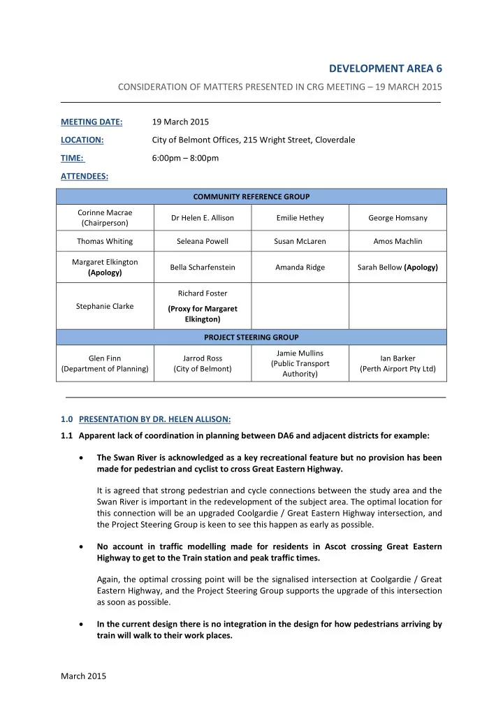
MEETING DATE: 19 March 2015 LOCATION: City of Belmont Offices, 215 Wright Street, Cloverdale TIME: 6:00pm – 8:00pm ATTENDEES:
COMMUNITY REFERENCE GROUP Corinne Macrae (Chairperson) Dr Helen E. Allison Emilie Hethey George Homsany Thomas Whiting Seleana Powell Susan McLaren Amos Machlin Margaret Elkington (Apology) Bella Scharfenstein Amanda Ridge Sarah Bellow (Apology) Stephanie Clarke Richard Foster (Proxy for Margaret Elkington) PROJECT STEERING GROUP Glen Finn (Department of Planning) Jarrod Ross (City of Belmont) Jamie Mullins (Public Transport Authority) Ian Barker (Perth Airport Pty Ltd)
1.0 PRESENTATION BY DR. HELEN ALLISON: 1.1 Apparent lack of coordination in planning between DA6 and adjacent districts for example: The Swan River is acknowledged as a key recreational feature but no provision has been made for pedestrian and cyclist to cross Great Eastern Highway. It is agreed that strong pedestrian and cycle connections between the study area and the Swan River is important in the redevelopment of the subject area. The optimal location for this connection will be an upgraded Coolgardie / Great Eastern Highway intersection, and the Project Steering Group is keen to see this happen as early as possible. No account in traffic modelling made for residents in Ascot crossing Great Eastern Highway to get to the Train station and peak traffic times. Again, the optimal crossing point will be the signalised intersection at Coolgardie / Great Eastern Highway, and the Project Steering Group supports the upgrade of this intersection as soon as possible. In the current design there is no integration in the design for how pedestrians arriving by train will walk to their work places.
SLIDE 2 March 2015 The current planning work does not include detailed road designs which would identify pedestrian/cycle paths, as this type of detailed work is only undertaken after a vision is put in
- place. The work that has been undertaken, however, indicates that streets will be specifically
designed to accommodate pedestrians and cyclists, particularly within proximity of the station where there will be the highest demand for such facilities. The Project Steering Group will continue to work on improving these connections. 1.2 Excluding the bushland and wetland areas within Perth Airport, minimal natural vegetation remains within the City of Belmont- less than 2% of the original extent. It is noted that within the existing residential area there is limited natural vegetation, and the Project Steering Group are committed to retaining mature trees wherever possible. 1.3 Every attempt should be made to retain and rehabilitate the small remnants that remain. All large trees are important and should be retained if possible. The Project Steering Group completely agrees and supports this statement, and will look to retain and enhance remnant vegetation wherever feasible. 1.4 Southern Main Drain. Consideration to the creation of a designed wetland, to enhance biodiversity values and act as a compensating basin, in DA6 would be a great idea - as
- pposed to the straight line drain it currently is.
The Project Steering Group is working with a drainage consultant to ensure that the design of the southern main drain is integrated with the design of the surrounding area. It is anticipated that this will incorporate a living stream and some form of compensation basin within the primary public open space area adjacent to First Avenue. The actual design work for the drainage will not be finalised until later in 2015, but the suggestion of a designed wetland has been noted and will be considered by the drainage consultant as a component of the design. 2.0 PRESENTATION BY MR. GEORGE HOMSANY: 2.1 (Refer Slide 1) The concept proposal to design a large enough roundabout at the GEH intersection @ Brearley Ave to ease traffic congestion, which is possible due to the large area available adjacent to the proposed roundabout as depicted in the slide. The concept also depicted closing off the south side carriageway of Brearley Ave, leaving the north side of Brearley Ave open modifying it to a 2 way street and realigning it to GEH to create a safer entry & intersection point into the roundabout. The advantages were to allow local residents to gain safe access and egress from that area & for others to access the train station and the greater part of Belmont. The concept of the total closure of Brearley Ave may reduce traffic congestion marginally on GEH in the future but the south bound traffic off Tonkin that filters
- nto GEH will still need traffic lights therefore I & others within the CRG do not understand
what will be achieved with the closure of Brearley. The removal of the Brearley Avenue connection to GEH removes two of the four signal phases from this intersection. This has a significant impact on GEH as the amount of green time that can be allocated to GEH can be significantly increased. Green time cannot be taken from the Tonkin Highway southbound off ramp due to safety concerns if the queues do extend back to Tonkin Highway, a high speed environment. Whilst Main Roads WA are currently trying to use roundabouts instead of new signalised intersections where possible, Main Roads WA need to maintain control of the queuing that
- ccurs on the Tonkin Highway southbound off ramp. A roundabout is an uncontrolled measure
SLIDE 3 March 2015 that has the possibility to not favour the off ramp in some instances, therefore possibly resulting in queues that extend back to Tonkin Highway. It would also be difficult to provide a safe crossing point for pedestrians and recreational cyclists at a roundabout of the size and lane configuration required. The Project Steering Group is continuing to work to ensure that the alternative connections into and out of Development Area 6 are adequate to cater for the expected traffic volumes in the absence of Brearley Avenue. 2.2 The train station location, in regards to Northing and Easting positioning, should be as close as possible to the roundabout at Dunreath Rd with the advantages being less distance for commuters to walk to the airport terminals as well as minimising the impact of its location on the residence’s and the current area availability. The proposed station foot print is too large and should be reduced to a modest size with the proposed alternative concept presented consisting of a North & South wing connected with an outdoor alfresco area that are elevated above both sides of Brearley Ave which are to remain open adjacent to the Brearley Ave & Dunreath Rd Roundabout. The advantages of this proposal is the creation of a covered area for drop offs and pickups, low impact to the area due to it being on structural columns, minimum vegetation and tree removal as they will be incorporated within the alfresco area. The closure of the south side of Brearley Ave from GEH to Second St creates an area on the
- pen section of road from Dunreath Rd to Second St with a no through Rd for a Station car
- park. A small 3 way roundabout should be installed at the intersection of Second St and
Brearley Ave allowing a smooth & safe traffic flow for residents and people from the greater part of Belmont to access the future infrastructures. The station has been located as close as physically possible to the Brearley Ave / Dunreath Drive intersection taking into account the station and tunnelling construction constraints and the ultimate rail and bus operational requirements. The station footprint has been designed for ultimate patronage requirements. The inclusion of alfresco areas and design features to minimise the impact of the station on the surrounding area are being considered by the station architect. 2.3 The current proposed area designated for the Station car park requires the total removal of the few remaining endemic trees and vegetation in the Belmont area. As presented on the slide showing the existing car parks, there is so much area already allocated to existing car parks in close proximity to the proposed station location, the recommendation is to approach the Corporate Bodies who manage these car park facilities and create an agreement so those underutilised car park areas can be used for commuters using the train service. If an agreement can be made then the proposed Station car park wouldn’t be required & the current car parks can continue to be utilised ensuring a sustainable income for the corporations who manage these facilities which will then ensure the preservation of the ecology of the area. The parking areas already constructed on the Airport are required to ensure that future aviation related parking demand can be met, and it is anticipated that these will continue to be required by the airport. If a section of existing car park was to be allocated for train passengers, then an equivalent number of car park spaces would need to be constructed elsewhere in the area. All new stations must have sufficient, dedicated and controlled car parking made available within close proximity, or the overflow parking on verges within the surrounding area becomes a significant issue.
SLIDE 4 March 2015 2.4 The existing wet land area and open drainage system adjacent to the proposed station location should be preserved and enhanced with the reintroduction of endemic native flora and native trees which will in turn will encourage the return of endemic marsupials and birds within this area. The advantages of this being the recreation of a once thriving ecosystem which will provide a natural environment for people to enjoy and children to learn & can be driven by the local community inviting school children to help plant out, design and enhance. The Project Steering Group is working with a drainage consultant to ensure that the design of the southern main drain is integrated with the design of the surrounding area. It is anticipated that this will incorporate a living stream and some form of compensation basin within the study
- area. This work will also include the preparation of landscape designs by the project team’s
landscape architect. The actual design work for the drainage and landscape designs will not be finalised until later in 2015, but the suggestion of introducing endemic species has been noted and will be considered by the project team. 3.0 PRESENTATION BY MR. RICHARD FOSTER 3.1 The size constraints of Development Area 6: The Vision Plan proposes too much vehicle traffic flow through such a small area. (up to 2,500 vehicle movements/day, just for the Train/Bus Station). Across an entire day, the vehicle movements related to the station is relatively low. Even during the AM peak period, there are minimal adverse impacts on the local road network. It should be noted that this AM peak period relating to the station will occur before the AM school peak period. 3.2 The Community Open Day: Ref Board 11A and its propositions: these will have a negative impact on Redcliffe DA6 and the SAFETY of residents entering their suburb. The closure of Brearley Avenue will direct local traffic to enter via Coolgardie Avenue traffic lights where there is no right hand turn. Traffic and pedestrian safety is of the utmost importance to the Project Steering Group. It is recognised that the closure of Brearley Avenue will increase right turn traffic movements at GEH / Coolgardie Avenue, and to this extent the Project Steering Group is supportive of the upgrade of this intersection to better cater for the increased traffic volumes. It is also recognised that pedestrian crossing points from the DA6 area to the Swan River foreshore are currently poor, and an upgrade to the GEH / Coolgardie Avenue intersection would assist in improving these movements. The timing of an upgrade to this intersection remains unclear at this point of the project, however, as it is currently linked to the wider upgrade of Great Eastern Highway. This is a matter that the Project Steering Group will continue to work on with a view that this upgrade should occur as early as possible. 3.3 Reinstating the road grid and traffic flow management There is a logical argument for Brearley Avenue to remain open with simple modifications made to the Great Eastern Highway intersection.
SLIDE 5 March 2015 This has been raised with Main Roads WA and they are not supportive of maintaining the Brearley Avenue / Great Eastern Highway intersection. The Project Steering Group supports Main Roads decision based on the evidence and rationale provided. The planning for Development Area 6 will continue on the assumption that Brearley Avenue will be closed during 2016. There is evidence that impact on Redcliffe DA6 has not been thought through by the traffic movement consultants. The safety issues of having the Coolgardie Avenue intersection as the ONLY access point off GEH to the suburb have been ignored and argued against without acknowledging this will create a traffic hazard. The Project Steering Group recognises that the closure of Brearley Avenue will increase traffic movements at the Coolgardie Avenue intersection, as per the comments in 3.2
- above. The potential issues that may occur, and the benefits of an upgrade to this
intersection, are noted by the group and we are continuing to work on progressing an upgrade to this intersection as early as possible. 3.4 The Train/Bus Station - Critique of the Design as Presented in the Vision The station footprint is too large and is disproportionate to the size of the DA6 area. The size of the station and bus infrastructure is as small as it can be based on the engineering standards and constraints we are required to meet. The station itself requires significant infrastructure to cater for the operation of the rail, and the movement of passengers, and as such the station is required to have a minimum length of 150m at ground level. The bus circuit has been designed around the station to minimise the impact
- f this infrastructure on pedestrian movements throughout the precinct.
The Vision’s design for traffic to flow around the train station will create a gridlock. The ultimate future year Vision design has multiple internal and external connections and there is enough capacity on the network to cater for the increase in land use densities. It must also be noted that Qantas will have likely moved to the Airport Central location before the Vision is fully developed. Vehicle/pedestrian/bicycle traffic to be 'interwoven' at the train station will create a nexus of conflict. The safety of all road users is of the utmost priority to the Project Steering Group. The need to upgrade existing roads to ensure that they can safely cater for vehicles, bicycles and pedestrians as a result of development has been noted on several occasions. This detailed design can only commence once the Vision Plan has been agreed. There is no allowance for parking for a shopping precinct. Vehicle parking for retail operations is required as a component of individual development applications and would not be provided within the public realm. As a result, it is not shown
- n any of the Vision Plans. The Project Steering Group anticipates that the majority of
developments will be multi storey buildings, with parking either below ground or contained within the built form. In any event, it will be the responsibility of developers to demonstrate that they can provide sufficient parking within their site prior to their development application gaining approval.
SLIDE 6
March 2015 The proposed Station is surrounded by 'busy' roads. Unless underpasses or overpasses are provided, this will create a hazard for Pedestrian/bicycle users who have been ignored in the design. The traffic modelling and design do not support this assertion. The traffic modelling indicates that the proposed road network will be entirely sufficient to cater for the predicted traffic volumes. The safety of the upgraded road network, particularly for pedestrians and cyclists, will largely be a function of design of the roads themselves. This work is yet to be undertaken, but the safety of all using the road network will be of the utmost priority. No exit to Dunreath provided for vehicles that have entered the train station precinct from Dunreath. Traffic will have to exit via Coolgardie, Boulder, Central and Bulong through the suburb further reducing the chance of a pedestrian/bicycle friendly 'village' atmosphere and creating an internal ‘rat run’ of traffic movement. This may be a misinterpretation of the draft Vision Plan. A vehicle that accesses Central Avenue from Dunreath Drive may turn immediately right to access the ‘Kiss and Ride’ bays if they are looking to do a drop-off or pick-up from the station. Alternatively traffic may exit via Second Street, or they may choose to leave via Coolgardie, Boulder, Central or Bulong (provided that access to Great Eastern Highway is made available). The only alternative to provide secondary access to Dunreath would be to provide an additional connection from the subject area to Dunreath Drive (logically at Coolgardie Avenue) which is not considered desirable by the Project Steering Group. 3.5 The Timeline for the different phases of Development Area 6 The upgrade of Great Eastern Highway from Tonkin Hwy to the GEH Bypass is crucial to accommodate the increased traffic being directed into and out of the DA6 area (to access the train station) and cope with an exponential increase in residents from 300 to 3000. The upgrade of this extent of GEH is required in the ultimate future year, not only for the DA6 area, but also to allow GEH to perform at a satisfactory level. Main Roads WA has developed concept plans to upgrade this section of GEH, however these upgrades are currently unfunded. MRWA plans to upgrade GEH, is unfunded until at least 2035. The Project Steering Group understands that the Great Eastern Highway upgrade (Tonkin to GEH Bypass) is currently unfunded, but there is no set timeframe assigned to the funding status. Why is it unfunded when it is a major component of a major transport orientated development? The traffic modelling undertaken by Main Roads WA and the Project Steering Group do not indicate that the upgrade of Great Eastern Highway is a necessary component of the Forrestfield Airport Link or the redevelopment within Development Area 6 during the project period. It is, however, recognised that additional traffic pressure will occur at the Coolgardie Avenue / GEH intersection, and this should be the subject of a planned upgrade as early as possible.
SLIDE 7 March 2015 Concern raised that the Gateway Project starts/finishes at GEH. The extent of the Gateway project has been public knowledge for several years. The upgrade of Great Eastern Highway (Tonkin to the GEH Bypass) has been planned by Main Roads WA, but no funding or timeframe has been identified as yet. One lane entrance off GEH from the City to Tonkin Hwy and Gateway Project, which WILL carry the MOST traffic to the Airport from the City - Brearley Avenue had 2 lanes to access ONLY the Domestic Terminal. The right turn from GEH into Brearley Avenue has two lanes so that more vehicles can turn in the green time provided by the signals. The single lane from GEH is controlled by a through lane signal and the GEH through movements receive much more green time than the GEH right turn movements currently do at Brearley Avenue. Main Roads has designed Gateway WA to provide access to the airport with a number of changes to the road network, including the closure of Brearley Avenue. Congestion on GEH area and safety. The safety of motorists, cyclists and pedestrians both within DA6 and within the surrounding area is of the utmost importance to the Project Steering Group. The traffic modelling undertaken has indicated that the proposed road network will sufficiently cater for the traffic movements provided that upgrades to these roads are undertaken. This more detailed planning of road upgrades will only be undertaken once the Vision Plan has been approved, but road safety and potential congestion will be key factors in the design. 3.6 Community Involvement (that is listened to) before 'boards 'concepts are presented to the general public. There is no evidence that the ideas/recommendations of the community have been adopted or even acknowledged. The consultation process needs to be shown to be meaningful, but the adoption of the resident’s proposals. The Project Steering Group is actively listening to the concerns of the local community. In
- rder to engage with the community the Project Steering Group needs to provide
information and concepts to elicit debate and to create an optimal outcome for all residents of Belmont. The Vision Plan being reviewed is based upon extensive consultation and community feedback in 2013 and upholds the values provided by the community at that time. 4.0 PRESENTATION BY MS. BELLA SCHARFENSTEIN: 4.1 The current planning framework, at a Residential (R20) zoning remains in effect and single storey residences have been approved and continue to be constructed in the area. Yet, this seems to contradict the objectives of the Vision Plan and creates confusion. We understand that until the next stage of DA6 is implemented existing regulations must remain in effect, however, continuing to let residents labour under a misapprehension runs the risk of meeting with resistance and protest when the land assembly process is initiated, despite the (an unsubstantiated promise) of realising handsome returns on their properties through rezoning.
SLIDE 8 March 2015 In the interim period, the existing planning framework must remain in place to ensure that landowners and residents can continue to enjoy their properties without unreasonable
- interference. The ‘Development Area’ allocation of DA6 under the provisions of Local Planning
Scheme No. 15 ensure that the City gives due consideration of a development proposal in the context of future planning for the area, to ensure that a development now does not compromise development opportunity into the future. By way of example, if a landowner wished to demolish an existing house, and develop a new house, the City would not restrict this solely on the basis of future planning for the area, as this would be an unreasonable restriction on the landowner to enjoy their property. If that same landowner proposed to demolish their home and replace it with eight apartments, however, the City would likely restrict the development on the basis of future planning for the area, as the additional subdivision and property ownership of that portion of land likely would restrict development potential into the future. Speculation over property values (whether substantiated or not) is beyond the Project Steering Group’s immediate control. We can only provide accurate and relevant information to landowners to ensure that they are not labouring under any misapprehension. The potential for land assembly requirements has not yet been foreshadowed, and will only be undertaken in consultation with the local community, and full realisation of the commercial realities of such requirements. 4.2 The Stakeholders need to provide all residents a clear written explanation of the objectives of DA6 in relation to the transformation of the area with a uniform high density multi storey residences, clearly indicating that existing residents will be required to either amalgamate blocks with neighbours and redevelop their properties themselves to specific and rigorous design guidelines or relinquish their land to developers. This is a worthy point and one which will be taken up in the Vision Plan and Implementation Strategy. The Draft Vision Plan and Implementation Strategy, upon release for public comment in mid 2015, will clearly outline the objectives in relation to the transformation of DA6, as the previous Vision Plan (2013) outlined. The potential scenarios with respect to land assembly can also be included within the draft Vision Plan as they are important for understanding implementation – but the actual requirements, as opposed to the potential scenarios, would not be determined until development guidelines were prepared for DA6. These guidelines would be prepared in consultation with the local community and with a full realisation of the commercial reality of land assembly requirements. 4.3 Specifically inform the residents : Of the anticipated time frames in relation to construction of new high density housing in the area. Construction of private development is at the discretion of individual property owners. It would be reasonable to anticipate that property development will commence upon the removal of impediments (zoning, rail construction timeframes and road construction timeframes). On this basis, the Project Steering Group could anticipate that some development may occur during the rail construction period of 2016 – 2020, with the bulk
- f the private development occurring after 2020.
SLIDE 9 March 2015 How long residents can expect to remain living in their existing residences after their properties have been rezoned. The timeframe for residents to remain in their existing residents is entirely at their
- discretion. Neither the City nor the WAPC have any ability to force landowners to
redevelop their properties to meet new planning requirements. How the land assembly process will unfold. As per your suggestion in 4.1, options for land assembly will be considered in the draft Vision Plan and Implementation Strategy, and will be further detailed and outlined as a component of the design guidelines during the next stages of the project. As to whether Council or WAPC will facilitate introduction of residents to potential developers, and how this will occur. Neither the City nor the WAPC will be facilitating the introduction of residents to potential
- developers. The development industry is well attuned to redevelopment opportunities
and will likely investigate opportunities to work with landowners on development options, but this will be in negotiation with those landowners. It would be inappropriate for the City
- r the WAPC to intervene or interfere in this process, as we will be the arbitrators of formal
development applications once lodged. Protect residents from bearing the higher council rates because of the rezoning. Individual properties are rated based on Gross Rental Value, which is a measure established by the Valuer General. If the Valuer General considers that your property value (Gross Rental Value) has increased, then your rates may be increased proportionately. The Project Steering Group has no influence over the factors taken into account in determining the Gross Rental Value of individual properties, and cannot take this into account in planning for the local area. 4.4 Incentivize, positively not punitively: offers for resident’s land needs to be sufficient to encourage them to leave. The amount offered for an individual’s property is beyond the control of the Project Steering
- Group. The price will be determined by the market based on demand and supply at the time,
along with the development potential offered as a result of rezoning and infrastructure upgrades throughout the area. It is recognised that in order to achieve the development desired the design guidelines need to be realistic to ensure that outcomes are commercially feasible. It is equally important, however, to ensure that the planning for the area is orderly and proper, and good planning outcomes for the longer term are not diminished by short term financial gains. 4.5 Have a series of formal meetings with residents on the above, include representatives from the development industry. This is a very worthy suggestion and one that the Project Steering Group will take on board. It is anticipated that when design guidelines are prepared for DA6 a series of community engagement and public consultation events will occur. This is highly likely to include both residents and developers interested in investing in the local area.
SLIDE 10
March 2015 4.6 The best possible outcome – to have a smooth and expeditious transition to realise the DA6 Vision - would be achieved by eliciting the complete and informed cooperation of the residents and that can only occur with their full comprehension of what will be expected of them. The Project Steering Group fully supports an open and transparent process which provides information to the community and intends to continue liaising with the community at each stage of the planning, construction and implementation of the Development Area 6 project.