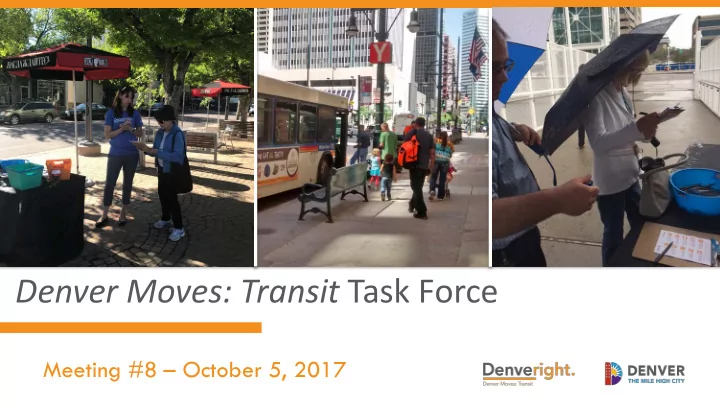

Insert transit picture Denver Moves: Transit Task Force Meeting #8 – October 5, 2017
1. Welcome & Introductions • Opening remarks and housekeeping • Task Force and audience introductions • Upcoming events and good-to-knows 2 10/5/2017
Upcoming Events & Good-to-Knows • 7th Annual Transit Event/Transportation Summit (Oct 23) http://www.transitalliance.org/annualtransitevent • Blueprint Denver’s Future Places Map Survey (through Oct 20) https://app.maptionnaire.com/en/3238/ • Denver Moves: Pedestrians & Trails Prioritization Survey https://docs.google.com/forms/d/e/1FAIpQLSdIa_76EBJ9x9hAM3wpvx9v5zpnORfIj- kioCmsmrBR8E3qGA/viewform • Hampden Corridor Study Open House (Nov 1) http://www.denvergov.org/HampdenAve 3 10/5/2017
2. Project Updates • Recent Denver Moves: Transit Plan work • Schedule moving forward 4 10/5/2017
Corridor Outreach Overview • 1,000 total responses • Survey open for 6 weeks – mid-August through September Favorite Quote: “We need to leverage mass transit in a variety of forms as a catalyst for Denver's successful growth.” 5 10/5/2017
Engagement Efforts 52% of online respondents from • newsletter or social media Paper surveys collected at 7 events • (e.g., South by Southeast, Green Valley Ranch Farmers Market) Flyer printed and distributed at • Blueprint events (and beyond) 6 10/5/2017
Survey Results 853 online responses, 153 • paper responses Colfax received 525 • overall votes for highest priority corridor 7 10/5/2017
Who Participated Online survey received • high percentage of responses from choice transit riders Lower participation from • people using transit more frequently 8 10/5/2017
Who Participated 9 10/5/2017
Update on Corridor Evaluation 10 10/5/2017
Evaluate for Transit Corridor Capital Improve- ments 11 10/5/2017
Preliminary Plans for Winter Outreach Combine open house, drop-in • EXAMPLE workshop, and public meeting 4 corridor locations and 1 • downtown location Boards, activities, and short • (looped) presentation Supplement with online • engagement tools 12 10/5/2017
Task Force Roadmap 13 11/16/2016
Questions? 14 10/5/2017
3. Completing the System: Transit Access and Connections • Introduction to Vision Zero Action Plan • Pedestrians and Trails progress report • Overview of transit-friendly streets and key access and connections to transit 15 10/5/2017
Denver’s Vision Zero Plan 16 10/5/2017
Denver Moves: Pedestrians and Trails 17 10/5/2017
Transit-Friendly Streets Guide • Part of draft plan release • Table of contents: – Make Transit Fast & Reliable – Support Access to Transit – Build Comfortable, Safe Transit Stops & Stations – Support Transit with Programs & Policies – Foster a Sense of Place 18 10/5/2017
EXAMPLE GRAPHIC Stop & Corridor Toolkits 19 10/5/2017
Make Transit Fast & Reliable • Dedicated transit lanes • Running way (center/side) • Grade separation • Queue jumps • Signal priority • Stop spacing/consolidation 20 10/5/2017
Support Access to Transit • Wayfinding • Carshare integration • Bike access • Pick-up/drop-off • Pedestrian access • Mobility hubs 21 10/5/2017
Connected Networks What are they? High-quality, buffered, ADA-compliant • sidewalks and trails Why are they important? Help pedestrians access transit • Improve access for all • Examples of elements: Landscape buffers • Universal design • Wayfinding • 22 10/5/2017
Mobility Hubs EXAMPLE GRAPHIC What are they? Major transit stations and the • surrounding area Places where mobility and • placemaking come together to support multimodal trips Why are they important? Maximize first/last mile • connections Seamlessly integrate modes • 23 10/5/2017
Comfortable, Safe Stops & Stations • Stop and station location • Wayfinding • Landscaping, trees, art • Passenger information • Shelter design • Safety and security 24 10/5/2017
Passenger Information What is it? Includes route schedules, system • maps, real-time information Why is it important? Informs decision making • Improves transit experience • Where can it be implemented: Stops, stations, transit vehicles, • websites, apps, phone 25 10/5/2017
Wayfinding What is it? Directs people to transit and nearby • destinations Why is it important? Builds awareness of transit • Improves connections • Key elements: Visible to all • Static or dynamic • Recognizable brand • 26 10/5/2017
Support with Programs & Policies • Improvements to access and connections must be matched with programs and policies, such as TDM, modal priority, targeted marking, and curb management 27 10/5/2017
Foster a Sense of Place • Transit-supportive land uses • Street networks and complete streets • Plazas and parklets • Blueprint place types and “Complete Neighborhoods” 28 10/5/2017
People-First Places What are they? Gathering places with furnishings, • landscaping, activation, and art Why are they important? Creates sense of community • Provides attractive, comfortable space • for transit riders Examples: Parklets and plazas • Temporary installations • 29 10/5/2017
Questions? 30 10/5/2017
4. Short Break (not 1 hour) 31 10/5/2017
5. Small Group Activity and Discussion: Designing Transit Stops and Stations • Activity overview, objectives, materials • Design your stop or station • Discuss results 32 10/5/2017
Objectives • Explore improvements and amenities that support safe, comfortable, and welcoming transit stops and stations • Collaborate with your group to identify the most important improvements for your stop or station 33 10/5/2017
Materials • Game pieces: 4 of each improvement, 100 total • Game board: urban or suburban context • Instructions: list of improvements and cost calculation table 34 10/5/2017
Your Task 1. Identify the issues and opportunities of your land use context related to the improvements 2. Without considering cost, build your ideal station 3. Record the total price tag and take a picture 4. Celebrate your success 5. But wait…funding has been slashed 6. Prioritize which investments are most important 7. Report back 35 10/5/2017
Small Group Report Out 36 10/5/2017
6. Next Steps • Next Task Force participation opportunity: Spread the word about winter outreach • Task Force Meeting #9: December 7 • Task Force Meeting #10: February 1, 2018 37 10/5/2017
7. Questions and Comments www.denvergov.org/denveright 38 10/5/2017
Recommend
More recommend