
SLIDE 1
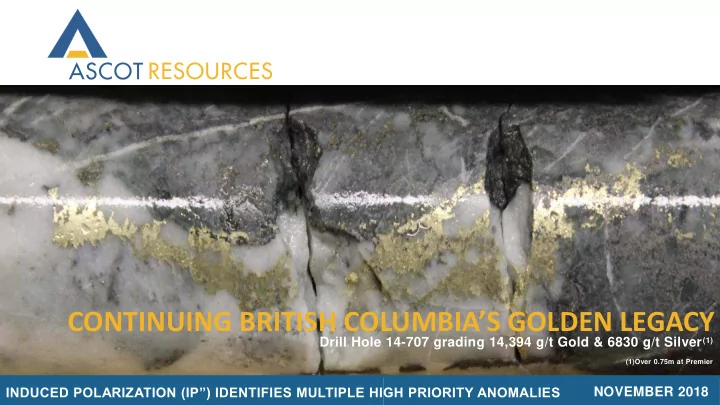
CONTINUING BRITISH COLUMBIA’S GOLDEN LEGACY
NOVEMBER 2018 Drill Hole 14-707 grading 14,394 g/t Gold & 6830 g/t Silver(1)
(1)Over 0.75m at Premier
INDUCED POLARIZATION (IP”) IDENTIFIES MULTIPLE HIGH PRIORITY ANOMALIES
CONTINUING BRITISH COLUMBIAS GOLDEN LEGACY Drill Hole 14-707 grading - - PowerPoint PPT Presentation
CONTINUING BRITISH COLUMBIAS GOLDEN LEGACY Drill Hole 14-707 grading 14,394 g/t Gold & 6830 g/t Silver (1) (1)Over 0.75m at Premier INDUCED POLARIZATION (IP) IDENTIFIES MULTIPLE HIGH PRIORITY ANOMALIES NOVEMBER 2018 CAUTIONARY
NOVEMBER 2018 Drill Hole 14-707 grading 14,394 g/t Gold & 6830 g/t Silver(1)
(1)Over 0.75m at Premier
INDUCED POLARIZATION (IP”) IDENTIFIES MULTIPLE HIGH PRIORITY ANOMALIES
This presentation contains certain forward-looking information concerning the business of Ascot Resources Ltd. (the "Corporation"). All statements, other than statements of historical fact, included herein including, without limitation; statements about the exploration of the Premier Property are forward-looking statements. These forward-looking statements are based on the opinions of management at the date the statements are made and are based on assumptions and subject to a variety of risks and uncertainties and other factors that could cause actual events to differ materially from those projected in forward-looking statements. Important factors that could cause actual results to differ materially from the Corporation's expectations include fluctuations in commodity prices and currency exchange rates; uncertainties relating to interpretation of drill results and the geology, continuity and grade of mineral deposits; the need for cooperation of government agencies and native groups in the exploration and development of properties and the issuance of required permits; the need to obtain additional financing to explore and develop properties and uncertainty as to the availability and terms of future financing; the possibility of delay in exploration programs and uncertainty of meeting anticipated program milestones; uncertainty as to timely availability of permits and other governmental approvals. The Corporation is under no obligation to update forward-looking statements if circumstances or management's opinions should change, except as required by applicable securities laws. The reader is cautioned not to place undue reliance on forward-looking statements.
pyrite or chalcopyrite that are chargeable
charge (direct current) is put into the ground
3
Source: UBC-GIF (F. Jones). Tuesday, December 4, 2001.
Why does IP work on Ascot’s property?
✓ Right geological setting ✓ Lots of disseminated pyrite with gold ✓ Multiple prospective locations under cover have never been explored ✓ Ability to test on known zones of gold mineralization ✓ Wireless technology reduces time and cost compared to traditional IP
Measure Voltage change
4
concept (Figure 1)
individual data points
targets that were under cover, and have never been explored Area covered 1) Premier/Northern Lights 2) Alaska border to the Big Missouri Ridge 3) Profile between the Silver Coin and Big Missouri The following slides will review 10-12 targets shown on figures 1-4 outlined in yellow on the map
Figure 4 Figure 3 Figure 2 Figure 1
5
shapes are the soft outlines of the May 2018 resource estimate superimposed on the chargeability section. The image clearly demonstrates that the areas of high chargeability coincide with known gold mineralization
that IP can be used to identify exploration targets in other parts of the property. The new test profiles identified numerous areas with chargeability signatures that are very similar to that observed in the test profile
(Fig.2 in news release 13 November)
SW NE
6
unknown anomaly. The absolute chargeability is a little less (7mV/V versus 10mV/V) than observed at Premier but the geometry of the anomaly is strikingly similar
(Fig.3 in news release 13 November)
S N
7
known mineralization at Premier
(Fig.4 in news release 13 November)
S N
Tail end of Northern Lights
8
three previously unknown anomalies. The absolute chargeability of these anomalies is higher than
pyrite associated with sericite alteration in this area. This has previously been observed in drill core
(Fig.5 in news release 13 November)
SW NE
Ideal drill hole perpendicular to mineralization
Wasted drill hole missing mineralization
9
2D target
10