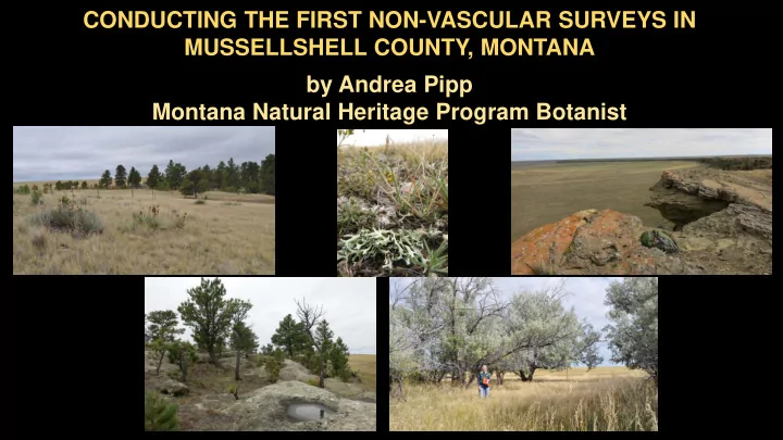
SLIDE 1
CONDUCTING THE FIRST NON-VASCULAR SURVEYS IN MUSSELLSHELL COUNTY, MONTANA by Andrea Pipp Montana Natural Heritage Program Botanist
SLIDE 2
2014 by Bruce McCune Roger Rosentreter Toby Spribille Othmar Breuss Tim Wheeler
SLIDE 3
SLIDE 4
Bill & Dan Milton Mussellshell County, Montana
SLIDE 5
Bill & Dana Milton meals & lodging Montana Native Plant Society Travel Costs Montana / Dakotas BLM Wendy Velman Data Processing Montana Natural Heritage Program Andrea Pipp & Wildfire Wanderning Logistics & more! Daphne Stone Bruce McCune Ann DeBolt Rob Smith Katherine Glew Roger Rosentreter
SLIDE 6
MONTANA
Mussellshell County
Milton Ranch - northeast of Roundup
SLIDE 7
SLIDE 8 GOALS
- Survey all substrates for mosses and lichens
- soil, wood, bark, rock, & aquatic
- Sample a variety of habitats, geography, & ownerships.
- Document species with latitude/longitude locations, population,
substrate, habitat, and micro-site data
- Document species with verified specimens
- University of Montana herbarium
- Photograph species for Montana Field Guide: http://fieldguide.mt.gov/
- Test in Montana the use of the Ground Layer Indicator for Rangelands
SLIDE 9
September 13-15, 2016 Morning Surveys & Afternoon / Evening Identifications
Milton Ranch boundary
SLIDE 10 MOSS SURVEY RESULTS
≈ 97 moss observations
- 27 moss species found
- 86 specimens at MONTU
Top 5 commonly collected:
- Syntrichia ruralis
- Jaffueliobryum wrightii
- Pseudoleskella tectorum
- Gemmabryum caespiticium
- Hypnum vaucheri
Montana Species of Concern (SOC)
- Syntrichia pappilosissima
1st Montana Records
- Didymodon tectorum
- Gemmabryum kunzei
2nd Montana Record & SOC
- Pseudocrossidium obtusulum
SLIDE 11
Moss Observations in the MTNHP Botany Database
http://mtnhp.org/mapviewer/
SLIDE 12 LICHEN SURVEY RESULTS
≈ 395 lichen observations
- 117 lichen species found
- specimens to go to MONTU
Top 8 commonly collected:
- Xanthoparmelia chlorochroa
- Cladonia pocillum
- Enchylium tenax
- Xanthoparmelia camtschadalis
- Circinaria hispida
- Placidium rufescens
- Phaeophyscia constipata
- Diploschistes muscorum
1st Montana Records
- Baglierroa calciseda (Verrucaria calciseda)
- Cladonia imbricarica? (upon TLC test)
- Collema crispum (Blennothallia crispa)
- Rinodina albertana
- Usnea diplotypus
- Xanthoparmelia neowyomingica
SLIDE 13
Nostoc commune Microcoleus Nostoc flagellare Scytonema
CYANOBACTERIA
SLIDE 14 Ground Layer Indicator for Rangelands in Montana
- Smith et al. 2015: Ground Layer Indicator method
is a modification of the USFS Forest Inventory Analysis (FIA) for use on land with <10% tree cover.
- non-destructive method
- Assesses the Ground Layer community
- bryophytes, lichens, cyanobacteria,
micro-fungi, & algae
- growing on soil [biological soil crust], wood,
rock, & dead organic matter
- Uses ground layer functional groups, not species,
to estimate biomass, carbon sequestration, & nitrogen content http://mtnhp.org/reports.asp
SLIDE 15 Yucca Shrubland Introduced Grassland Grassland Silty Grassland Sagebrush Shrubland Yucca Shrubland
Ground Layer Indicator for Rangelands September 13-15, 2016
SLIDE 16
- Plot ≈ 1 acre
- 3 transects w/ 32 microquads
- microquad
- 20 x 50 cm
- Percent Cover & Depth of
each Functional Group
Ground Layer Indicator for Rangelands
GOAL Accurately quantify volume and density of ground layer to estimate biomass, carbon and nitrogen contents.
SLIDE 17
SLIDE 18 FUNCTIONAL GROUPS
- 11 Functional Groups found on 5 plots
- No liverworts
- Micro-fungi infrequent
SLIDE 19
SLIDE 20
CARBON CONTENT (sequestration)
SLIDE 21
0.2 2.1 2.7 3.8 4.0 0.0 0.5 1.0 1.5 2.0 2.5 3.0 3.5 4.0 4.5 Introduced Grassland Grassland Yucca Shrubland Silty Grassland Sagebrush Shrubland Average Ground Layer Nitrogen Content (kg/ha)
NITROGEN CONTENT
SLIDE 22 Ground Layer Indicator for Rangelands can be used to:
- develop baseline conditions
- track long-term environmental changes (temperature, precipitation)
- track changes in physical disturbance (fire, trampling, soil compaction)
SLIDE 23
CONCLUSIONS Ground Layer Indicator for Rangelands
SLIDE 24
2019 Pilot Study Ground Layer Indicator for Rangelands
At 100 plots on BLM lands, AIM (Assessment, Inventory, & Monitoring) and GLIR protocols will be implemented.
SLIDE 25
http://mtnhp.org/
SLIDE 26
http://fieldguide.mt.gov/
SLIDE 27
SLIDE 28
http://fieldguide.mt.gov/
History, Biogeography, and Species of Montana Mosses (1880-2018) coming soon in Evansia