
SLIDE 1
Chapter 01
What and Where Are the Tropics?
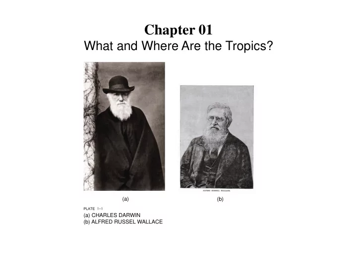
(a) (b) PLATE 1-1 (a) CHARLES DARWIN (b) ALFRED RUSSEL WALLACE
Chapter 01 What and Where Are the Tropics? (a) (b) PLATE 1-1 (a) - - PowerPoint PPT Presentation
Chapter 01 What and Where Are the Tropics? (a) (b) PLATE 1-1 (a) CHARLES DARWIN (b) ALFRED RUSSEL WALLACE PLATE 1-2 ALEXANDER VON HUMBOLDT PLATE 1-3 SNOW ON PRAMO Snow is common at high elevations in equatorial regions. Here, bunch
(a) (b) PLATE 1-1 (a) CHARLES DARWIN (b) ALFRED RUSSEL WALLACE
PLATE 1-2 ALEXANDER VON HUMBOLDT
PLATE 1-3 SNOW ON PÁRAMO Snow is common at high elevations in equatorial regions. Here, bunch grasses of the high páramo life zone are partially snow-covered. From Ecuador. PLATE 1-4 FOREST CANOPY The dense canopy of a low-elevation, humid tropical moist forest, such as this one in the Arima Valley in Trinidad, is typically irregular, with some emergent tree species rising above others. Forest gaps created by fallen trees also add to canopy heterogeneity.
FIGURE 1-1 (a) Curl-crested toucan. (b) Mobbed by curl-crested toucans. (b) (a)
PLATE 1-5 WILLIAM BEEBE
PLATE 1-6 The OTS 3 eld station at La Selva.
PLATE 1-7 The harpy eagle (Harpia Harpyja) released on Barro Colorado Island, Panama, is monitored by radio tracking. FIGURE 1-2 This graphic depicts the number of studies published in two professional journals, Biotropica and Journal of Tropical Biology, from 1995 to 2004. It shows how many studies were conducted in each of various countries. Note that most studies are focused in the Neo-tropics. (Numbers on bars are actual numbers of published studies.)
FIGURE 1-3 This sketch illustrates the use of a large industrial crane to examine tropical forest canopies: a is the tower, b is the counterjib, c is the counterweight, d is the operator’s cab, and e is the gondola, where a researcher would be located. PLATE 1-8 CANOPY WALKWAY AND FOREST This tall and lengthy canopy walkway at Sacha Lodge in Ecuador provides safe and easy access that permits study of species largely con3 ned to the forest canopy.
PLATE 1-9 HIGH CANOPY WALKWAY Viewed from the ground, the canopy walkway is seen crossing a major forest gap. PLATE 1-10 VIEW FROM CANOPY WALKWAY The expanse and structural complexity of Ecuador’s lowland forest is readily evident, as
PLATE 1-11 WOODEN CANOPY TOWER Canopy towers allow more restricted access than walkways but, if strategically placed, afford excellent
branching pattern of the tree. The tower is essentially built around the tree. From Sacha Lodge, Ecuador.
FIGURE 1-4 This is a sketch of a forest pro3 le in what was then British Guiana and is now the independent nation of
forest pro3 les included in Richards’s famous book The Tropical Rain Forest. FIGURE 1-5 Also adapted from Richards’s classic volume, this is a pro3 le of a mixed Dipterocarp forest in Borneo. Compare this with Figure 1-4. Both forests are structurally similar but contain entirely different tree species.
FIGURE 1-6 This drawing illustrates the morphotypes of tropical leaves found near Castle Rock, Denver, dating back 64.1 million years. Only the leaves in the upper right are nondicot leaves. By this time, modern plants, dominated by dicots, dominated terrestrial plant communities.
PLATE 1-12 ANACONDA PLATE 1-13 CAMPTOSAURUS, APATOSAURUS, STEGOSAURUS, DRYOSAURUS, CAMARASAURUS AND ALLOSAURUS (LEFT TO RIGHT) Each of these dinosaurs cohabited tropical regions in western North America during the late Jurassic period. The tropics then would bear scant resemblance to the tropics of today.
FIGURE 1-7 Satellite image of Earth, showing the band of tropics around the equator. FIGURE 1-8 Political map
showing nations that
the tropics.
PLATE 1-14 The Komodo dragon, which sometimes reaches a length of nearly 3 meters (9.8 feet), is endemic to the Lesser Sunda Islands of Indonesia.
FIGURE 1-9 These graphs contrast the climate in tropical Brazil with that of temperate
seasonality of the tropics with regard to precipitation but the steady temperature that prevails in the tropics. The
characterizes the temperate zone. FIGURE 1-10 This is the famous Holdridge diagram that illustrates the relationship between ecosystem types as determined by latitude, elevation, and combination of precipitation and temperature.
FIGURE 1-10 (continued)
FIGURE 1-11 Diagram showing the relationship between ecosystem type, mean annual temperature (ºC), and mean annual precipitation (centimeters). Note that tropical rain forest
highest. PLATE 1-15 Where rainfall is highly seasonal, tropical ecosystems are often dry forest, with many species of deciduous trees. Forest stature is generally small, and trees are usually widely spaced. From Venezuela.
PLATE 1-16 Northern Australia is an area of vast dry forest with tall, scattered termite mounds. This is the ecosystem typically called outback PLATE 1-17 Rapidly growing tree species such as Cecropia trees, shown here in the foreground, typify the forest edge, where vegetation structure is dense. This would be considered tropical moist forest in the Holdridge
PLATE 1-18 Herds of wildebeest move with rainfall patterns in a vast seasonal migration on the East African
PLATE 1-19 Savannas are open areas dominated by grasses and scattered trees, particularly in the genus Acacia. Here giraffes are feeding on acacia leaves on the East African savanna. From Tanzania. PLATE 1-20 Australia has many endemic plant species, including hundreds of Eucalyptus species and grasses such as
south central Australia.
FIGURE 1-12 This diagram shows the distribution of ecosystem types in Venezuela as they relate to elevation and climatic variables. PLATE 1-21 Members of the Composite family, Espeletias are unique shrubs of the high páramo of the Andes Mountains. Several hummingbird species specialize on feeding on Espeletia nectar. From Venezuela. PLATE 1-22 At high elevations in the Andes Mountains where moisture is normally abundant, gnarled forests of Polylepis trees are supported. From Ecuador.
PLATE 1-23 Clouds shroud much of the mountainsides along the east slope of the Andes Mountains in parts of South America, supporting dense, species-rich ecosystems called cloud
PLATE 1-24 Many tree species are found in cloud forests, along with numerous epiphytes such as orchids, cacti, bromeliads, and various vines. The ecosystem is normally cloud- covered for at least part of each day. From Ecuador.
PLATE 1-25 The complexity of structure and diversity of species characterizes tropical moist, wet, and rain forests throughout the world. This forest is in central Brazil. PLATE 1-26 The term jungle refers to a disturbed area where an abundance of sunlight results in a dense array of many plant species, often so thick that it is difficult to penetrate without the use of a machete. Jungles typify areas of moist forest. From Ecuador.
FIGURE 1-13 These climate diagrams from (a) Darwin, Australia, and (b) Singapore illustrate the extreme contrast between savanna and rain forest. But note that temperature is about the same, and relatively constant in both places. What varies is the seasonality of precipitation. (a) (b)
FIGURE 1-14 If Earth were not rotating, this would be the distribution of primary and secondary air movement
FIGURE 1-15 Earth’s daily rotation deflects the Hadley cell currents and creates the trade wind belts. Note the lack of wind at the equator.
FIGURE 1-16 The angle of the Earth relative to the sun varies during the course of Earth’s annual orbit, creating the seasonality that characterizes Earth.
FIGURE 1-17 This diagram shows how climate varies in the tropics. Note the absence of seasonality at the equator.
(b) PLATE 1-27 (a) KINKAJOU AND (b) SPIDER MONKEY (a)
FIGURE 1-18 This map shows the general location of the ITCZ.
FIGURE 1-19 Human population size and age distribution contrasted between developed and underdeveloped nations, with projections to 2050.
PLATE 1-28 GORILLA