
SLIDE 1
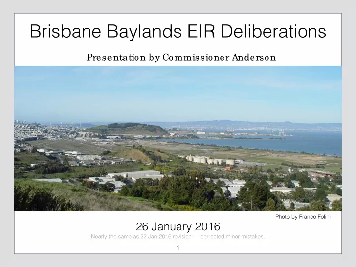
Brisbane Baylands EIR Deliberations
26 January 2016
1
Photo by Franco Folini Nearly the same as 22 Jan 2016 revision — corrected minor mistakes.
Presentation by Commissioner Anderson
Brisbane Baylands EIR Deliberations Presentation by Commissioner - - PowerPoint PPT Presentation
Brisbane Baylands EIR Deliberations Presentation by Commissioner Anderson Photo by Franco Folini 26 January 2016 Nearly the same as 22 Jan 2016 revision corrected minor mistakes. 1 Greg Anderson Recently appointed to Planning
26 January 2016
1
Photo by Franco Folini Nearly the same as 22 Jan 2016 revision — corrected minor mistakes.
Presentation by Commissioner Anderson
2
Provide Supporting Data
3
Determine Schedule for Deliberations
4
5
Brisbane General Plan
6
7
Side Point Reference Open Issue Recommendation
Related but external topic Something said somewhere else Questions, things to find out, etc. To be discussed and decided
?
D e l i b e r a t i
process.
in order to determine a recommendation to send to the City Council, where the final decisions are made.
Red slides are items to be discussed, NOT recommendations
8
please write a letter to the City Council.
9
10
The City of Brisbane and its Mountain will remain a place independent and distinct, with a small town quality and a volunteer spirit, where diversity is welcomed and everyone can participate in town meetings, and elected officials carefully consider the desires and needs of the citizens, and govern through circumscribed rules and regulations,
protection of the environment.
11
D e l i b e r a t i
12
13
D e l i b e r a t i
14
15
Photo by Wayne Hsieh
16
D e l i b e r a t i
17
18
19
One answer to: “What is the most important problem that Brisbane will have to face and try to solve over the next ten years?
20
21
22
Warehouses, distribution facilities, offices, retail uses, restaurants, commercial recreation, personal services, light industrial, research and development, public and semi-public facilities, educational institutions.
Repair and maintenance services
23
D e l i b e r a t i
24
D e l i b e r a t i
25
26
D e l i b e r a t i
27
28
D e l i b e r a t i
29
[See also open space element discussion below]
30
Paraphrased from letter to Staff, 12 November 2015
D e l i b e r a t i
31
32
33
34
35
36
Germany has just opened the first 5km stretch of a traffic- free bicycle highway that is set to span over 100km.
http://road.cc/content/news/173907-germany-opens-first-stretch-bicycle-%E2%80%98autobahn%E2%80%99
37
SF: 4,500 bikes Oakland: 800 bikes Berkeley: 400 bikes Emeryville: 100 bikes San Jose: 1,000 bikes
38
39
Jake Coolidge
Based on 1956 Bart Planning Maps
D e l i b e r a t i
40
D e l i b e r a t i
41
42
http://www.nowtopians.com/public-space/hills-and-dales-of-summer-in-san-francisco
43
44
45
D e l i b e r a t i
46
[See also wind study discussion above]
47
Though small town Brisbane cannot be duplicated in the Baylands, the Community’s values will be woven throughout the development. Buildings will be esthetically creative, enhance open space and public areas, convey the appearance of an organic/independent development process, rather than large scale development based on generic standards and generally enhance the esthetic and cultural value of Brisbane.
D e l i b e r a t i
48
49
D e l i b e r a t i
50
51
Dominic Meily
https://www.flickr.com/photos/dominicmeily/7056121879
52
D e l i b e r a t i
53
54
55
Quarry Operations, January 2015
56
57
See also: FEIR p. 2.9.1-12, BBCAG-38
58
59
BBCAG Comments attachment, 16 Nov 2015 Planning Commission FEIR Public Hearing Minutes, p. H.7.24
60
See also DEIR p. 4.G-9
61
62
See also DEIR p. 4.G-10
63
64
65
66
67
See also FEIR Workshop #1, slide 19
68
69
70
least 30 days in accordance with section 25356.1(e).
written public comments received during the public comment period.
determines are appropriate in response to the public comments.
https://www.dtsc.ca.gov/LawsRegsPolicies/Policies/SiteCleanup/upload/eo-95-007-pp.pdf
D e l i b e r a t i
71
DTSC will determine which mitigation measures are appropriate in the Remediation Action Plan. Since Brisbane will have only indirect influence on the RAP process (during public commentary), and may only enforce, not set, required remediation levels, it is important that the city should only approve land uses that can confidently be expected to be safe after the expected RWQCB and DTSC remediation are complete.
72
73
74
Cancer Statistics, 2015
Rebecca Siegel, MPH, Kimberly Miller, MPH, Ahmedin Jemal, PhD http://onlinelibrary.wiley.com/store/10.3322/caac.21254/asset/caac21254.pdf
75
Cancer Cases Rising At An Alarming Rate Worldwide
Jason Beaubien, NPR http://www.npr.org/sections/health-shots/2014/02/04/271519414
76
http://curesearch.org/Incidence-Rates-Over-Time
77
Paraphrased from minutes of Planning Commission meeting of 8 Oct 2015
78
http://cleanenergyaction.org/2013/07/18/to-frack-or-to-freak-the-effects-of-hydraulic-fracturing-on-our-environment/
http://robynobrien.com/a-farmers-perspective-on-gmos/
D e l i b e r a t i
79
80
Removed Duplicate.
81
Eckardt Beck, EPA http://www.epa.gov/aboutepa/love-canal-tragedy
[Love Canal] cannot be regarded as an isolated event. It could happen again--anywhere in this country. Twenty five years after the Hooker Chemical Company stopped using the Love Canal here as an industrial dump, 82 different compounds… have been percolating upward through the soil, their drum containers rotting and leaching their contents into the backyards and basements of 100 homes and a public school built on the banks of the canal.
82
83
D e l i b e r a t i
84
D e l i b e r a t i
85
D e l i b e r a t i
86
D e l i b e r a t i
87
Remediation in the former landfill area will be largely out
made with the utmost of care. Uses involving little public contact are best.
D e l i b e r a t i
88
89
90
Figure 4.E-11 shows that the liquefaction hazard at the Project Site is very high according to maps of Quaternary deposits and liquefaction susceptibility prepared by the USGS (USGS, 2006b).
91
92
The referenced study in the comment was conducted in order to study the 9.0 magnitude earthquake that
study is needed in order to better determine the likelihood of an earthquake that is substantially more powerful than what is currently accepted in accordance with building code regulations would be speculative and outside the scope of CEQA.
D e l i b e r a t i
93
94
95
96
97
FEIR Workshop #6, slide 3
98
99
D e l i b e r a t i
100
101
102
103
104
105
D e l i b e r a t i
106
107
Photo courtesy of Dan Ryan
108
Paraphrased from Planning Commission Minutes from 4 Nov 2015 Meeting
D e l i b e r a t i
109
110
Photo courtesy of Dan Ryan
111
rating required.
and mixed use buildings with a Platinum rating required.
for Residential by 2020 and Zero Net Energy for Commercial by 2030, including for any buildings permitted prior to code requirements being enforced.
112
113
114
D e l i b e r a t i
115
116
117
118
119
120
D e l i b e r a t i
121
grade and middle school?
authority.
are known.
122
123
What this chapter makes very clear is that this project is simply too large to be absorbed by the San Francisco Bay Area. The fact that it overruns mitigation measures, population and job growth, air quality attainment, traffic congestion and other areas
sincerely hope that some small project or maybe a longer timeline will be approved by the city.