BioSIRT .. BioSIRT .. Bio security S urveillance I ncident R esponse - - PowerPoint PPT Presentation

biosirt
SMART_READER_LITE
LIVE PREVIEW

BioSIRT .. BioSIRT .. Bio security S urveillance I ncident R esponse - - PowerPoint PPT Presentation

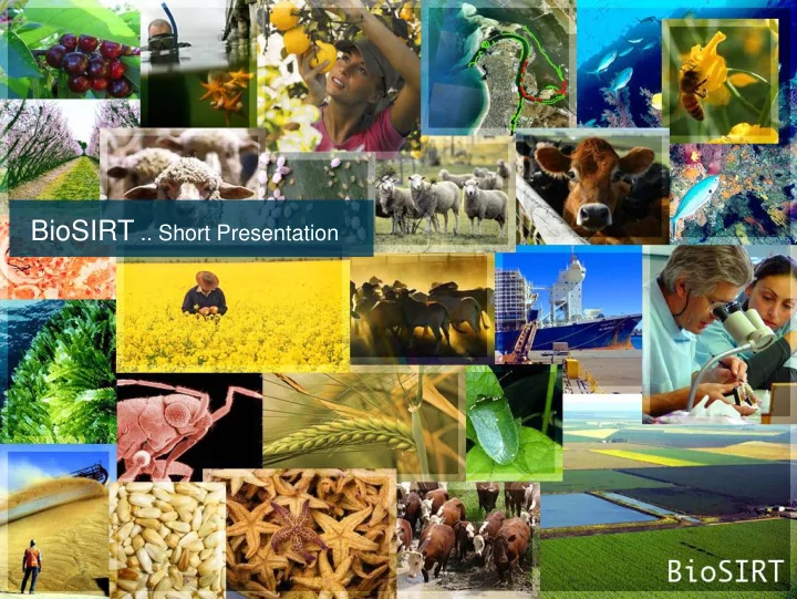
BioSIRT .. Short Presentation BioSIRT .. BioSIRT .. Bio security S urveillance I ncident R esponse & T racing BioSIRT is a web enabled, spatial database An informal meeting held in May 2002 discussed the benefits of aligning national


slide-1
SLIDE 1

BioSIRT .. Short Presentation

slide-2
SLIDE 2

BioSIRT .. Biosecurity Surveillance Incident Response & Tracing

  • BioSIRT is a web enabled, spatial database
  • An informal meeting held in May 2002 discussed the

benefits of aligning national jurisdictional information systems

  • There was agreement between the Executives, Directors-

General and Ministers of all states, territories and the Commonwealth

  • Involved were all State governments, DAFF, Animal

Health Aust, Plant Health Aust, AWC, CSIRO, ABS, Taronga Zoo

BioSIRT ..

slide-3
SLIDE 3

BioSIRT .. Who will use it?

BioSIRT has been designed to deal with a wide variety of disciplines These include…

Animal health – veterinary Animal health – production Animal health - native Animal health - zoos Plant health – horticulture Plant health – weeds Plant health - broadacre Plant health - insects Plant health – pathology Plant health – forestry Fish health – aquaculture Fish health - wild fisheries Pests, vertebrates - foxes, rabbits Pests, insects - locusts, fire ants Pests, avian – starlings Pests, fish - carp Pests, marine Epidemiology - general Epidemiology - veterinary Public Health specialists Laboratory – diagnostic Chemicals – rural Environmental health Emergency - tracing Emergency - IP operations Emergency - RA movements Emergency - mapping Emergency - planning & reporting Emergency - logistics Emergency - recovery Emergency – valuation Auditing for legislative compliance

slide-4
SLIDE 4

BioSIRT .. Spatial data

slide-5
SLIDE 5

BioSIRT .. Spatial features

slide-6
SLIDE 6

BioSIRT .. Multiple data types SPATIAL IMAGERY TEXTUAL Record Use

slide-7
SLIDE 7
  • S.37 Record keeping obligations of local

control authorities

  • (1) A local control authority must monitor the

presence of noxious weeds in its local area and keep records of the following matters: (a) the presence and distribution of noxious weeds in the local area, ……….. (2) A local control authority must, if required to do so by the Director-General, report to the Director-General

  • n the presence and distribution of noxious

weeds in the local area ………..”

LCA reporting under the Noxious Weeds Act

slide-8
SLIDE 8

Notifiable Noxious Weeds Database

  • Currently information on control class 1,2

and 5 noxious weeds is reported to DPI.

  • Form available on DPI’s external website

and reported to DPI.

  • Once initial incursion reported, no follow up
  • n the status of the incursion
slide-9
SLIDE 9
  • BioSIRT configured to capture data of initial

incursion PLUS to track the status of the incursion and/or re-infestation.

1.

Initial incursion observation (what is already reported)

2.

Incursion treated (successful or not)

3.

Area free of the weed (follow up inspection)

  • If reinfestation observed - reporting cycle

starts again

Notifiable Noxious Weeds Database

slide-10
SLIDE 10

Notifiable Noxious Weeds Database

Stage 1 Stage 2 Stage 3 ID required?

N eradicated Y

Herbarium

  • r

Other expert

Y Reinfestation N

Initial observation:

  • 1. Details recorded in BioSIRT
  • 2. Relevent people informed

LCA updates BioSIRT

  • 1. Identificaion confirmed
  • 2. Treatment detailed
  • 3. Eradication confirmed
  • 4. Reinspection date set

Reminder of reinspection to LCA Reinspection LCA updates BioSIRT & confirms eradification

slide-11
SLIDE 11

This form collects information on the status of the weed incursion

slide-12
SLIDE 12

Click to see location This form collects data for each observation

  • Multiple observations can be collected against an incursion
slide-13
SLIDE 13

Show incursion spatially

slide-14
SLIDE 14

This form directs who can identify the sample

slide-15
SLIDE 15

This form details identification results

slide-16
SLIDE 16

BioSIRT .. Summary SPATIAL IMAGERY TEXTUAL Record Use

slide-17
SLIDE 17
  • Questions-