
SLIDE 1
Applied Geomatics--connecting the pp g dots between grapevine - - PowerPoint PPT Presentation
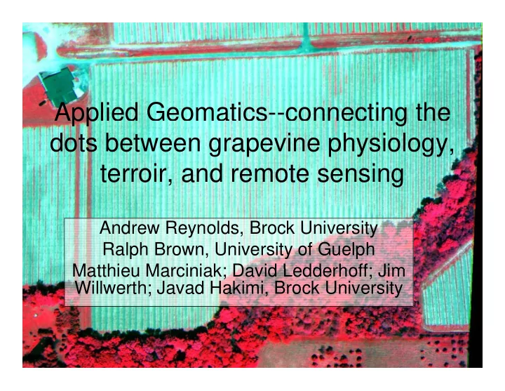
Applied Geomatics--connecting the pp g dots between grapevine physiology, terroir and remote sensing terroir, and remote sensing Andrew Reynolds, Brock University Ralph Brown, University of Guelph Matthieu Marciniak; David Ledderhoff; Jim
ASEV/ES 2001; others STILL in preparation] ASEV/ES 2001; others STILL in preparation]
Using GPS to delineate blocks and to geo-locate vines
Ji Will th PhD did t 2010 Jim Willwerth, PhD candidate 2010 Willwerth & Reynolds Progres Agricole et Viticole 2010 accepted
A B C “High” water status zones Spatial distribution of leaf water potential (-bars) Myers Vineyard Vineland ON; “Low” water status zones Spatial distribution of leaf water potential (-bars), Myers Vineyard, Vineland, ON; A: 2005; B: 2006; C: 2007. Consistent zones; temporally stable.
A B C High water status Low water status
Spatial distribution of berry weight (g), Myers Vineyard, Vineland, ON; A: 2005; B: 2006; C:2007. Higher LWP = higher berry weight.
A B C
Spatial distribution of berry Brix, Myers Vineyard, Vineland ON; A: 2005; B: 2006; C: 2007. Low LWP = highest Brix.
A B C
Spatial distribution of berry titratable acidity (g/L), Myers Vineyard, Vineland, ON; A: 2005; B: 2006; C:2007. Low LWP = lowest TA.
A B C
Spatial distribution of leaf water potential (-bars), Chateau des Charmes (Paul Bosc Estate), Niagara-on-the-Lake, ON; A: 2005; B: 2006; C: 2007. Once again, temporally stable spatial patterns.
A B C
Spatial distribution of berry potentially volatile terpenes (mg/L), Chateau Spatial distribution of berry potentially volatile terpenes (mg/L), Chateau des Charmes (Paul Bosc Estate), Niagara-on-the-Lake, ON; A: 2005; B: 2006; C: 2007. Low LWP = highest PVT.
Soil and vine water status responsible for 75% of the variability in the data set
J d H ki i PhD 2009 Javad Hakimi, PhD 2009 Hakimi and Reynolds AJEV 2010 in press
Variables (axes F1 and F2: 63.94 %) Observations (axes F1 and F2: 63.94 %)
Green bean associated with high water potential Lakeshore or riverfront sites
( )
Acidity bell pepper green bean black pepper BELL PEPPER GREEN BEAN 0 5 0.75 1
( )
Cave sp George Harbour 2 3 Color black currant black cherry BLACK CHERRY 0.25 0.5
26.13 %)
Buis Reif 1
26.13 %)
High water status
Bitterness Astringency red fruit BLACK PEPPER BLACK CURRANT
F2 (2
Buis Vieni HOP Hernder
F2 (2
Low water status
RED FRUIT
0.25 0.5 0.75 1
F1 (37 81 %)
CDC
1 2 3 4 5 6
F1 (37.81 % )
F1 (37.81 %)
Correlations with t on axes t1 and t2 (84.3%) Clusters
Berry wt
Hue
sand
Bl CURRANT Astringency Color
0.75 1
Yield y
TA
WP
SM
Color RED FRUIT BLACK PEPPER BELL PEP red fruit
green bean Bitterness Acidity Color
0.25 0.5
24.3%)
vine size
Brix
pH
Phenols Soil pH OM Ca
CEC
BS
GREEN BEAN
bl cherry
black pepper bell pep
Acidity
t2 2
Anthocyanin clay
P K Mg
CEC BLACK CHERRY bl currant
0.25 0.5 0.75 1
t1 (60 0% ) t1 (60.0% )
M tthi M i i k MS did t 2010 Matthieu Marciniak, MSc candidate 2010 Reynolds et al. Progres Agricole et Viticole 2010 accepted
Courtesy Ralph Brown
Temporal stability is apparent (orange areas = lowest soil moisture 2007-0; blue = lowest 2009) S il M i t 2006 S il M i t 2007 Soil Moisture 2006 Soil Moisture 2007 Soil Moisture 2008 Soil Moisture 2009
Again temporal stability is apparent, as are spatial correlations between soil moisture and leaf ψ; yellow and orange areas are highest absolute values of leaf ψ (i.e. most negative or lowest) Leaf Water Potential 2007 Leaf Water Potential 2006 Leaf Water Potential 2008 Leaf Water Potential 2009
Once again, clear temporal stability is present (yellow/orange areas are highest yields) 2006 2007 2008
Some inverse spatial correlations with water potential and soil moisture
WPY WPY WPB WPB
18.09 18.82 18.82 19 55WPY WPY WPB WPB Triangle Triangle SPY SPY SPB SPB
17.36 17.36 18.09 18.09 18.09 18.09 18.09 18.09 18.09 18.09 18.82 18.82 18 82 19.55 19.55 19.55 19.55 19 55 19.55 19.55 20.28 20.28 20.28 21.01 21.01 21.01 21.01 21.01 21.74 21.74 21.74 21.74 22.4701 22.4701LE LE
18.09 18.82 18.82 19.55 19.55 19.55 19.55 20.28 21.74three vintages. Note the higher Brix (orange) in the low water status zones
WPY WPY WPB WPB
11.3 11.3 11.7 11.3 10.9 11.7 11.3 8.4 8.8 10.5LE LE Triangle Triangle SPY SPY SPB SPB
10.5 10.5 11.3 11.3 10.9 11.3 10.5 9.6 10.5 10.9 10.5 11.3 12.1 10.9 11.3 11.7 10.5 10.5 11.7 12.1 10.5 10.9 10.1 9.6 11.3 10.9 9 2 9.6 10 1 10.1 11.2716Titratable acidity. Also has been temporally
10.5 10.9 10.5 11.7 11.7 9.2 10.9 10.1 11.4consistent over three vintages. Note the lower TA (blue) in the low water status zones
Highest in the low-vigor zones
WPY WPY WPB WPB SPB SPB
2.0 2 3 2.6 1.78
SPY SPY Triangle Triangle
2.6 2.3 2.3 2.3 2.30299
LE LE
2.3 1 78 2.3 1.78
Once again highest in the low-vigor zones, particularly Steel Post & Triangle
Low leaf water potential associated with higher Brix values Berry Brix 2007 Leaf Water Potential 2007 Note: Orange areas represent highest Brix and highest absolute values of water potential (i.e. most negative or lowest)
A clear and temporally stable relationship between the two variables
WPB WPB WPY WPY
3.91 3.91 3.91 3.17 4.66 4.66 3.17 4.66 5.41SPY SPY SPB SPB
6.90 2.42 5.41 4.66 3.17Yield “Y” zones (high
vigor) = high-yielding too
0.66 0.67 0.66 0.66 0.67 0.65 0.68 0.64 0.65 0.71 0.69 0.70 Spatial patterns and relationships that are temporally stable
WPY WPY WPB WPB
SPY SPY SPB SPB
SPY SPY
Temporally stable compared to previous years
Once again, temporal stability was apparent relative to prior years
Variables (axes D1 and D2: 67.95 %) after Varimax rotation
Observations (axes D1 and D2: 67.95 %) after Varimax rotation
Berry wt Berry pH Berry Brix Vine Size 0.5 0.75 1
Triangle 2 3
Berry TVT Berry PVT Berry FVT 0 25 0.25
D2 (25.98 %)
1 2
D2 (25.98 %)
M ean SM M ean WP Berry TA Yield
D
SPY SPB LE WPY WPB
D
Elevation
0.25 0.5 0.75 1
D1 (41.97 %)
SPY
1 2 3
D1 (41.97 %)
The Triangle Block has consistently won the most awards at Ontario wine The Triangle Block has consistently won the most awards at Ontario wine
Triangle in other cultivars?
(Images and text courtesy David Ledderhof MSc candidate 2010)
Geolocating Sentinel Vines Soil Sample Collection & Analysis
Aerial Image Capture (x4 in 2008 and 2009) TDR - Soil Moisture
Pressure Bomb – Vine Water Status Ground-based Leaf Reflectance
Image Source: Niagara Navigator {http://navigator.yourniagara.ca/navigator/#}
Images: July 29, 2008
% silt % clay % sand
Note: Different scale for each map
yield Leaf ψ NDVI-red
The challenge e tracting NDVI data from co er The challenge-extracting NDVI data from cover- cropped vineyards without assessing the cover crop R d P 2 NDVI Red Paw 2 NDVI Red Paw 2 masked NDVI Red Paw 2 NDVI map
(Vickie Tasker, MA 2010 pending)
Images courtesy Ralph Brown Images courtesy Ralph Brown
CF1
CF2
CH1