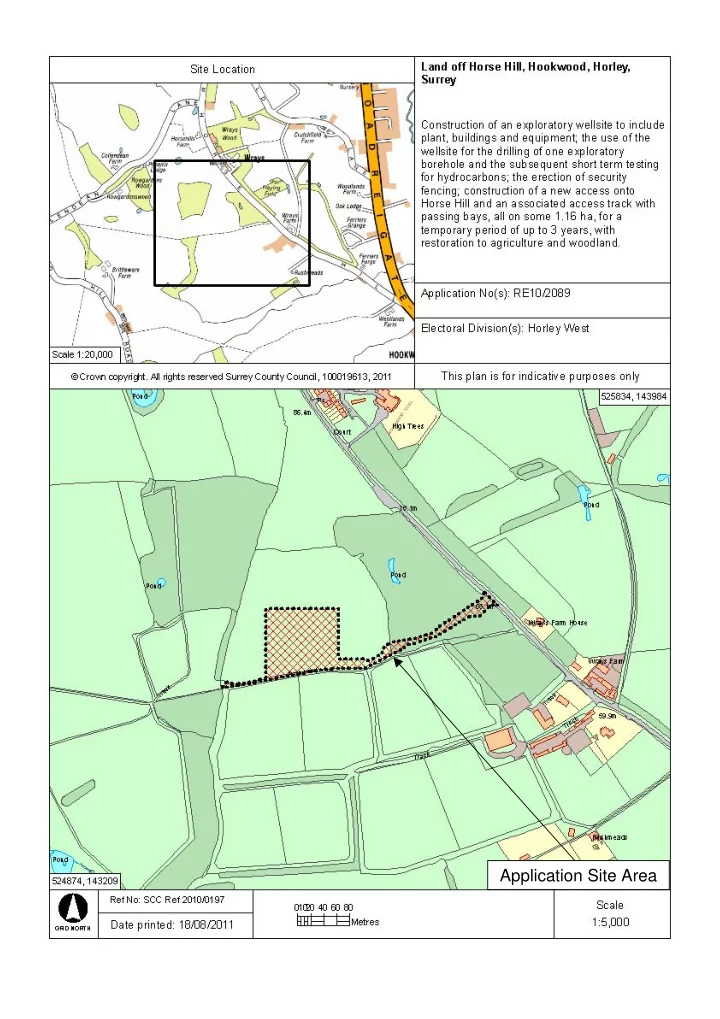
SLIDE 1
Application Site Area
SLIDE 2
Aerial 1 : Horse Hill
Application Number : RE10/2089
2006 Aerial Photos All boundaries are approximate
N
SLIDE 3
Aerial 2 : Horse Hill
Application Number : RE10/2089
2006 Aerial Photos All boundaries are approximate
N
Application Site Area Horse Hill Site access Five acres Footpath 414
SLIDE 4
Fig 1 : Horse Hill at Proposed Site Access Looking North
Application Number : RE10/2089
SLIDE 5
Fig 2 : Horse Hill at Proposed Site Access Looking South
Application Number : RE10/2089
SLIDE 6
Fig 3 : Location of the Proposed Site Access from Horse Hill
Application Number : RE10/2089
SLIDE 7
Fig 4 : The Blue Posts Mark the Proposed Route of the Access Track Through the Woodland
Application Number : RE10/2089
SLIDE 8
Fig 5 : Looking Along the Line of the Access Track Towards the Proposed Drillsite Location
Application Number : RE10/2089
SLIDE 9
Fig 6 : Photograph Taken From the Proposed Drillsite Location Looking Northwards
Application Number : RE10/2089
SLIDE 10
Fig 7 : Photograph Taken from the North of the Field Looking Towards the Location of the Proposed Drillsite Compound
Application Number : RE10/2089
SLIDE 11
Fig 8 : Photograph Taken from the Location of the Proposed Drillsite Looking Towards the gap in the Filed Boundaries and Right of Way Beyond
Application Number : RE10/2089
SLIDE 12
Fig 9 : Right of Way Adjoining the Hedgerow to the south of the Proposed Drillsite Location
Application Number : RE10/2089
SLIDE 13
Fig 10 : Right of Way Alongside the Woodland
Application Number : RE10/2089