
SLIDE 1
- H. H. Aumann
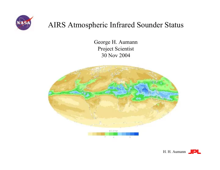
AIRS Atmospheric Infrared Sounder Status
George H. Aumann Project Scientist 30 Nov 2004
AIRS Atmospheric Infrared Sounder Status George H. Aumann Project - - PowerPoint PPT Presentation
AIRS Atmospheric Infrared Sounder Status George H. Aumann Project Scientist 30 Nov 2004 H. H. Aumann AIRS/AMSU/HSB Project Overview Spacecraft: EOS Aqua Spacecraft: EOS Aqua Instruments: Instruments: AIRS, AMSU, HSB, AIRS, AMSU, HSB,
George H. Aumann Project Scientist 30 Nov 2004
Spacecraft: Spacecraft: EOS Aqua EOS Aqua Instruments: Instruments: AIRS, AMSU, HSB, AIRS, AMSU, HSB, MODIS, CERES, AMSR-E MODIS, CERES, AMSR-E Launch Date: Launch Date: May 4, 2002 May 4, 2002 Launch Vehicle: Launch Vehicle: Boeing Delta II Boeing Delta II Intermediate ELV Intermediate ELV Mission Life: Mission Life: 5 years 5 years Team Leader: Team Leader: Moustafa Moustafa Chahine Chahine
AIRS Project Objectives AIRS Project Objectives 1.
Support Weather Forecasting 2.
Climate Research 3.
Atmospheric Composition and Processes
RMS Requirement RMS Requirement Current Estimate Current Estimate Radiance Products (Level 1B) Radiance Products (Level 1B) AIRS IR Radiance AIRS IR Radiance AIRS VIS/NIR Radiance AIRS VIS/NIR Radiance AMSU Radiance AMSU Radiance HSB Radiance HSB Radiance Standard Core Products (Level 2) Standard Core Products (Level 2) Cloud Cleared IR Radiance Cloud Cleared IR Radiance Sea Surface Temperature Sea Surface Temperature Land Surface Temperature Land Surface Temperature Temperature Profile Temperature Profile Humidity Profile Humidity Profile Total Precipitable Water Total Precipitable Water Fractional Cloud Cover Fractional Cloud Cover Cloud Top Height Cloud Top Height Cloud Top Temperature Cloud Top Temperature 3%* 3%* 20% 20% 0.25-1.2 K 0.25-1.2 K 1.0-1.2 K 1.0-1.2 K 1.0 K 1.0 K 0.5 K 0.5 K 1.0 K 1.0 K 1 K 1 K 15% 15% 5% 5% 5% 5% 0.5 km 0.5 km 1.0 K 1.0 K <0.2K <0.2K 10-15% 10-15% 1-2 K 1-2 K N/A N/A <1.0 K <1.0 K 1.0 K 1.0 K TBD TBD 1K 1K 15% 15% 5% 5% TBD TBD TBD TBD TBD TBD
*Absolute Relative to NIST *Absolute Relative to NIST
– Excellent health – No trends in almost all currents, temperatures, and voltages Cooler active drive levels creeping up very slowly—at present rate of increase we should never have to de-ice Chopper drive current, chopper drive delay, chopper phase slowly increasing – The levels are far below alarm levels, but potential effect on M11 and M12 channel are being monitored Both of the above trends are thought to be due to slow ice build up Since launch, 20 channels have experienced increased noise (all but one due to radiation dosage effects)—14 of these have recovered after temperature cycling, leaving just six detectors which were good at launch but not today
– Age is starting to show – Change in electronics since launch are gain degradations of about 17% in Channel 5 and about 5% in Channel 6 (accounted for in the two point calibration) – Temperature sensors became noisy in Nov 04
The L1b files include all spectral radiances measured by AIRS They have been radiometrically calibrated. The data have not been tuned, edited, apodized, shifted or re-registered QA flags are set as necessary The L2 files include results from all all processed spectra. If the solution does not converge at key points appropriate flags is set When a L1b or L2 flag is raised, the user can skip the spectrum or retrieval evaluate if the flag is relevant to his application Ignore the flag at his own risk A considerable effort in the V4.0 delivery is in QA flag refinements Three presentations this afternoon and tomorrow deal with QA.
Illustrations of effects using granule 176 from 20020906 centered in the Atlantic ocean centered on the Azores. Temperatures range from 200K cloud tops to 300K at the surface Gradients between adjacent footprints are as large as 80K
AIRS Calibration Accuracy, and Stability Validation Radiometric accuracy and stability relative to RTG.SST Spectral Stability relative to upwelling L1 b Algorithm Theoretical Basis (ATBD) update required
Instrument Stability Fundamental to Weather and Climate Quality Observations SST2616 compared to RTG.SST at night
First principles using NIST traceable calibration Stability better than 8 mK/Year
Bias: Slope = 5mK/year
Aumann et al 2004 Aumann et al 2004 “ “Evaluation of AIRS Data for Climate Applications Evaluation of AIRS Data for Climate Applications” ” SPIE 5570b Las Palmas September 2004 SPIE 5570b Las Palmas September 2004
difference between observed and expected bias due to cloud contamination
SST1231 compared to RTG.SST two year mean day bias=-0.22K night bias=-0.57K day-night bias
MODIS 0.37K day bias observed –0.22K expected zero explanation: low cloud contamination
Bias: Slope = 5mK/year
Aumann et al 2004 Denver August 2004 SPIE 5548-42 Aumann et al 2004 Denver August 2004 SPIE 5548-42
AIRS spectral calibration more accurate and stable than the +/-8 ppmf required for weather applications
SRF centroids determined relative to resolved upwelling spectral features knowledge within 0.2 ppmf stability +0.9+/- 0.5 ppmf/year The trend needs to be corrected for critical climate applications Day/night (red/blue) variability under investigation November 2003 protective shut down due to Solar flair
+ /
p p m f
The AMSU is used for the initial estimate of the T(p) profile and the clear column radiance. The AMSU calibration is complicated by sidelobe issues.
The scan position dependent bias is a calibration artifact 0 K McMillin /NESDIS +2 K
The radiances are statistically bias corrected in level 2 processing using empirical tuning. The empirical bias correction appears to be stable Closure is required on AMSU Level 1b L1b product status has to upgraded to "beta validated".
The radiative transfer algorithm (RTA) converts the the signal from surfaces and layers in the atmosphere to the signal seen from space. Evaluation of the (observed - calculated.ECMWF) indicates no scan angle dependence. Residual frequency dependent bias at the less than 0.5K level may be due to systematic offsets in the ECMWF analysis. Bias change as function of time at the 100mK/year level in co2 sensitive channels is due to increase in co2 column abundance of 2.2 ppmv/year
What may be good enough for weather forecasting or 1K/1km requirements is not good enough for climate quality work
EOS Aqua launch At the level of AIRS sensitivity, the atmosphere is not as simple as the current RTA Global change is already evident in the AIRS data after only two years. The RTA still uses the at launch 370 ppmv co2
vis3 Obtaining good retrievals in the presence of clouds is a key requirement
Only 6% of the spectra are cloud free using the classical spatial coherence test 28% of the spectra are reasonable cloud free using the cf3 spectral filter The cf3 spectral filter use 2388 cm-1 and 2387 cm-1 channel and high SNR at 250K.
Obtaining good retrievals in the presence of clouds is a key requirement for forecast impact
Obtaining good retrievals in the presence of clouds is a key requirement for forecast impact
Only 68% of the spectra can be used after cloud-clearing 28% of the spectra are reasonable cloud free using the cf3 spectral filter The cf3 spectral filter use 2388 cm-1 and 2387 cm-1 channel and high SNR at 250K.
Obtaining good retrievals in the presence of clouds is a key requirement for forecast impact
Only 68% of the spectra can be used after cloud-clearing The cloud-clearing algorithm has difficulties in the areas of steep gradients
Susskind November 2004 Hawaii meeting on “Sounding of the Environment” 1 K rms in 1km layers in the troposphere achieved for non-polar
ECMWF analysis
There is little correlation between the estimated error for each retrieval and the demonstrable error based on surface truth
Error Estimates for the retrieval from each footprint are key to data assimilation and level 2 product generation
AIRS radiances have been assimilated into the operational forecast at ECMWF and UKMeto since May 2004. Experimental radiance and L2 assimilation at NCEP/DAO All NWC report significant positive forecast impact with AIRS data
20N - 80N Waves 1-20 1 Jan - 27 Jan '04
0.6 0.65 0.7 0.75 0.8 0.85 0.9 0.95 1 1 2 3 4 5 6 7 Forecast [days] Anomaly Correlation Ops Ops+AIRS
Figure 2. 500hPa Z Anomaly Correlations with (Ops.+AIRS) and without (Ops.) AIRS data, Northern hemisphere, January 2004
“The improvement in forecast skill at 6 days ....equivalent to gaining an extension of forecast capability of several hours in both hemispheres” Atmospheric InfraRed Sounder (AIRS) Observations: Impact on Weather Forecasts
NOAA/NASA/NAVY/Air Force Joint Center for Satellite Data Assimilation Camp Springs, MD
Bob Atlas (GSFC) assimilations of AIRS level 2 data shows improved 500 mb geopotential height anomaly correlation
Level 2 products are mapped into daily, weekly and monthly level 3 products This reduces the data volume by two orders of magnitude for climate research The Level 3 products are currently only beta validated (not for research) partly due to the lack of error estimates for each retrieval
AIRS Upper Atmospheric Water Vapor (July 2003) level 3 product
10% of the water is above 600 mb Upper tropospheric water transports moisture and latent heat away from the tropical oceans towards the poles.
Getting ready for V4.0 reprocessing Level 1b Level 2 T(p) q(p) validated over non-polar oceans with up to 80% clouds. Meets “radio sonde quality” 1K/1km requirement Level 3 products (beta validated) Clear ocean/land data subset
Only 320 of the 2378 AIRS channels are used for the T(p), q(p) retrievals and data assimilation The remaining channels can be used for research products The 320 channels were picked by the AIRS team with an understanding of the instrument properties the calibration and the details of the retrieval algorithm. Developers of research product need to be very familiar with the channel properties file and QA flags
McMillan: CO Strow: SO2 and Aerosol Fetzer et al.: Correlations between Kelvin Waves, OLR and UTW Knutson Surface Emissivity Aumann: Two year AIRS trends Irion: Ozone Li, Hunag, Revercomb Cloud Emissivity + Carbon Dioxide, Methane, OLR, and more
CO retrieved from 4.67 µm CO fundamental vibration-rotation band (2180-2220 cm-1)
(W. Irion/JPL)
What What’ ’s New from AIRS: s New from AIRS:
Coverage of Ozone Hole in Polar Winter (Night);
Tropospheric Ozone (In Progress)
Atmospheric Kelvin Waves with Humidity and Convection as Observed in AIRS Data. Submitted to Journal of Geophysical Research.
The 47+/-9 mK/year trend in the difference between bt2229.- bt2388 is explained by a 2.2 ppmv/year co2 and 0.6 ppmb/year n2o increase Aumann et al 2004 (Submitted to GRL)
Updated ATBD for level 1b and Level 2 Validation of level 2 products over land and polar Global emissivity maps to facilitate data assimilation over land Cloud-clearing for single footprints for better horizontal resolution Global co2 and ch4 maps Measure five year trend in mid tropospheric temperatures and water Use AIRS data for intermediate range (El Nino) forecasting Improve AIRS data utilization by science community
With more than two years of data the stability and accuracy of the AIRS calibration is established at a climate quality level and sets the standard for future hyper-spectral sounders AIRS data are used operationally in the forecast with positive impact Level 2 products have validated 1K/1km accuracy over non-polar ocean with about 50% yield from the bottom to the top of the atmosphere Publications of research products are emerging The first climate trends are showing up in the AIRS data