Aerial counts of southern royal albatrosses at Enderby Island - - PowerPoint PPT Presentation

aerial counts of southern royal albatrosses
SMART_READER_LITE
LIVE PREVIEW

Aerial counts of southern royal albatrosses at Enderby Island - - PowerPoint PPT Presentation

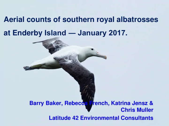
Aerial counts of southern royal albatrosses at Enderby Island January 2017 . Barry Baker, Rebecca French, Katrina Jensz & Chris Muller Latitude 42 Environmental Consultants background accurate estimation of numbers critical for


slide-1
SLIDE 1

Aerial counts of southern royal albatrosses at Enderby Island ― January 2017.

Barry Baker, Rebecca French, Katrina Jensz & Chris Muller Latitude 42 Environmental Consultants

slide-2
SLIDE 2

background

― accurate estimation of numbers critical for determining conservation status of any animal ― aerial photography increasingly preferred as census method of choice for surface nesting seabirds, especially in remote locations

(Wolfaardt & Phillips 2011)

― applied to a range of colonially nesting albatrosses BBA, WCA, SA, GHA ― techniques still under development for loosely colonial species

2

slide-3
SLIDE 3

background

― 2012 & 2013 trials conducted on: Enderby Is – Southern royal albatross Disappointment Is – Gibson’s albatross ― 2 approaches adopted:

― construction of landscape-style montage ‘scenic photo’ or ‘landscape’ approach ― use of transects to construct strip montages ‘transect photo’ approach

― 2015 & 2016 Adams Island preliminary work

3

slide-4
SLIDE 4

4

Scenic or landscape photo approach

slide-5
SLIDE 5

5

Transect approach

slide-6
SLIDE 6

Photo-mapping

  • 2016 photo mapping technique developed for

Gibson’s albatross at Adams Island

  • In particular,
  • vertical mounted camera in waterproof pod
  • transect precision with GPS guidance system

TracMap Flight Pro

  • Nikon D800 DSLR, 36 mp, fitted with Garmin

GPS, GPS stamp stored in EXIF metadata

6

slide-7
SLIDE 7

―photo resolution fit for purpose, ―extensive transect overlap permitted high resolution maps to be built ―birds easily detected on maps ―high correspondence between ground & aerial counts BUT ―costly to produce maps as extensive helicopter charter necessary to ensure ground coverage & transect overlap

7

slide-8
SLIDE 8

8

slide-9
SLIDE 9

Photo analysis

9

slide-10
SLIDE 10

Project aims

―test the suitability of direct counts of nesting southern royal albatross on Enderby I. ―develop a rapid assessment & cost- effective method for counting Gibson’s albatross in the Auckland Islands

10

slide-11
SLIDE 11

SRA background

―endemic NZ species

biennial breeder

―Campbell Island

8,300 – 8,700 pairs Moore et al 2012

―Enderby Is, Auckland Islands

60 pairs

―both populations severely reduced during the farming era, now recovered

11

slide-12
SLIDE 12

methods

12

―Enderby Island (50°30´S, 166°20´E) small 710 ha, low lying, max elevation 45 m ― history of annual ground counts ― flew series of 8 transects spaced at 200 m running West to East ― Direct count of birds seen within 200 m wide transect ―

slide-13
SLIDE 13

methods

― timing January 2014

―SRA mid incubation ―chicks from previous year fledged

― aerial platform Squirrel Helicopter

― flight height 300 ft asl ― flight speed 40 knots

— data recorded

―distance of bird from transect line ― angle from the line ―angle of inclination (to permit conversion of offset spatial data) ―potential use of distance sampling to estimate popn size

13

slide-14
SLIDE 14

ground counts

—ground search of Enderby Is. carried out 1 day after aerial count 22 January 2017 —search by 2 people walking 20 – 40 m apart —most of island searched, dense rata excluded —location of all nests mapped & GPS —sample of nests inspected to determine breeding status

14

slide-15
SLIDE 15

15

slide-16
SLIDE 16

SRA results

―19 birds assessed on ground

16

Aerial count Ground count 62 apparently occupied sites 52 occupied sites apparently

  • ccupied

sites loafer egg broken egg 19 5 12 2 26%

slide-17
SLIDE 17

SRA results

17

Adjusted Aerial count Ground count 46 nesting pairs 38 nesting pairs

slide-18
SLIDE 18

discussion

  • Use of transects and counts of 200 m wide

transects was effective in rapidly assessing population size of royal albatrosses on Enderby Is.

  • Ground counts were 16.1 % lower than ground

counts, but ground count may have under- estimated birds present?

– only 2 observers used, survey time shorter than usual 2 days historically allocated to ground counting

  • Technique permits rapid counting of great

albatrosses, & is cost-effective

  • Use of GPS guidance system TracMap Flight Pro

recommended to improve transect precision

18

slide-19
SLIDE 19

Acknowledgements

Department of Conservation Katie Clemens-Seely Southern Lakes Helicopters Mark Hayes Blue Planet Marine Simon Childerhouse, Sarah Michael, Deepwater Group, MPI Funding for charter of helicopter

19

slide-20
SLIDE 20

Thank you

20