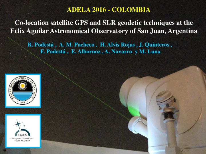
SLIDE 1 ADELA 2016 - COLOMBIA Co-location satellite GPS and SLR geodetic techniques at the Felix Aguilar Astronomical Observatory of San Juan, Argentina
- R. Podestá , A. M. Pacheco , H. Alvis Rojas , J. Quinteros ,
- F. Podestá , E. Albornoz , A. Navarro y M. Luna
SLIDE 2 This presentation shows the strategy followed to get the mathematical co-locations between SLR telescope and permanent station GPS antenna, in the Felix Aguilar Astronomical Observatory of San Juan, Argentina The work allows the coordinates of the Station can be
- btained by combining data from both techniques and
greater level of accuracy than each individually. The IERS considers stations co-localized as the points more valuable and important for maintaining the Terrestrial and Celestial Reference Systems.
SLIDE 3
Félix Aguilar Astronomical Observatory SAN JUAN - ARGENTINA
Surface: 89.651 Km² Population: 700000 people Density: 7 people / Km² Weather: Sunny and Dry
SLIDE 4 In Astronomy, Geodesy and Geodynamics two fundamental RS and RF are necessary
System and Frame References Reference System (RS) is a geometric structure that serves to refer the coordinates of points in space. It can be defined by three axes with its
and directions, scales, algorithms spatial-temporary transformations and constant. Reference Frame (RF) is the SR materialization. It is a group of element that determine accurately the SR and is constructed by the coordinates of the points of definition (observatories), applied techniques and methods
CELESTIAL TERRESTRIAL
SLIDE 5
Quasi Inertial System: NO rotating system based on classical mechanics. Its origin can be accelerated The Earth geocenter moves around an ellipse, while its axis is always parallel to themselves Inertial Systems: A body persists in resting state or uniform rectilinear movement to unless an applicant force change their status
SLIDE 6
International Geodesy and Geophysics Union (IGGU) International Astronomical Union (IAU) Modification of traditional and ancestral definitions from 01/01/2003 New definitions to Celestial and Terrestrial RS. An Intermediate System appears
New concepts
Celestial Intermediate Pole (CIP) Changes in Precession-Nutation theory (PN) Celestial Intermediate Origin (CIO) Terrestrial Intermediate Origin (TIO) Earth Rotation Angle (ERA) Vernal Point or Equinox Sideral Time Assembly Year 2000
Obsoletes concepts
Ecliptical Plane Greenwich Meridian
SLIDE 7
rdinat nates es J2000. 0.0 0 with VLBI of 900 Radi dio-sources sources IERS S ( ( more e 300 defini nition
gin Baricent ricentri ric of the Solar ar System em + + General ral Rel elat ativi vity
RS RS Celestia stial l Baricentrica icentrical (BCRS) CRS) Celestia stial l Geocen centri trical cal (GCRS) RS) International Celestial Reference Frame (ICRF)
cisi sion
SLIDE 8
International Terrestrial Reference System (ITRS) * Accompanies the rotation of the Earth * Gives the position and velocity of a point on the surface * The variations are due to geophysical causes * The RF associated is formed by the coordinates geodesic Stationsl International Terrestrial Reference Frame (ITRF) * Net Statios VLBI, LLR, SLR, GPS and Doris. * Set of Coordinated and Velocity of IERS Stations (epoch ITRF yy) * Each Station produces particular RF and IERS give the final ITRF
SLIDE 9
Celestial Intermediate Pole (CIP)
New Definitions to Origins
Assembly UAI 2000 From date 01/01/2003
Celestial Intermediate Origin (CIO) Terrestrial Intermediate Origin (TIO)
= arc
SLIDE 10
GPS Permanent Station
ASHTECH - Micro Z-CGRS
Reference point Pillar with GPS antenna
SLIDE 11
Edificio Walter T. Manrique Punto de referencia
SLIDE 12
Satellite Laser Ranging (SLR)
Operating Scheme ILRS Net Global International Laser Ranging Service
SLIDE 13
Cassegrain Telescope Aperture 0.60 [m] Mont AZ - EL Oscillator Nd: YAG Primary Wavelength 1064 [nm] Máx. Energy 80 [mJ ] Secundary Wavelength 532 [nm] Pulse width 30-50 [ps] Place
X = 1984104.114 m Y = -5068867.289 m Z = -3314482.433 m L = -31.5086249 B = -68.6231602 H = 727.221 m
SLR System in OAFA
SLIDE 14 Co-locación Definition - Local Ties LT
Geodesic Net
W V U B B cos L B cos L cos L B L cos B cos L L cos B Z Y X sen sen sen sen sen sen
Co-localization site is defined by two or more space geodetic techniques
- ccupying nearby, linked to each other with very precise measurements in 3D
SLIDE 15
GPS geodésic TRIMBLE GPS GTR-A
SLIDE 16
Geodesy Net
SLIDE 17
Set up of the reference points Point 3 Point 7 Points 1 y 2
SLIDE 18
Metodology
Measure of angles and distancess Trilateration and Leveling Tradicional Net in a local system GPS Net in a local system Vectors determination
Posgar
SLIDE 19
SLIDE 20
SLIDE 21 Output file REDGPS_ALV with the matrix Variance – Covarianceof the observed vectors components
Matriz OGPS Punto Origen / Punto Extremo / dx / dy / dz 6.0000 5.0000 2.2740 31.6120 -45.3680 6.0000 7.0000 79.4790 -17.6240 73.6150 6.0000 7.0000 79.4770 -17.6300 73.6190 6.0000 3.0000 46.9970 49.0400 -45.2550 5.0000 7.0000 77.2050 -49.2340 118.9810 5.0000 3.0000 44.7260 17.4260 0.1130 …… ….. Punto Origen-Punto Extremo 1.0e-004 * 6-5 0.1330 0 0
0.0043 0.0061 0.0963 6-7 0.1820 0 0
- 0.1070 0.2980 0
- 0.0127 0.0077 0.0920
6-3 0.2280 0 0
0.0066 0.0129 0.1680 … *PASA EL TEST CHI CUADRADO AL 95%* *COORDENADAS AJUSTADAS* PUNTO X Y Z 1.00 1984110.41 -5068864.32 -3314482.44 2.00 1984106.39 -5068864.51 -3314484.58 3.00 1984100.26 -5068831.66 -3314531.04 4.00 1984077.89 -5068840.38 -3314531.10 5.00 1984055.53 -5068849.09 -3314531.15 6.00 1984053.25 -5068880.70 -3314485.78 7.00 1984132.73 -5068898.33 -3314412.17 8.00 1984095.78 -5068868.33 -3314485.50 *ERRORES ESTANDAR DE LAS COORDENADAS AJUSTADAS* PUNTO ERRX. ERRY. ERRZ. EERM(est.) 1.0000 0.0005 0.0007 0.0005 0.0009 2.0000 0.0006 0.0008 0.0007 0.0012 3.0000 0.0005 0.0007 0.0005 0.0010 4.0000 0.0005 0.0007 0.0005 0.0010 5.0000 0.0005 0.0006 0.0005 0.0009 6.0000 0.0005 0.0007 0.0005 0.0010 7.0000 0.0005 0.0007 0.0004 0.0009 8.0000 0.0004 0.0006 0.0004 0.0009
Calculation and compensation
SLIDE 22 *ELIPSE PUNTO* 1 *SEMIEJE MAYOR A=0.0011 m , *SEMIEJE MENOR B=0.0009 m *AZIMUT FI=34.83 grados , *EXCENT. =0.1881 , *AREA (cm2) = 0.03
Elipse de Error 95% 0.0002101 0.00042019 0.00063029 0.00084039 0.0010505 30 210 60 240 90 270 120 300 150 330 180
Error Ellipses
*ELIPSE PUNTO* 7 *SEMIEJE MAYOR A=0.0012 m , *SEMIEJE MENOR B=0.0009 m *AZIMUT FI=14.54 grados , *EXCENT. =0.4456 , *AREA (cm2) = 0.03
Elipse de Error 95% 0.00023056 0.00046112 0.00069167 0.00092223 0.0011528 30 210 60 240 90 270 120 300 150 330 180
SLIDE 23 Error propagation 206265 R f 206265 f 206265 f 1E f
2 R 2 2 12 2 2 2 2 2 2 1E 2 2 u
12 E
206265 R f 206265 f 206265 f 1E f
2 R 2 2 12 2 2 2 2 2 2 1E 2 2 v
12 E
206265 f 1E f
2 2 2 1E 2 2 wE
Based on the local system centered on the vertex 1
- f the geodetic network, errors propagated by the
linear and angular measurements cornerbacks points are determined by the formulas:
SLIDE 24 Punto X Y Z 1 1984110,4081
- 5068864,3161
- 3314482,4443
2 1984106,3887
- 5068864,5135
- 3314484,5838
3 1984100,2568
- 5068831,6577
- 3314531,0416
4 1984077,8903
- 5068840,3763
- 3314531,1024
5 1984055,5276
- 5068849,0898
- 3314531,1517
6 1984053,2547
- 5068880,6993
- 3314485,7836
7 1984132,7308
- 5068898,3303
- 3314412,1670
8 1984095,7826
- 5068868,3277
- 3314485,5004
9 1984105,4952
- 5068866,0664
- 3314482,3068
10 1984104,1382
- 5068868,7369
- 3314479,3020
11 1984107,6748
- 5068868,1806
- 3314477,1238
12 1984109,0978
- 5068865,6022
- 3314480,1866
CGL 1984106,7928
- 5068867,4829
- 3314479,9346
Posgar 2007, epoch June 26/2012 (2012.403).
Final coordinates of the network points
metros 12.3659 Z Z Y Y X X CGL 8 Punto Vector
2 8 2 CGL 8 2 CGL 8
CGL
SLIDE 25
Standard errors of the adjusted coordinates (meters)
Punto sX sY sZ 1 0,0005 0,0007 0,0005 2 0,0006 0,0008 0,0007 3 0,0005 0,0007 0,0005 4 0,0005 0,0007 0,0005 5 0,0005 0,0006 0,0005 6 0,0005 0,0007 0,0005 7 0,0005 0,0007 0,0004 8 0,0004 0,0006 0,0004 9 0,0015 0,0011 0,0023 10 0,0014 0,0016 0,0022 11 0,0010 0,0024 0,0016 12 0,0011 0,0023 0,0016 CGL 0,0010 0,0031 0,0014
SLIDE 26 Conclusions
Spac ace geode
ic techniq niques ues are e only ly used ed in the e develop lopmen ent of fram ramew ewor
Addit ditio ion n to the e prim imar ary core
bserv ervat atio ion n stat atio ions ns, the he globa
l networ
is dens ensif ified ied with h region gional al GPS subn bnet ets. In Americ erica and nd in Argent gentina ina dens nsif ific icatio ion n SIRGA GAS S and nd POSGA GAR hav ave e posit ition ions within hin the e cent ntim imeter r accur urac acies ies and nd speed peeds of the e orde der r of 1.5 5 mm / year ar. A stat ation ion acqu quires ires stat atus stat atio ion n co- locat ated, d, you
n integ egra rate thes hese e net etwork
efere erenc nce e of the e firs rst
der
SLIDE 27 The network designed did not consider the location of any point east of the building Walter Manrique. Despite this adjustment was excellent but, in order to provide the network with greater strength, it would be advantageous densify with a vertex to the east with direct visibility point 1. Due to the impossibility of view between the terrestrial network points and mount SLR, we had to designing a particular methodology for connection Obvio ious usly ly there here are re propag ropagat ation ion of error rrors in the he coord
inates due e to linear near and d angu gular lar meas asur urem ement nts tak aken en. The e aver erag age e stan anda dard rd dev eviat iation ions in all three hree axes es increas eased d from rom extern rnal al point ints (1 to
ernal nal (9 to CGL); ); but every erything ing indic dicat ates es that at work rked ed very ery caref arefully ully, bec ecau ause the he res esult ulting ing erro ror r in det eter ermining ining the e CGL is within hin the he requ quire iremen ents of the he IERS. The e stand andard rd deviat eviation ions of the e rect ectang ngular ular geode
ic coordin
ates es obtained ined in the e adjus justment ent of all networ
ints were re within hin 3 mm, excellin elling g value lue that hat will l enable able the he OAFA A to be cons
idered ed by the he IERS as a co-loc locat ated ed stat ation ion.
SLIDE 28
MUCHAS GRACIAS