9/28/2009 Introduction Continuous Nearest Neighbor Monitoring in - - PDF document

9 28 2009
SMART_READER_LITE
LIVE PREVIEW

9/28/2009 Introduction Continuous Nearest Neighbor Monitoring in - - PDF document

9/28/2009 Introduction Continuous Nearest Neighbor Monitoring in Road Networks The k -NN problem: Given a query point q and a set of objects P , find the k objects in P that are closest to q. K. Mouratidis 1 M.L. Yiu 2 , D. Papadias 3 , N.


slide-1
SLIDE 1

9/28/2009 1

Continuous Nearest Neighbor Monitoring in Road Networks

  • K. Mouratidis1 M.L. Yiu2, D. Papadias3, N. Mamoulis2

Afsin Akdogan

University of Southern California Computer Science Department

1

CS 599 - Geospatial Information Management

Introduction

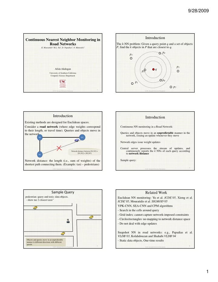
The k-NN problem: Given a query point q and a set of objects P, find the k objects in P that are closest to q. p4 p3

2

q p1 p2 p6 p5 p7

CS 599 ‐ Geospatial Information Management

Introduction

Existing methods are designed for Euclidean spaces. Consider a road network (where edge weights correspond to their length, or travel time). Queries and objects move in the network.

N2 N3

Network distance: the length (i.e., sum of weights) of the shortest path connecting them. (Example: taxi – pedestrians)

3

N1 Network distance between [N1,N3] = [N1,N2] + [N2,N3]

CS 599 ‐ Geospatial Information Management

Introduction

Continuous NN monitoring in a Road Network: Queries and objects move in an unpredictable manner in the network, issuing an update whenever they move Network edges issue weight updates Central server processes the stream

  • f

updates, and continuously reports the k NNs of each query according to network distance Sample query:

4

CS 599 ‐ Geospatial Information Management

Sample Query

pedestrian: query and taxis: data objects.

  • show me 2 closest taxis”

CS 599 ‐ Geospatial Information Management

5

Objects and queries move in an unpredictable manner to different directions with different speeds.

Related Work

Euclidean NN monitoring: Yu et al. ICDE’05, Xiong et al. ICDE’05, Mouratidis et al. SIGMOD’05 YPK-CNN, SEA-CNN and CPM algorithms

  • Search in the cells around query
  • Grid index: cannot capture network-imposed constraints

Circles/rectangles: no mapping to network distance space

  • Circles/rectangles: no mapping to network distance space
  • Do not deal with edge updates

Snapshot NN in road networks: e.g., Papadias et al. VLDB’03, Kolahdouzan and Shahabi VLDB’04

  • Static data objects, One-time results

6

CS 599 ‐ Geospatial Information Management

slide-2
SLIDE 2

9/28/2009 2

Incremental Monitoring (IMA) and Group Monitoring (GMA) Algorithms

Two methods (IMA, GMA) for: monitoring NNs according to network distance, with low CPU cost. Edges: indexed with a quad-tree. S h d i h Store each edge with (i)the objects in it (ii)an influence list Queries: For each query we store its current NNs, and its expansion tree. (Memory consumption)

7

CS 599 ‐ Geospatial Information Management

IMA: Initial NN computation

Initial result (k=3): expansion tree, infl. intervals, and marks

q.kNN_dist = 7 n3 = 9 An edge e affects q, if it contains an interval where the network dist is less than q.k-NN Parts until marks are valid.

q.kNN_dist = The network distance of furthest NN from q q= root. Retrieves kNNs with Dijkstra algorithm Store q in influence lists of affecting edges Terminates when the next node has weight larger than q.kNN_dist

8

CS 599 ‐ Geospatial Information Management

Types of Object Updates

Only updates affecting the expansion tree can alter the result! (p5 not)

(i) Current NNs moving within distance q.kNN_dist from q (e.g., p3) (ii) Incoming object: used to lie further than q.kNN_dist but their new location is closer to q than q.kNN_dist (e.g., p4) (iii) Outgoing object: current NNs moving further away than q.kNN_dist from q (e.g., p1)

9

CS 599 ‐ Geospatial Information Management

IMA: Object updates (Case 1)

Outgoing no more than incoming NNs:

10

At least k objects within distance q.kNN_dist Remove outgoing NNs (p1) Calculate union of remaining NNs and incoming objects ((p3’,p2) U p4’) Report best k among them

In brief: update result and shrink expansion tree

CS 599 ‐ Geospatial Information Management

IMA: Object updates (Case 1)

New (shrunk) expansion tree

New q.kNN_dist

11

CS 599 ‐ Geospatial Information Management

IMA: Object updates (Case 2)

More outgoing than incoming:

Fewer k objects within distance q.kNN Notice: q.Tree grows according to the new q.kNN_dist !

12

In brief: re-compute from marks (not from q. it speeds things up) and expand tree

CS 599 ‐ Geospatial Information Management

slide-3
SLIDE 3

9/28/2009 3

IMA: Object updates (Case 2)

New (grown) expansion tree

New q.kNN_dist

13

CS 599 ‐ Geospatial Information Management

IMA: Query updates

Re-compute starting from valid tree marks

Valid expansion tree n5 is reachable via a shorter path

14

Sub‐tree q’ remains valid and NNs as well. They are just subject to some trivial distance

  • updates. The rest of

the tree is discarded

CS 599 ‐ Geospatial Information Management

IMA: Edge updates - Weight increase

There might exist shorter alternatives paths to objects in sub‐tree

n9 is reachable via shorter path Invalid expansion tree

15

Updated Edge with higher weight

CS 599 ‐ Geospatial Information Management

IMA: Edge updates - Weight decrease

Valid because all nodes therein become shorter by 2 units

New Marks

Updated Edge

  • ld= 3 new =1

16

QUESTION: Why did we set the new marks? Marks show valid parts. The update can NOT affect the paths to nodes/objects that lie closer than d(n7,q)=3, because any path passing through n1n7 has length at least d(n7,q)

New Marks

  • ld

3 new 1

CS 599 ‐ Geospatial Information Management

GMA: Main idea

Intersection node: degree above 2 (e.g., n1, n2, n5) Terminal node: degree 1 (e.g., n8, n9, n4, n3) Sequence: path between consecutive intersection

  • r

terminal nodes {n1n8},{n1n7,n7n6,n6n5},{n2n5}…

Lemma 1: The k-NN set of any query in sequence s is in the union of (i) the objects in s, (ii) the k-NNs of its intersection nodes (endpoints).

17

CS 599 ‐ Geospatial Information Management

GMA: Main idea (example)

Main idea GMA groups together the queries falling in the same sequence and monitors static nodes (at the endpoints of the sequence), instead of each

Objects on sequence between n1 and n5 = {p4, p5} 2-NNs of intersection n1 = {p1, p5} 2-NNs of intersection n5 = {p3, p2} 2-NNs of q1 or q2 ∈ {p4, p5} ∪ {p1, p5} ∪ {p3, p2} n.k = the max number of NNs required by any query in n.Q

18

query individually

CS 599 ‐ Geospatial Information Management

slide-4
SLIDE 4

9/28/2009 4

GMA: Active nodes

active node: a node n is active if n is the endpoint on any sequence that has at least 1 query (e.g., n1, n5) GMA monitors the k-NNs of active nodes (using IMA), and uses them to compute the NNs of the actual user queries uses them to compute the NNs of the actual user queries GMA reduces CPU time by (i) shared execution among queries in the same sequence (ii) reduction from NN monitoring of moving queries to NN monitoring of static active nodes.

19

CS 599 ‐ Geospatial Information Management

GMA: Initial Result (2NN of q1)

Mark for q1

20

1. First Consider edge n1n7 and add {p5} to q1.NN list 2. Among the 2 reached nodes (n1 and n7) n1 is closer so get NNs of n1 {p1, p5} 3. Search continues towards n5, next node on the path is n7 4. Currently q1.kNN_dist = d(p1, q1) and dist(n7,q1) < q1.kNN_dist 5. Search continues. Consider edge n7n6 6. Terminate at this point with NNs {p1,p5} since the next node n6 has d(n6,q1) > q1.kNN_dist Notice that as opposed to IMA, GMA does not store expansion tree for queries

CS 599 ‐ Geospatial Information Management

GMA: Update processing

Initial Result: utilizing active node NNs NN Maintenance: In every processing cycle do: 1. Update NNs of active nodes with IMA. 1. Update NNs of active nodes with IMA. 2. If NNs of active node n change, re-compute affected queries in sequences adjacent to n 3. If object/edge updates occur in sequence s, re-compute affected queries within sequence s 4. Re-compute moving queries

21

CS 599 ‐ Geospatial Information Management

IMA vs. GMA

GMA outperforms IMA when

  • (i) the number of queries is large with respect to the

number of query nodes. Note: IMA stores an expansion tree for each query Note: IMA stores an expansion tree for each query

  • (ii) When the queries are concentrated in a small part
  • f the network.

22

CS 599 ‐ Geospatial Information Management

Sample experimental results

No previous work. OVH: re-computes from scratch.

IMA GMA OVH CPU time (sec)

2 2.5 3

23

Number of queries

0.5 1 1.5 1K 3K 5K 7K 10K

CS 599 ‐ Geospatial Information Management

Sample experimental results

IMA GMA OVH

Space (KByte)

1200 1400 1600 1800

24

200 200 400 600 800 1000 1 25 50 100

Number of NNs

CS 599 ‐ Geospatial Information Management

slide-5
SLIDE 5

9/28/2009 5

Summary

First work about Continuous NN monitoring in road networks.

  • No advance information about query/object moving patterns
  • Edge weights fluctuate

Two methods: IMA: processes each query individually. Stores an expansion

tree for each q.

GMA: groups queries falling in between 2 intersection. GMA is faster and requires less space.

25

CS 599 ‐ Geospatial Information Management

Thank you y

26

CS 599 ‐ Geospatial Information Management

Discussion

  • IMA Edge update – Increase Weight

– Inefficient if edges close to root issue update

  • IMA Object update which is out of expansion

tree tree

– No change on expansion tree but still some computation: quad‐tree might be traversed to find if updated object is a part of any edge that falls into some expansion tree

CS 599 ‐ Geospatial Information Management 27