
SLIDE 1
2018 PennDOT TMA Annual Summit Research Goal Determine the - - PowerPoint PPT Presentation
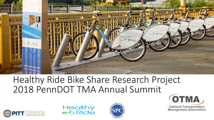
Healthy Ride Bike Share Research Project 2018 PennDOT TMA Annual Summit Research Goal Determine the sustainable transportation benefits of the bike share system established in the Pittsburgh region, the Healthy Ride System (HRS) Tasks to
transportation benefits of the bike share system established in the Pittsburgh region, the Healthy Ride System (HRS)
Literature Review User Survey
and exposure to carbon emissions
levels of greenhouse gas emissions (GHG) in Beijing, China
quality, the researchers focused on the behavior of a bike-share users based on the ambient air quality
in the active travel of populations in Australia, Great Britain and United States
bike share is used by a third of the member survey respondents to connect to transit, serving as a first-mile last-mile connector
placing bikeshare stations near transit stops
the local level rather than at the regional level
benefits but bikeshare systems seem to encourage local business and economic activity.
page
Important information that can be used to determine the benefits to the transportation system:
auto trips with bicycle trips.
although over 20% shifted from the auto mode.
reported from both transit and private auto modes users.
determine the potential impact of the HRS system was collected
frequency information can be used in a methodology
levels reductions in the region and Oakland
Task 1: Data Collection
Obtain the number and length of users on the roadway network to/from HRS stations (2016)
Create origin/destination matrix for one full year of data (2016)
Estimate the most likely routes and volumes of users between stations for bikes and vehicles trips replaced
day/year
( by direction)
the model
volume to select an Oakland study area
COMPLETE O/D MATRIX – BIKE TRIPS (HRSBT)
average month = 1.378
CONVERT HRS TRIPS TO VEH. TRIPS (HRSVT) 𝐼𝑆𝑇𝑊𝑈 = (𝐼𝑆𝑇𝐶𝑈)(𝑁𝑝𝑒𝑓 𝑇ℎ𝑗𝑔𝑢 %) 𝐵𝑤. 𝐵𝑣𝑢𝑝 𝑃𝑑𝑑𝑣𝑞. (𝑄𝑓𝑠𝑡𝑝𝑜𝑡 𝑤𝑓ℎ ) Mode Shift % = 2% Auto Occupancy: SPC Model = 1.1 *Note: Mode shift % found using survey data = (Auto HRS) & (Freq. Users: 4-7 days/week) USED SIGNFICANT BIKE AND VEH TRIP DATA TO PLOT ROUTES BIKE VOLUMES: Screened by >0.5 AADT trips VEHICLE VOLUMES: Screened by >0.38 Veh. trips annually (80% of ALL Veh. trips) ROUTE O/D PAIRS PLOTTED Using Google Earth to assign routes BIKE TRIPS/LINK GROUPED BY AREAS
VEH TRIPS/LINK
HRS Trip rip Data Co Conversio ion to Vehic icle le tr trip ips an and Routes
CREATE GIS MAP OF HRS TRAVEL AREA OVERLAY SPC NETWORK AND TAZ MAP ON BASE MAP
Cr Creatio ion of f GIS IS Model, l, Coordin inatio ion and Plo lottin ing
f Bik Bike and Vehic icle le Tri rips with ith SP SPC C Model l
PLOT HRS BIKE TRIPS
Cluster
PLOT VEHICLE TRIPS
than 0.38 annual vehicle trips from bikeshare trip reductions per day for each O/D pair.
with multiple route usage by HRS vehicle replacement trips
HRS that are frequent daily users.
network) in Oakland
in Oakland
intersections showing vehicular, bus and bicycle (HRS + other bikes) volumes
and without HRS/all bikes
OD Matrix: Clusters
OD Matrix: Oakland-Shadyside Cluster
OD Matrix: Downtown-Strip District-Lawrenceville Cluster
Variation of HRS Trips by Temporal Distribution
2000 4000 6000 8000 10000 12000
Bike Volumes
2016 HRS Data: Monthly Variation
Variation of HRS Trips by Temporal Distribution
Average of high months used to adjust AADT bike trips = 1.378
Bicycle Route Car Route Routing Method Using Google Earth: Liberty Ave & Stanwix St to S Bouquet St & Fifth Ave
Comparison of Google Route Duration VS HRS Average Trip Duration
Blvd Of The Allies & Parkview Ave to Fifth Ave & S Bouquet Google Duration: 5 mins Average Duration: 6.25 mins 21st St & Penn Ave to Fifth Ave & 10th St & Penn Ave Google Duration: 5 mins Average Duration: 11.3 mins
Creating a GIS Base Map for the Study Area
frequencies/overlapped routes in the links)
Total annual trip volumes by links – Oakland to Shadyside (Part 1)
Total annual trip volumes by links – Oakland to Shadyside (Part 2)
Spatial and Volume Distribution of HRS Bicycle Trips – Oakland Shadyside
Link No. Route Name Route Frequency Sum of Annual Bike Trips for all frequencies 1 Dawson St 5 1848 2 Schenley Drive and Boulevard of the Allies 3 1060 3 Schenley Drive and Boulevard of the Allies 2 630 4 Boulevard of the Allies 1 430 5 Boulevard of the Allies 1 430 6 Schenley Drive and Boulevard of the Allies 2 630 7 Dawson St 4 1381 8 S Bouquet St and Dawson St 1 467 9 Atwood St and Oakland Ave 2 454 10 Coltart Ave 1 134 11 Schenley Drive and Boulevard of the Allies 3 1060 12 Schenley Drive and Boulevard of the Allies 2 630 13 Boulevard of the Allies 1 430 14 Schenley Drive and Boulevard of the Allies 3 1060 15 Dawson St 4 1418 16 Atwood St and Oakland Ave 1 249 17 Oakland Ave 1 205 18 Ellsworth Ave 3 982 Link No. Route Name Route Frequency Sum of Annual Bike Trips for all frequencies 19 Dawson St and S Bouquet St 2 760 20 Dawson St and S Bouquet St 2 1022 21 Dawson St 2 396 22 Ellsworth Ave 2 390 23 Dawson St and S Bouquet St 2 804 24 S Bouquet St and Dawson St 2 672 25 Dawson St 1 233 26 Dawson St 1 163 27 Ellsworth Ave 3 527 28 Forbes Ave 1 190 29 Ellsworth Ave 2 328 30 Ellsworth Ave 2 337 31 Ellsworth Ave 2 303 32 Ellsworth Ave 1 147 33 Marchand St 2 748 34 Walnut St 1 472 35 Marchand St 1 276 36 Marchand St 2 748 37 Ellsworth Ave 1 156
Total annual trip volumes by links – Downtown Lawrenceville (Part 1)
Total annual trip volumes by links – Downtown Lawrenceville (Part 2)
Spatial and Volume Distribution of HRS Bicycle Trips – Downtown Lawrenceville
Link No Route Name Route Frequency Sum of Annual Bike Trips for all frequencies 39 Three Rivers Heritage Trail and Penn Ave 12 3492 55 Forbes Ave 11 3041 58 Forbes Ave 11 2930 44 Three Rivers Heritage Trail 10 2857 33 Three Rivers Heritage Trail and Penn Ave 8 2484 15 Forbes Ave 11 2481 13 Forbes Ave 10 2337 62 North Shore Trail/Three Rivers Heritage Trail 8 2154 10 Forbes Ave 9 2088 17 Three Rivers Heritage Trail and Penn Ave 8 1955 1 Forbes Ave 8 1820 70 Penn Ave 7 1770 6 Penn Ave 7 1612 72 Three Rivers Heritage Trail and Penn Ave 6 1481 71 Three Rivers Heritage Trail and Penn Ave 5 1351 38 Three Rivers Heritage Trail and Penn Ave 6 1329 67 Penn Ave 4 1256 27 Penn Ave and Smallman St 5 1176 59 Three Rivers Heritage Trail and Penn Ave 4 1154 68 Three Rivers Heritage Trail and Penn Ave 4 1154
Study Area: Oakland (Outlined in red)
Recommended Study Area – Oakland Shadyside
Link No. Route Name Route Frequency Sum of Annual Bike Trips for all frequencies 7 Dawson St 4 1381 9 Atwood St and Oakland Ave 2 454 15 Dawson St 4 1418 16 Atwood St and Oakland Ave 1 249 17 Oakland Ave 1 205 19 Dawson St and S Bouquet St 2 760 20 Dawson St and S Bouquet St 2 1022 23 Dawson St and S Bouquet St 2 804 24 S Bouquet St and Dawson St 2 672
associated with this mode shift in region - SPC
emissions measures using Synchro for Oakland Study Area
quality impacts 9/1/18